Oxford Street Transformation
The Mayor of London has announced the first phase plans to pedestrianise Oxford Street; London’s main retail street. Currently Oxford Street is dominated by buses and taxes, but the intention is to gradually phase out all vehicular traffic along the entire length of Oxford Street.
- Phase I (completion December 2018) will run from Orchard Street to Oxford Circus.
- Phase II (completion December 2019) will run from Oxford Circus to Tottenham Court Road
- Phase III (completion 2020+) will run from Marble Arch to Orchard Street
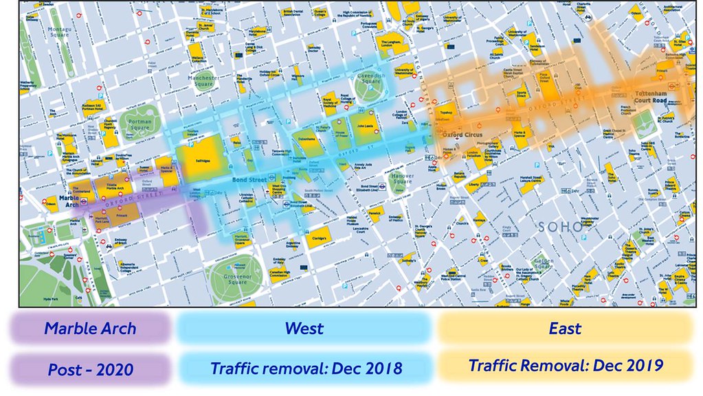 Image sourced from Transport for London: https://consultations.tfl.gov.uk/roads/oxford-street
 Image sourced from Transport for London: https://consultations.tfl.gov.uk/roads/oxford-street
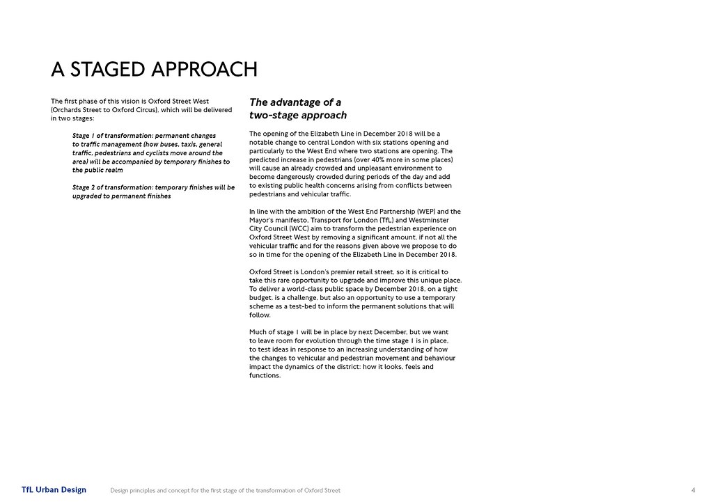 Image sourced from Transport for London: https://consultations.tfl.gov.uk/roads/oxford-street
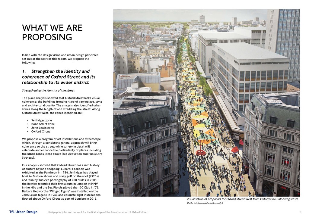 Image sourced from Transport for London: https://consultations.tfl.gov.uk/roads/oxford-street
 Image sourced from Transport for London: https://consultations.tfl.gov.uk/roads/oxford-street
 Image sourced from Transport for London: https://consultations.tfl.gov.uk/roads/oxford-street
 Image sourced from Transport for London: https://consultations.tfl.gov.uk/roads/oxford-street
 Image sourced from Transport for London: https://consultations.tfl.gov.uk/roads/oxford-street
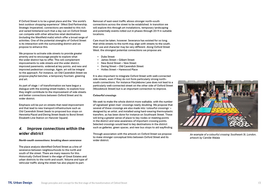 Image sourced from Transport for London: https://consultations.tfl.gov.uk/roads/oxford-street
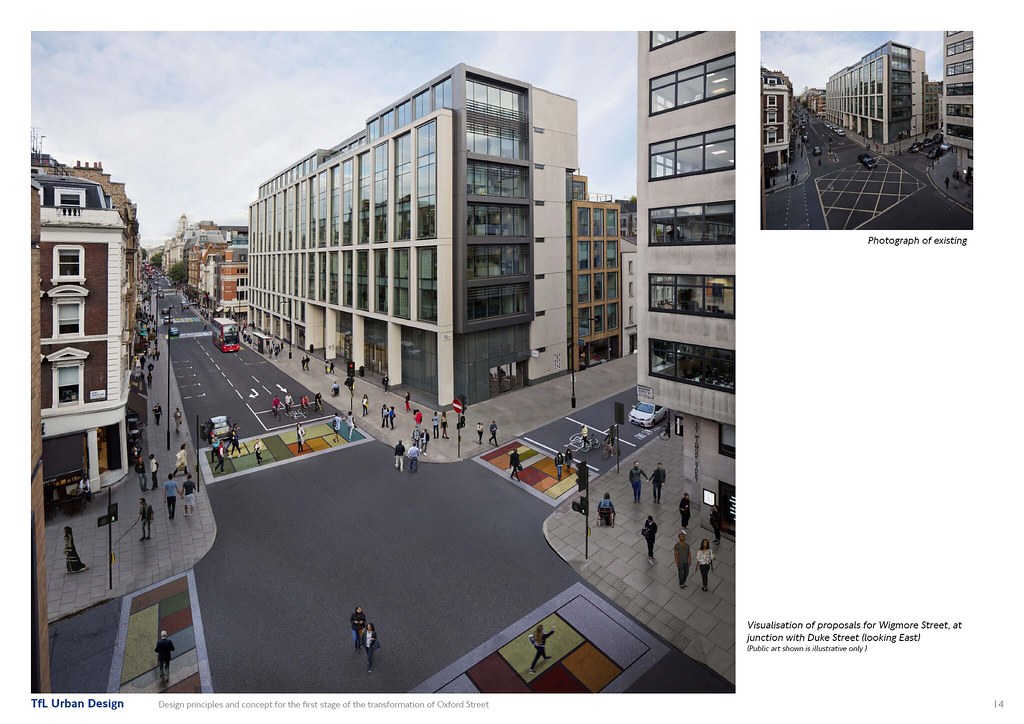 Image sourced from Transport for London: https://consultations.tfl.gov.uk/roads/oxford-street
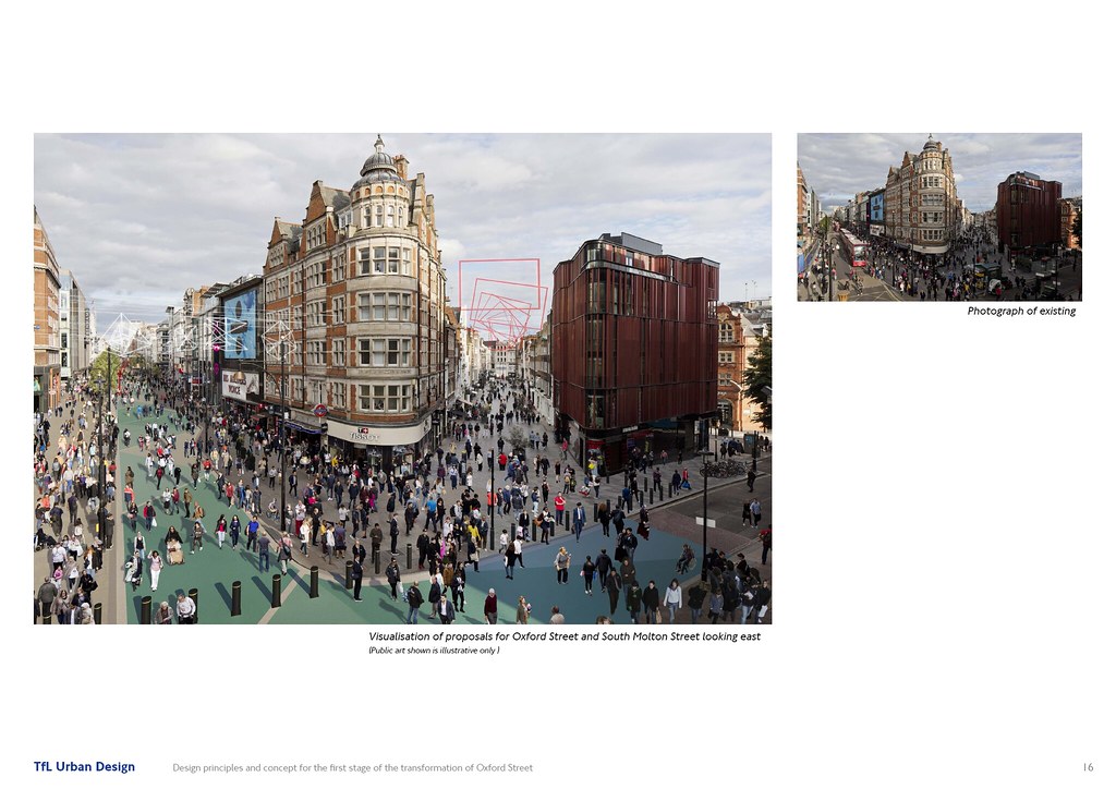 Image sourced from Transport for London: https://consultations.tfl.gov.uk/roads/oxford-street
Next Train Capacity Programme
Image sourced from Transport for London: https://consultations.tfl.gov.uk/roads/oxford-street
Next Train Capacity Programme
TfL have begun trialling a new capacity management system at Shoreditch High Street on the London Overground which shows capacity on the next train. The colour-coded capacity system is easy to read, and has promise to ease congestion and train dwell times at stations across the network. All of the class 378 trains (which are walk-through) running on the Overground have the sensors in place, meaning this could be rolled out across the entire Overground network in future. A real-time display of the system can be viewed here:
http://shoreditch.opencapacity.co
Diamond Geezer has further information on the technology here:
http://diamondgeezer.blogspot.co.uk/...:00:00%2B01:00
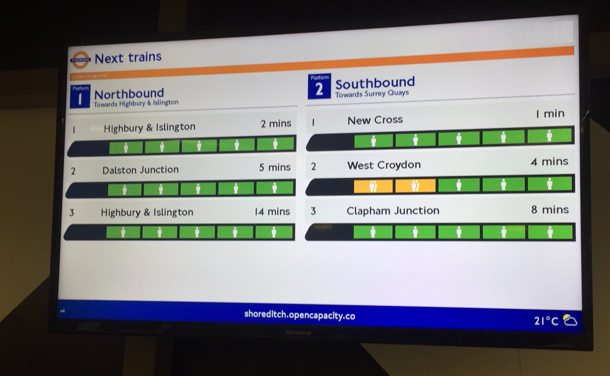 Image sourced from Transport for London: https://twitter.com/TfL/status/920253077806047232
London Luton Airport Mass Passenger Transit (MPT)
Image sourced from Transport for London: https://twitter.com/TfL/status/920253077806047232
London Luton Airport Mass Passenger Transit (MPT)
London Luton Airport is the fourth busiest airport serving the capital, used by 14.6mn passengers in 2016, the airport has experienced 39 consecutive months of passenger growth and is currently undergoing a substantial upgrade plan to increase capacity by 50%. Last year, the dual-carriageway to the terminal was upgraded, a new multi-storey car park constructed and the short-term car park rebuilt which included a new sheltered pedestrian walkway. Pier A was also extended. 2017 will also bring an expansion of the main terminal building, a new pier B and renovated baggage hall & arrivals.
One of the long-standing issues of Luton however has been the absence of an adequate train connection. Unlike London’s other airports, passengers wishing to travel into London and other destinations across the UK by rail need to catch a shuttle bus to the nearby Luton Airport Parkway station. To rectify this issue, Luton Airport have now secured planning to construct a £200mn 1.4mile fully automated 24/7 transit system. The system will run on a dedicated alignment and integrate directly into the terminal building and the Midland Main Line station. A third station will be constructed at the mid-term car park. Once complete in 2020, journey times from the terminal to London St Pancras will be reduced to under 30 minutes.
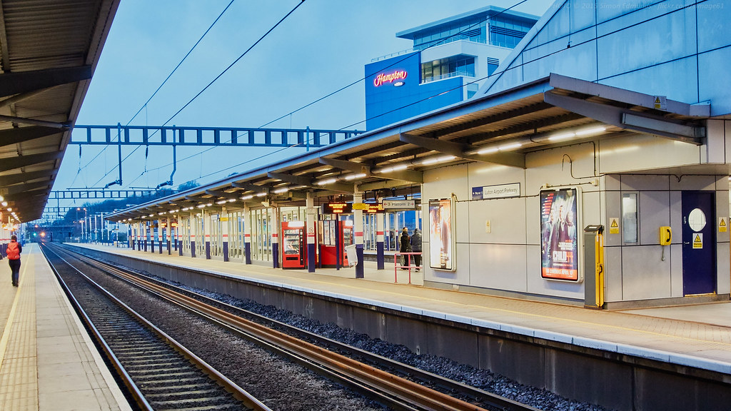 Image taken by simage61 on Flickr: https://www.flickr.com/photos/simage...788143/sizes/l
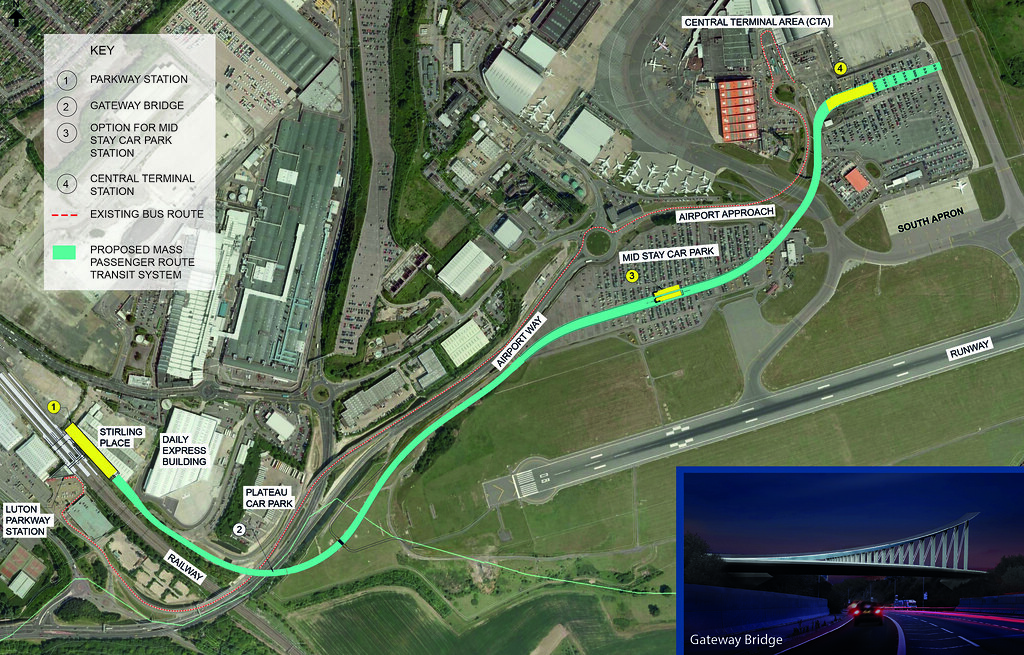 Image sourced from London Luton Airport: http://www.llal.org.uk/LLAL-MPT.html
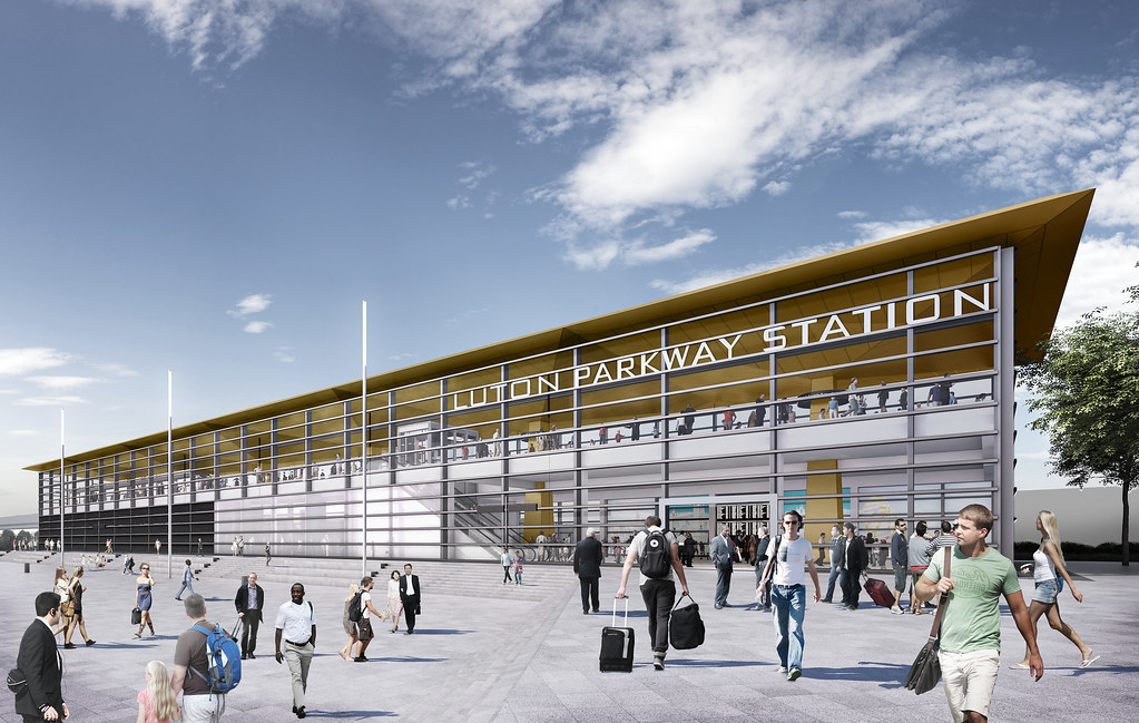 Image sourced from London Luton Airport: http://www.llal.org.uk/LLAL-MPT.html
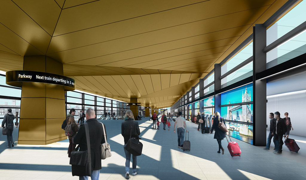 Image sourced from London Luton Airport: http://www.llal.org.uk/LLAL-MPT.html
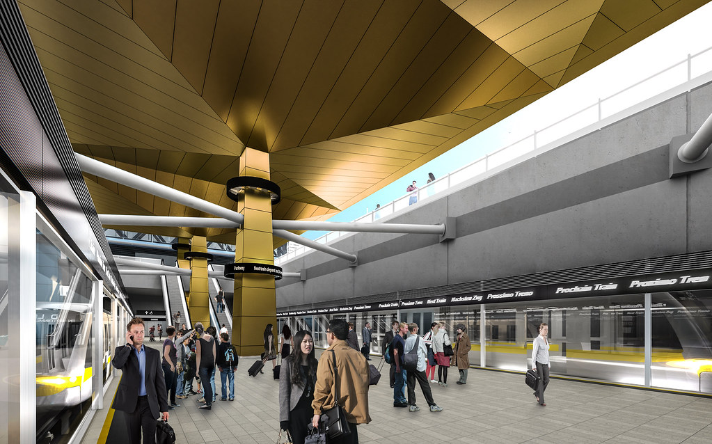 Image sourced from London Luton Airport: http://www.llal.org.uk/LLAL-MPT.html
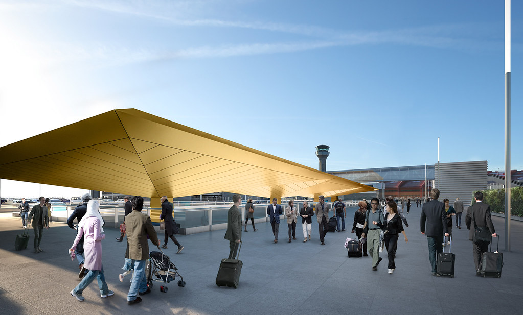 Image sourced from London Luton Airport: http://www.llal.org.uk/LLAL-MPT.html
To further enhance the accessibility of the airport towards London and the north, a business proposal has also been lodged to increase the number of East Midlands Trains that stop at Luton Airport Parkway. Currently the station is served by several Thameslink trains each hour, but only one intercity train per hour. The airport is keen to increase this to 4tph an hour. This creates two substantial benefits: reduced non-stop journey times to London St Pancras, and improved connectivity to the Midlands and beyond with single-seat services to Leicester, Nottingham, Derby and Sheffield.
Northern Line Battersea Power Station Extension
Plans have been unveiled of the Northern Line station at the large Battersea Power Station development site.
 Image sourced from IanVisits: https://www.ianvisits.co.uk/blog/201...n-line-station
 Image sourced from IanVisits: https://www.ianvisits.co.uk/blog/201...n-line-station
 Image sourced from IanVisits: https://www.ianvisits.co.uk/blog/201...n-line-station
 Image sourced from IanVisits: https://www.ianvisits.co.uk/blog/201...n-line-station
London Overground Barking Riverside Extension
Image sourced from IanVisits: https://www.ianvisits.co.uk/blog/201...n-line-station
London Overground Barking Riverside Extension
TfL have unveiled renders of the proposed Barking Riverside station which will see the Gospel Oak to Barking Line extended beyond Barking towards the River Thames. Barking Riverside will be at the heart of a large mixed-use development.
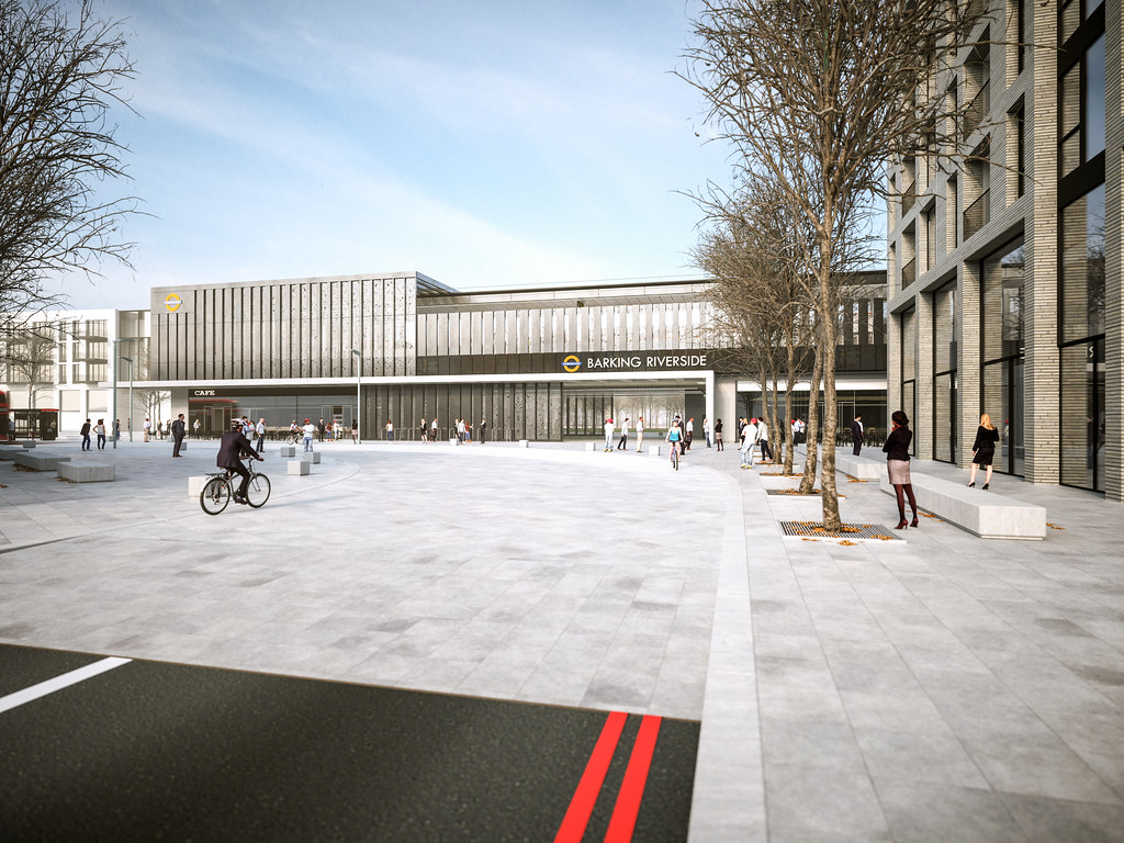 Image sourced from Transport for London: https://www.flickr.com/photos/tflpress
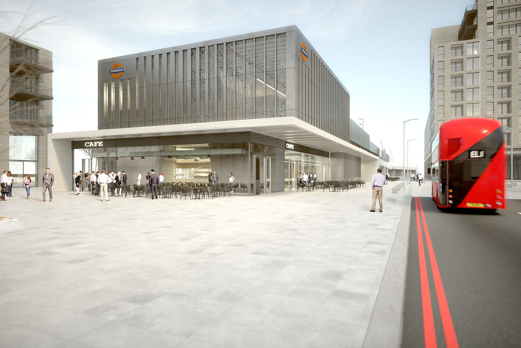 Image sourced from Transport for London: https://www.flickr.com/photos/tflpress
London Overground Old Oak Stations (Hythe Road and Old Oak Common Lane
Image sourced from Transport for London: https://www.flickr.com/photos/tflpress
London Overground Old Oak Stations (Hythe Road and Old Oak Common Lane
As part of the massive development in and around Old Oak Common, TfL propose two new stations; Hythe Road on the West London Line, and Old Oak Common Lane on the North London Line. Both technically indirectly serve the HS2 and Great Western Main Line/Crossrail station planned for Old Oak Common.
Hythe Road
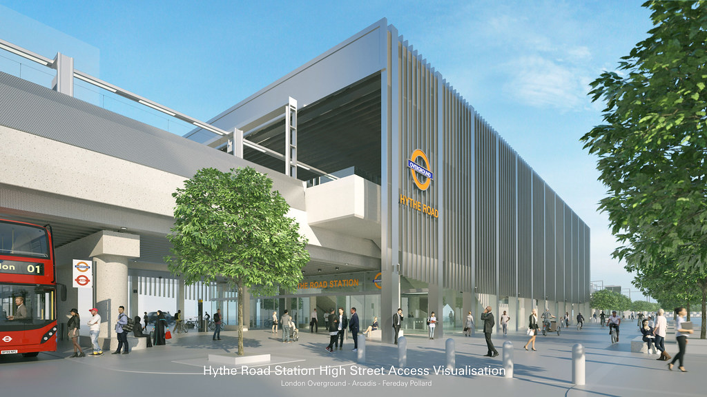 Image sourced from Transport for London: https://www.flickr.com/photos/tflpress
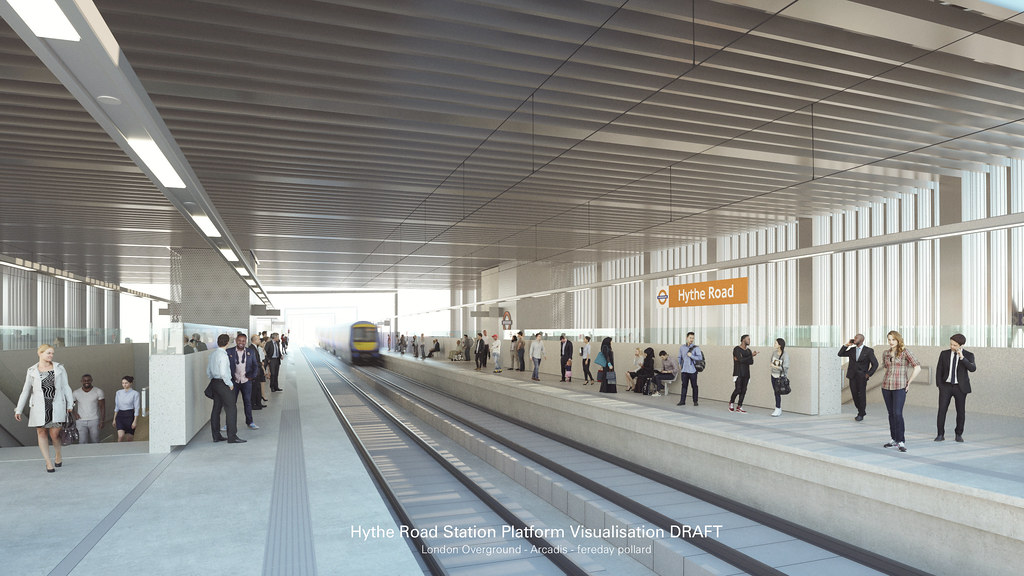 Image sourced from Transport for London: https://www.flickr.com/photos/tflpress
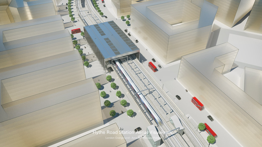 Image sourced from Transport for London: https://www.flickr.com/photos/tflpress
Old Oak Common Lane
Image sourced from Transport for London: https://www.flickr.com/photos/tflpress
Old Oak Common Lane
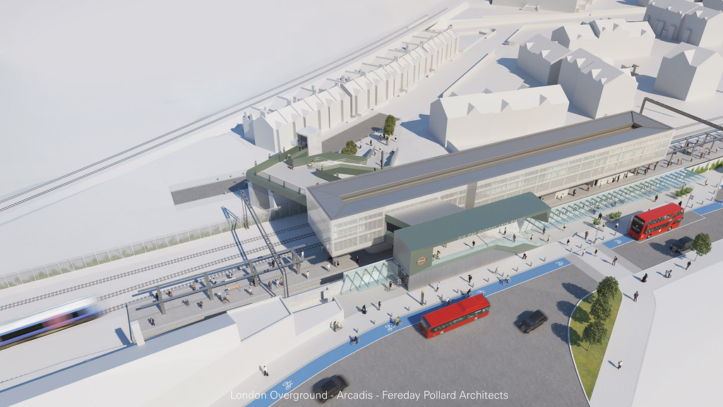 Image sourced from Transport for London: https://www.flickr.com/photos/tflpress
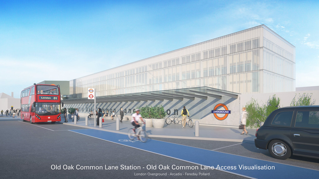 Image sourced from Transport for London: https://www.flickr.com/photos/tflpress
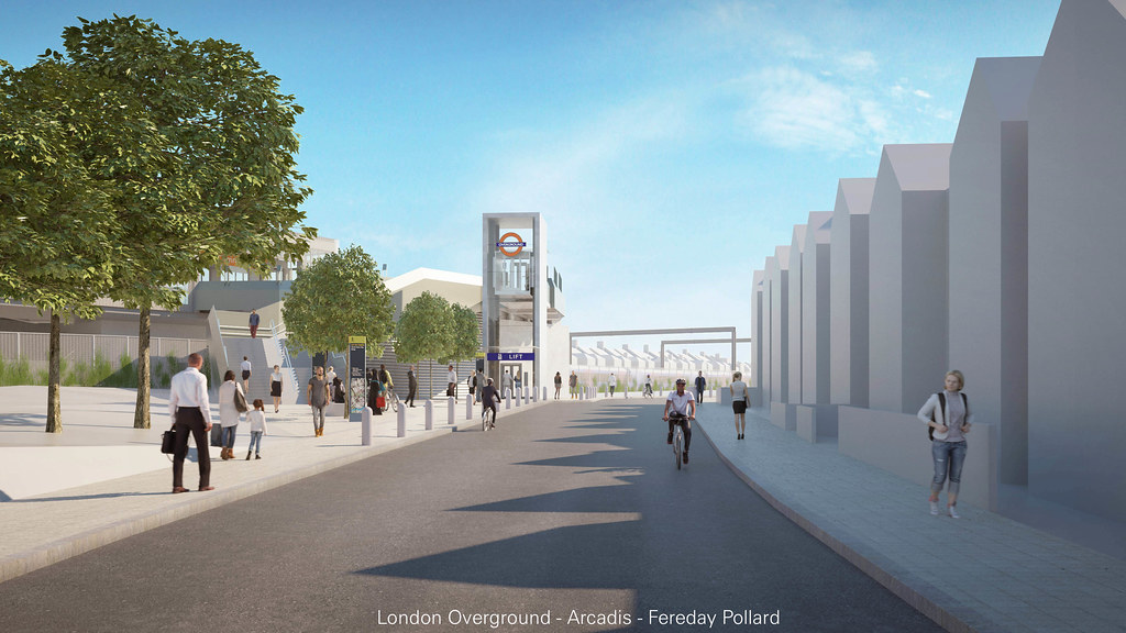 Image sourced from Transport for London: https://www.flickr.com/photos/tflpress