Quote:
Originally Posted by AusTxDevelopment

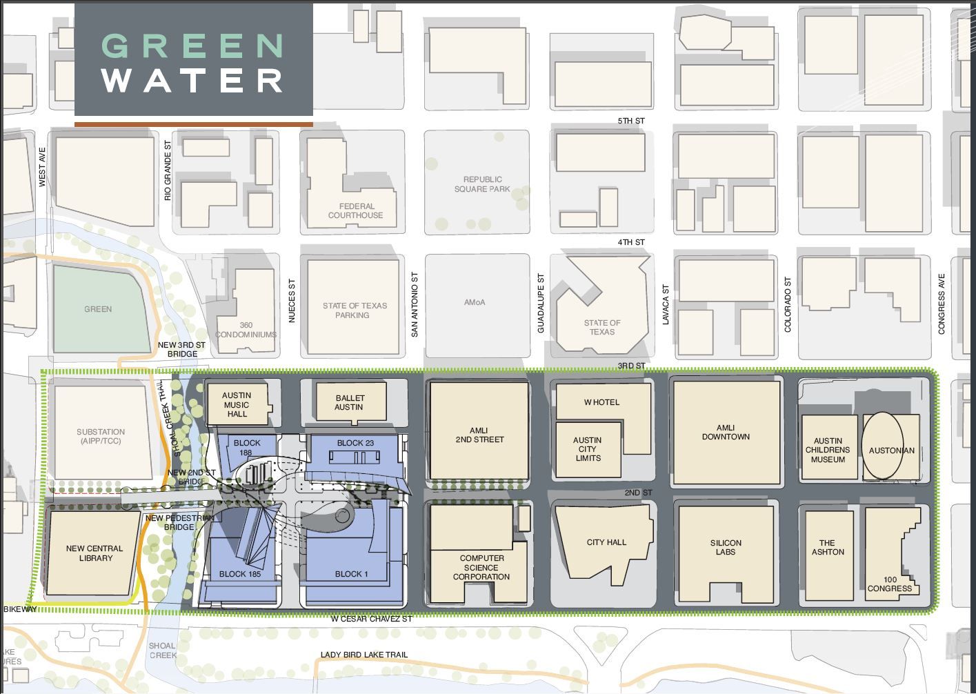
Here is a map from the Green Water Development marketing materials from 2010 . Things have changed slightly since then (the footprints of the GW buildings, for example, are no longer curved) but the map is mostly correct with regard to existing buildings. I'm posting it because it shows the AECC site as well. The Green Water buildings are the blue areas, and the green dotted line outlines the "Second Street District".
 http://i1072.photobucket.com/albums/...ps9b87ec4b.jpg
 |
Trying to translate this old 2010 map into what is happening today, with all the dirt moving and structures rising. I think the Block 1 structure will be the 38 story "Northshore" building, right? But I'm not sure how tall the structures on the parcels labeled as Block 23, 185 and 188 are scheduled to be. Can someone tell me?