ohmigaaaawd Ive just dipped back into this thread....
okay the metro London stat is of of course ludicrous to suggest that people in Norfolk are still metro Londoners somehow. That is especially clear to Europeans, who don't much use metro definitions based on commuting, even though they do a lot of it, and from far distances.
However that is exactly the same case for NYC's just as ludicrously generous catchment area, which of course is based on the same commuting patterns. Also bear in mind if you read the smallprint this low threshold (as low as 6%) 'commuting' is not even into the central city, but into the next rural county along.
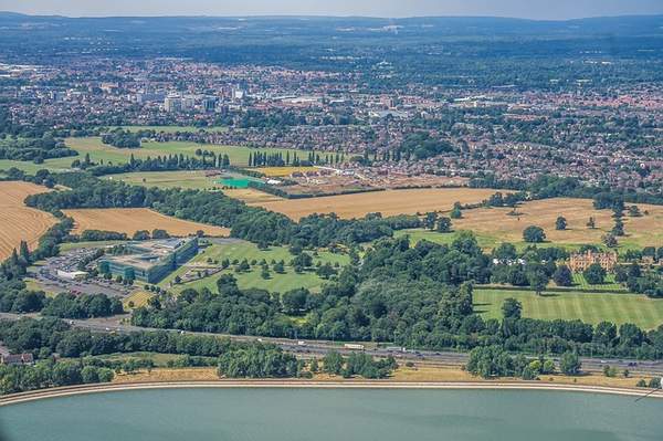
In terms of the physical layout NYC sprawls in low density, contiguous suburbia at first (giving it a bigger urban footprint that London), but soon into disparate super-low densities that are mostly greenery and open land. London however has the infamous Green Belt, a huge semi-urban, semi-rural failed monster that is high density development patchworked into protected land (there is no real 'belt', just a vast tapestry of carcentric commuter towns and villages).
If you look at a highlighted map showing urban areas (in pink - this is 2007, it will have grown considerably since then, by nearly 2 million), you'll see the density of the 'Green Belt' is not really that green, nor a belt, and that fits a density of NYC into it's 'countryside'. The hidden reality is that Britons suffer the smallest housing in the West, at densities 25% smaller than even the Japanese, though the large proportion of urban parks, and of course protected Green Belt land, hides the dense peppering/ density. Even from satellite the urban developments are hidden in the green morass, and need to be artificially highlighted to show their true colours.

The jury's out on whether the Green Belt has protected the environs from continuous sprawl, or just created a much larger semi-urban, semi-rural beast of carcentric dormitory developments.

^This is why people in Norfolk can just as (in)conceivably be counted into the London metro, the density and connections are definitely there, and only a small amount have to commute into the next county closer into London to be counted, just like NYC's metro. In short both definitions are unrealistic imo, not just inflated (for example what about the other 94% who dont commute???).
If you read between the lines there are two definitions of 'metro' here. 1. The contiguous city + immediate commuter belt, or 2. the much wider, much more lax catchment which is a large majority countryside, and the size of Belgium, and truth be told has very little to do with commuting into the contiguous city (2%).
In all honesty I perceive NYC to be the bigger city, as I would use the first idea of a metro. NYC would weigh in at about 17 million, London at 14 million. However the much wider second catchment would put London slightly ahead in a slightly bigger catchment area, where both cities top 20 million. The thing is England's 'countryside' is so dense (it fits 50 million into an area the size of Maine), the reality is there would be no boundary delineating the peppering density, that spreads throughout much of England. NYC has a more delineated format, and easier to categorise thanks to blanket sprawl (let's ignore the densities for the time being), but at the end of the day it's wider metro is based instead on only very scant commute patterns.