Quote:
Originally Posted by Scott Charles

And then there's this street, highlighted in hot pink, which lies right in the middle of the current-day 101 freeway. Is it California Street? Or something else?

Many thanks in advance! These are the only streets I don't understand in the entire DTLA area, I promise! 
PS: It's so sad seeing the empty lot where the beautiful County Court House used to be... 
- - -
By the way, the detail shots above come from a beautiful aerial image at UC Santa Barbara's FrameFinder. |
Dang, sometimes I forget how much I love those aerials. As long as I'm looking at this one, let me blather 'bout it a bit...
Back in the day, before the internet, images of Bunker Hill existed in just a couple of hard-to-find books, or those "Changing Face of LA" calendars that came out 1989/90. In the early-mid 90s (or so I seem to remember) LAPL started putting their collection online and some of the first pics they uploaded were their Reagh & Hylen Bunker images. This one always popped up when you entered "Bunker Hill" into the search field.
 lapl
lapl
To this day if you google "Bunker Hill" or "Reagh Bunker Hill" it's always near the top.
This recent KCET story terms it Bunker Hill.
And it vexed me for the longest time because it didn't match Bunker Hill topography I knew of, until first of the Hill historians, NLA's rick m pointed out to Carolyn Cole that this was California Street, making this by rights Fort Moore Hill. (Rick points out as much in
this post.)
I'm thrilled that Cal State Lib has started posting their images larger, so now we can see it like this
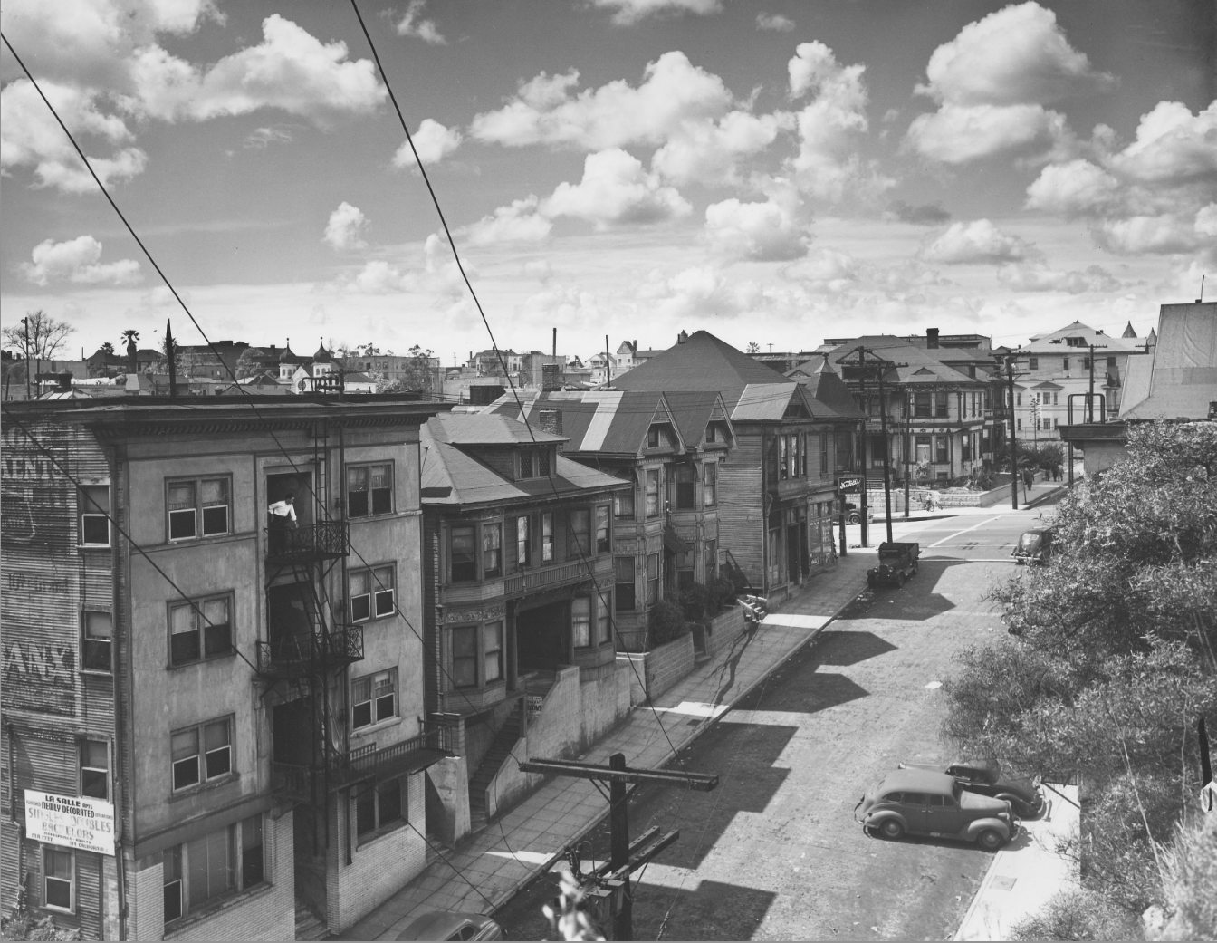
Which we can zoom in on like so:
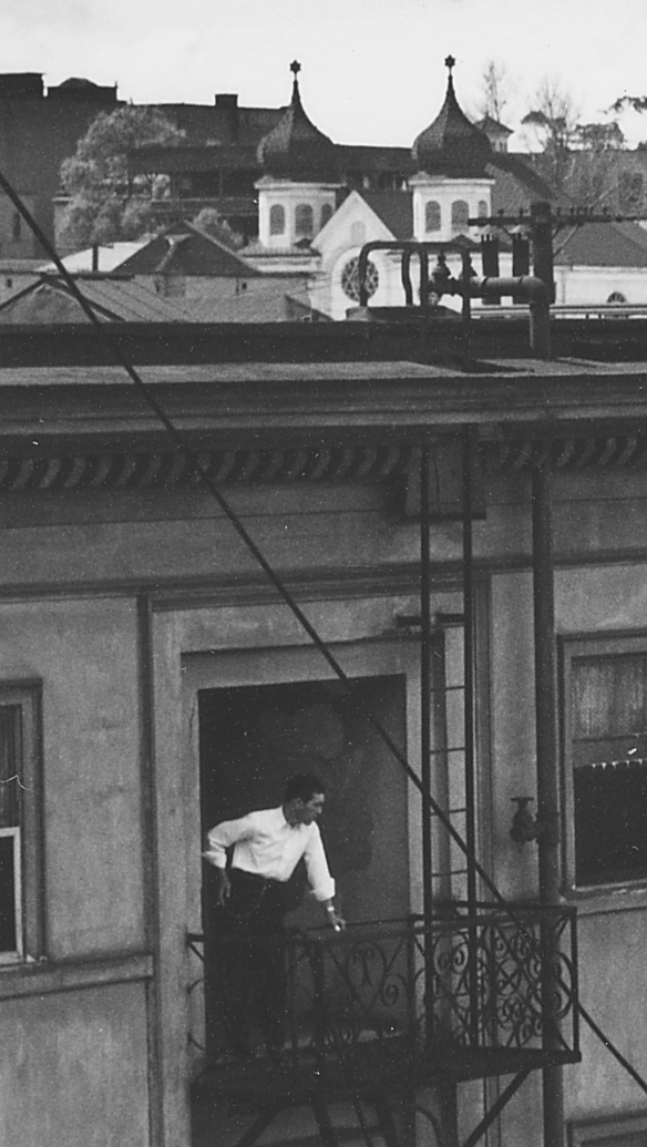
(Lest anyone say we're not being
noirish enough, check out that guy...my guess is he's peering down at his DeSoto and wondering if the body in the trunk is starting to smell.)
So aaaaanyway, in case anyone has ever wondered about that image, I threw together this:
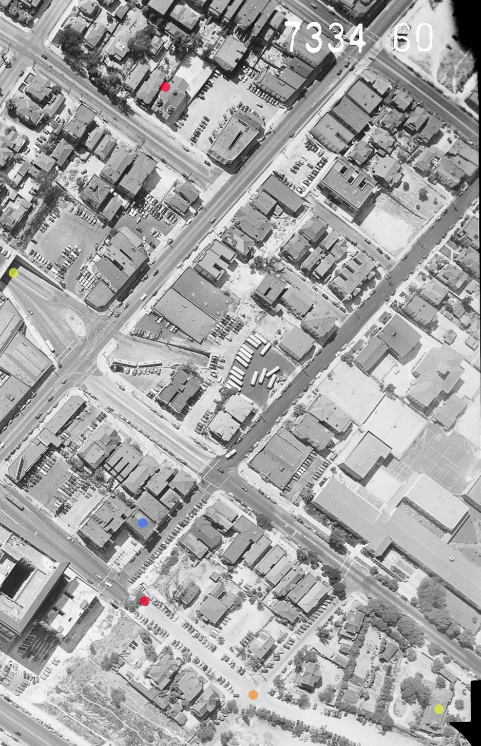
Red dot at the bottom is where Reagh shot the image, above the
Broadway Tunnel. Red dot at the top is the
Olive St Shul, 227 North Olive. Blue dot is the La Salle Apartments, 314 California, between Broadway and Hill, home of the guy with the DeSoto.
Orange dot is the inersection of Broadway and Fort Moore Place, where the grandest houses were. The yellow dot to the right is Mary Banning's place (that began life as the Buena Vista, Jacob Phillipi's beer hall, in 1883.) The other yellow dot to the left is the Hill St tunnel opening onto Temple.