Quote:
Originally Posted by Wig-Wag

David,
I never knew this hotel existed and I had fun rattling around on Google Maps trying to identify the various streets and roads. While I was unable to effect any positive ID's I am going to hazard a guess the Double Bow Knot Boulevard is now part of the Betty B. Dearing Trail as seen on Google Maps satellite view north of Mulholland Drive between Laurel Pass and Ardenwood Road.
Cheers,
Jack
|
Jack, thanks a lot for taking the time. I've been up there 2 more times since my last post here, and while I've ID'd a few road sections and made a little bit of slow progress, that "Double Bow Knot" road still has me completely baffled. In fact I spent about an hour this morning just looking for that road, with little to show for it.
I see that trail section on Google that that you mentioned, and in fact have hiked it a few times, but I kinda don't think that's the spot. I mainly say that because to my knowledge, there was no motor road that crossed Mulholland until Laurel Canyon was extended over the hill, well after the Lookout Mountain Inn burned down. But I could be wrong, and will ponder this some.
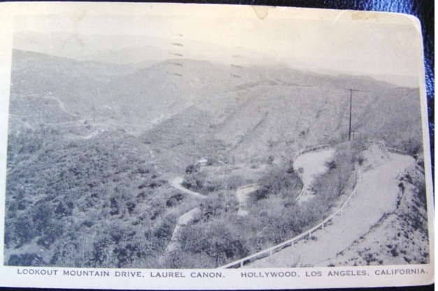
Here's another image of that same switchback section that's a little clearer. The caption suggests that this is part of Lookout Mountain Drive but I drove that whole road today, and there are no switchbacks like this at all.
 http://www.ebay.com/
My guess is that this road is now erased from the landscape, but used to zigzag from east to west, between what is now Brier Drive and Sunset Plaza Drive. There are two visual cues that make me think this. First, the horizon and profiles of the hills in the background seem very similar. (Actually you can see all the way to Griffith Observatory from above Brier Drive, though I don't think the observatory was there when the old photo was taken.)
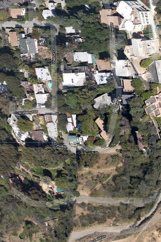
Second, this area, which is mostly now part of someone's yard, now has terraced sections that just might be what's left of old switchbacks. Here's a bad Google sat view of that area. This is really a terrible image and of course you have to pretend the houses aren't there, but this is the area:
 www.google.com
Whatever Double Bow Knot road was, I think it's gone now. I'm convinced that as new areas were developed in L.C., a lot of these steep, narrow old roads (which might not have been maintained after the Inn burned) became part of a residential lot, or some new, realigned road, or were returned to the earth by storms, slides, fires. Maybe some sections were even bulldozed away by developers, to make the hillsides look normal again. These upper reaches of Laurel Canyon were pricey, with a lot of fabulous homes.
In my sleuthing for the original old roads, I've learned to keep an eye out for old wood fences like this one. They always look have this look and are always painted white. In the old photos, most roads have these fences (though I doubt they stopped anyone from going over the side).
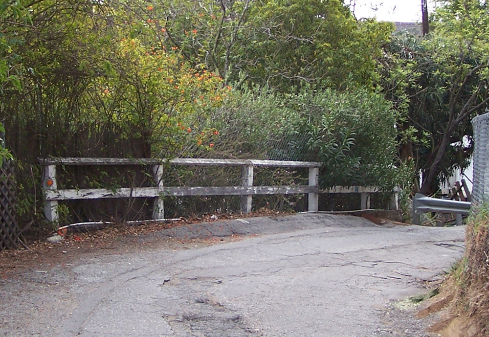
My photo.
When I see these fences I always think "old road". But the funny thing, I've seen little sections of these fences in some pretty random places, a block or 2 or 3 from any existing road. So for sure, some of those old roads were just erased.
Still and all, thanks a lot for your reply, and you just might be right -- maybe there
was a motor road from Mulholland to Lookout back then. I been pretty startled by other things in my L.C. explorations, and you never know.
In the next day or so Ill post some images that show the Lookout Inn site today. I'm still working on the roads part and will come back to that later. I found that the Auto Club office on Figueroa has an archive department, and I'm thinking to check with the city or county -- maybe they have records of these old roads.