Quote:
Originally Posted by Doady

I look at Surrey on the map and I see cul-de-sacs everywhere, no grid. Mississauga has very few cul-de-sacs. But otherwise, I don't see any difference fundamental difference in their planning. Looking at satellite image, I see the same TOD features in Surrey that Mississauga has, but noticeably fewer high rises. Concession roads in Surrey closer together, so they didn't need to build new corridors like Mississauga did (Bristol Rd., Glen Erin Dr., Courtneypark Dr., Mavis Rd., etc.).
That's Mississauga Valleys, not Mississauga City Centre. Mississauga Valleys is a subdivision from the 70s. Mississauga's downtown at the time was Cooksville; MCC was not even a concept yet.
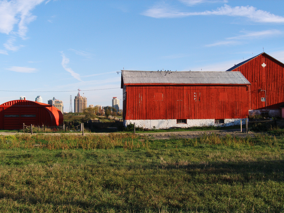
In 1982, Mississauga City Centre and the surrounding area was mostly farmland. There were 4 office buildings built in what is now MCC in the 50s and 60s, the mall was built in the 70s, but everything else was built in the late 80s onward. MCC is all greenfield development, and there are still greenfields. That's why I say walkability of Metrotown is more comparable to a place like Port Credit, or Cooksville (the original downtown of Mississauga), or North York City Centre.
Mississauga City Centre skyline in 2007:

I don't want to diminish how impressive Metrotown is, but keep in mind the difference in history and context when comparing it to MCC. |
If you can't see Surrey's grid (or Mississauga's cul-de-sacs) then I'm not really sure what to say. Both of them have similar structures of a large grid with typical suburban swirly streets within them, but Surrey's grid utilizes narrower streets with more intersections, whereas Mississauga's is much more heavily reliant on wide boulevards and is more reflective of a typical suburban local-collector-arterial road system. Most of its major streets, which form the grid, have no buildings fronting them.
Street networks are what make places suburban or urban, not the height of their buildings. And while both places have swirly roads within larger grids, Mississauga's grid is clearly just a gridded-version of the large arterials that you find in typical suburbs: wide and without fronting buildings. Surrey may appear heavily suburban at the moment with its low density, but it has a much higher opportunity to urbanize in the future as the bones are already there. Replace the run-down SFHs fronting the main arterials with mid-rise developments and CRUs and all of a sudden its streets are indistinguishable from those in inner-city anywhere. Surrey has an urban skeleton—it is just underdeveloped at the moment. No matter how dense you build Mississauga, it will never be urban.