Quote:
Originally Posted by ethereal_reality

Here's another...
Manhattan Beach, Calif. [1890s]
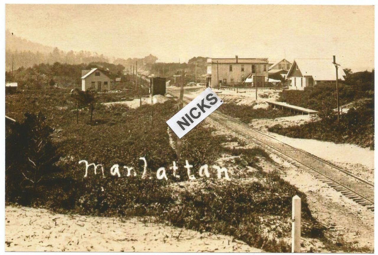
found back in Sept. 2016 on ebay
Does anyone recognize this area?
At first I thought that was a mile marker in the foreground. On closer inspection, I think it's just a plain ol' ordinary post.
__ |
Quote:
Originally Posted by Bristolian
I've been working on this one for a while and still can't provide a conclusive answer but this is what I did come up with: I showed the photo to Steve Meisenholder at the Manhattan Beach Historical Society and he agreed with several thoughts I had. First, the date is probably too early. There were really no buildings to speak of in the area that is now Manhattan Beach in the 1890s. Steve estimates the correct date to be around 1910. I thought the view was looking south along what is now Valley Drive. Valley Drive runs west of a greenbelt that contained the old Atchison, Topeka and Santa Fe railroad tracks until they were removed in the 1980s. That strip is now known as Veterans Parkway or The Greenbelt seen here:
 Google Earth
I thought the location was looking south towards what is now Manhattan Beach Blvd. but Steve believes it is further south, looking towards the southern border with Hermosa Beach. The hillside on the left seems to support that. Also, the sign seen in the distance of the original photo, next to the two story building, may be the railroad sign at the Manhattan/Hermosa border.
Here is that approximate view today:
 GSV
This is part of the reply I got from Steve:
"Hi Ian,
Here are a few more of my thoughts on the old photo. I want to clarify why there were houses along Longfellow Ave. in 1910. Longfellow was one of the streets laid out by Moses Sherman and Eli Clark in 1903 as part of their unsuccessful effort to establish a literary colony in the northern part of Hermosa Beach in 1903 to the east of Shakespeare Beach. Sherman and Clark had put in a trolley stop at Shakespeare Beach on their Los Angeles and Pacific (LAP) electrified railway line which which ran near the beach between Playa del Rey and Redondo Beach (begun in 1902 and completed in 1903).
Another thing about the old photo; I believe that East Railroad Dr. traverses the bridge on the right side of the RR tracks, to the north of the two story building."
Longfellow Ave can't be seen in the GSV but it intersects Valley Drive near the middle of the view. |
I don't know what
e_r's photo shows, but I don't think it shows either Manhattan or Hermosa Beach. There isn't enough sand,
and there are too many trees. Also, that steep hill in background looks out of place.
This photo looks north from just below 1st Street in south Manhattan Beach, c. 1927:
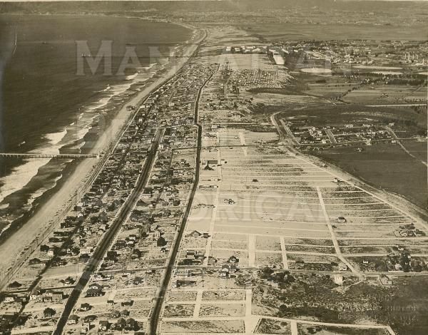 Manhattan Beach Historical Society
Here we look north from north Redondo Beach, up into Hermosa Beach, with Manhattan Beach further in the distance, c. 1927:
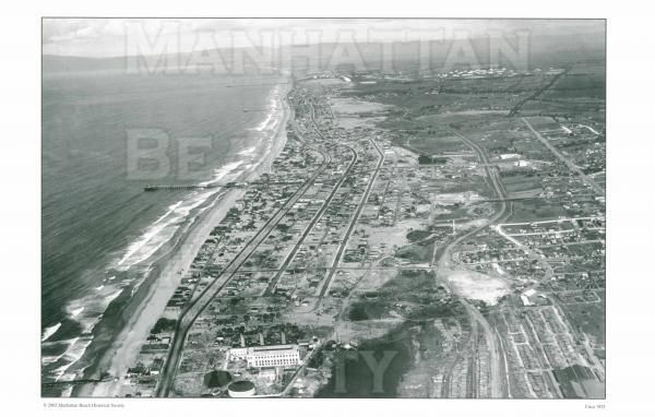 Manhattan Beach Historical Society