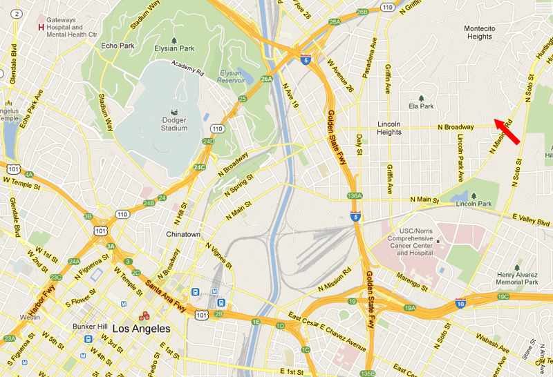
Montecito Heights is a unusual, little known part of town, northeast of downtown L.A. My wife and I explored this area once last year, and returned yesterday to see it again and see some roads that we had missed last time. We began near the northern terminus of Broadway at Mission Road, indicated by the red arrow and continued in essentially a straight line, trekking across the grain of the land and ending up near the bend in Griffin Ave.
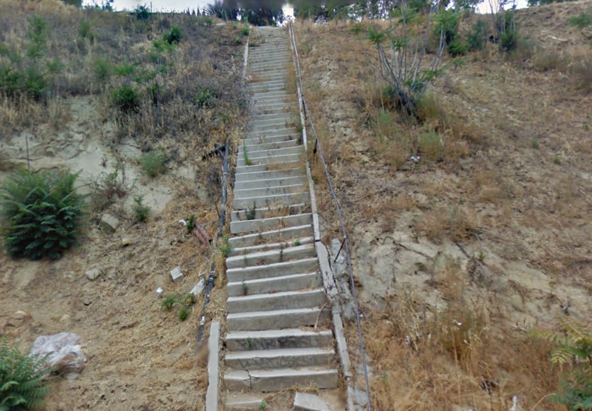
A steep old concrete stairway, cracked and coming apart, ascends the lower part of the hill. There are old remains and rubble on the hill, and what might be the foundation of a long lost house.
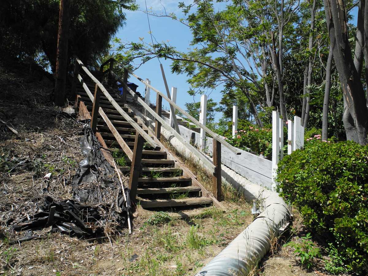
The stairway ends abruptly, then it's a scramble up the hill. Up near the top there are some even older wooden stairs that lead up to Meltzer Drive.
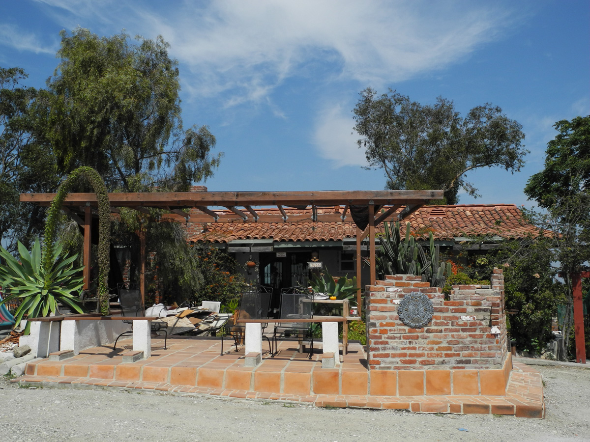
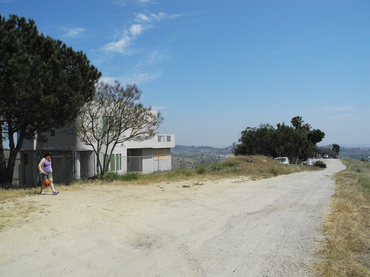
We followed Meltzer (the last paved road we'd see for a while) a short distance, then began climbing another hill, up towards Paradise Road. About half way up, at an excellent view spot, there's an odd little resting place with a bench and the remains of what looks like an old spa or grotto. (I wish I'd taken a picture of it.) At the top of the hill, we reached Paradise Road. This is a long winding road with a few scattered homes, all with excellent views. Most of the residents are Latino, most of the homes are fenced, and most have several dogs. The lower parts of this area have homes of every age, size, and description, and a lot of old public stairways -- some wood, some concrete. The residences on Paradise are newer, larger homes but all seem unusual in some way, including "Casa Salinas", below.
Mrs. 3940 checks out an unoccupied house on the eastern side of Paradise Road, which follows a ridge top.
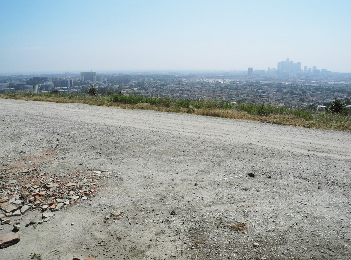
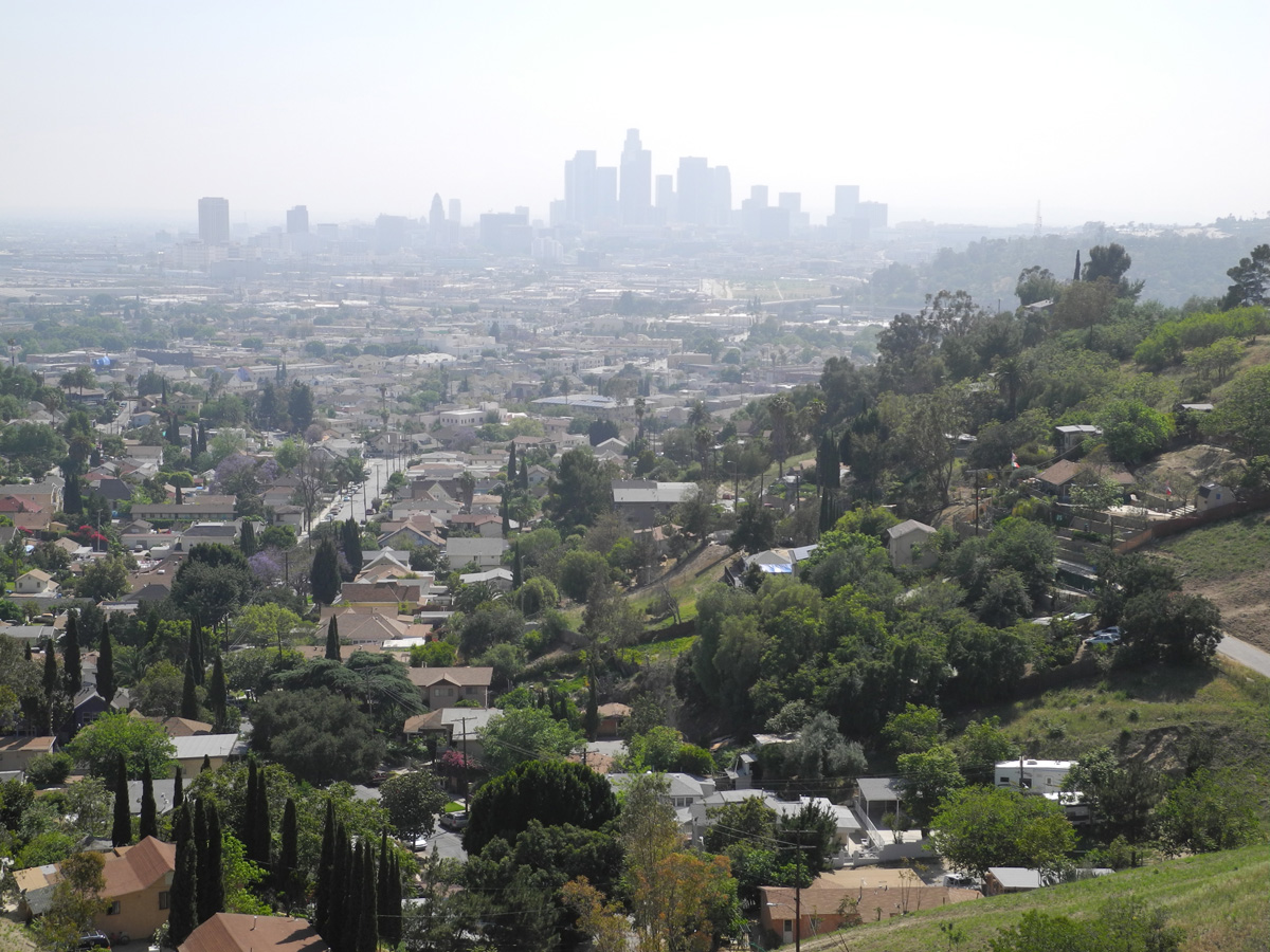
Looking towards downtown from Paradise Drive. City Hall, barely visible through the haze, is just 3 miles away.
After following Paradise Drive north for a few blocks we turned left on Telluride St. This is the roughest, funkiest street I've seen in L.A. and it's much steeper than it looks in the photo. You almost need a 4WD vehicle to drive it and in a heavy rainstorm, it must be very tricky!
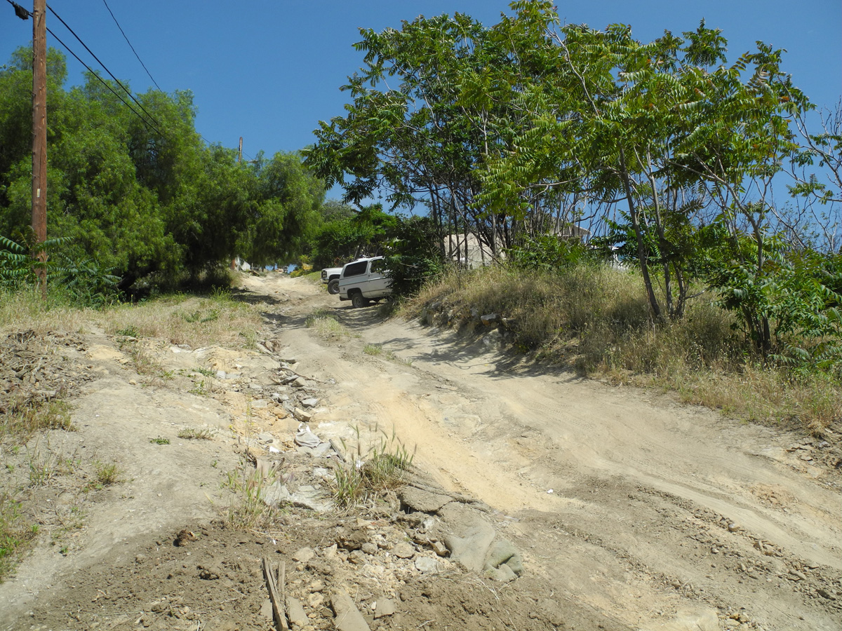
Many of the roads here are named after minerals and stones (Onyx, Pyrites, Amethyst, Topaz, Turquoise, Radium...) There are also the oddly named Sardonyx St., and East Von Keithian Avenue. Here's another view of Telluride, with downtown in the background. There are sections of old wooden steps alongside Telluride in some areas. It must be a kick to tell someone "My house is on a dirt road. near downtown L.A."
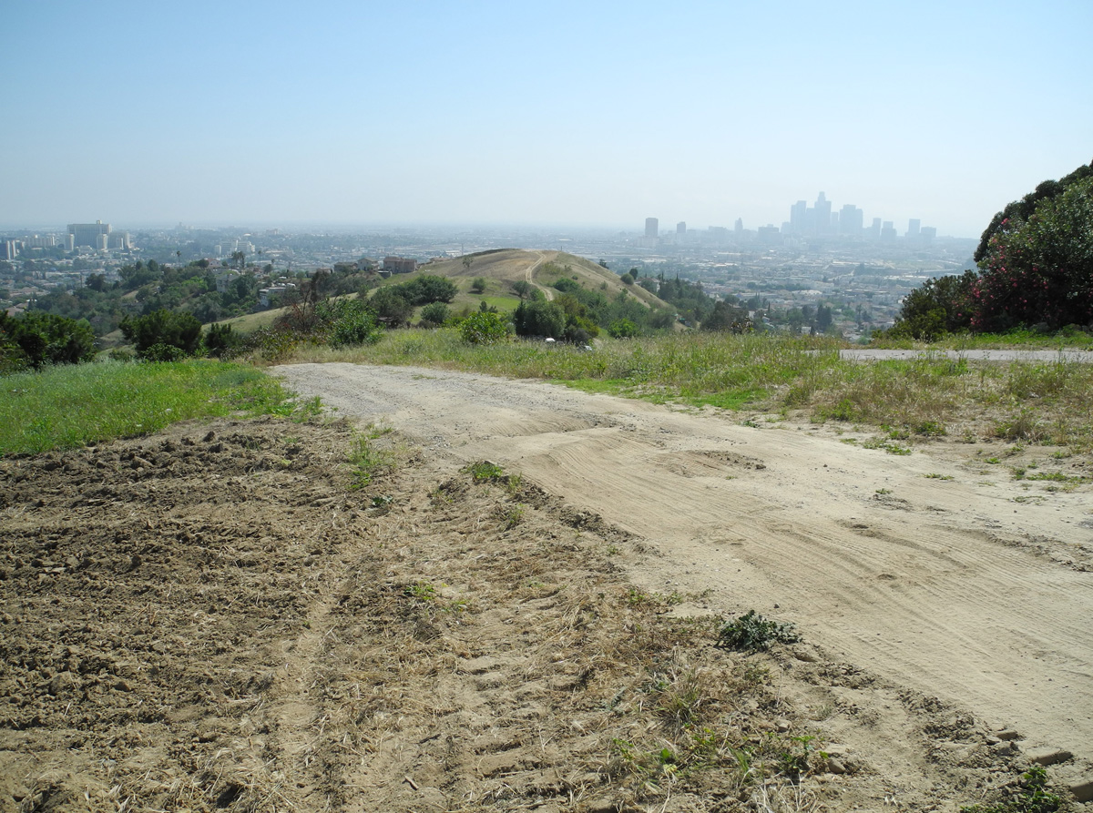
Telluride took us down to Sierra St., a paved road. We crossed Sierra and then headed up Gillin, a steep old concrete street that heads up the next hill. At the end of Gillin we again scrambled and continued up the hill to Radio Road, another of the many unpaved streets in this area, which the locals call Flat Top. Radio Road winds past a transmitting tower, then intersects with Fenn St.:
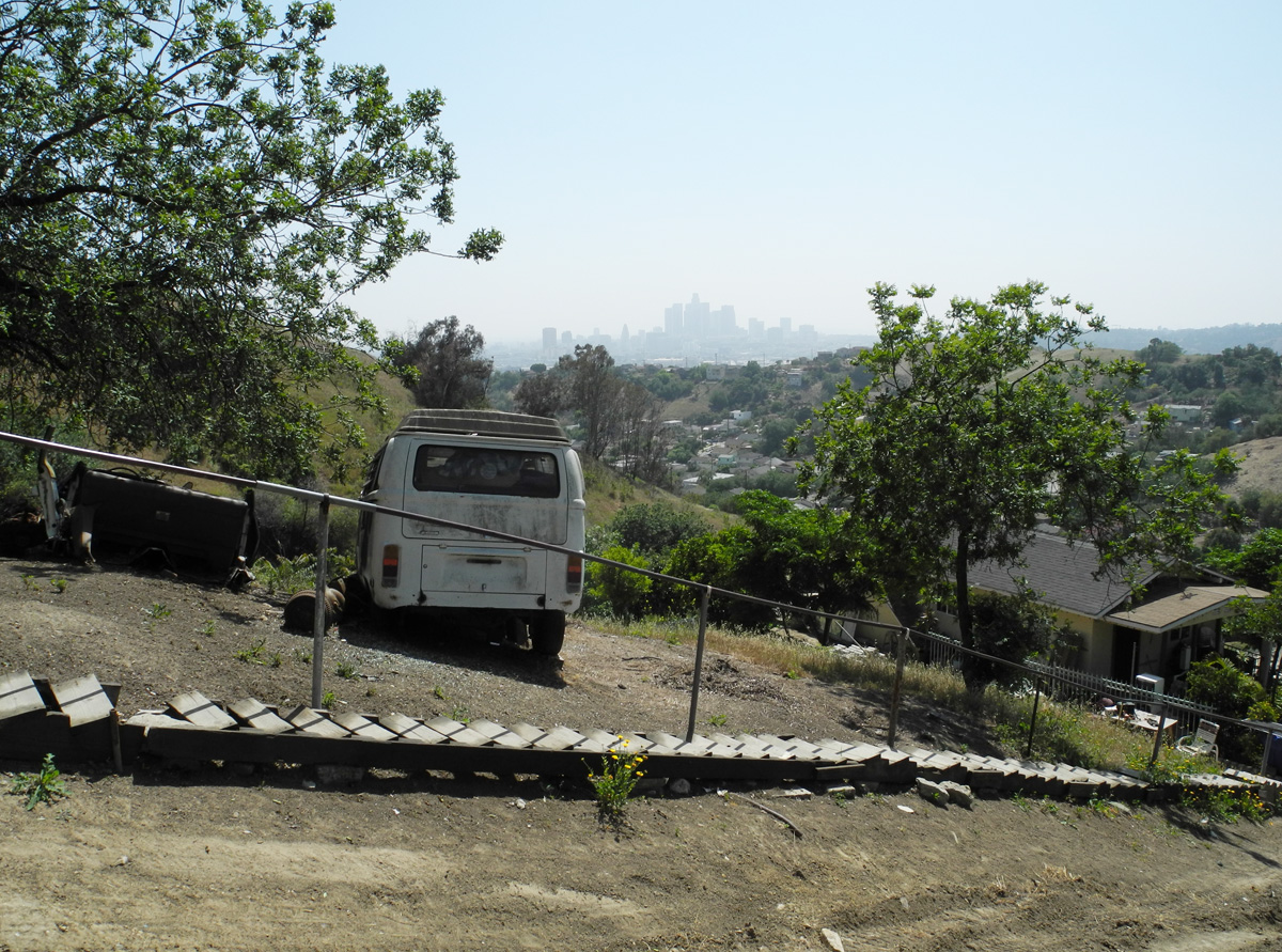
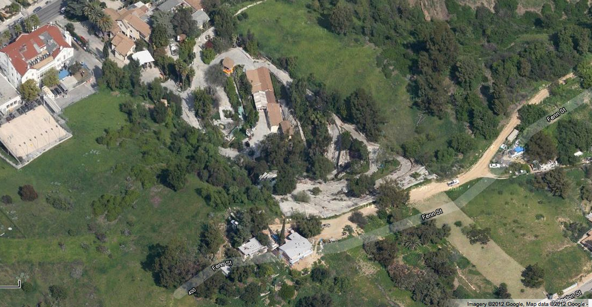
Fenn St. is long dirt road that leads to a remote home, which probably has a good view of Heritage Square. We didn't walk over to this home but noticed what seemed like odd concrete terraces (or something) near it. Here's a Google satellite view. I wonder who lives in this unusual isolated residence (2 buildings that wrap around the narrow tree at the bottom of the image), and I wonder what all that other stuff is, clustered north of it. The older red roof building in the upper left corner is the the L.A. Leadership Academy High School, at 234 E. Avenue 33.
This last photo shows East Avenue 33, with downtown in the background. That's Dodger Stadium on the hilltop near the upper right. We rarely see views of downtown L.A. from this perspective.
Monteceito Heights really intrigues me, but I've found very little info about it, or its history. My photos here just show a fraction of the interesting sights and homes that can be found in this area. If anyone can add anything about this little known neighborhood, I'd be very interested. One great thing about this area is that unlike L.A.'s developed hill and canyon areas and even Griffith Park, these hills are almost entirely in their original natural state, and there are no trees blocking the views. In old photos, Laurel Canyon, Lookout Mountain, Mulholland, the Hollywood Hills, etc. were originally "open spaces" that resembled these hills, but those areas are completely transformed now and 90% of the views are gone. The hills of Montecito Heights retain stunning, near-360 degree views. (Too bad it was so hazy yesterday.)