Quote:
Originally Posted by mja

We're disputing that. One might think so given that North Philly & South Philly have really strong images associated with them, but those two areas are arguably more similar to one another then they are to any of the other areas of the city.
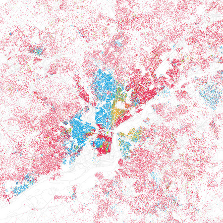
Also, here's a map of Philadelphia in 2000 by race, which shows far more of a division E/W (just because there's no East Philly is meaningless) than a N/S:
 |
Whether or not North and South Philly are more similar to one another than any other areas of the city really has nothing to do with whether or not
the city is geographically split more along north-south or east-west lines. And the claim of their similarities is highly arguable, anyway, depending on how one is attempting to compare them. They are similar in the fact that the traditional North and South Philly areas (
with Center City) comprise the dense urban core of the city... and that is precisely why there has been the N-S division historically.
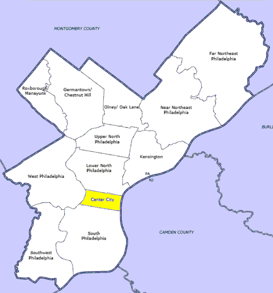
Take a look where
Center City is and you can still claim that Philly is situated more East-West than North-South? Seriously? Center City runs E-W from river to river, thus creating a N-S dividing line for the city. Flip the layout of Center City to a N-S linearity, and the opposite would be true... but that's not reality. Everything north of Center City is considered "North" (further classifying into the the very large Northeast and the Northwest enclaves) and all to the south of Center City is "South" (also including Southwest Philly). West Philly displays neighborhood characteristics very similar to its North, Center City, and South Philly counterparts across the Schuylkill.
If you think the map you shared shows more of a racial division E/W, then you have a very different understanding of the city of Philadelphia than I do. Racial division is just one parameter of the split, but ok, let's actually take a look at the City of Phildelphia racial makeup below.

Looking at this city map, it's very hard to defend that the city is separated along racial lines in a dominant E-W fashion. Remove the two "non-city" very white regions (Northwest and Northeast) which are much more suburban in nature than the rest of the city, and you can see a very large, decidedly non-white portion of the city to the north of Center City and a majority white portion to the south of Center City. Or include the Northwest and Northeast suburban sections... and now we have the westernmost portions of the city being almost exclusively white... and the easternmost portions of the city being almost exclusively white. So tell me how again does the city in terms of race, in your words, display
"far more of a division E/W than a N/S".
Quote:
Originally Posted by mja
Exactly my thoughts. Each region is quite distinct and the distinctions don't really fall on a N/S or E/W boundary.
|
Again, as I said to eschaton earlier, all of that detail is correct. But if you start getting into all of that distinction for each region of the city, you can't provide an answer to the general question. The answer being, Philadelphia is more split along N-S lines (by numerous measures) than it is split along E-W lines.