Quote:
Originally Posted by ethereal_reality

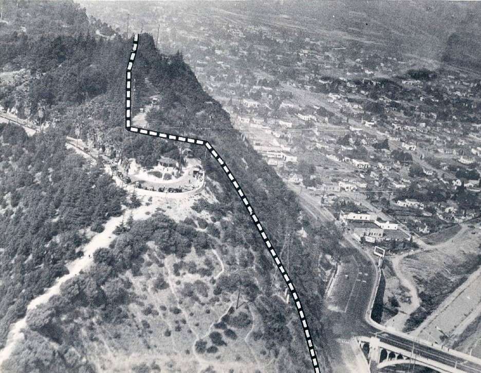
Here's an associated press photograph I found the other day on ebay. I am confused by the circular 'lookout' area that's located
just to the left of the dotted line (a probable landslide area).
found on ebay
above: Does anyone know the name of this 'turnabout' lookout area?
below: The information on the reverse side of the associated press photograph doesn't mentioned this 'lookout' point.

ebay
___ |
That was an incredible landslide... I think I read somewhere there was a water main break that caused the slide. But that may have been another event in the same location a few years later.
 LAPL.ORG
Oh.... it's called "Point Grand View"
http://www.flickr.com/photos/3208065...n/photostream/
 1966 Existing facilities in Elysian Park
 by
Deb Grantham, on Flickr
From the 37th Annual Report of the Board of Water and Power Commissioners of the City of Los Angeles:
http://www.monobasinresearch.org/his...nualreport.pdf
Quote:
In November, 1937, a landslide of large proportions took place in Elysian Park near Riverside Drive and Dayton Avenue. Because this earth movement occurred in a residential area close to the downtown district, it
attracted national attention and received a great deal of publicity in newspapers throughout the country. This slide crushed the Crystal Springs conduit which feeds the Buena Vista Reservoir, and a portion of the 40·inch
main conduit siphon feeding into the Elysian Park Reservoir. Both of these reservoirs supply water to the downtown business area, as well as to a portion of the residential district. Our construction forces responded
to the emergency in their customary prompt manner by laying a 30·inch main around the slide area, and water was again flowing into the Buena Vista and Elysian Park Reservoirs within 48 hours after the catastrophe, and
without any inconvenience to consumers.
|