New Orleans was founded in 1718 by the French as Nouvelle-Orléans, under the direction of Jean-Baptiste Le Moyne de Bienville. The site was selected because it was a rare bit of natural high ground along the flood-prone banks of the lower Mississippi, and was adjacent to the trading route and portage between the Mississippi and Lake Pontchartrain via Bayou St. John. It was, from this founding, intended to be an important colonial city.
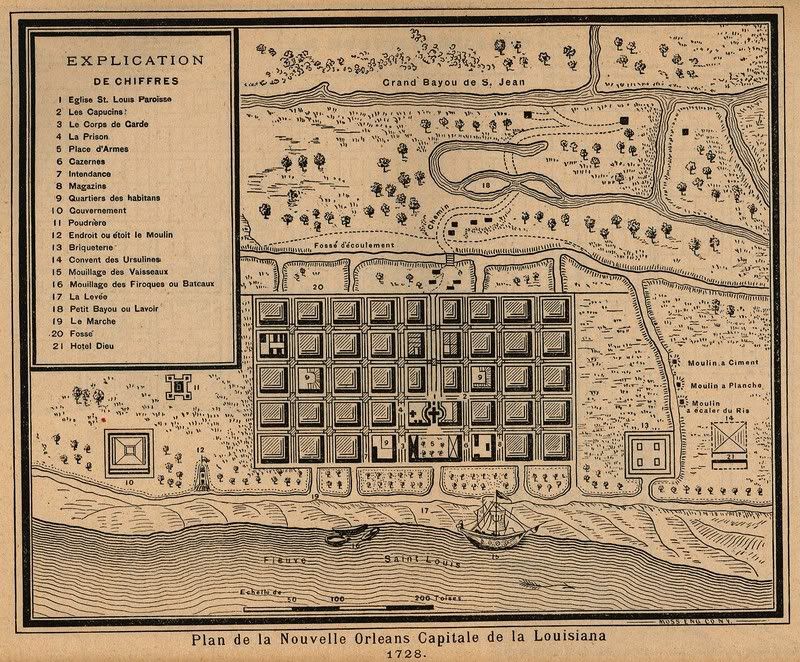
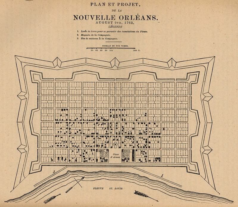
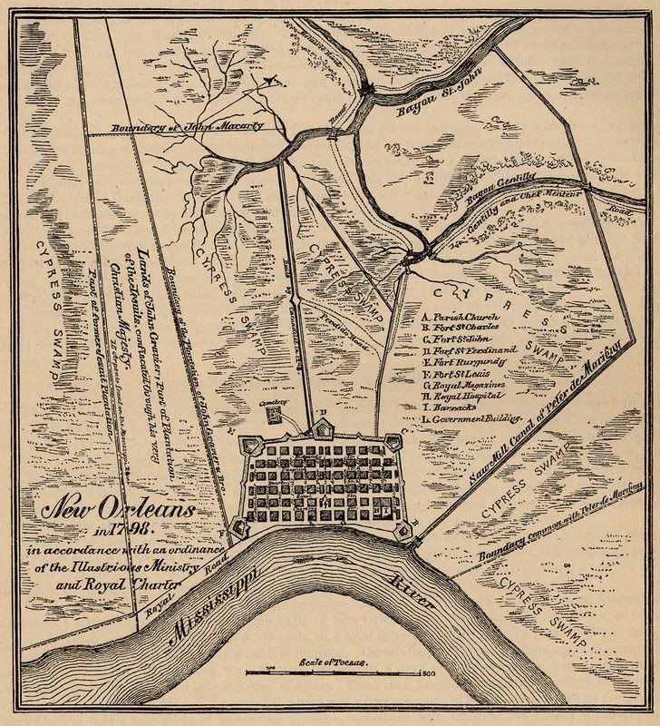
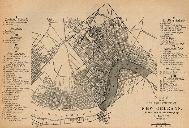
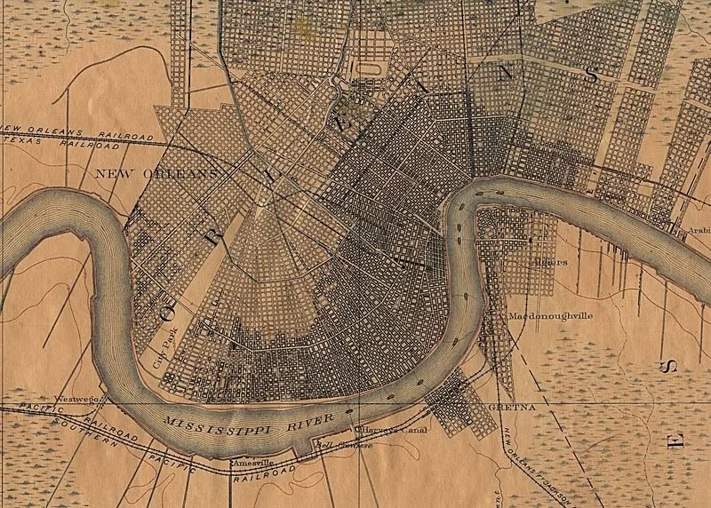
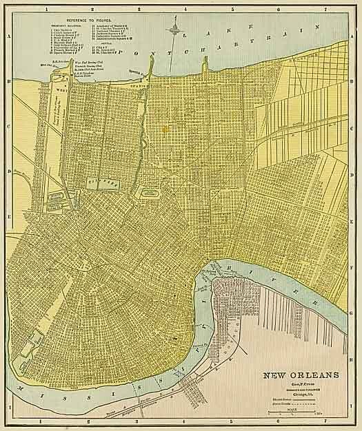
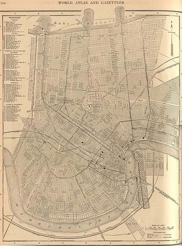
Here are a series of historical maps showing New Orleans from its' settlement through present. The 1798 map shows the initial interest in expanding the city north toward Lake Pontcahrtrain. Note the considerable expansion of the street network during the period from 1791 thru 1816 and again through the 20th century.
I just love maps!
1728
1763
1770

1798
1816
1891
1900
1908
The present day metropolitan area has considerable sprawl but this is (thankfully) limited by the large areas of water that surround the city.
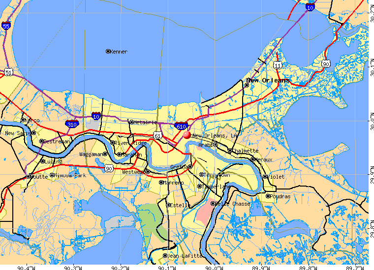
I am looking to fill in the timeframe from 1908 thru present if anyone can help.