|
A Walking Tour of Penn Avenue - One of America's Finest Streets
Penn Avenue is an 8.9 mile road in Pittsburgh, PA that starts out in the sleepy end of a first ring suburb and either passes through or intersects 10 of Pittsburgh's most fascinating and rapidly changing neighborhoods. I decided to grab the camera and head out for an end to end stroll as a chance to document each of these transitional neighborhoods.
We begin at the far eastern edge, in the neighborhood of Wilkinsburg at the intersection of Penn Avenue and Limecrest Road, the official termination of William Penn Highway and thus the beginning of Penn Avenue:

Heading west towards our destination of downtown, the setting is tranquil bungalows in various states of upkeep, but with no signs of the blight or abandonment that has been historically associated with Wilkinsburg over the past few decades which mirrored the region's decline.


Upon descending the slope of Penn Avenue you arrive in the central business corridor of Wilkinsburg, which is the proverbial "good bones, neglected, just needs the right stewardship and support" sort of town that every large city in America probably has in it's first ring. The repealing of an almost century old dry-law has perhaps given a boost to those hopes.


While it may not appear through these pictures (as I purposely was trying to miss foreheads), the Penn Ave corridor in Wilkinsburg is a very vibrant area. Wilkinsburg may never see the full development momentum of it's cousins west. A better guess would see it identified as a dynamic area for more affordable housing units. With convenient access to the East Busway, it is just accessible enough to flourish.
Moving along, after crossing under the East Busway and the Norfolk Southern ROW, you approach the Point Breeze neighborhood in the city proper. Point Breeze has unofficially served as the juxtaposition point between some of the cities most and least desirable areas, while still maintaining it's own charm and increasing attractiveness, using the East Busway as it's own buffer from some of the more distressed areas within the city's boundaries.


The Frick Art and Historical Center (which is actually addressed to a parallel side street), sits along the Penn Avenue Border. Renovations to multiple parcels (including a new construction project) are under way and the property is a hidden gem in the city.

Clayton, the name for Henry Clay's remodeled mansion, is most visible from street level.


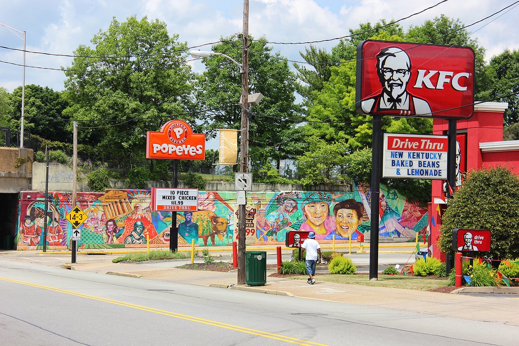
Beyond Point Breeze, at the intersection of Fifth Avenue, we straddle the border between the neighborhoods of Larimer and Shadyside where the defunct Nabisco factory has been developed and rebranded as Bakery Square. Regionally, BS is immediately identified with Google moving in to access the fountain of computer science talent matriculating from Carnegie Mellon University and generally credited with being the catalyst of a targeted (pun intended) pattern of development that has crossed over into the billions of dollars. To understand the drastic turnaround this area is undergoing, you'd have to truly research the levels of despair it just recently endured. As typically results in this rapid shift, not everyone is happy with the progress. Alas:


What Pittsburgh has generally gained in momentum, it has lost in inspiration. It's unfortunately caught in a paradigm of enough interest to develop, but bound by it's creativeness and capital to focus on legacy projects. Communist barracks not withstanding, just recently a few announcements, renderings and adaptive reuse plans (which given the city's punch-above-weight 20th century architecture, usually turn out well) may finally be tipping the scales towards tastefulness.
Moving beyond Larimer, we officially enter East Liberty, which has been the direct beneficiary of the Google effect (it should be noted that Google actually employs less than 1,000 workers in the region (which is a number no one actually knows because they are tight lipped with employment #'s) however they gave the area instant credibility and have also indicated they plan to continue expanding.)


"Big Box" is generally frowned upon in this setting, however the Target and Home Depot (around the corner on Highland Avenue) are fantastic examples of two such retailers that helped stabilize an area's micro economy and overall QoL. The guess is these two will not be the last in this area to pop up however.


There is a silly stat that caught on and has been parroted over and over recently that East Liberty used to be PA's 3rd largest retail sector behind the CBD's of Philly and Pittsburgh. While mostly, probably, completely unsubstantiated, it still shines a light on what a bustling corridor it once was.
East Lib Presbyterian Church is still, and will always be, the rockstar of the neighborhood however.


Moving west, multiple new build residential of various merit begins to pop up.


Penn Plaza apartments stand as a testament to the poor taste of generation's past. It does however lay claim to being a former home to one of baseball greatest, Roberto Clemente and his family, upon it's completion. Reading the correspondence from Clemente's agent, touting it's virtues after he toured it and "personally drove the distance to Forbes Field" is both interesting and depressing. Check that out at the Roberto Clemente Museum, which we will be walking past in a few miles.

Crossing Negley Avenue, we again straddle the intersection of two drastically different, "I wonder if any other city has this type of thing", neighborhoods. Garfield (up until recently one of Pittsburgh's most violent per capita) and ironically to the south, Friendship, share the other half of Penn Avenue. After a botched timeline on an infrastructure project along this portion of the Penn Avenue corridor (you may notice the lack of sidewalks...), this section will most likely see rapid appreciation and interest in the coming years. Between that and the tiny house project planned for Garfield, mentions in the local news will most likely not be of violence and neighborhood plea.


As we get to the Penn Avenue Entrance to the Allegheny Cemetery (which deserves its own tour), we have now entered another neighborhood straddling situation. This time the neighborhoods of Bloomfield and Lawrenceville.

To our left we see Pitt's cathedral a few neighborhoods away but still prevalent.

Pittsburgh's Children's Hospital sits on the land (and uses some of the non-razed facilities) of the former St. Francis Hospital in Lawrenceville and it's presence is (somewhat disputed) recognized for helping drive the resurgence of Lawrenceville, one of Pittsburgh's most boasted and cited neighborhoods, regardless of opinion.


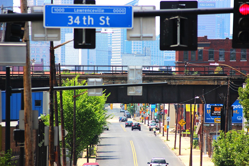
As we pass 40th Street, Bloomfield gives way to Lawrenceville on each side of Penn and we begin a downhill grade closer to town. In the background, Allegheny General Hospital sits offset of houses along Troy Hill.


This area of Lawrenceville is not generally associated with the notion of "Lawrenceville", as it is slightly removed from the Butler Street corridor, but it remains both quaint and appealing nonetheless.
As we round the bend, though still in Lawrenceville, we start to get somewhere...


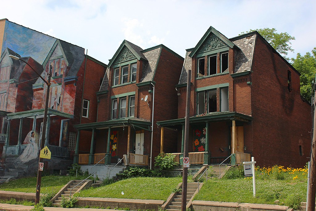
The few vacant lots remaining in Lawrenceville are mostly either under development or have been purchased and are in the pre-planning phase after going through the appropriate and sometimes simple-minded neighborhood planning process. The aforementioned Clemente Museum (Red Brick Engine House) sits directly next to a plot currently under said development. Twas a shame to see the rim shop get put down.


Crossing 33rd street gets us into The Strip District neighborhood of Pittsburgh. Let the pictures and internet tell its tale, however I will add that no area in Pittsburgh can offer the chance to achieve critical mass on a grand scale as the Strip. As new residential components are beginning to pop up frequently, even as a long awaited tract of land is held hostage with unimaginative dawdling, the chance to offer a contiguous density that would afford the ability to offer city services and collaboration to better serve it's residents would finally, almost, be achievable. That is something the city hasn't had since market forces and city planners took a machete to the city's landscape 60 years ago.
 (See: Brilliant Reuse Strategy) (See: Brilliant Reuse Strategy)


Approaching 11th Street we are now officially crossing into the Central Business District of Downtown Pittsburgh, or the Golden Triangle. Branded as The Cultural District, this area of the city has become the epicenter for bustle, unless you ask any of the provincial citizens of Pittsburgh that boastfully claim "The City is dead after 5 PM."


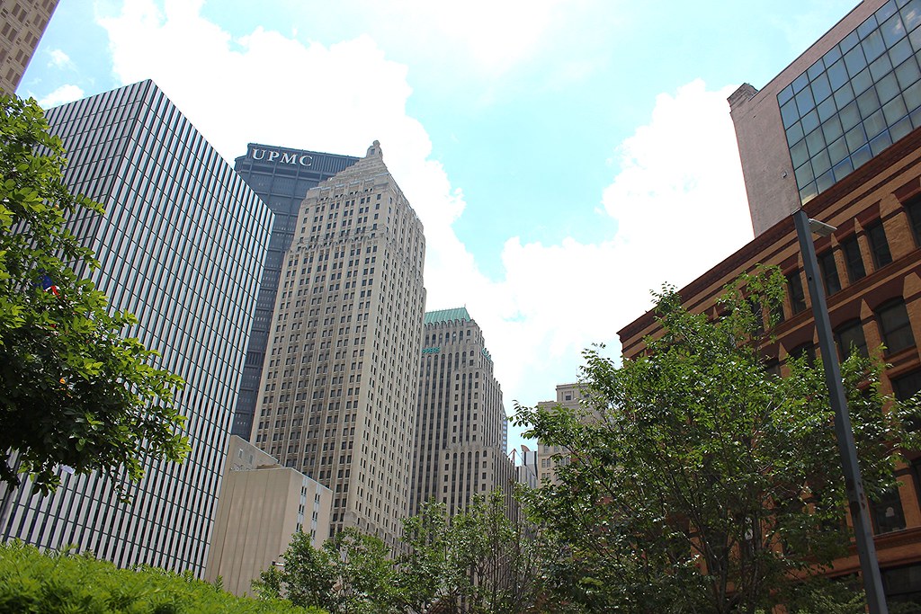
While Pittsburgh's skyline is generally revered, what really stands out when you are in town is how subsets of the buildings cluster together depending on your location and heading, but also the amazing collection of 19th and early 20th century structures that popped up at the height of it's industrial might. Wound within that web is the cultural districts offerings of theaters, dining options, parklets and trash, all peacefully coexisting in a wonderful pocket of urbanism.


Once beyond the heart of the theaters, you continue along Penn Avenue past the soon to be classic Gateway Center, at its termination point at the intersection with the tail end of Liberty Avenue.


Thanks, all. Apologies for lack of brevity, but it is the easiest means of illustrating Penn Avenue's brilliance.
Last edited by AFW523; Jul 6, 2015 at 7:34 PM.
|


 Threaded Mode