HomeDiagramsDatabaseMapsForum About
     

Go Back   SkyscraperPage Forum > Discussion Forums > Transportation


Reply

 
Thread Tools Display Modes
     
     
  #8081  
Old Posted Jul 26, 2011, 5:30 AM
ndrwmls10 ndrwmls10 is offline
Registered User
 
Join Date: Oct 2010
Posts: 28
Has light rail ever been considered to connect neighborhoods?
Reply With Quote
     
     
  #8082  
Old Posted Jul 26, 2011, 11:35 AM
the urban politician the urban politician is offline
The City
 
Join Date: Jul 2004
Location: Chicago region
Posts: 21,375
Quote:
Originally Posted by ndrwmls10 View Post
Has light rail ever been considered to connect neighborhoods?
^ Light rail?

OH MY GOD! That thought never crossed our mind!

I'm calling Mayor Emanuel right now
__________________
Supercar Adventures is my YouTube channel:

https://www.youtube.com/channel/UC4W...lUKB1w8ED5bV2Q
Reply With Quote
     
     
  #8083  
Old Posted Jul 26, 2011, 3:14 PM
emathias emathias is offline
Adoptive Chicagoan
 
Join Date: Sep 2007
Location: River North, Chicago, Illinois
Posts: 5,157
Quote:
Originally Posted by ndrwmls10 View Post
Has light rail ever been considered to connect neighborhoods?
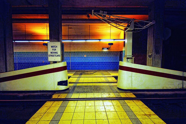
A less sarcastic answer is that Chicago used to have the largest streetcar system in the world, but tore it all out and replaced it with buses. Sometimes when they do construction on the streets, you can see the remnant rails still embedded in the streets under pavement.

In the late 1980s-early 1990s, there was a downtown lightrail Circulator proposed that would have run through and around the Loop to connect the West Loop and the Michigan Avenue area. When I first moved here in 1995, there were still posters in the Presidential Towers talking about the plan. That went nowhere for a variety of reasons, including that having light rail in one of the densest areas in North America wouldn't have really added much value.

Finally, in general light rail wouldn't add much, if any, value over either a regular bus line or a Bus Rapid Transit implementation. In the few places it would, heavy rail (like the "L") might be the better choice simply from a system integration standpoint. Grade-separated lightrail would likely cost nearly as much as new "L" service to implement and wouldn't be able to be integrated with any other existing "L" lines. Street-running lightrail would be relatively cheap to implement but would be slower than buses in nearly every case. The places where it might be most interesting to add, such as through Lincoln Park (the actual park, not just the neighborhood), or along the Boulevards system, would create safety issues or run into opposition because it would take some park land.

In general, improvements to the existing bus service would be cheaper and probably more effective than anything light rail could add. Even in the American city most famous for light-rail, Portland, it provides a mix of service that Chicago's "L" already provides, or when it runs through downtown on surface streets is often slower than buses running parallel routes.
Reply With Quote
     
     
  #8084  
Old Posted Jul 26, 2011, 3:17 PM
Illithid Dude's Avatar
Illithid Dude Illithid Dude is offline
Paramoderator
 
Join Date: Nov 2010
Location: Santa Monica / New York City
Posts: 3,021
Quote:
Originally Posted by emathias View Post
A less sarcastic answer is that Chicago used to have the largest streetcar system in the world
Ah-hem. Actually, L.A. had the largest rail system in the world, at over 1000 miles. But anyways, carry on.
Reply With Quote
     
     
  #8085  
Old Posted Jul 26, 2011, 4:22 PM
emathias emathias is offline
Adoptive Chicagoan
 
Join Date: Sep 2007
Location: River North, Chicago, Illinois
Posts: 5,157
Quote:
Originally Posted by Illithid Dude View Post
Ah-hem. Actually, L.A. had the largest rail system in the world, at over 1000 miles. But anyways, carry on.
I said "streetcar", so I stand by my assertion.

Your claim is only really true if you include the entire SoCal area, including interurban lines. Counting only the tram-style streetcars within a defined city (or even within a contiguous collection of cities), LA proper never had that many miles of trackage comparable to Chicago's. The fact that one company ran the streetcars in all the SoCal communities doesn't mean that they were comparable to Chicago or Buenos Aires.

To be comparable to Chicago, since the 1,000 mile number for SoCal includes interurbans, and multiple towns, you'd have to include Chicago's interurban lines that went as far north as Milwaukee and as far west as South Bend. And you have to add in all suburban streetcar lines in the Chicago area. You might even want to add in the "L" routes, since early on the "L" was quite literally streetcars running on elevated tracks. And since you said "rail" you'd also have to include all the commuter rail routes in Chicago.
Reply With Quote
     
     
  #8086  
Old Posted Jul 26, 2011, 5:22 PM
ardecila's Avatar
ardecila ardecila is offline
TL;DR
 
Join Date: Jun 2006
Location: the city o'wind
Posts: 16,383
Quote:
Originally Posted by emathias View Post
Grade-separated lightrail would likely cost nearly as much as new "L" service to implement and wouldn't be able to be integrated with any other existing "L" lines.
Actually, a light-rail subway is significantly cheaper than a heavy-rail subway, because the platforms are so much shorter and you usually don't need to build a mezzanine (people can cross the tracks at grade).

Using light-rail also lowers your costs overall because the trains can move to grade level once they move outside of congested areas.

This is why both LA and Toronto are pursuing light-rail, even though they both have massive congestion and existing heavy-rail systems.
__________________
la forme d'une ville change plus vite, hélas! que le coeur d'un mortel...
Reply With Quote
     
     
  #8087  
Old Posted Jul 28, 2011, 2:51 AM
Mr Downtown's Avatar
Mr Downtown Mr Downtown is online now
Urbane observer
 
Join Date: Nov 2006
Posts: 4,387
Quote:
Originally Posted by ardecila View Post
a light-rail subway is significantly cheaper [because] (people can cross the tracks at grade).
Can you name a place where that's ever actually been done? Even thinking about the pre-metro portions of Brussels or Cologne or Dallas, any time it's in subway you're not permitted to cross the tracks.
Reply With Quote
     
     
  #8088  
Old Posted Jul 28, 2011, 7:14 AM
ardecila's Avatar
ardecila ardecila is offline
TL;DR
 
Join Date: Jun 2006
Location: the city o'wind
Posts: 16,383
Queens' Quay, Toronto


flickr/sniderscion
__________________
la forme d'une ville change plus vite, hélas! que le coeur d'un mortel...
Reply With Quote
     
     
  #8089  
Old Posted Jul 28, 2011, 3:57 PM
Illithid Dude's Avatar
Illithid Dude Illithid Dude is offline
Paramoderator
 
Join Date: Nov 2010
Location: Santa Monica / New York City
Posts: 3,021
The problem with Light Rail is that most implementations of it are nothing more then glorified buses, and when it is built grade separated then it becomes Light Metro and just as expensive as heavy rail. I never got the Light Rail boosters, Heavy Rail is always so much better.
Reply With Quote
     
     
  #8090  
Old Posted Jul 28, 2011, 4:51 PM
emathias emathias is offline
Adoptive Chicagoan
 
Join Date: Sep 2007
Location: River North, Chicago, Illinois
Posts: 5,157
Quote:
Originally Posted by Mr Downtown View Post
Can you name a place where that's ever actually been done? Even thinking about the pre-metro portions of Brussels or Cologne or Dallas, any time it's in subway you're not permitted to cross the tracks.
Is there any place in the underground portion of Boston's Green Line you can cross tracks?
Reply With Quote
     
     
  #8091  
Old Posted Jul 28, 2011, 5:15 PM
nomarandlee's Avatar
nomarandlee nomarandlee is online now
My Mind Has Left My Body
 
Join Date: Jan 2006
Posts: 3,359
Quote:
Originally Posted by ardecila View Post
Actually, a light-rail subway is significantly cheaper than a heavy-rail subway, because the platforms are so much shorter and you usually don't need to build a mezzanine (people can cross the tracks at grade)..
Also theoretically in Chicago's case the places where LRT potentially could run below or above grade (Carol St, Grant Park bus way, St. Charles Air Line, Bloomington Line) already exist and I think would be much easier to adopt to LRT lines compared to reconfiguring such lines/routes to heavy rail.

Subway cars aren't even a theoretical option to run on Carol Street or the Grant Park bus way. In the Bloomington/St.Charles such lines could be reconfigured as part of L routes I suppose but you would eventually have to hook them into expensive or logically impossible new below/above routing infrastructure anyway.
Reply With Quote
     
     
  #8092  
Old Posted Jul 28, 2011, 6:22 PM
lawfin lawfin is offline
BANNED
 
Join Date: Sep 2008
Location: Chicago
Posts: 1,697
Quote:
Originally Posted by emathias View Post
I said "streetcar", so I stand by my assertion.

Your claim is only really true if you include the entire SoCal area, including interurban lines. Counting only the tram-style streetcars within a defined city (or even within a contiguous collection of cities), LA proper never had that many miles of trackage comparable to Chicago's. The fact that one company ran the streetcars in all the SoCal communities doesn't mean that they were comparable to Chicago or Buenos Aires.

To be comparable to Chicago, since the 1,000 mile number for SoCal includes interurbans, and multiple towns, you'd have to include Chicago's interurban lines that went as far north as Milwaukee and as far west as South Bend. And you have to add in all suburban streetcar lines in the Chicago area. You might even want to add in the "L" routes, since early on the "L" was quite literally streetcars running on elevated tracks. And since you said "rail" you'd also have to include all the commuter rail routes in Chicago.
I really wish there was a google map overlay with the old CSL route map on it....Just to get a better idea of the coverage and the ability to zoom down to intersections would be cool.

any of the map whizzes on here interested in doing that?
Reply With Quote
     
     
  #8093  
Old Posted Jul 28, 2011, 6:30 PM
emathias emathias is offline
Adoptive Chicagoan
 
Join Date: Sep 2007
Location: River North, Chicago, Illinois
Posts: 5,157
Quote:
Originally Posted by lawfin View Post
I really wish there was a google map overlay with the old CSL route map on it....Just to get a better idea of the coverage and the ability to zoom down to intersections would be cool.

any of the map whizzes on here interested in doing that?
I have a 1940s maps of it on my living room wall, and just based on that there are way too many routes for me to volunteer to do that!
Reply With Quote
     
     
  #8094  
Old Posted Jul 28, 2011, 7:17 PM
sukwoo sukwoo is offline
Registered User
 
Join Date: Jul 2007
Location: Oak Park, IL
Posts: 204
Quote:
Originally Posted by emathias View Post
Is there any place in the underground portion of Boston's Green Line you can cross tracks?
Sure, at Park St station (http://www.flickr.com/photos/photos_...ce/3446652102/)
Reply With Quote
     
     
  #8095  
Old Posted Jul 28, 2011, 8:01 PM
ardecila's Avatar
ardecila ardecila is offline
TL;DR
 
Join Date: Jun 2006
Location: the city o'wind
Posts: 16,383
Quote:
Originally Posted by emathias View Post
I have a 1940s maps of it on my living room wall, and just based on that there are way too many routes for me to volunteer to do that!
The problem is that, just like the bus routes of today, the streetcar alignments tended to be fairly complex, zigging and zagging up various different streets. Drawing a map that only showed streetcar LINES (tracks) but not actual routes, would be easier.

The routes tended to change over the years, so you'd need to pick a given year if you wanted to make a map.
__________________
la forme d'une ville change plus vite, hélas! que le coeur d'un mortel...
Reply With Quote
     
     
  #8096  
Old Posted Jul 28, 2011, 8:05 PM
ardecila's Avatar
ardecila ardecila is offline
TL;DR
 
Join Date: Jun 2006
Location: the city o'wind
Posts: 16,383
Quote:
Originally Posted by emathias View Post
Is there any place in the underground portion of Boston's Green Line you can cross tracks?
Actually, the first example that came to mind for me was Copley in Boston, but I must have been confusing it with Park Street.

Copley doesn't have a mezzanine, but it doesn't have a pedestrian crossing either. There's no free way to switch directions.

Park Street is a weird place... I'm surprised they allow the at-grade crossing, since the tracks are curved and the sight lines to approaching trains are very short.
__________________
la forme d'une ville change plus vite, hélas! que le coeur d'un mortel...
Reply With Quote
     
     
  #8097  
Old Posted Jul 28, 2011, 9:14 PM
emathias emathias is offline
Adoptive Chicagoan
 
Join Date: Sep 2007
Location: River North, Chicago, Illinois
Posts: 5,157
Quote:
Originally Posted by ardecila View Post
The problem is that, just like the bus routes of today, the streetcar alignments tended to be fairly complex, zigging and zagging up various different streets. Drawing a map that only showed streetcar LINES (tracks) but not actual routes, would be easier.

The routes tended to change over the years, so you'd need to pick a given year if you wanted to make a map.
This is more or less the maps I have - I think mine is a couple years different, but it's largely the same:

Chicago-L.org map
Reply With Quote
     
     
  #8098  
Old Posted Jul 28, 2011, 11:26 PM
Mr Downtown's Avatar
Mr Downtown Mr Downtown is online now
Urbane observer
 
Join Date: Nov 2006
Posts: 4,387
Reply With Quote
     
     
  #8099  
Old Posted Jul 29, 2011, 12:31 AM
ndrwmls10 ndrwmls10 is offline
Registered User
 
Join Date: Oct 2010
Posts: 28
I was thinking about something like the streetcar map. Much less, more of a circulator and connector to each neighborhood. I know that it would never happen, but would it be a good idea and would it spur economic development?
Reply With Quote
     
     
  #8100  
Old Posted Jul 29, 2011, 3:23 AM
Rizzo Rizzo is offline
Registered User
 
Join Date: Jun 2004
Location: Chicago
Posts: 7,285
Quote:
Originally Posted by Mr Downtown View Post
Occasionally, I'll see some roadwork dig really deep and you'll see the old streetcar lines. Some were almost 10" below the surface. Currently a set of tracks are exposed on Halsted while the road substrate is rebuilt for the bridge approaches. I have some awful phone photos.
Reply With Quote
     
     
This discussion thread continues

Use the page links to the lower-right to go to the next page for additional posts
 
 
Reply

Go Back   SkyscraperPage Forum > Discussion Forums > Transportation
Forum Jump


Forum Jump


All times are GMT. The time now is 5:14 PM.

     
SkyscraperPage.com - Archive - Privacy Statement - Top

Powered by vBulletin® Version 3.8.7
Copyright ©2000 - 2024, vBulletin Solutions, Inc.