Charlotte
 View this photo full size.
Last Friday I had to opportunity to take an aerial tour of Charlotte, thanks to a friend who is part of a local flying club. I went with two other local photographers with whom I work on city related projects. We spent almost 2 1/2 hours in the air, mostly circling downtown between 2,600 and 2,000 feet. Speed Street, the festival for the Coca-cola 600 was going on downtown, and at one point, with the airplane's windows open, we could actually smell the funnel cake. Let's begin:
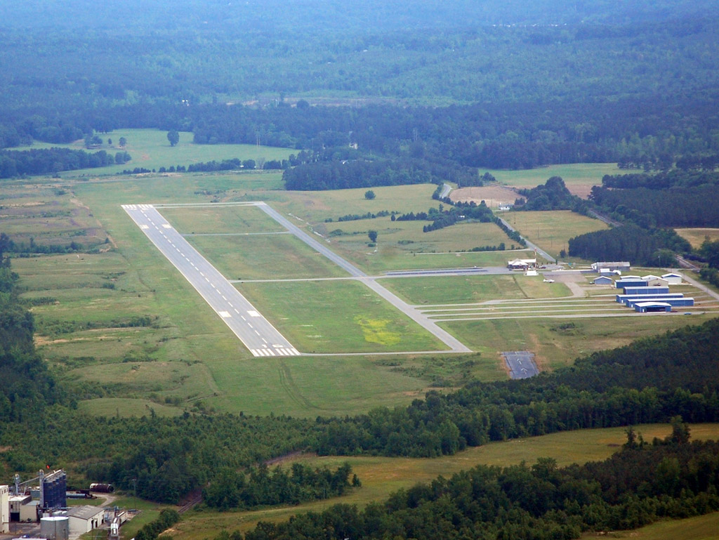
We started off at the Anson County airport, about an hour and 20 minutes drive from Charlotte, but about 20 minutes or so by air. Here is our plane; a 1976 Cessna 172:

There's not much to this little airport.
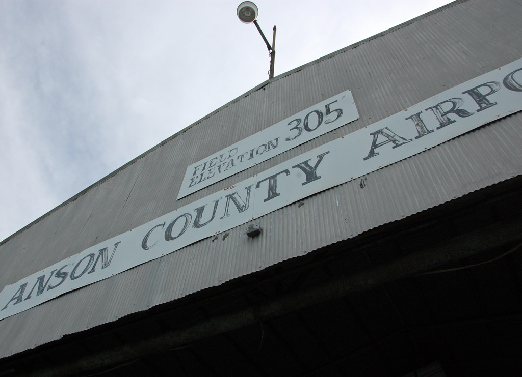
Looking back at the little airport:
 South Park
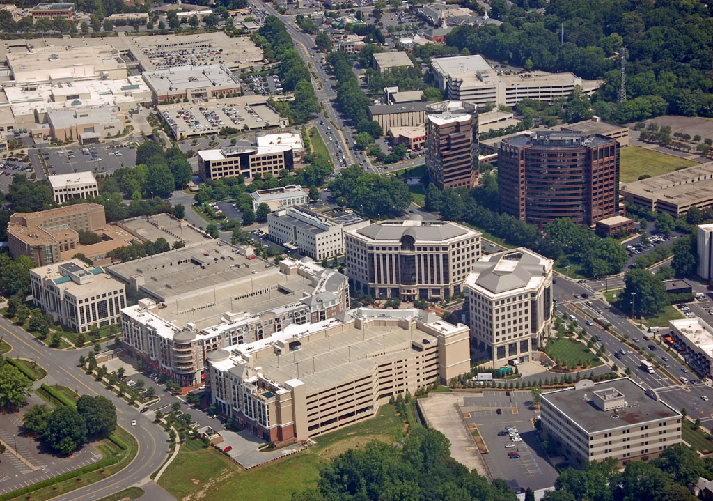
South Park is one of the more developed and affluent areas of Charlotte, and some would say it is a small scale version of Atlanta's Buckhead. It is located about 6 or so miles south of downtown. The heart of South Park is South Park Mall - Charlotte's most upscale mall. No Radio Shacks here - tenants include Neiman Marcus, Nordstrom, Louis Vuitton and the like. Over the past couple of decades, the area has grown rapidly with office, residential, and hotel developments. I've heard several times that South Park has more office space than all of downtown Raleigh, but I don't know if it is true.
This gives a good overview of the area, looking West. The main road running up and down is Fairview, and Sharon Rd. runs left and right. The mall can be easily seen in the center right, surrounded by parking decks.

The two darker colored buildings are the tallest in South Park, at 16 and 14 floors.

The mall can be seen again in the upper-left corner:
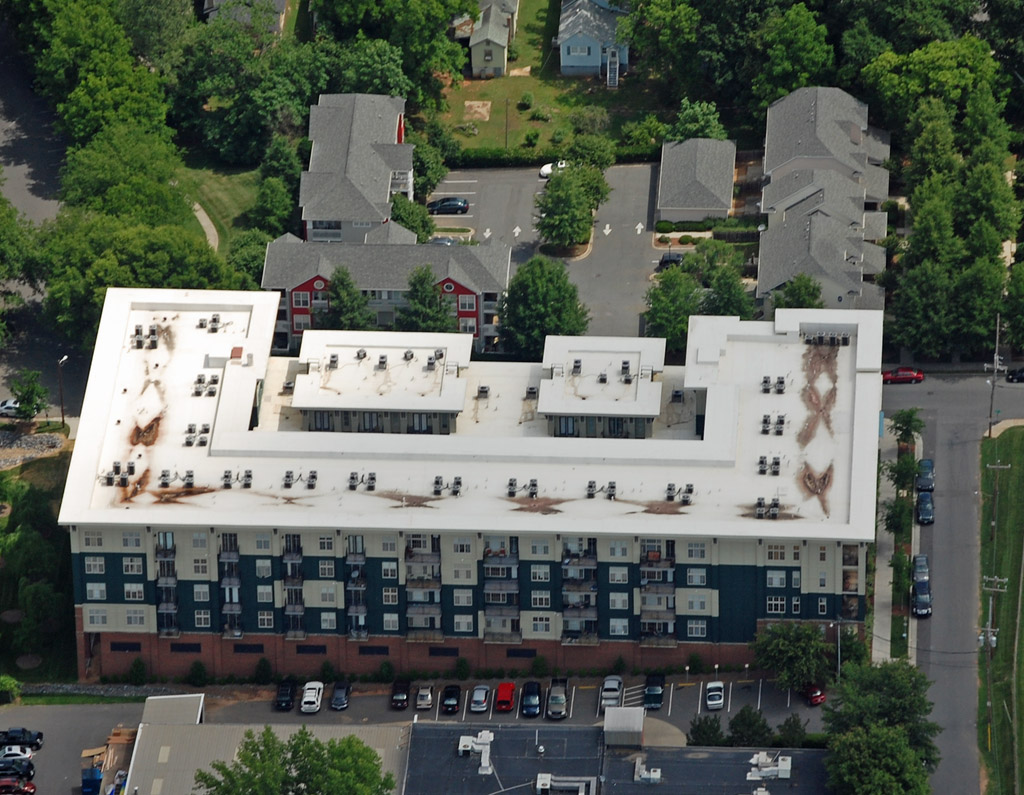
Another residential project in South Park:
A few kind of boring buildings in the area:

Towards to the top center-right of the photo you can see a park with a pond and amphitheater. Several outdoor events are held here, including concerts and the Beer, Bourbon, and BBQ festival.

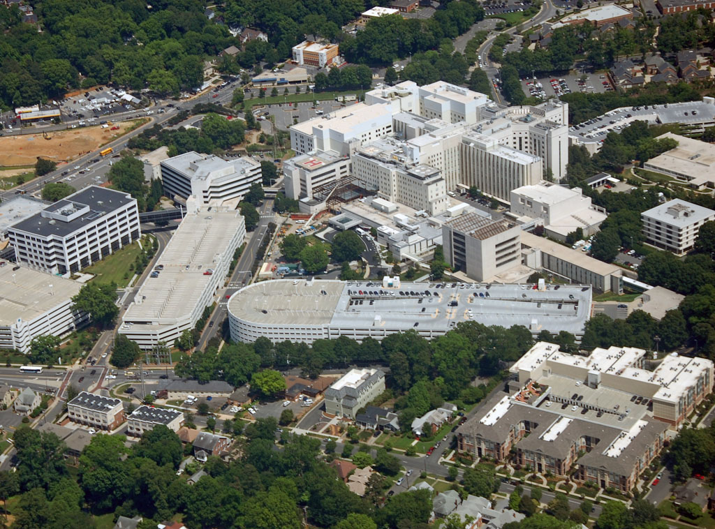
We're now heading towards downtown, or as it is called here: uptown. This view is from the South Park area looking towards downtown. Towards the bottom-left of the photo is the historic and upper class Dilworth neighborhood. Towards the bottom-left of the photo you can see the large Carolinas
Medical Center and Levine Childrens' Hospital area, which we'll pass over on our way.
 South Charlotte
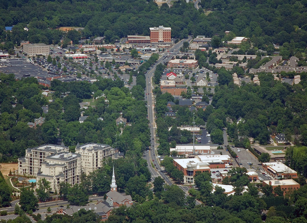
The area just south of downtown between downtown and South Park includes Park Road, Myers Park, and areas.
This is the Park Road shopping center. It is one of the older, yet still popular, strip malls in the city. It is generally considered a pretty good area.
More of the area around Park Road. The Park Road Shopping Center is off the bottom-right corner of this photo.
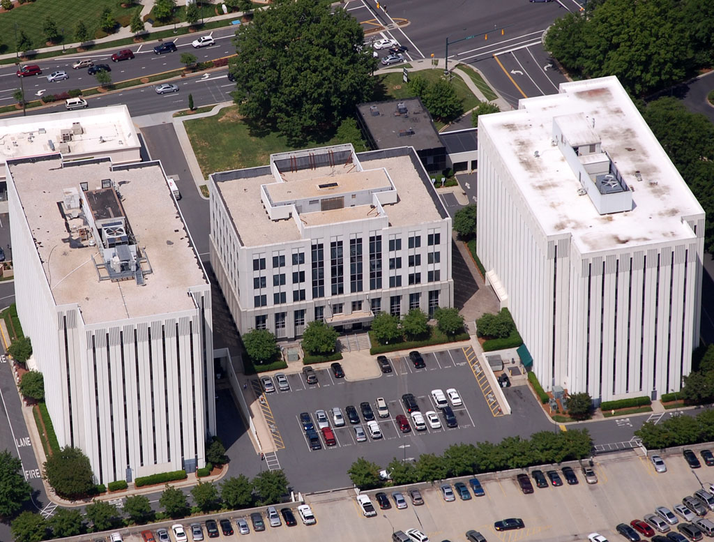
This photo is looking east along Sharon Amity Rd. from Providence Rd. to Randolph Rd./Cotswold Mall area (the top-left quarter of the photo). It is another older, still popular strip mall like the one on Park Road. The upscale residential development in the bottom-left corner is Rosewood. The brick building towards the center-top is Colwick tower, which was recently refurbished and turned into medical offices.
[/IMG]
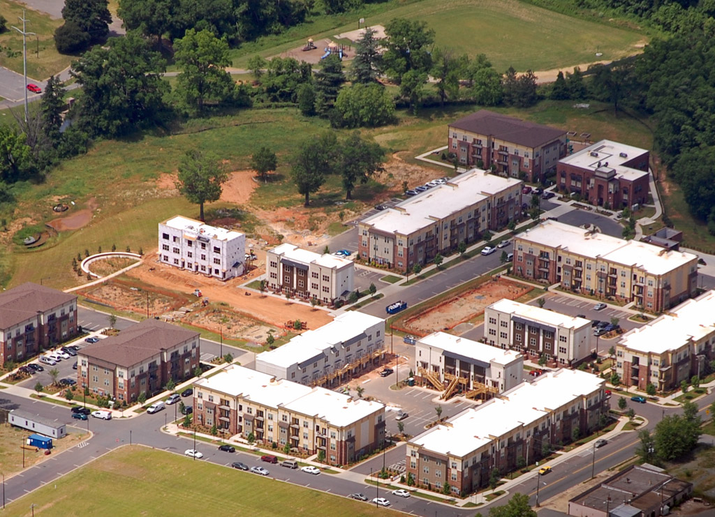
Here we have Queens University. This college is located in Myers Park; one of the richer suburbs just south of downtown. It is a popular area due to it's great tree lined streets. The area around this small college is very popular for bicycle riders. So popular, in fact, that the route - known as the "Booty loop" - has spawned a hugely successful annual 24-hour charity ride for cancer.

The large Carolinas Medical Center and Levine Childrens' Hospital campus. This area is on the very southern edge of Dilworth, just north of Myers Park.
 Elizabeth
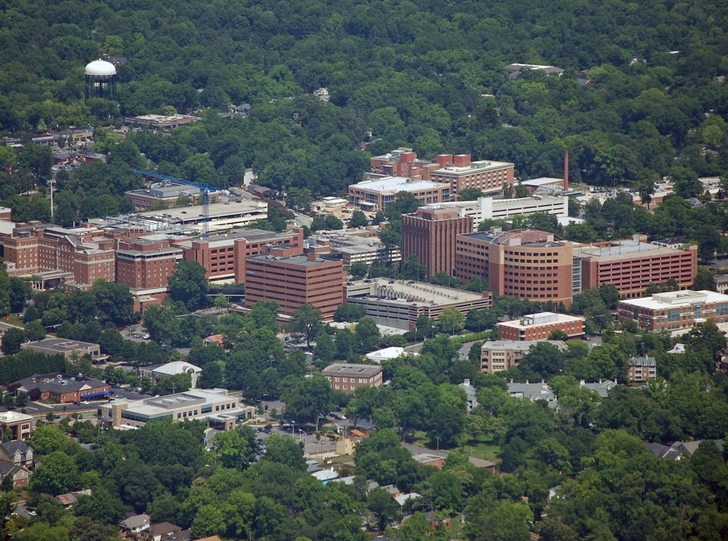
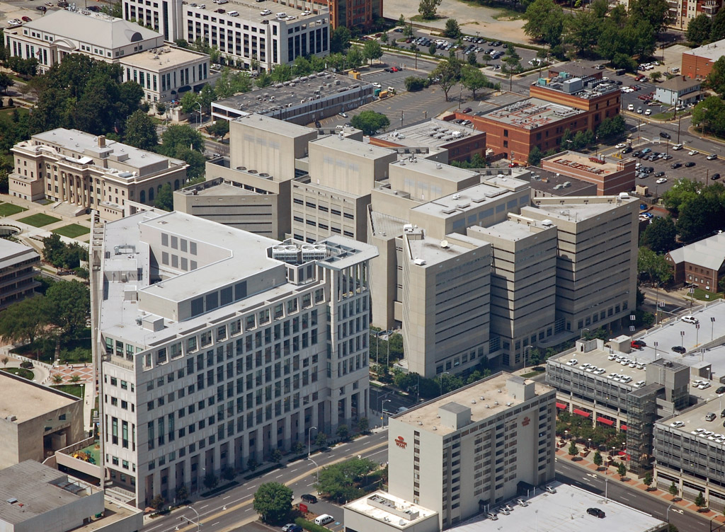
Elizabeth is a neighborhood immediately Southeast of downtown. The neighborhood includes the largest campus of Central Piedmont Community College, the small Kings College, Presbyterian Hospital, and Carolinas Medical Center - Mercy, along with a number of restaurants, bars, and music venues. The 2030 transit plans call for a streetcar line that will connect Elizabeth with downtown.
We start with Metropolitan Midtown - a mixed use development just outside of center city, on the border between Dilworth and Elizabeth. Tenants include Best Buy, Target, Trader Joes, and other. In the photo you can see Sugar Creek and the Sugar Creek greenway project under construction. Sections of the Sugar Creek greenway are being expanded, and it will be an important pedestrian and bicycle connector between several neighborhoods.

Another view of Metropolitan Midtown, with part of Elizabeth in the background.
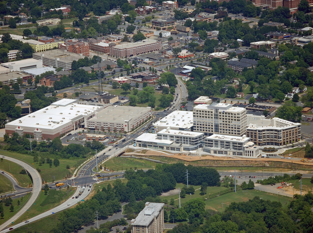
Part of Elizabeth, with Presbyterian Hospital on the far right of the photo.
A few more photos of the area:
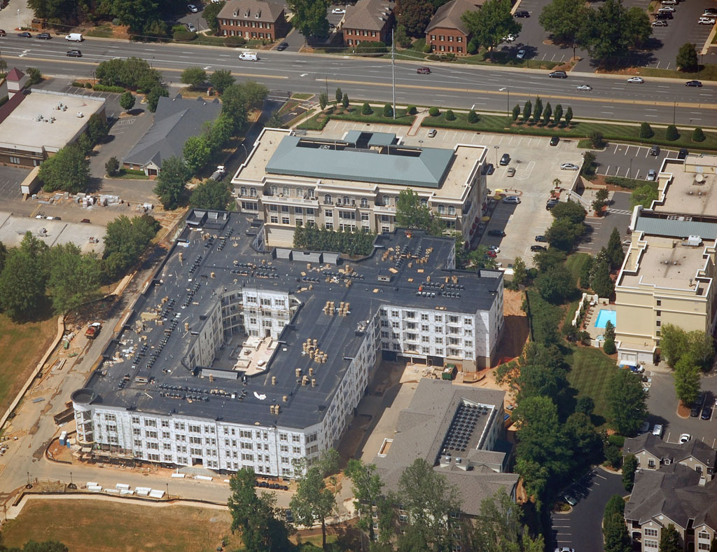
While some projects in the neighborhood, a few are on hold until the economic climate improves. These include a mid-rise residential tower and movie theater, which would fill up some of the vacant lots off to the bottom-right.

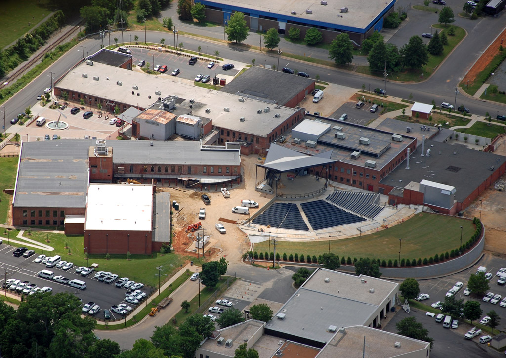
This photo shows part of the Central Piedmont campus, and Memorial Stadium. This old stadium is used for highschool and lower-level college football games, and is home to Charlotte's Oktoberfest. The building just to the right of the stadium is the Grady Cole center, which hosts smaller performances.
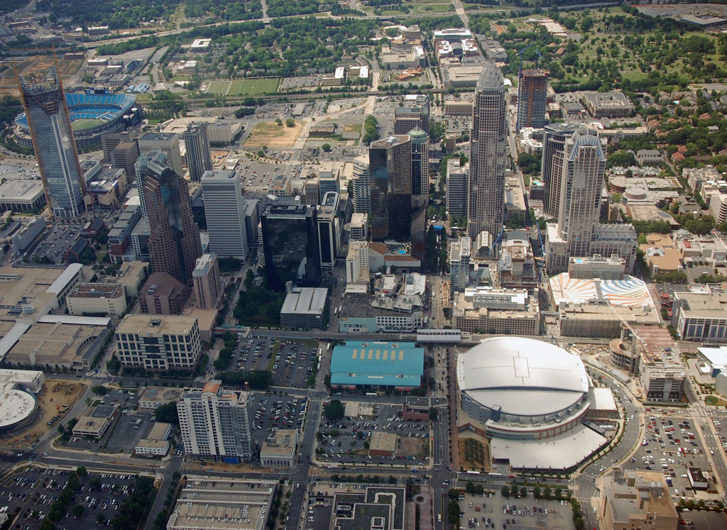
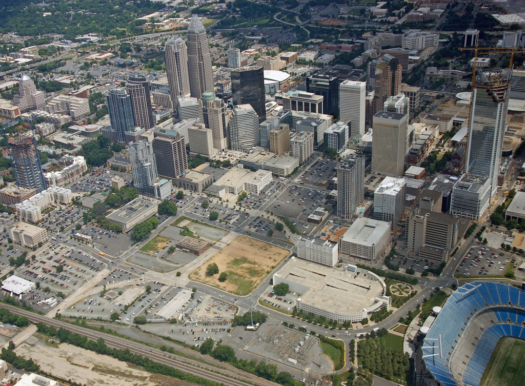
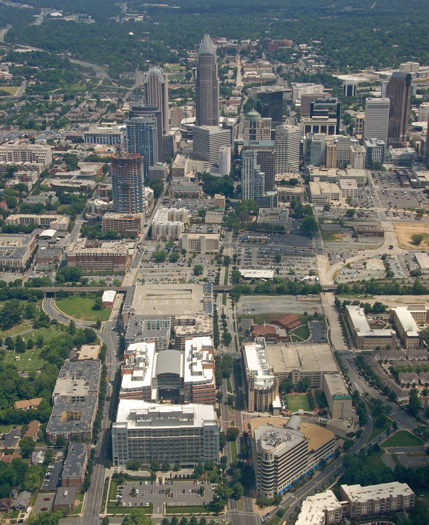
 Center City
Center City - downtown, or uptown if you like, is the area inside the I-277 loop. The two main intersecting streets, Trade and Tryon, divide center city into four quadrants: 1st, 2nd, 3rd, and 4th Ward.
Looking towards center city from above the Elizabeth neighborhood. The I-277 beltway the separates center city from Elizabeth can be seen in the foreground.
At the top of this photo we can see the Carolinas Medical Center campus. Below that and to the left we see the Metropolitan Midtown mixed use development and the Sugar Creek greenway. Just below that is part of the I-277 beltway. Below that is part of 2nd Ward. This area is mostly governmental buildings, including the county jail, courthouse, city gov building, Federal Reserve, and a few hotels and residential buildings. Bottom-right corner you can see part of the arena.

Looking at the Time-Warner Cable Arena area. Just to the right of it is Center City Green under construction - a green market with restaurants with a parking deck on top. Of course the condo portion of the project is on hold. Towards to the top-left you can see 1 Bank of America under construction - more on that later.
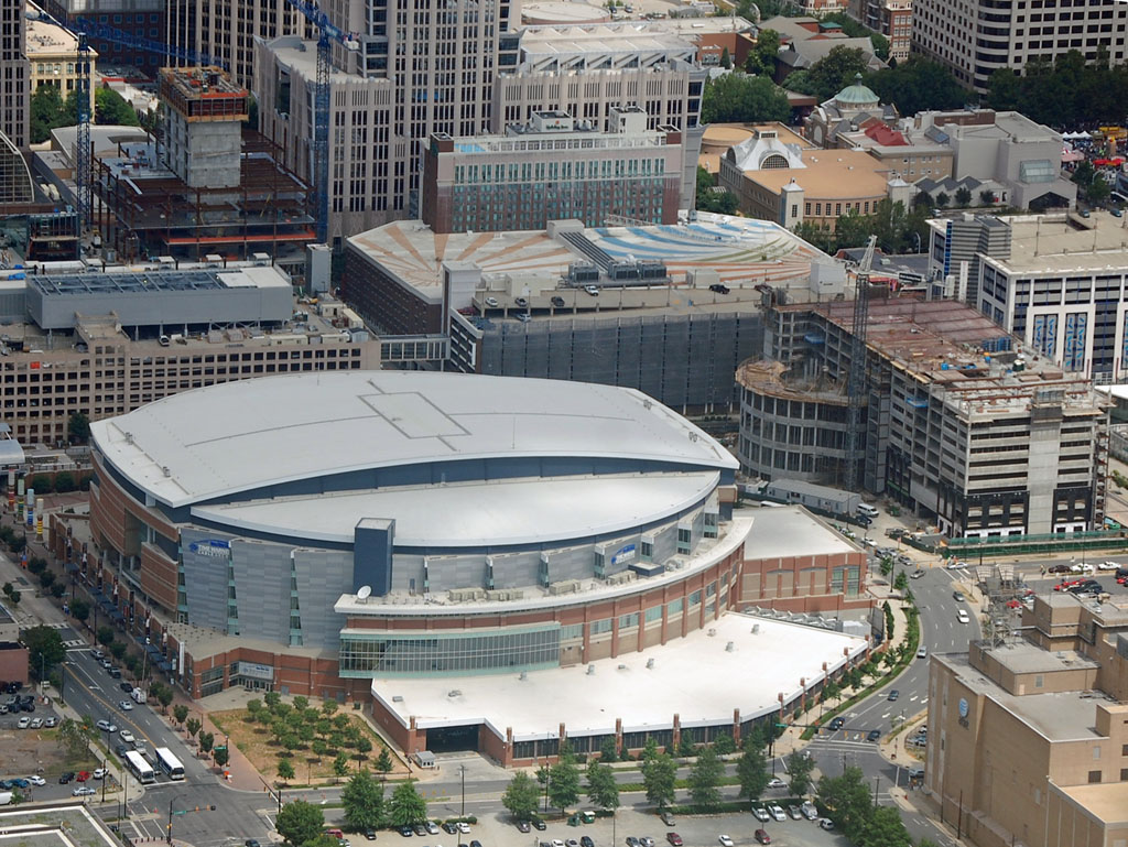
Closer look at the arena. The teal roof building is the Charlotte Transportation Center - the main city bus terminal. Just up and to the right of the arena is the light rail line, with a covered station above Trade Street adjacent to the transportation center. The arena is home to the Charlotte Bobcats (they're getting better) and the ECHL Charlotte Checkers hockey team. The arena also hosts the CIAA basketball tournament, and has recently hosted the ACC basketball tournament and regional NCAA tournament games. Next year it will host the Southern Conference tournament, which includes Davidson University whose campus is in a small town in the northern part of the county.
Close look at part of 2nd Ward, including some government buildings, the county jail at the bottom, and Marshall Park with its pond.
Another angle:
The heart of uptown. You can see tree-lined Tryon Street running through the center.
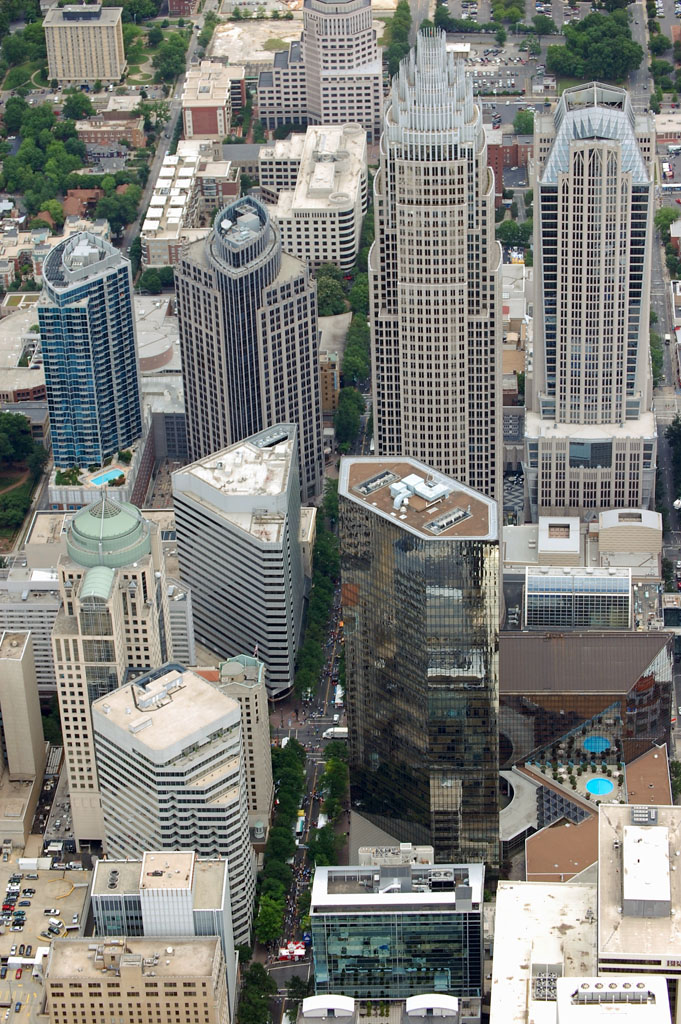
Looking at center city from above 2nd ward:
See that gray/white building towards the bottom-left corner, the one with the little copper roof? That is The Park. It is/was a condo project whose developer ran out of money and had to file for bankruptcy. The bank foreclosed on the tower and construction halted at about 70-80% complete. The building hasn't been touched since early last year. Attempts to auction off the building last year failed. Nobody knows what will happen to the shell of the building at this time, and if/when a developer will buy it and finish it. With all the other condo towers opening, it is a tough sell. It will probably sit vacant for another couple years until the economic outlook improved. It can be yours for as low as $10 million.
In the bottom-left corner of this photo you can see part of the I-277 beltway. Here they are redoing some of the off ramps from the freeway. This will free up a couple large parcels of land the city wants to sell to sell for future mixed-use development.
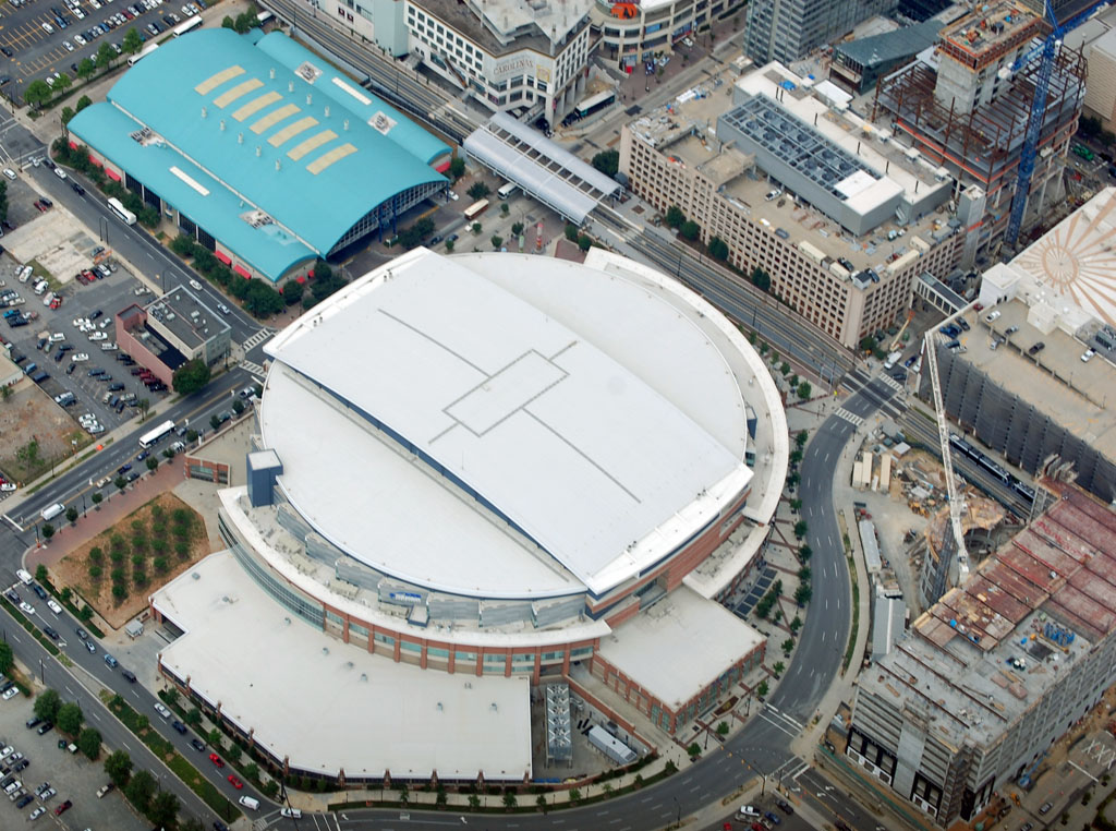
Center city has great density at its core, but this came from sacrificing many old, historic low and midrise buildings. One interesting thing: you can see the light rail line cross the I-277 beltway at the bottom-center of the photo. Going up, you see Stonewall station next to the Westin hotel, the tracks then go through the convention center, you see 3rd St. station under the beige building, and going up you see the covered Transportation Center/Arena station that is above Trade St.
Zooming out a little bit you can see the teal roof of the Transportation center (main city bus terminal) and part of the arena on the far right. Towards the bottom-right you can see the oval shape of the NASCAR Hall of Fame and attached office tower, which will be opening next year. After Charlotte beat out Atlanta to get it, Atlantians said "We didn't want it anyway!" It's okay, I still love you Atlanta.

A closer look at the Hall of Fame. This is the backside, and really isn't that interesting to look at:

Looking up tree-lined Tryon Street:
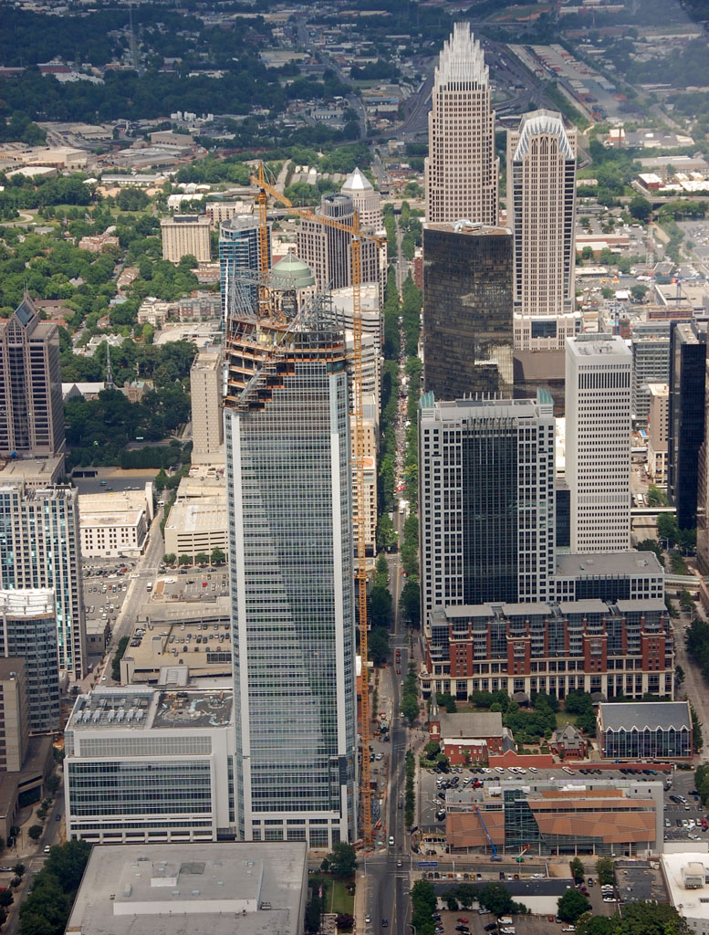
A little higher up. You can see the other side of the I-277 beltway run horizontally towards to top of the photo. In the bottom-right, the convention center with light rail line running through it.

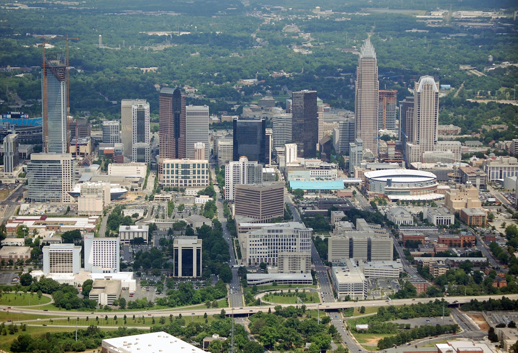
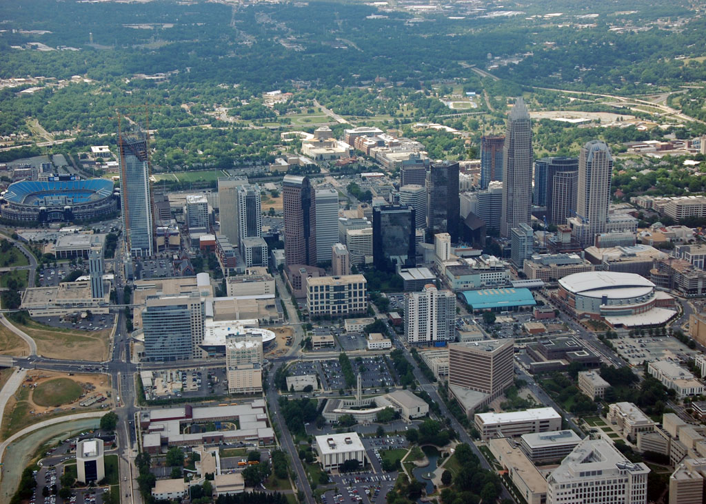
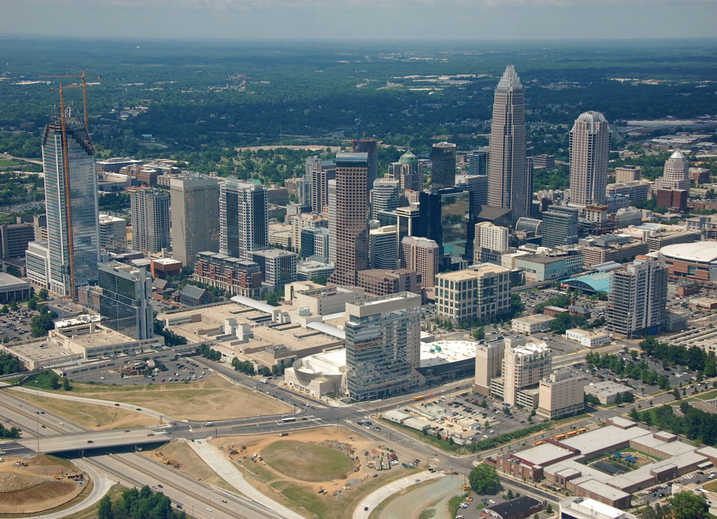
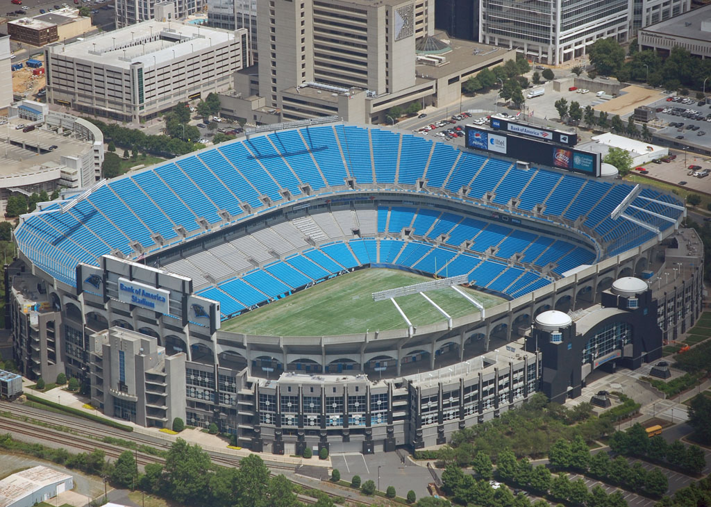
Changing angles, we're looking towards center city from 3rd Ward, with the Bank of America stadium, home of the NFL Carolina Panthers, in the foreground.
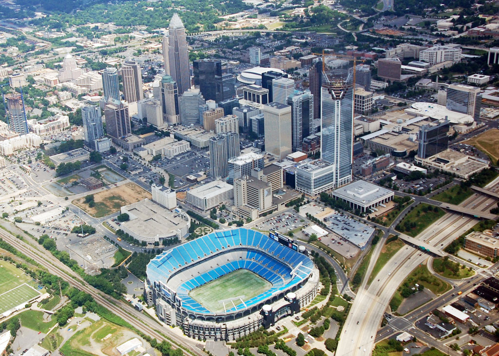
The large brown patch? That's the planned location of the Charlotte Knights AAA baseball stadium. There were some legal issues with the land swap that would allow the city to lease the land to the Knights, so instead of playing here this season, the stadium is now several years away, if at all.
Just up and right of the brown patch are several parking lots that are being turned into 3rd Ward Park, also called Roman Bearden Park. This project is moving forward with certainty. Overall, 3rd Ward is the most under-developed quadrant of center city, with way too many surface lots.
In the far bottom-left corner you can see the Greyhound bus terminal. This is the proposed location of the Multi-modal transportation center. Here will be the terminal for the proposed high speed rail line, the streetcar line, the northern commuter rail line, and the Greyhound bus terminal. Oh, and if you look along the very top edge of the photo, just right of center, you can see old Memorial Stadium and part of the Central Piedmont campus along the edge of Elizabeth.
Another angle over the stadium:
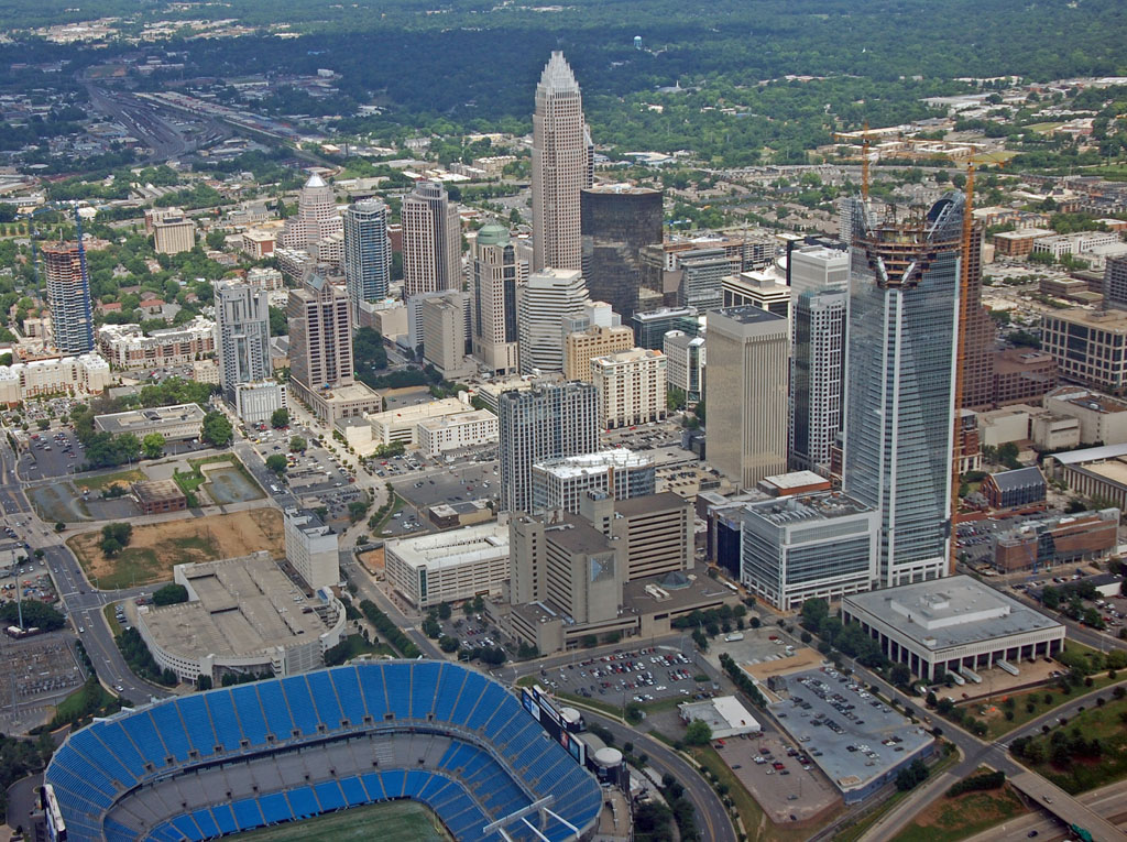
Bank of America stadium, home of the NFL Carolina Panthers and the Mineke Car Care bowl between the ACC and the Big East. Several other college games are played here every year, which last year included the sold-out match-up of East Carolina and Virginia Tech.
Some 3rd Ward residential:
Circling clockwise, we're now getting over 4th Ward:

This is the NC Music Factory, on the outer edge of center city, tucked just inside the I-277 beltway. It is made up of several old factory buildings that are being converted into bars, nightclubs, and live music venues, including an amphitheater. It has partnered with Live nation, and a branch of the Filmore will open here (I guess it is being franchised like the House of Blues was).
This is a good location for bands that aren't quite big enough to fill the arena or the large Verizon amphitheater up in the University Area, but are too big to play at many of the small music venues in the city like Tremont Music Hall and Neighborhood Theater. The first act to perform here when the first section opens this summer will be The Fray.
Still further clockwise. This is Graham Street with I-277 in the bottom-left corner. Garrison Lofts looks good from center city, but it's backside which faces I-277 is just plain fugly.
We've now circled around to the other side of center city, here you can see some of the typical residential development in 4th ward. The tall building in the center is the Odell building, and just to the bottom-left of it is Tryon Street. Across Tryon are several historic brick buildings.
 Gateway Village
Gateway Village is a part of uptown, located inside the I-277 loop, and is split by Trade Street, straddling 3rd and 4th Ward. It is somewhat separated from the rest of center city by train tracks, and generally is considered it's own neighborhood.
Here Gateway village is in the foreground, separated from center city by the horizontal train tracks in the middle of the photo. 4th Ward is to the left and 3rd Ward towards the right:
The cathedral-looking building right and below the center of the photo is part of the Johnson and Wales University campus. It is primarily a cullinary and hospitality college. The students run the Double Tree Inn next door (with the green roof).

Another angle. Some of the Johnson and Wales dorms are in the top-right corner.
Looking down at some of the space between some of the buildings. This is the location of the annual Pride Charlotte festival. The spire atop the Johnson and Wales building can be seen in the very bottom of the photo.
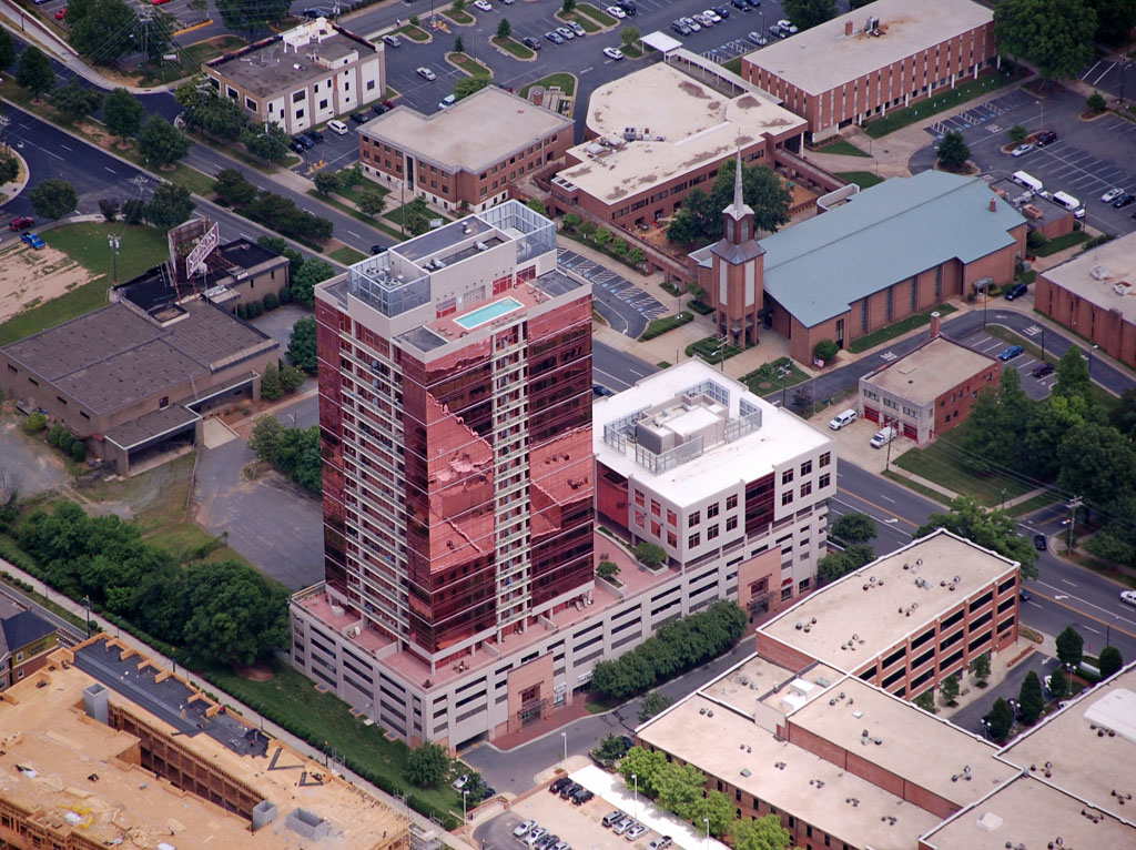
 Southend
Southend includes a collection of historic warehouses, art galleries, bars & restaurants, and new residential construction. It's revitalization is largely due to the new light rail line that runs through the heart of it. Southend is located immediately south of center city, just outside the I-277 beltway.
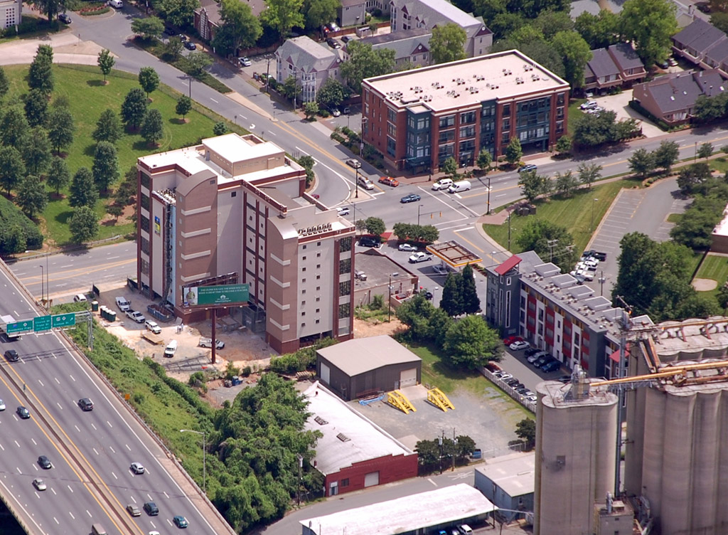
Royal Court condos, a new development just outside I-277:

In the heart of Southend. The pink building, The Arlington condos, is the tallest building in Southend. Across the light rail line from it is Millennium, another new residential development. On the far right you can see Circle at Southend, yet another new residential under construction. South Blvd., one of the main roads through Southend, is towards the bottom-left corner. The lots toward the bottom-right corner are the location of a planned office and hotel tower almost as tall as the Arlington, but it has been put on hold for now.
From the opposite angle. The Arlington can look a little ugly with it's pink glass, but depending on the light it can look pretty cool, especially at sunset.
More of Southend along the light rail line. The large apartment building is Ashton Southend. In this photo you can see several old mills that have been refurbished and converted into retail, art, and restaurant space. In the top-left corner is South Blvd. and part of the urban Lowe's store. In the top-right is yet another under construction residential building, Spectrum.
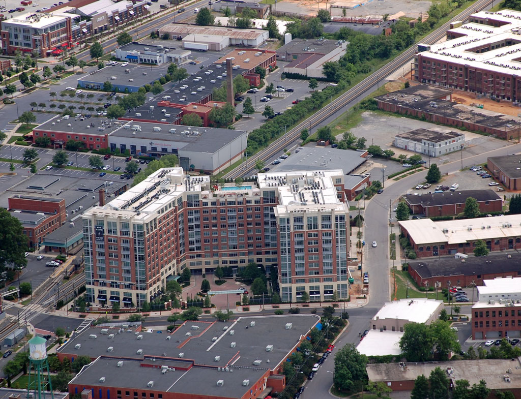
A closer look at Spectrum, though it almost has a bit of a commie-block feel to it.
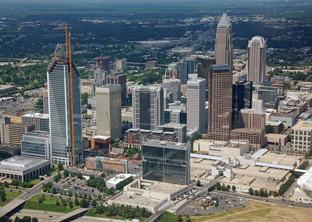
 Center City Construction. A few notable projects downtown:
Novare's Catalyst and 440 South Church
Catalyst is the taller residential tower and 440 South Church is the shorter office building. GMAC is moving a lot of the space in this building when finished, and it is likely to renamed after them. The parking lot just to the left of Catalyst will be the new 3rd Ward Park.
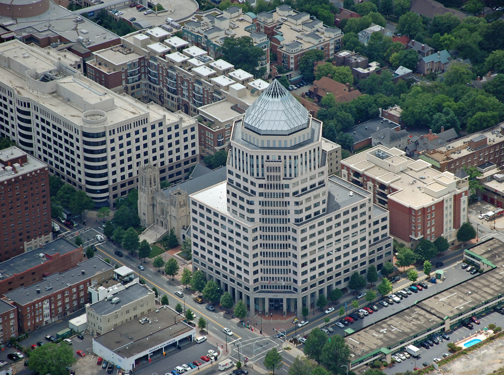
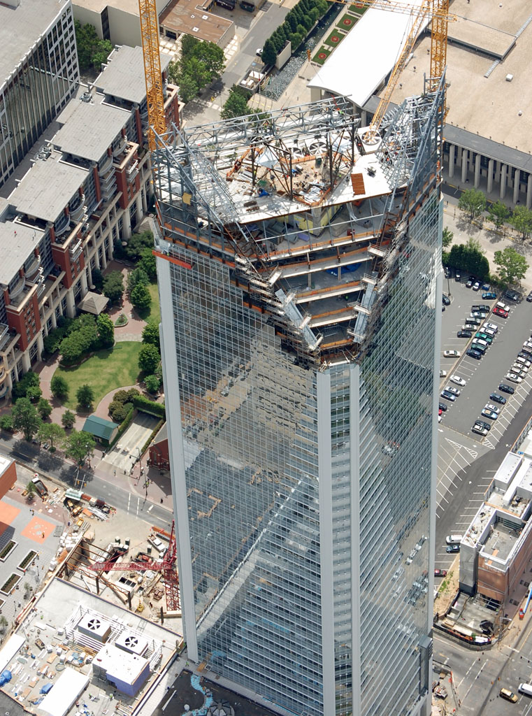
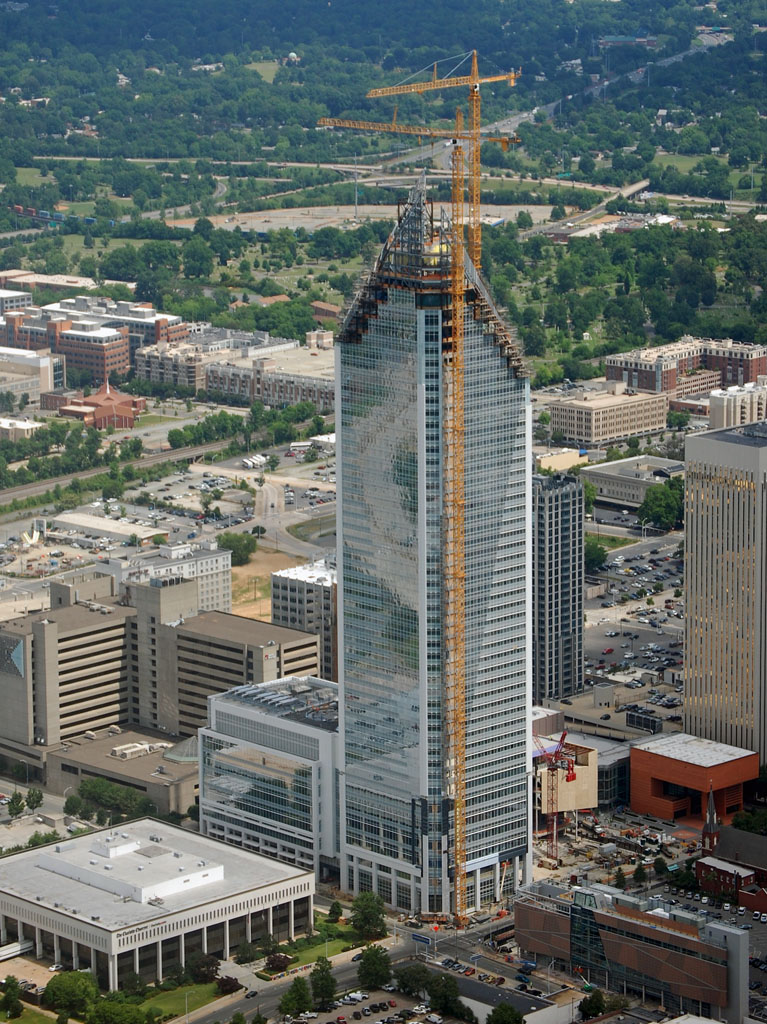
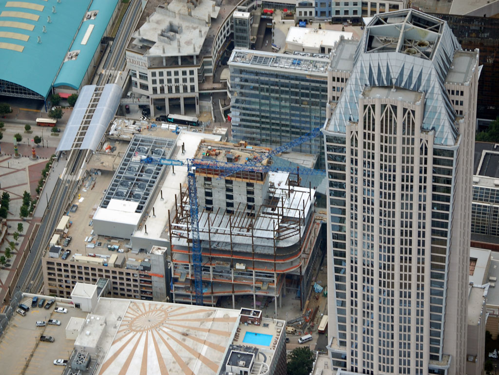
 Duke Energy Center.
This was originally Wachovia, then Wells Fargo. Duke, who had been wanting to build their own signature tower downtown, jumped at the opportunity to increase their space in the building and become the major tenant.
The tan building to the right of the tower will be the Mint Museum of Art. To the right of that, the terra cotta building will be the Bechler Museum of Art, and behind it, with the glass curtain, will be the new Knight theater. The long skinny building below the tower and to the left is the new African American Cultural Center.
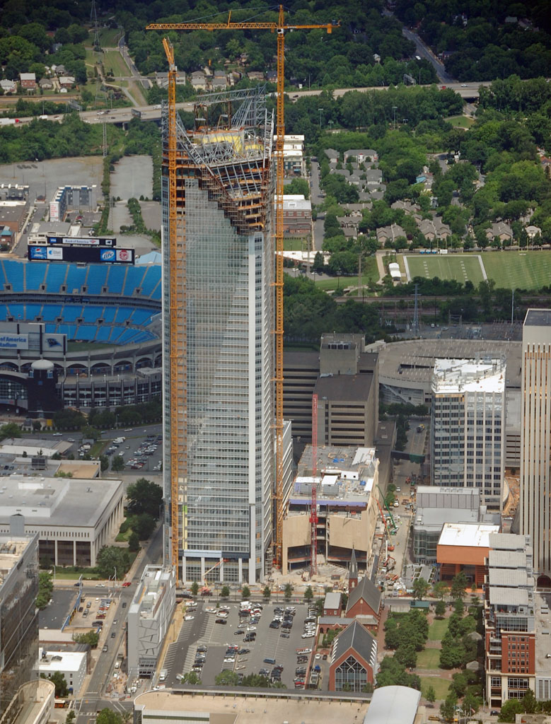
The "handle" portion of the tower is going up now, and the braces under the middle of it will be removed. In the background you can see part of 4th Ward, including the tree canopy of 4th Ward Park.
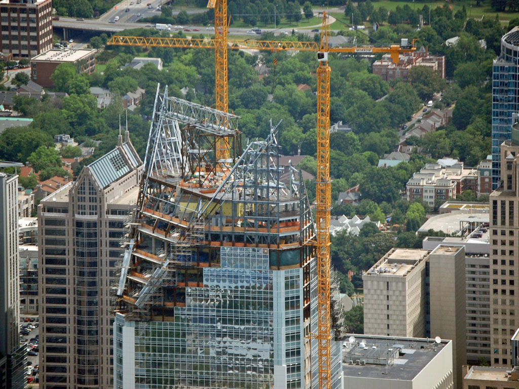

Here you get a better view of the African American Cultural Center in the bottom-left. Also, a good view of the terra cotta Bechler Art Museum. It was designed by Mario Botta, who also designed the San Francisco Museum of Modern Art.
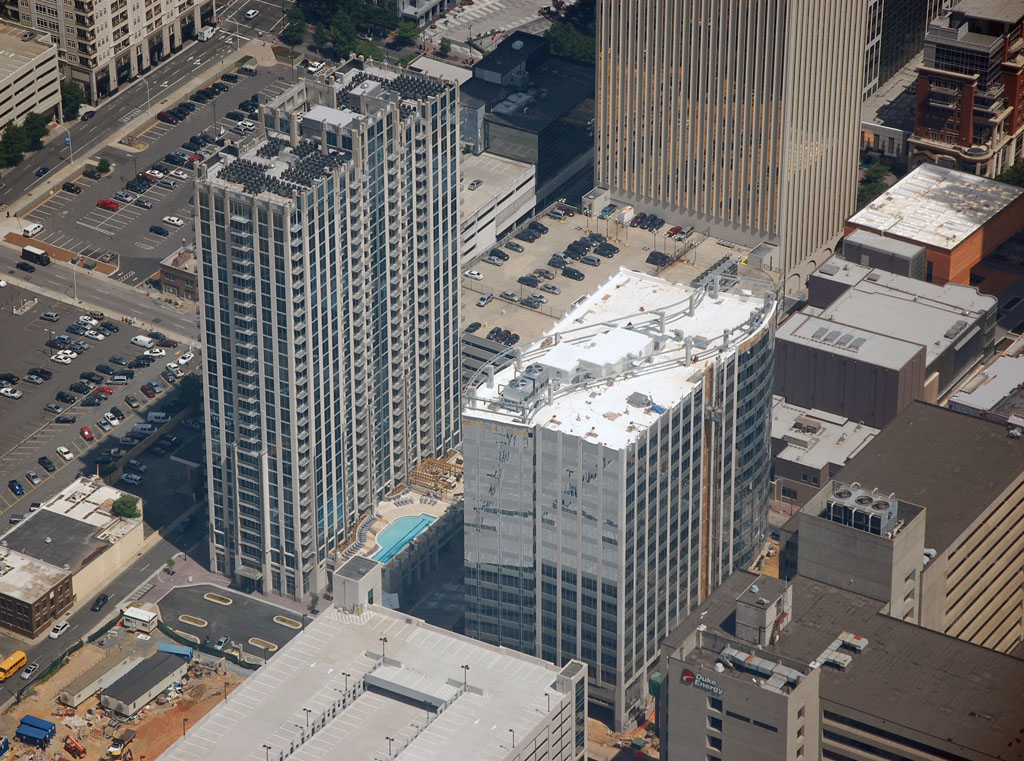
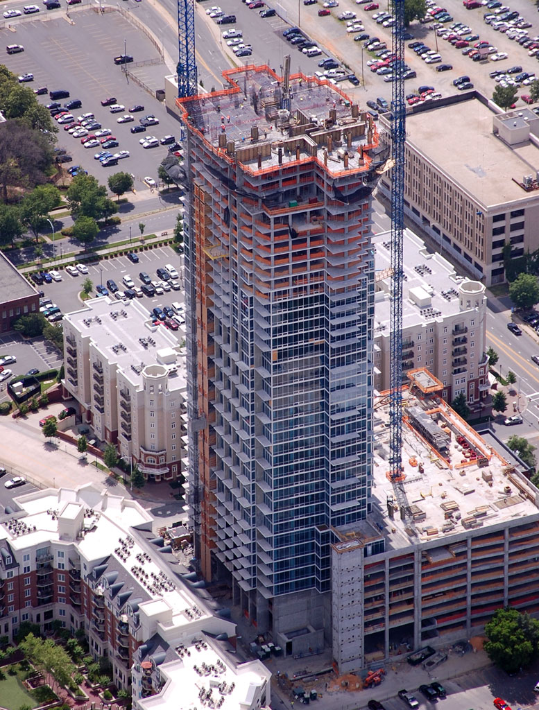
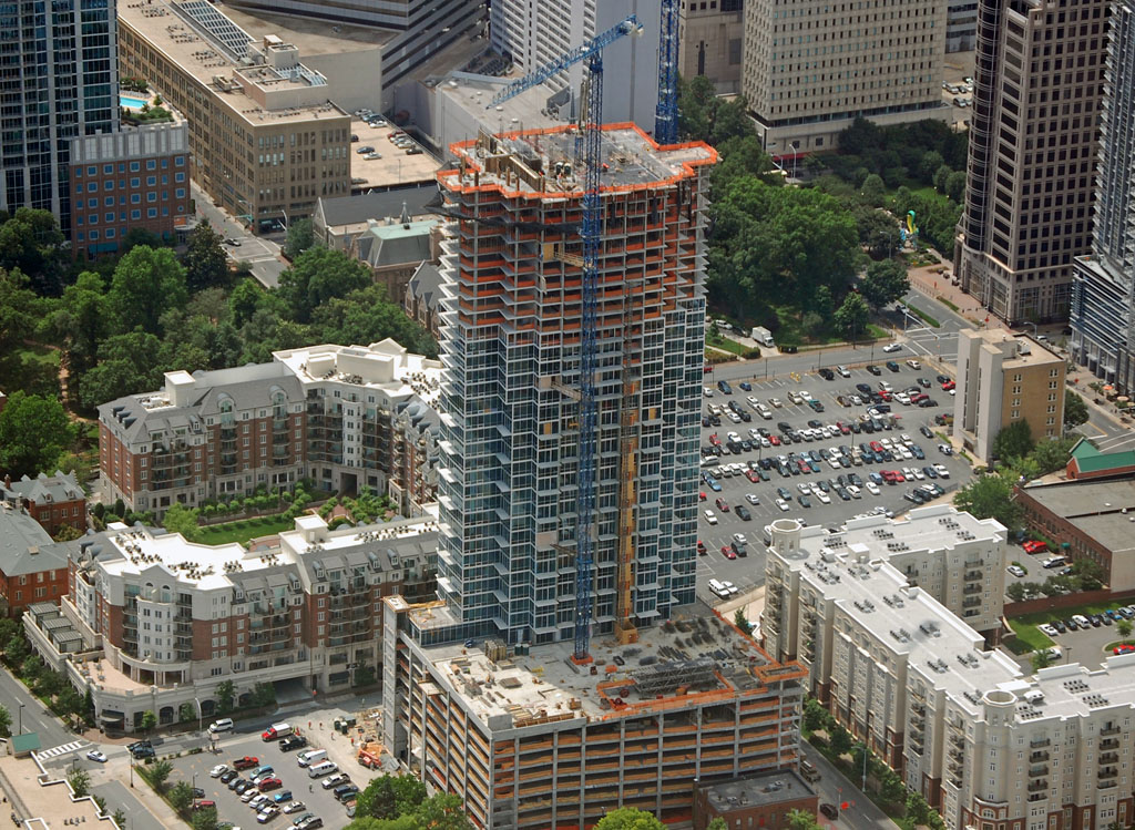
 The Vue.
The Vue will be Charlotte's first 50 floor residential tower.
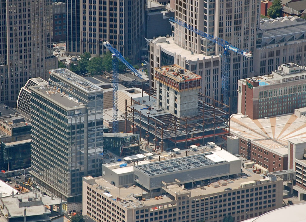
 1 Bank of America
Another 30 floor office tower:
 NoDa
NoDa
Northeast of center city is NoDa, a former mill area that has become a hub of art galleries, restaurants, and live music venues. From the air, it really doesn't look as urban as it feels on the ground.
The tallest building in NoDa, with the white roof, is Fat City Lofts. A mural is being painted on its side. Some of the mills in the area have been converted to residential and galleries, some are likely to be converted during the next economic upturn. The light rail extension is planned to run along the tracks in this photo, with a stop here.
From another angle:
 East Charlotte
East Charlotte really includes a lot of different neighborhoods lumped together.
Located just outside the I-277 beltway to the east, this used to be the location of Piedmont Court, one of the most run down housing projects in the city. It was torn down and being replaced by this much better looking affordable housing.
Charlotte's first Colosseum built in the 1950's is still standing. It seats just under 10,000 and is used for concerts and shows. To the right is the the Merchandise Mart, home of trade shows, RV shows, boat shows, home & garden shows, etc. Independence Blvd., one of the main freeways leading into downtown, runs horizontally across the photo:

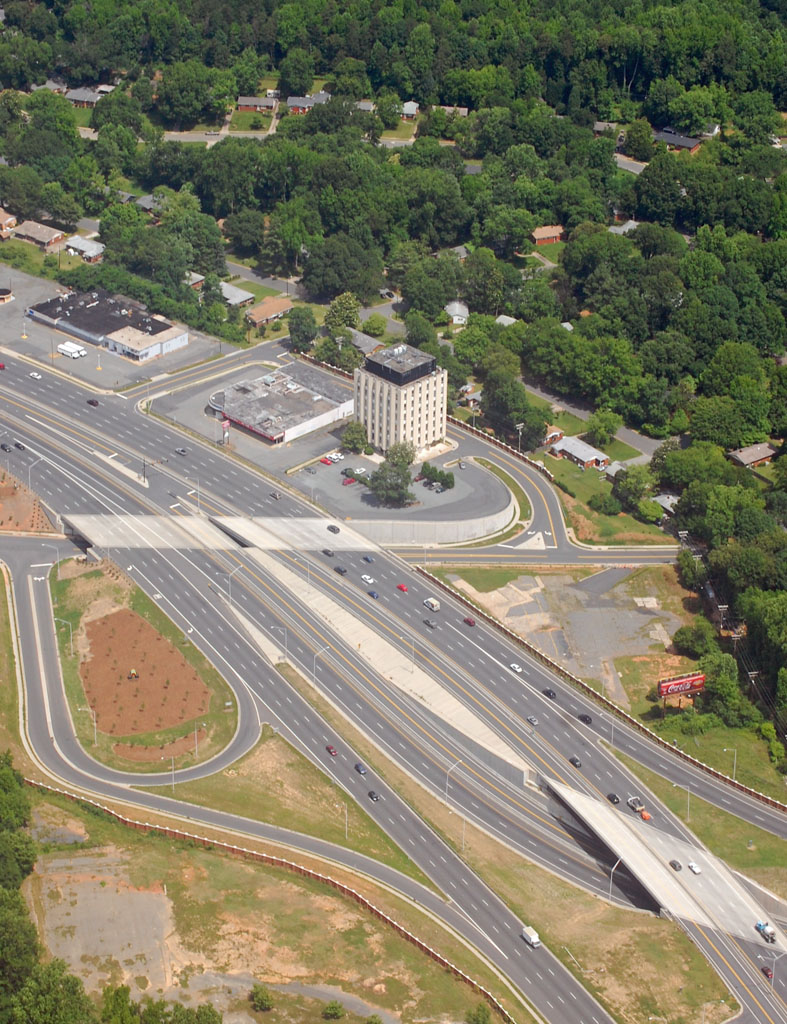
The Albemarle Rd. interchange on Independence Blvd. The state, which maintains these highways, and the city have been clashing recently over independence Blvd. The widening and removal/realignment of interchanges has cut off access to many businesses that used to thrive along the freeway. You can see of the the old concrete lots where some used to be located before this interchange was turned from a stoplight into what you see here a couple of years ago. It is one of the biggest issues in this years mayoral election.
Eastland Mall is another issue that the city is trying to address. The mall is one of the older ones in the city. There was a major problem with loitering and a couple of years ago a shooting in the mall. Many stores have left. The city is looking at redevelopment plans that may include remodeling the mall or removing it completely.
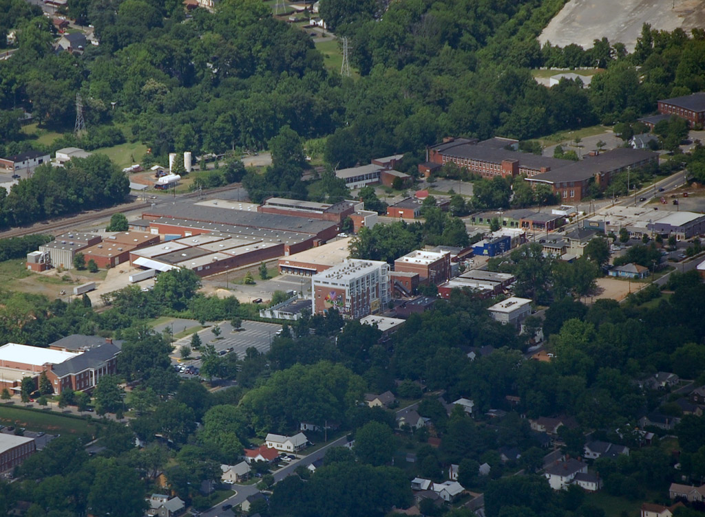
Way out in the eastern edges of the city. Sort of what you would expect to see in the outer edges of the suburbs. This is Hickory Grove Baptist Church. Flyover country!
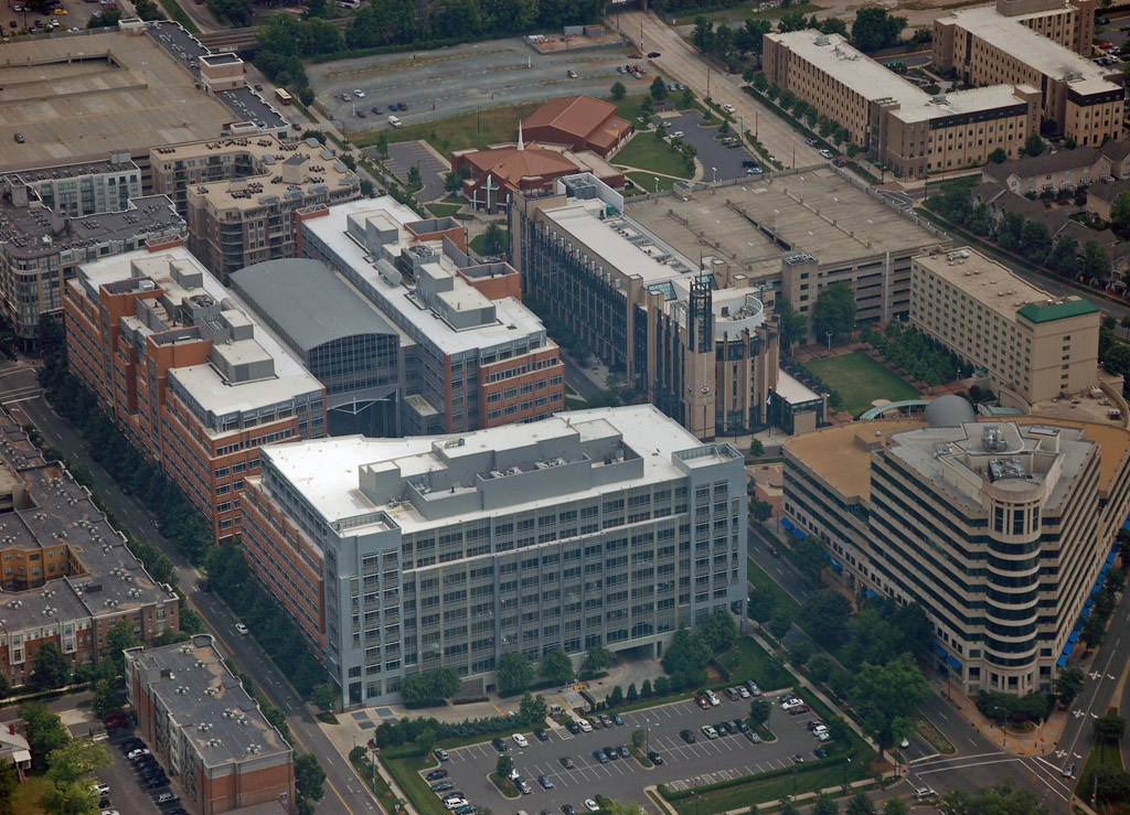
 University City
University City is a very large suburb in Northeast Charlotte, most notable for being the home of UNC Charlotte. There have been debates about changing the name to simply University of Charlotte, similar to college like Louisville, Cincinnati, and Memphis. The university has over 23,000 students and is looking to expand to 35,000 by 2020. U City, as the area is referred to, is home to a lot of immigrants, retail shops, and quite a few suburban office parks. If incorporated into it's own city, it would be something like the 7th largest city in the state. It is still fairly suburban, but is urbanizing. The area will be the northern terminus of the light rail line extension.
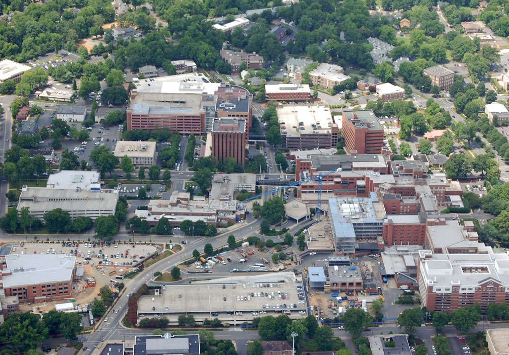
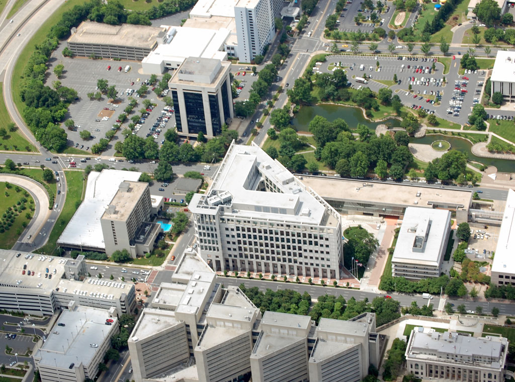
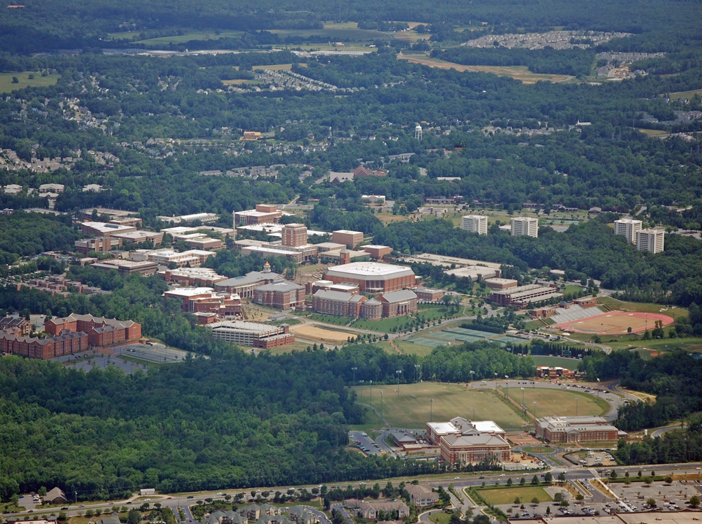
This is a good overview of the area. The college is obviously in the middle of the photo. Below it is the Carolinas Medical Center - University Hospital. Towards The bottom-left is University Place - a large collection of stores, restaurants, offices, hotels, and residential. The road running horizontally between the hospital and University Place will be the loction of the light rail line.
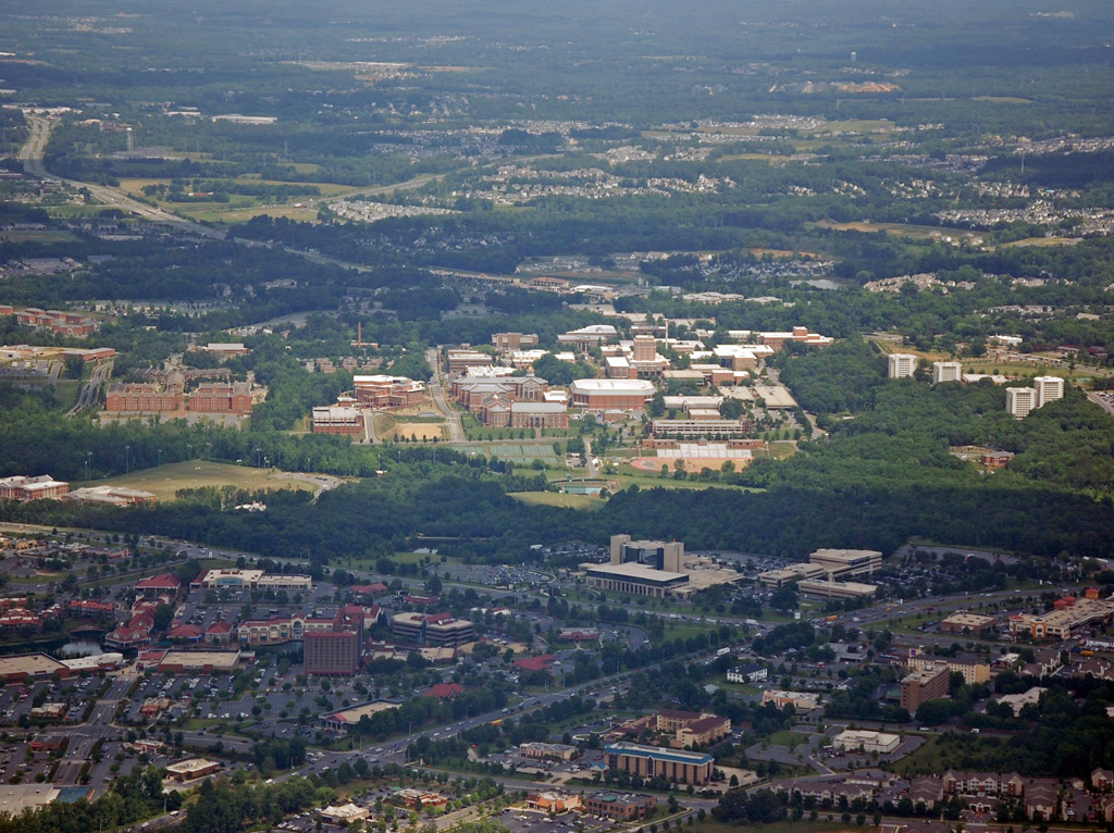
A closer look at part of the university. The tallest building is the Atkins library. Below that is the over 9,000 seat arena where the Charlotte 49ers play. They beat ranked Xavier at home last season.

Looking at University Place. The hospital is towards the top-right of the photo. The tallest buildings along the lake include the university Hilton.
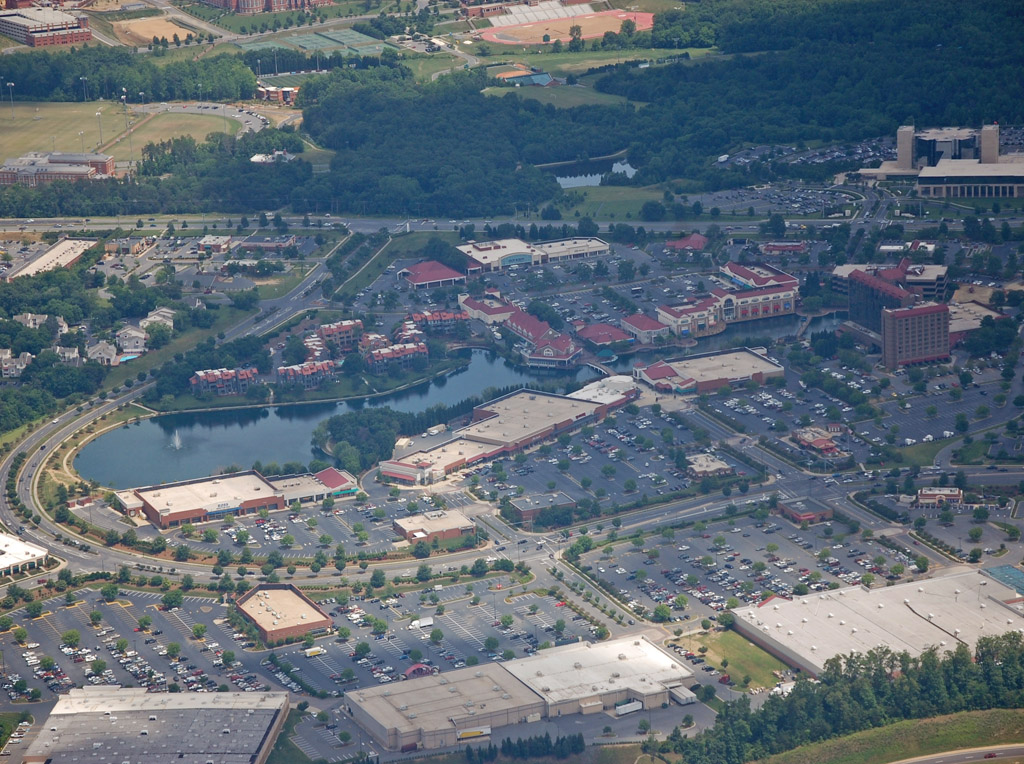
The university owns all the wooded land towards the bottom-left of the photo, and plan on expanding along here as they increase their student body by 15,000 over the next decade. The school has recently voted to start a football program, with plans to move up to the Bowl Subdivision after about five years. The planned location of the new football stadium will be where the grassy field is located just right of the wooded area. Also, Bank of America is looking at moving some of its
operations to the area, and is planning on starting a 200 foot tower off to the bottom-left of this photo.
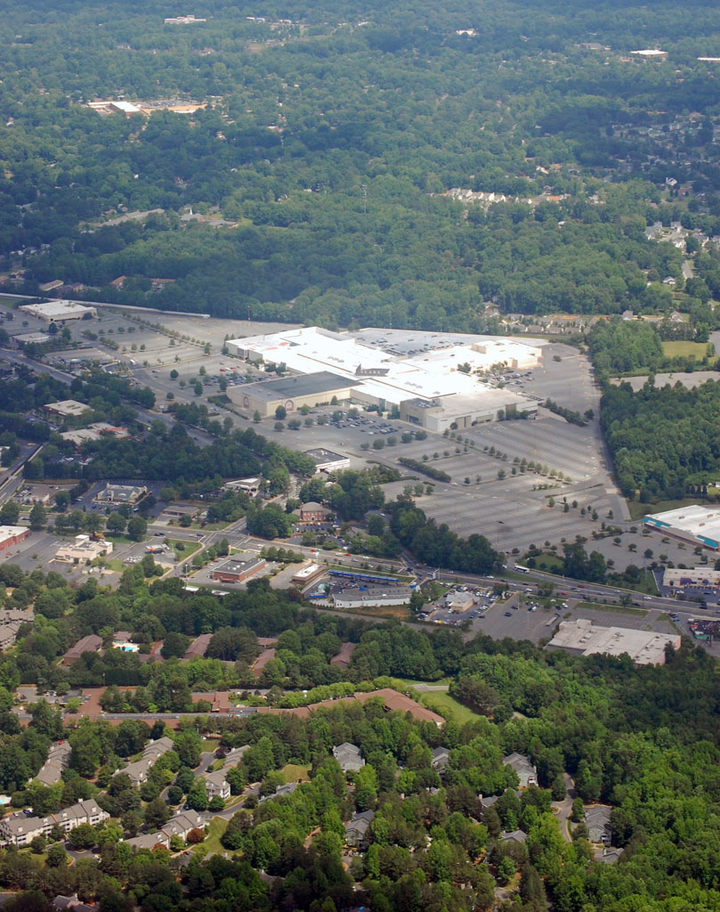
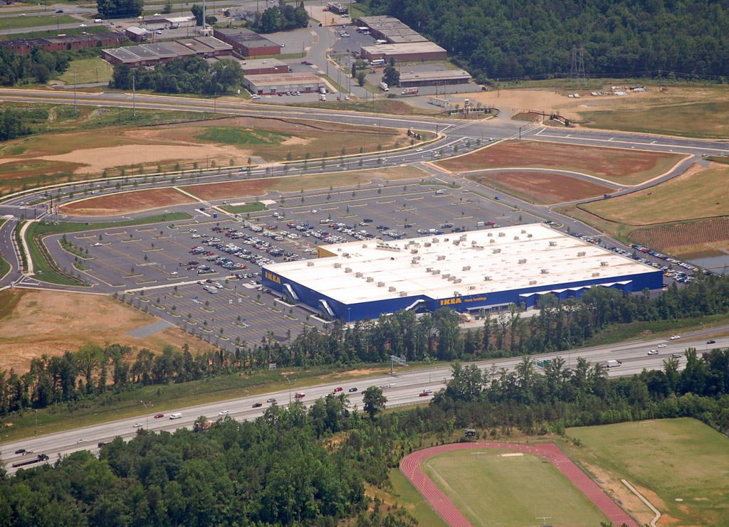
The new suburban IKEA store. Meh.
 Concord
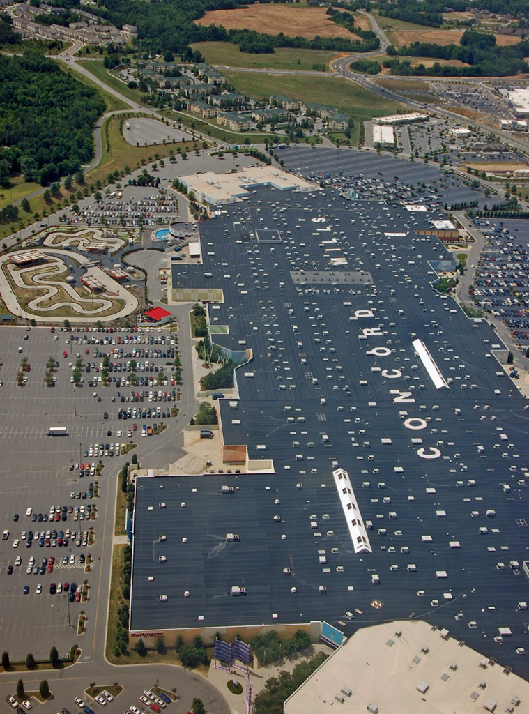
Concord is a city just outside of Charlotte. It is notable for being the home of Lowe's Motor
Speedway, and Concord Mills - the largest mall in the state.
Concord Mills:
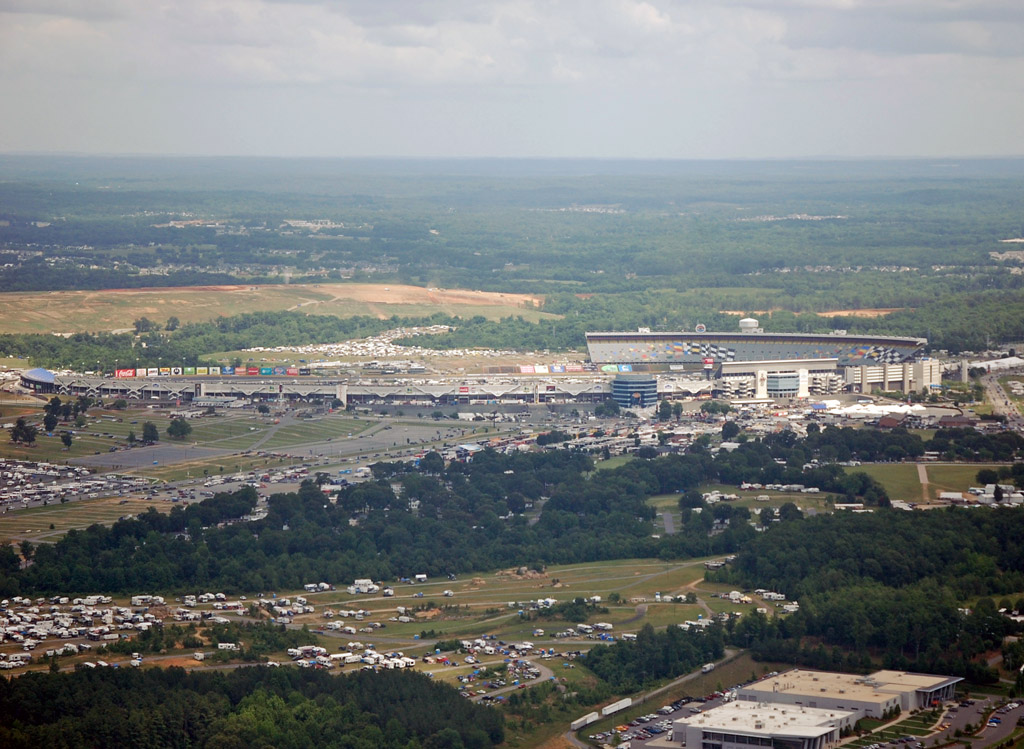
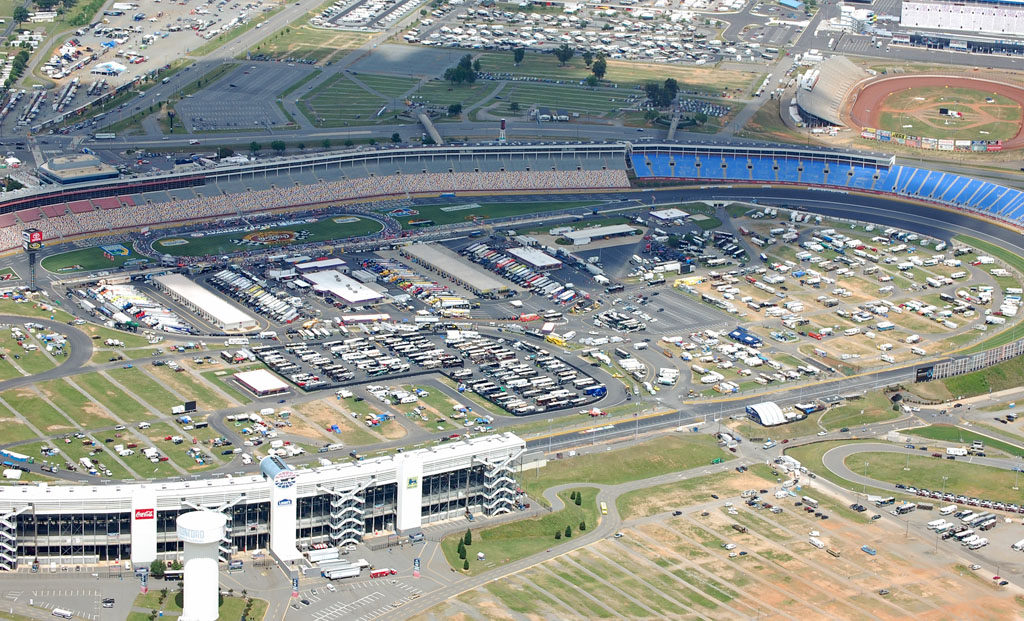
Lowe's Motor Speedway, getting ready for the Coca-Cola 600. Look at all the camgrounds:
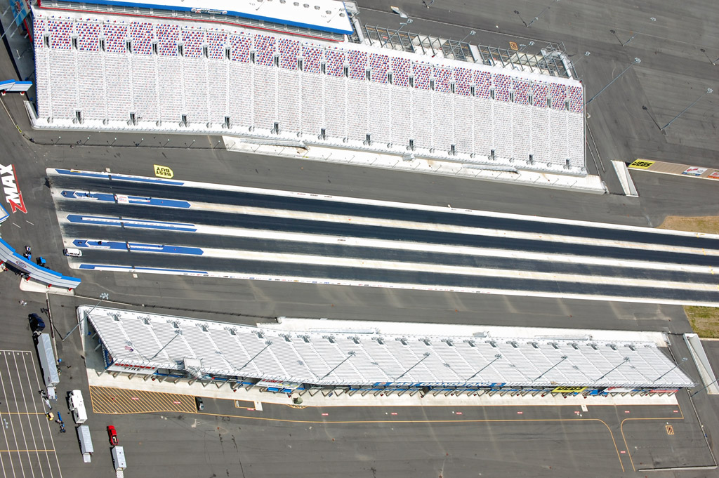
The new Zmax Dragway that just opened this year at the speedway:
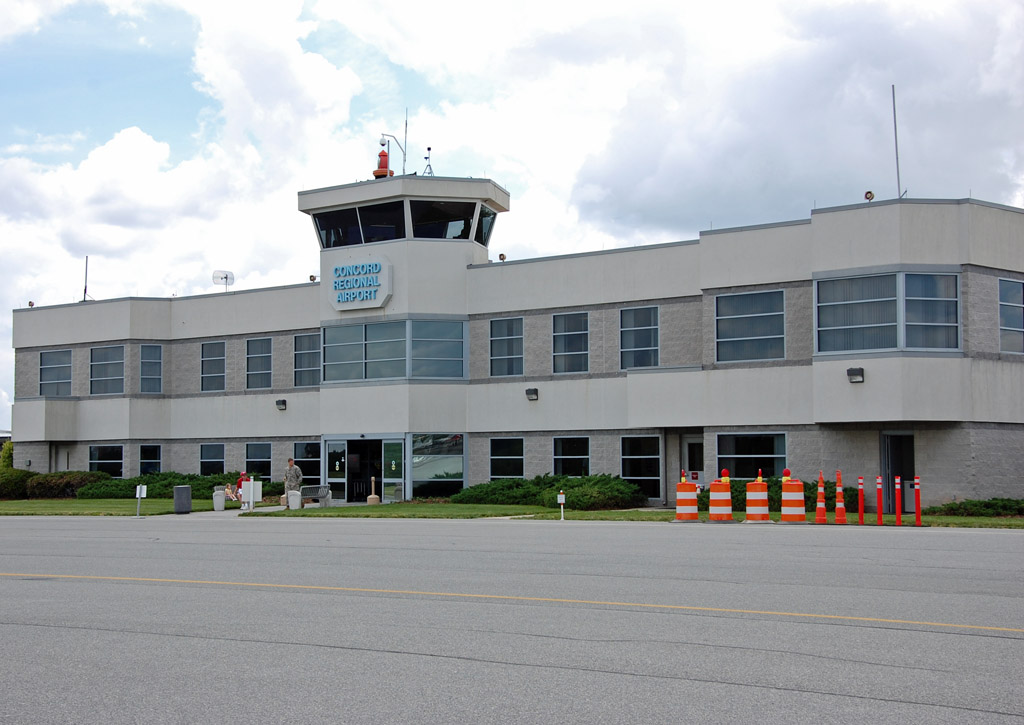
Welcome to Concord Regional Airport. A lot of NASCAR teams opperate out of here, as well as general aviation from the Charlotte area. It is 8 minutes by Cessna from downtown to this airport.

Hope you enjoyed the tour as much as I did!


 Prev
Prev


 Linear Mode
