HomeDiagramsDatabaseMapsForum About
     

Go Back   SkyscraperPage Forum > Global Projects & Construction > General Development


Reply

 
Thread Tools Display Modes
     
     
  #241  
Old Posted Nov 16, 2012, 4:46 PM
uakoops uakoops is offline
Registered User
 
Join Date: Jul 2009
Posts: 201
Very sterile and uninviting. Like a cemetery. Definitely a memorial, not a park.

And that ramp between the concrete walls is downright scary.

Just my 2 cents...
Reply With Quote
     
     
  #242  
Old Posted Nov 16, 2012, 6:19 PM
401PAS's Avatar
401PAS 401PAS is offline
Registered User
 
Join Date: Aug 2011
Location: NYC
Posts: 236
Quote:
Originally Posted by uakoops View Post
Very sterile and uninviting. Like a cemetery. Definitely a memorial, not a park.

And that ramp between the concrete walls is downright scary.

Just my 2 cents...
Certainly agree with you on the "memorial and not a park" critique. But, regardless of name, I think that is what it was always intended to be. And as a memorial, it is very impressive.

I also believe that very soon people will believe that FDR is actually buried there.
Reply With Quote
     
     
  #243  
Old Posted Nov 17, 2012, 12:16 PM
pico44's Avatar
pico44 pico44 is offline
Registered User
 
Join Date: Nov 2006
Posts: 1,450
Quote:
Originally Posted by 401PAS View Post
Certainly agree with you on the "memorial and not a park" critique. But, regardless of name, I think that is what it was always intended to be. And as a memorial, it is very impressive.

I also believe that very soon people will believe that FDR is actually buried there.


You mean he's not?
Reply With Quote
     
     
  #244  
Old Posted Nov 17, 2012, 12:26 PM
pico44's Avatar
pico44 pico44 is offline
Registered User
 
Join Date: Nov 2006
Posts: 1,450
Jk

I'm going to try to go there for a third time today. Maybe I should look to see if it's open beforehand this time.
Reply With Quote
     
     
  #245  
Old Posted Feb 7, 2013, 5:49 AM
khaizer007 khaizer007 is offline
Registered User
 
Join Date: Aug 2012
Posts: 58
A Plan Aims to Reconnect Residents With the East River Waterfront

http://www.nytimes.com/2013/02/07/ny...ront.html?_r=0


Quote:
As New Yorkers have watched the waterfront around Manhattan open up in recent years, one stretch has lagged: the East River waterfront, especially from the Brooklyn Bridge north to 38th Street, where the Franklin D. Roosevelt Drive impedes access, bike lanes are squeezed by development and, now in the wake of Hurricane Sandy, storm surges threaten parkland.

A new blueprint for that section, called the East River Blueway Plan, will be announced on Thursday by the Manhattan borough president, Scott M. Stringer, in his annual state of the borough speech. The plan, which involved public meetings with dozens of community groups and consultations with seven city and state agencies, lays out various ways to reconnect residents with the riverfront.

The plan will not be officially released for a few weeks, but a copy was obtained by The New York Times in advance of the speech. Among the major recommendations are the development of a new public beach and kayak launch directly beneath the Brooklyn Bridge, where a naturally occurring sand beach forms a rock-strewn crescent that is now fenced off; the creation of two boat launches at Stuyvesant Cove at the ends of 20th and 23rd Streets; the installation of marshlands and sea walls in especially vulnerable flood zones, and the planting of trees and greenery all along the F.D.R. Drive to provide shade and absorb storm water runoff.

“We want very much to open the waterfront from a recreation perspective, but we also want to protect our fragile waterfront from Mother Nature by recognizing the reality of storm surges,” Mr. Stringer said in a phone interview. “What’s novel here is that we actually remedy some of the issues with storm surges through amenity enhancements for the public.”

One proposal — the most costly to execute — would elevate the bike and pedestrian path over the F.D.R. Drive at 14th Street, where the path currently narrows to four feet near the Consolidated Edison substation. The plan calls for a new pedestrian bridge that would rise gradually from blocks away, allowing users to avoid that difficult bottleneck. The bridge would also serve as an inland sea wall that could help prevent flooding and an explosion like the one that rocked a substation during Hurricane Sandy, which contributed to the blackout across Lower Manhattan.

While there is no pot of money set aside to pay for all of the proposals, Mr. Stringer has pledged $3.5 million in capital funding toward new marshlands detailed in the plan. Both Mr. Stringer, who is running for the city comptroller’s office, and Brian Kavanagh, the New York state assemblyman who collaborated on the report, expect that other elements could be financed gradually while the storm protections could receive a boost from the billions in federal money that was recently allocated in response to Hurricane Sandy.

“There are lots of smaller-ticket items that can be financed over time in the normal course of budgeting from city agencies,” Mr. Kavanagh said. “Having lighting and adequate bathrooms and places where you can get refreshments and other supplies are not extraordinarily expensive.”

The plan builds on a decade of activity along the East River, from newly opened piers to park renovations, as well as on earlier city studies, notably the City Planning Department’s “Vision 2020: New York City Comprehensive Waterfront Plan” and the Economic Development Corporation’s “Transforming the East River Waterfront.”

While the 14-month planning process had already addressed climate change, Hurricane Sandy led to deeper discussions with experts on approaches to flooding in places like Venice and the Netherlands. “We now know that this area was the Achilles’ heel of the storm surge,” Mr. Stringer said. “We have got to make the case to the federal government and state government that if we are going to continue to build our waterfront, we can’t build the way we used to.”
Reply With Quote
     
     
  #246  
Old Posted Feb 7, 2013, 7:41 AM
NYguy's Avatar
NYguy NYguy is offline
New Yorker for life
 
Join Date: Jul 2001
Location: Borough of Jersey
Posts: 51,815
http://www.nytimes.com/2013/02/07/ny...=nyregion&_r=0


Quote:
The plan will not be officially released for a few weeks, but a copy was obtained by The New York Times in advance of the speech. Among the major recommendations are the development of a new public beach and kayak launch directly beneath the Brooklyn Bridge, where a naturally occurring sand beach forms a rock-strewn crescent that is now fenced off; the creation of two boat launches at Stuyvesant Cove at the ends of 20th and 23rd Streets; the installation of marshlands and sea walls in especially vulnerable flood zones, and the planting of trees and greenery all along the F.D.R. Drive to provide shade and absorb storm water runoff.


Robert Gim


CaptainKidder


__________________
NEW YORK is Back!

“Office buildings are our factories – whether for tech, creative or traditional industries we must continue to grow our modern factories to create new jobs,” said United States Senator Chuck Schumer.
Reply With Quote
     
     
  #247  
Old Posted Mar 14, 2013, 11:13 AM
NYguy's Avatar
NYguy NYguy is offline
New Yorker for life
 
Join Date: Jul 2001
Location: Borough of Jersey
Posts: 51,815
http://archpaper.com/news/articles.asp?id=6542

The Great Blue Way
WXY proposes transformation of Manhattan's East River waterfront.


Quote:
During Hurricane Sandy, floodwaters overwhelmed bulkheads along Manhattan’s East River waterfront and spilled into neighborhood streets, inundating houses, businesses, and a power substation and causing widespread blackouts. Whether a freak 100-year storm, or a harbinger of the effects of global climate change, the flooding raised serious concerns about New York City’s ability to withstand such weather events. In answer, WXY Architecture + Urban Design has developed a scheme to bolster 3.5 miles of Manhattan waterfront from the Brooklyn Bridge to 38th Street.

Manhattan Borough President Scott Stringer unveiled the East River Blueway Plan in his 2013 State of the Borough address last month. The presentation revealed new details in a program to enhance the riverfront that was begun in 2010 as a collaboration between Community Boards 3 and 6, the Lower East Side Ecology Center, Stringer, and State Assemblyman Brian Kavanagh. “The goal of the Blueway was to redesign an often forgotten stretch of our precious eastside waterfront,” Stringer said in his address. “But as the Blueway evolved, it became clear that we also had to create a state-of-the-art plan to help protect this area from another catastrophic storm.” In his speech, Stringer committed $3.5 million in funding to jumpstart construction.

WXY’s plan calls for a softer edge along the waterfront that will mitigate threats from future storms and provide the community with recreational and educational amenities. “We addressed the dual goals of how to improve the East River habitat and water quality—to bring in more birds and fish—and how to slow down the water speed in the river,” said Claire Weisz, principal at WXY. “We’re creating more living edges, more surface area for nature.”

A series of salt marshes will extend to the edge of the East River’s navigation channel that Weisz said will bring a significant capacity for water storage and filtration. The wetlands will also help slow down the river and minimize waves, allowing the community easier access to the water. Beneath the FDR, WXY proposed a man-made tray system of freshwater marshes that will filter runoff from the highway. At two naturally occurring coves—beneath the Brooklyn Bridge and at a bend in the coastline above 14th Street—the Blueway calls for removing bulkheads and creating a series of river-filtering tidal pools and beaches. “We’re trying to make the coves more like natural coves,” Weisz said.

At the 14th Street substation the highway currently crowds out the waterfront. WXY proposed a dramatic bowtie-shaped elevated bridge for the site, what Weisz calls “a flyway for bikes and people,” that brings added security and a floodwall to the substation while providing a vital link for the community to access the water. Elsewhere along the waterfront, the scheme locates elevated platforms for walking and biking over the river. “We wanted to get out from under the shadow of the FDR,” said Weisz.

Weisz stressed that the Blueway is a blueprint that can inform waterfront interventions elsewhere in the city. “The Blueway plan addresses how we can move into a future of resilient cities with active and sustainable waterfronts,” Weisz said. “If you have to repair a road, why not make it more permeable? If you have to rebuild a bridge, why not think about bridges differently? It’s different from a master plan; it’s a game plan.” The full Blueway plan with technical details on how it can be built will be released in April.


Tidal pools would filter river water and provide educational and recreational opportunities along the East River


Tidal pools form a cove beneath the Brooklyn Bridge while salt marshes extending into the East River create a soft edge for the waterfront


A proposed bowtie-shaped pedestrian and bicycle bridge at 14th Street forms a secirity and flood barrier for a substation while connecting to the waterfront


Stuyvesant Cove, just above 14th Street


_____________________________________________


http://blog.archpaper.com/wordpress/archives/56741

Before & After> WXY’s Blueway Plan To Transform Manhattan’s Waterfront

March 13, 2013
Branden Klayko


Beneath the Brooklyn Bridge, wetlands will calm the East River’s choppy waves and a newly-accessible beach would allow recreational access to the river. Water-filtering tidal pools allow a cleaner option than swimming directly in the East River itself.


Where pedestrian and cyclist paths are crowded against the FDR highway, WXY proposes building elevated platforms to pull away from the highway and make room for a landscaped waterfront.


Beneath the FDR, a tray system holds freshwater marshes that filter rainwater runoff before it enters the saltwater wetland system in the East River.


Stuyvesant Cove just above 14th Street includes more tidal pools and wetlands and a more dramatic network of paths elevated over the water.
__________________
NEW YORK is Back!

“Office buildings are our factories – whether for tech, creative or traditional industries we must continue to grow our modern factories to create new jobs,” said United States Senator Chuck Schumer.
Reply With Quote
     
     
  #248  
Old Posted Mar 14, 2013, 2:43 PM
Busy Bee's Avatar
Busy Bee Busy Bee is offline
Show me the blueprints
 
Join Date: Feb 2006
Location: on the artistic spectrum
Posts: 10,333
Is it premature to start talking about removing the FDR entirely?
__________________
Everything new is old again

There is no goodness in him, and his power to convince people otherwise is beyond understanding
Reply With Quote
     
     
  #249  
Old Posted Mar 14, 2013, 6:26 PM
Astorian Astorian is offline
Registered User
 
Join Date: Jan 2013
Posts: 22
Quote:
Originally Posted by Busy Bee View Post
Is it premature to start talking about removing the FDR entirely?
I wouldn't remove the FDR, Manhattan needs it, but I'd sure like to see it entirely buried. Or if not completely buried, then built over, like in parts of the FDR that runs through the UES, only instead of having a building on top of it, have a promenade.
Reply With Quote
     
     
  #250  
Old Posted Mar 14, 2013, 11:59 PM
NYguy's Avatar
NYguy NYguy is offline
New Yorker for life
 
Join Date: Jul 2001
Location: Borough of Jersey
Posts: 51,815
Quote:
Originally Posted by Busy Bee View Post
Is it premature to start talking about removing the FDR entirely?
Only if for a "Westway" type project. But I think the only part of the FDR that doesn't flood when it rains heavily is the elevated part.
__________________
NEW YORK is Back!

“Office buildings are our factories – whether for tech, creative or traditional industries we must continue to grow our modern factories to create new jobs,” said United States Senator Chuck Schumer.
Reply With Quote
     
     
  #251  
Old Posted Jul 1, 2013, 4:55 PM
NYguy's Avatar
NYguy NYguy is offline
New Yorker for life
 
Join Date: Jul 2001
Location: Borough of Jersey
Posts: 51,815
http://archpaper.com/news/articles.asp?id=6736

Waterfront Access
Mathews Nielsen proposes two solutions for Manhattan's Pier 42.


7.1.2013
B. Tyler Silvestro


Quote:
Two proposals were set forth recently by Mathews Nielsen Landscape Architects, overseen by the New York City Department of Parks and Recreation, to enhance the East River Greenway at Pier 42. The plan to develop the site, formerly a banana warehouse, adds another feather to the cap of Manhattan’s ambitious waterfront connection effort. With the help of U.S. Senator Chuck Schumer and State Senator Daniel Squadron, Community Board 3 is now $9.8 million closer to the estimated $60 million in total costs. The funding was secured from the Lower Manhattan Development Corporation.

In discussing the community’s impact on the program diagrams, Noriko Maeda, project manager for Mathews Nielsen, acknowledged the clear objectives of locals. “Everything was developed from the meetings,” Maeda said. Mathews Nielsen associate Greg Leonard added that his firm sees the site as an opportunity for an environmental approach, as indicated by the slew of environmentally friendly terminology. It’s an appropriate response to Community Board 3’s guiding principles, outlined in its 2004 motion to improve the waterfront, to “add more nature.”

The FDR, as is the case with much of the East River esplanade, either severs cross circulation or pinches parallel programming to the point of discomfort. The same is the case with Pier 42, which sits between the Williamsburg and Manhattan bridges across the estuary from the Brooklyn Navy Yard. “Access is limited to two points, Montgomery Street and Corlears Hook Park,” said Leonard. “The priority is safety and access. Aesthetics is not a primary concern.”

The piers, which were built in the 1950s, will remain in place, having passed structural inspection. The warehouse, however, will be removed, opening this portion of the waterfront to more passive pleasures. “The opportunity is in the directions this design can go,” said Leonard.

This summer, a portion of the parking lot behind the warehouse will be open for public use. “Pier 42 is finally transforming from a blighted, abandoned warehouse into a beautiful open green space for children and families,” said Senator Schumer in a statement. It may be years before Community Board 3 cuts the ribbon to the park, but it is clearly already a special place to locals.


Partial deck


Full deck


__________________
NEW YORK is Back!

“Office buildings are our factories – whether for tech, creative or traditional industries we must continue to grow our modern factories to create new jobs,” said United States Senator Chuck Schumer.
Reply With Quote
     
     
  #252  
Old Posted Aug 1, 2013, 8:09 PM
NYguy's Avatar
NYguy NYguy is offline
New Yorker for life
 
Join Date: Jul 2001
Location: Borough of Jersey
Posts: 51,815
Quote:


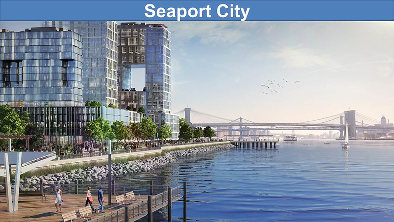
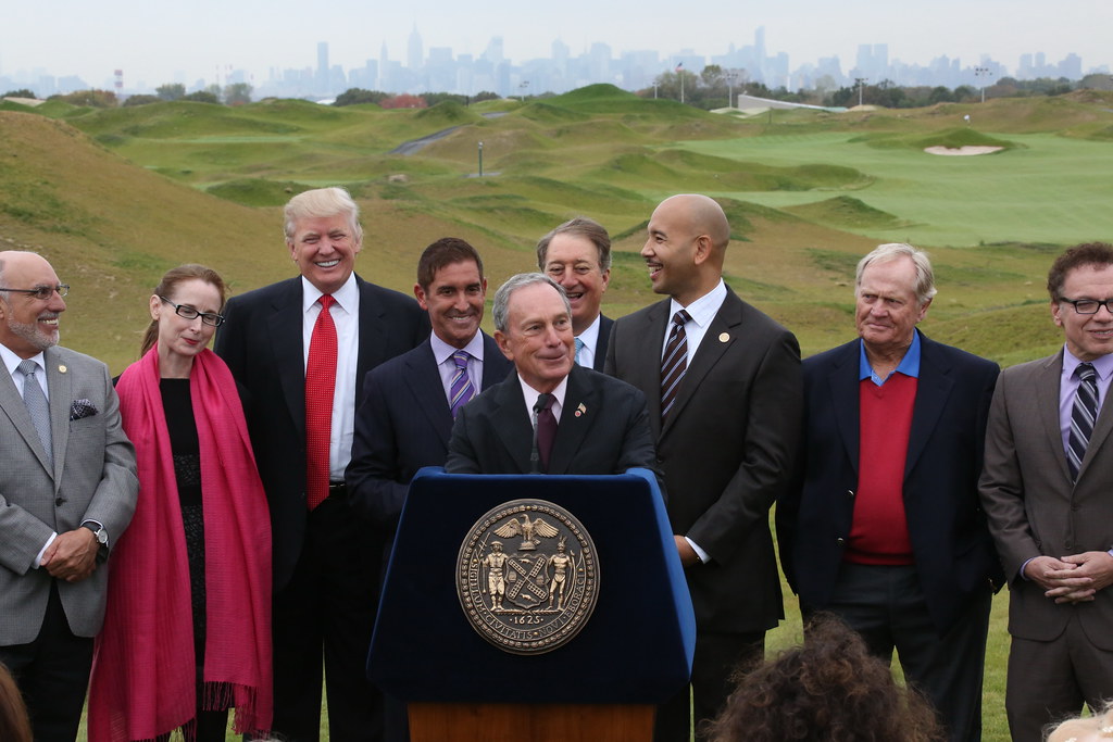
Bloomberg kicks off the Seaport City initiative...

http://www.nycedc.com/opportunity/se...lity-study-rfp

Seaport City Feasibility Study RFP


Submission DeadlineAugust 22, 2013 at 12:00 pm


Quote:
NYCEDC is seeking a consultant or consultant team to study the feasibility of developing a multi-purpose levee (MPL) along the eastern edge of Lower Manhattan. The levee would first seek to address coastal flooding and enhance resiliency in Lower Manhattan and also create economic development opportunities in the area that could fund resiliency measures citywide. The study is intended to advance recent recommendations from the June 2013 report “A Stronger, More Resilient New York.”

The study is envisioned as a comprehensive and detailed assessment that considers all the relevant aspects needed to establish the feasibility of developing the MPL, including technical, environmental, financial, and legal feasibility. The Consultant will holistically evaluate specific factors such as the technical configuration of the MPL, infrastructure requirements, costs, environmental issues, legal issues, and implementation strategies. The Consultant will identify and evaluate visionary options for developing the MPL and put forward a recommended option at the end of the study.

NYCEDC plans to select a consultant on the basis of factors stated in the RFP which include, but are not limited to: the quality of the proposal, experience of key staff identified in the proposal, experience and quality of any subcontractors proposed, demonstrated successful experience in performing services similar to those encompassed in the RFP, and the proposed fee.


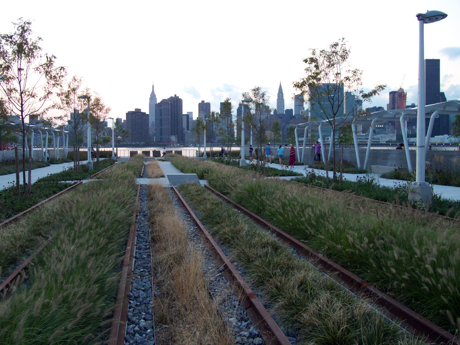
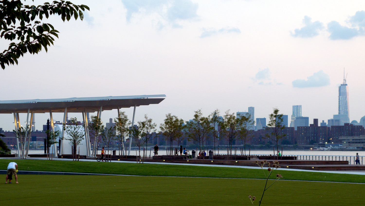
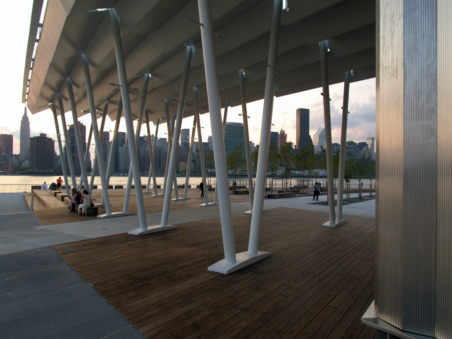
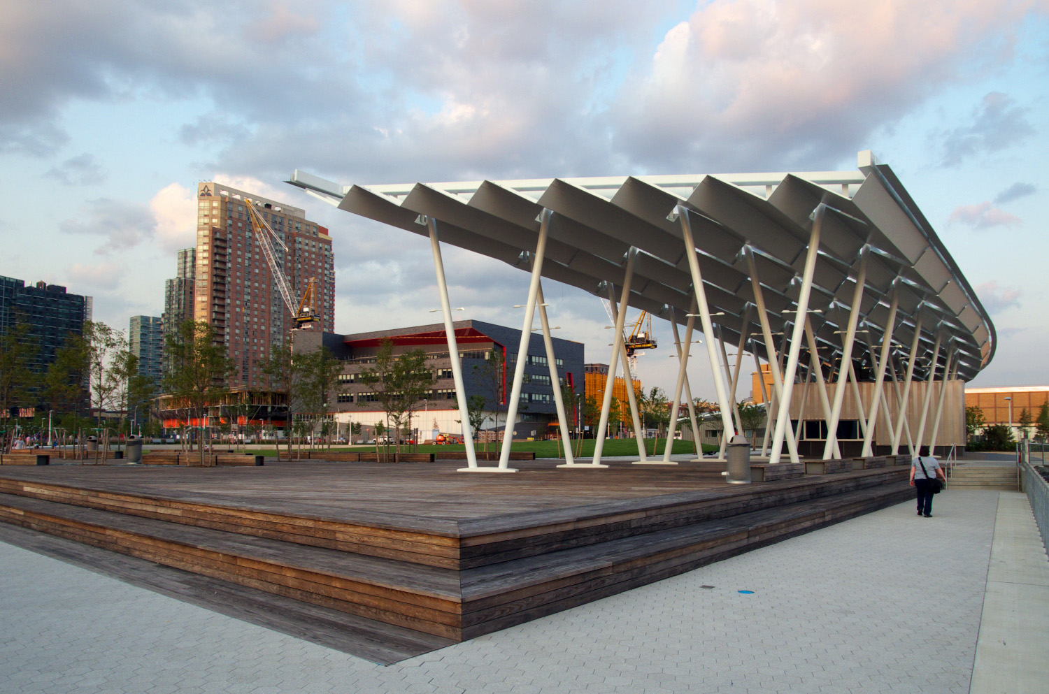
A little further up the east river, another initiative moves forward...

http://www.nydailynews.com/new-york/...icle-1.1414183

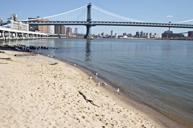
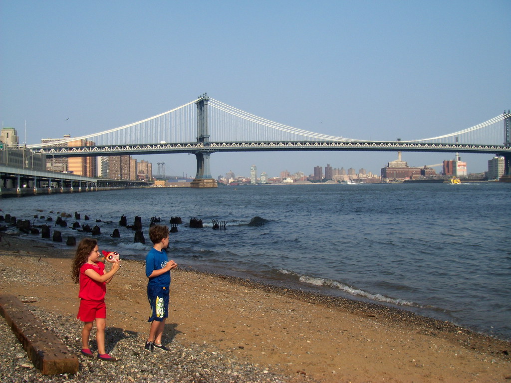
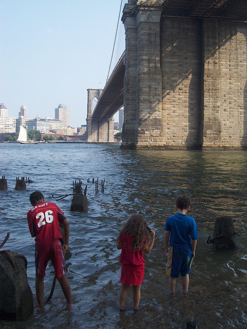
Brooklyn Bridge Beach plan brings sand and surf to lower Manhattan


By Erin Durkin
August 1, 2013


Quote:
Lovers of sand and sun no longer will have to troop to Coney Island or the Rockaways for a day at the beach. The city will transform a desolate swath of land along the East River in lower Manhattan into a beautiful beach with sand, seating and waterfront views, the Daily News has learned.

City Council Speaker Christine Quinn and Manhattan Borough President Scott Stringer have set aside a total of $7 million for the groundbreaking project, which will be officially announced Thursday.

The area — 11,000 square feet at low tide — will feature sand, terraced seating, a kayak launch, a spot for fishing, tree-lined walkways and concession stands, all just minutes from Wall Street in the shadow of the Brooklyn Bridge. “The redevelopment of Brooklyn Bridge Beach will transform an unused and forgotten stretch of waterfront into a premier staycation destination,” Quinn said. “New York has always been a city of water, and this project will reconnect us to one of our greatest resources,” said Quinn, who is running for mayor.

The project will include the creation of salt marshes just offshore to help spare the waterfront from the full fury of storms. “We’re bringing New Yorkers closer to the water, and we’re also protecting our city against future storms,” said Stringer, a candidate for city controller.

The beach site is now a fenced-off no-man’s land strewn with trash and impossible to reach on foot.

Brooklyn Bridge Beach originally was conceived as part of the “Blueway” plan creating access to the entire Manhattan waterfront, from the tip of northern Manhattan to the foot of Battery Park.

A kayak and canoe launch will also be built at Stuyvesant Cove, on the East River between E. 18th and 23rd Sts., with $1 million in funding provided by City Councilman Dan Garodnick (D-Manhattan). The two new kayak launches will be the only ones on the Manhattan side of the East River.

__________________
NEW YORK is Back!

“Office buildings are our factories – whether for tech, creative or traditional industries we must continue to grow our modern factories to create new jobs,” said United States Senator Chuck Schumer.
Reply With Quote
     
     
  #253  
Old Posted Aug 28, 2013, 2:07 PM
NYguy's Avatar
NYguy NYguy is offline
New Yorker for life
 
Join Date: Jul 2001
Location: Borough of Jersey
Posts: 51,815
Yet another new park opens...


archidose


__________________
NEW YORK is Back!

“Office buildings are our factories – whether for tech, creative or traditional industries we must continue to grow our modern factories to create new jobs,” said United States Senator Chuck Schumer.
Reply With Quote
     
     
  #254  
Old Posted Sep 19, 2013, 6:06 PM
NYguy's Avatar
NYguy NYguy is offline
New Yorker for life
 
Join Date: Jul 2001
Location: Borough of Jersey
Posts: 51,815
http://archpaper.com/news/articles.asp?id=6845

Hunter's Point South Park
Alan G. Brake explores New York's newest waterfront park by Thomas Balsley Associates and Weiss/Manfredi.


9.11.2013
Alan G. Brake


Quote:
As New York City's Bloomberg administration comes to an end, one of its major accomplishments is coming into focus: the construction of a new middle-income neighborhood on the formerly industrial waterfront of Long Island City, Queens. Known as Hunter's Point South, the area includes thousands of apartments (many of which are permanently affordable), ground floor retail, a bold new school by FXFOWLE Architects, and an expansive new park designed by Thomas Balsley Associates and Weiss/Manfredi.

The park’s design displays clever pragmatism that capitalizes on the site’s assets. Lacking a dedicated conservancy, this city park needs to be tough and low maintenance. Balsley, a veteran of city public space projects, has figured out how to pack a visual and programmatic punch within a constrained budget.

The newly completed first phase is divided into four distinct zones: to the south a sandy “beach,” at the center a large lawn and amphitheater, to the north a decorative “rail garden,” and finally a dog park. The lawn is dominated by a large oval surrounded by curved, stepped terraces which create an amphitheater to watch games or take in the magnificent view of the East River and the midtown skyline. The oval serves a number of functions: it creates a focal point for the park, which opens up views on axis with the street; it also cleverly separates natural turf areas from the artificial turf within the oval (if the natural grass is green, the artificial turf appears seamless with the natural); it also serves as an athletic field for the new school across the street.

.....When the economy stalled the Bloomberg administration wisely pushed ahead with construction of the park and the school, correctly guessing that housing would quickly rebound and that the neighborhood would function better with these public amenities in place. Hunters Point South may stand as a good example of when Bloomberg’s integrated approach to architecture, landscape, real estate development, and public services actually lived up to his vision. In any case, residents of Queens now have an excellent new neighborhood park with a world-class view. For those from outside the area, it is well worth the ride on the 7 train, or better yet, the Bloomberg-approved East River Ferry.


__________________
NEW YORK is Back!

“Office buildings are our factories – whether for tech, creative or traditional industries we must continue to grow our modern factories to create new jobs,” said United States Senator Chuck Schumer.
Reply With Quote
     
     
  #255  
Old Posted Sep 27, 2013, 1:16 PM
dumbo dumbo is offline
Registered User
 
Join Date: Jun 2013
Location: Brooklyn, NY
Posts: 67
^ That park looks gorgeous.
Reply With Quote
     
     
  #256  
Old Posted Oct 11, 2013, 1:52 PM
NYguy's Avatar
NYguy NYguy is offline
New Yorker for life
 
Join Date: Jul 2001
Location: Borough of Jersey
Posts: 51,815
Just a concept...


http://www.nydailynews.com/new-york/...#ixzz2hMXwjv1q

A commute with a view! Visionaries plan a Queens-to-Central Park tramway
Roosevelt Island route would be expanded in both directions. Commuters aren't too impressed.


The latest visionary idea for Queens includes a two-stop extension of the Roosevelt Island tram to Queens Plaza.


By Joey Scarborough AND Lisa L. Colangelo
October 10, 2013


Quote:
Imagine going from Central Park to Queens Plaza without ever touching the ground.

That’s one of the bold ideas being forwarded to the new mayor after a brainstorming project by some of the city’s top planners and designers.

The best of the bunch is the ultimate pie-in-the-sky: an ambitious two-sided extension of the Roosevelt Island Tramway west to Central Park South and east to Queens Plaza.

“I was always fascinated by the tram,” said Claire Weisz of WXY Architecture + Urban Design, who came up with the concept with partner Mark Yoes and Jacob Dugopolski.

“I always wondered why it stopped,” she added. “You could go from a transportation rich place like Queens Plaza and Long Island City where there are a lot of new, exciting things happening.”

Subway riders waiting for the train at Queens Plaza were intrigued by the idea. “I love the view,” said 31-year-old Katie Riegel of Sunnyside. “One of my favorite things about living out there is being on the 7 train and having the view of the city as I come in.”

But Riegel and others said they wouldn’t depend on the tram for their daily commute, especially since there is a direct rail link along all the proposed stops already. "It would be inconvenient, because there would be too much traffic,” said Rashida Selim, 62. “The tram cars are very small, and they are already crowded during rush hour.”

No matter; there’s no money in anyone’s budget to actually build the sky-high link.

Extending the tram was one of 46 proposals included in the Next New York project coordinated by the Forum for Urban Design. Other ideas included merging all the metropolitan area’s disparate rail systems into one organized network, allowing the coastlines of the city to be dictated by the natural flow of water, and building a light rail system along the Queens and Brooklyn waterfront.

“These are ideas for the next mayor to consider,” said Daniel McPhee, deputy director of the organization of architects and urban planners.
__________________
NEW YORK is Back!

“Office buildings are our factories – whether for tech, creative or traditional industries we must continue to grow our modern factories to create new jobs,” said United States Senator Chuck Schumer.
Reply With Quote
     
     
  #257  
Old Posted Oct 16, 2013, 8:56 PM
NYguy's Avatar
NYguy NYguy is offline
New Yorker for life
 
Join Date: Jul 2001
Location: Borough of Jersey
Posts: 51,815
http://www.golfcoursearchitecture.ne...x#.Ul78gnXD-bw

Trump Links at Ferry Point nears public opening as construction work concludes

By Sean Dudley | 16 October 2013


http://www.golfmagic.com/news/trump-...rse/17194.html

Trump and Nicklaus unveil their Bronx golf course
Golden Bear and American business tycoon finish their unlikely masterpiece


Posted: 16 October 2013
by Ed Greenland


Quote:
Trump will also invest over £500k to manage the grow-in of the course while appointing Gregory Eisner to make sure the various native grasses and fescues develop properly.

"Had they not chosen me, it would have been 15 years before it opened," Trump said. "I broke their [behinds], you have no idea. I sent the roughest guys there. I sent construction guys that eat nails."

The exclusive-members club that will include a comprehensive junior golf section is not planned to open until 2015 but has intentions to host future golf championships.

"[Ferry Point] was built to house a championship and to be able to bring the outside world to New York City to see that they have golf, and for the people
in the city to have it and allow people to play it that live there," Nicklaus said.


nycmayorsoffice


__________________
NEW YORK is Back!

“Office buildings are our factories – whether for tech, creative or traditional industries we must continue to grow our modern factories to create new jobs,” said United States Senator Chuck Schumer.
Reply With Quote
     
     
  #258  
Old Posted Oct 16, 2013, 9:08 PM
Submariner's Avatar
Submariner Submariner is offline
Registered User
 
Join Date: Mar 2013
Posts: 1,341
Tram? I'd rather have platforms that didn't hit 120 degrees in the summer.
Reply With Quote
     
     
  #259  
Old Posted Dec 13, 2013, 1:52 PM
NYguy's Avatar
NYguy NYguy is offline
New Yorker for life
 
Join Date: Jul 2001
Location: Borough of Jersey
Posts: 51,815
http://www.downtownexpress.com/2013/...ast-side-pier/

Lots of green planned for Lower East Side pier


Dec 9, 2013
BY SAM SPOKONY


Quote:
The city’s plan for a new park at Pier 42 focuses heavily on wide open lawn space, waterfront marshes and near-complete removal of the large shed that currently stands on the Lower East Side pier.

Community Board 3’s Parks Committee on Dec. 5 approved the master plan — which is estimated to cost $94 million — and also approved the proposed Phase 1 plan for construction on the pier, which could begin as early as the start of 2016.

Phase 1 — which is already funded and will cost $9.8 million — includes demolishing the majority of the shed, planting lawns and trees along the eight-acre pier’s upland portion (which is currently a parking lot), creating walking paths, providing interim park lighting and adding a garden near the pier’s main entrance at the intersection of Montgomery and South Sts.

If the master plan and Phase 1 pass C.B. 3’s full board meeting on Dec. 17, both proposals will be sent to the city’s Public Design Commission for approval.

During the Dec. 5 presentation, Signe Nielsen, of Mathews Nielsen Landscape Architects, stressed similarities between flood-resistant, eco-friendly aspects of her firm’s design and Borough President Scott Stringer’s East River Blueway Plan, which was proposed earlier this year and would transform the waterfront between the Brooklyn Bridge and E. 38th St.

“I feel that this park is doing exactly what the Blueway Plan is doing, and that it addresses what everyone is thinking about in terms of producing a resilient shoreline,” said Nielsen, alluding to widespread concerns of storm surge flooding after Hurricane Sandy. “I think this is the poster child for all these proposals that say what we should be doing along the East River.”

Her Downtown firm has also designed parts of Hudson River Park.


__________________
NEW YORK is Back!

“Office buildings are our factories – whether for tech, creative or traditional industries we must continue to grow our modern factories to create new jobs,” said United States Senator Chuck Schumer.
Reply With Quote
     
     
  #260  
Old Posted Jan 10, 2014, 7:43 PM
Hypothalamus's Avatar
Hypothalamus Hypothalamus is offline
Homo sapiens sapiens
 
Join Date: May 2012
Location: 3rd planet from the Sun
Posts: 1,666
Curbed NY:

$92 Million Pier 42 Plan Gets Go Ahead From City
Thursday, January 9, 2014, by Jeremiah Budin

Quote:
The Mathews Nielsen Landscape Architects makeover of Pier 42 has been given the green light by a Community Board 3 subcommittee and the Public Design Commission of the City of New York, and now just needs full board authorization from Community Board 3 in order to get underway.
....

Phase 1 of the project, which will cost $12 million, is expected to be completed by 2016.
__________________
“If I have done the public any service, it is due to my patient thought.” ― Isaac Newton

~ My Stamford, CT Thread ~~ My Danbury, CT Thread ~
Reply With Quote
     
     
This discussion thread continues

Use the page links to the lower-right to go to the next page for additional posts
 
 
Reply

Go Back   SkyscraperPage Forum > Global Projects & Construction > General Development
Forum Jump


Thread Tools
Display Modes

Forum Jump


All times are GMT. The time now is 11:17 AM.

     
SkyscraperPage.com - Archive - Privacy Statement - Top

Powered by vBulletin® Version 3.8.7
Copyright ©2000 - 2024, vBulletin Solutions, Inc.