Alberta Transportation has some planning studies to improve the Trans Canada Highway in the Calgary area.
The first is an
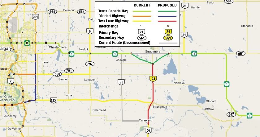
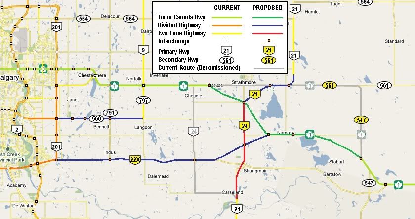
Alignment and Area Network Study east of Calgary which involves a Strathmore Bypass, major realignment between Gliechen and Strathmore, and an eastern extension of Hwy 22X which provide an alternate eastern approach into Calgary. Here’s the initial stage with the Strathmore bypass and Hwy 24 realigned to follow Hwy 817 into Strathmore.
Along with other major studies in the
Calgary area, the province is also looking at twinning Highway 560 between Calgary and Langdon. I included it in the Final Stage of the Trans Canada Highway realignment and Hwy 22X extension.
While these projects are ambitious and would improve the Trans Canada Highway east of Calgary, the problem of the Trans Canada Highway through Calgary still exists with 16 Avenue N. Hwy 201 (Stoney Trail) provides a free-flowing beltway around Calgary, however it is twice the distance and doesn’t provide the best alternative if TCH traffic needs to go into the city. Hwy 22X could provide a free-flowing alternative, however it enters Calgary at the furthest SE point and does not easily connect with TCH 1 west. Hwy 22X also only connects with the rest of Calgary via three routes; Deerfoot Trail (Hwy 2) and Macleod Trail and the SE portion of Stoney Trail (Hwy 201). Hwy 22X also is heavily reliant on the completion of the SW Ring Road, something that has been hung up for many years.
What I propose is that the realignment be slightly adjusted to link with Hwy 560, which becomes Glenmore Trial, Calgary’s major east-west connector. ROW exists to build interchanges along the signalized intersections and it easily connects with TCH 1 west via Sarcee Trail. I attached a map with some options on how this could happen.
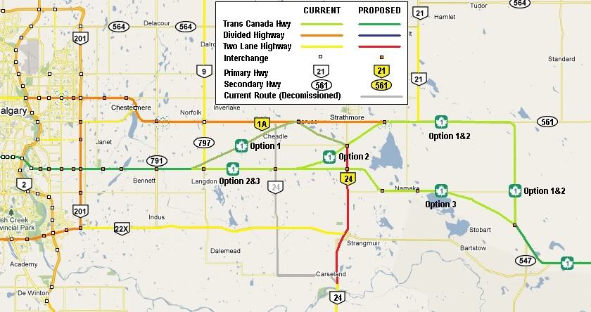
The Trans Canada Highway could follow Glenmore & Sarcee Trails through Calgary as a freeflowing route that still provides easy access to mulitple points of the city via Stoney Trail (Hwy 201), Deefoot Trail (Hwy 2), Macleod Trail (direct access to downtown), Crowchild Trail, and Bow Trail. Dangerous Goods could use Stoney Trail and avoid the Glenmore Causeway.


 Prev
Prev


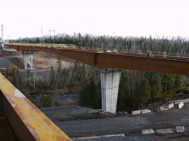
 It's a five kilometre project and will be complete in 3 years. (Which is MTO-speak for "it will be complete in 7 years")


 Linear Mode
