HomeDiagramsDatabaseMapsForum About
     

Go Back   SkyscraperPage Forum > Global Projects & Construction > City Compilations


Reply

 
Thread Tools Display Modes
     
     
  #921  
Old Posted Apr 26, 2012, 5:05 PM
Austinlee's Avatar
Austinlee Austinlee is offline
Chillin' in The Burgh
 
Join Date: Nov 2004
Location: Spring Hill, Pittsburgh
Posts: 13,095
Quote:
Originally Posted by Urbana View Post
CMU is planning another fairly major addition to their campus anticipated to start construction this summer. It will be a 100,000 sq. foot "Bio, Energy, Nano" research facility

http://www.cit.cmu.edu/media/feature..._building.html

http://www.post-gazette.com/stories/...cility-219026/

Renderings:


Image Credit: Office 52

Nice pics! i hope the massive individual donations that CMU & Pitt recently recieved will be put to good use, in addition to each Universities billion & multi billion dollar fund drives.
__________________
Check out the latest developments in Pittsburgh:
Pittsburgh Rundown III
Reply With Quote
     
     
  #922  
Old Posted Apr 26, 2012, 5:43 PM
glowrock's Avatar
glowrock glowrock is offline
Becoming Chicago-fied!
 
Join Date: Dec 2002
Location: Chicago (West Avondale)
Posts: 19,689
[QUOTE=Private Dick;5679838]
Quote:
Originally Posted by glowrock View Post

Yeah, the Strip-to-Downtown connections are by far the easiest from a physical standpoint. That's why I've always thought that the Strip is the natural extension of Downtown/Cultural District. The Strip has the potential to become Pittsburgh's "Warehouse District" a la New Orleans or Cleveland -- and it's made big moves in that direction with the renovations and construction of "loft-style" living options, addition of restaurants and cultural amenities.

I really think it would be huge for Pittsburgh to get a T line extending out from downtown providing transit to the Strip and into Lower Lawrenceville, then connecting with the tracks that parallel the busway into Oakland, thru Panther Hollow to 2nd Ave to connect with that proposed 2nd Ave line. The rights of way exist already, and let's face it, Pittsburgh is not going to build a T line through the Hill to connect Downtown and Oakland -- that's just not going to happen when flat, largely-unused railroad lands already exist that can be utilized to provide transit connections. It has about as much chance as the Strip to Hill District incline... meaning, not a chance in hell

10th Street Bridge really isn't a viable option to go between the Southside and Downtown. You can certainly do it without too much trouble, but it's not realistic to think that people will. Duquesne students use it (and then climb that crazy staircase), but few others do. Going downtown, it leaves you at a busy no mans land intersection under the parkway lanes and exit ramps with the Armstrong Tunnels facing you -- which leaves you with the option of either crossing busy traffic lanes to walk through a long, dark, smoggy tunnel or turning left and walking down along 2nd Ave past the jail. Either way, it's a rather long, unpleasant walk. The Smithfield St. Bridge is probably more realistic (and used much more by pedestrians) to go back and forth between downtown and Southside... though it leaves you in Station Square which is then a good hike through a crappy area along Carson St. to the Southside proper.

As for the part about the state ignoring Philadelphia and Pittsburgh almost entirely in favor of the vast part of the rest of the state... no, just no. Ever been anywhere else in PA? Thriving cities, booming even, with state funding, huh?


The Arena site redevelopment SHOULD do wonders for connecting downtown once again. And the proposals to deck Crosstown would be awesome, but I'm not going to get too hopeful about that idea ever getting off the drawing boards.
I agree that the 10th St. Bridge does kind of put you in the middle of nowhere on the north side of the Mon, Private Dick. That being said, it's really a pretty easy walk down 2nd St. to downtown, even if it does involve walking past the jail...

As for the state essentially ignoring Pittsburgh and Philly for the benefit of the vast middle of the state, I wasn't implying that the region was thriving, nothing of the sort. But when it comes to things like infrastructure, the middle of the state gets far, far more per capita than the two ends (Pgh/Philly)...

Hopefully the area surrounding Station Square will start to redevelop, so the no-man's land on the South Side end of the Smithfield St. Bridge will start to slowly disappear...

Aaron (Glowrock)
__________________
"Deeply corrupt but still semi-functional - it's the Chicago way." -- Barrelfish
Reply With Quote
     
     
  #923  
Old Posted Apr 26, 2012, 6:11 PM
guyFROMtheBURGH guyFROMtheBURGH is offline
Registered User
 
Join Date: Dec 2007
Location: Allentown, PA
Posts: 178
I'm not sure what I think about the 'modernness' in the architecture for the new CMU building but the pedestrian bridge will be a fantastic addition!
Reply With Quote
     
     
  #924  
Old Posted Apr 26, 2012, 8:51 PM
Urbana's Avatar
Urbana Urbana is offline
Registered User
 
Join Date: Jul 2011
Posts: 580
Quote:
Originally Posted by guyFROMtheBURGH View Post
I'm not sure what I think about the 'modernness' in the architecture for the new CMU building but the pedestrian bridge will be a fantastic addition!
I agree, the rainbow accents make it look rather tacky. Additionally, I don't believe the pedestrian bridge will commence construction until the building adjacent to the museum is constructed. As of yet, I have not seen a timetable for it, so it could be a while. The architectural studio did seem to have it front-and-center in their designs though, so perhaps they are designing it as well and we will see it sooner rather than later. It will bring some new life into a relatively unsavory block. i believe I read somewhere that in addition to its academic and research function it will have ground level retail

Last edited by Urbana; Apr 26, 2012 at 11:55 PM.
Reply With Quote
     
     
  #925  
Old Posted Apr 26, 2012, 10:17 PM
BrianTH BrianTH is offline
Registered User
 
Join Date: Jan 2010
Posts: 6,071
I've thought in the past it would be cool if they provided a pedestrian/bike staircase and switchback from the 10th Street Bridge down to the Jail Trail, roughly similar to what they have planned for the Smithfield Street Bridge to the Mon Wharf:


I think that would really provide more sense of connection to Downtown (despite the existing paths).
Reply With Quote
     
     
  #926  
Old Posted Apr 26, 2012, 10:33 PM
Evergrey's Avatar
Evergrey Evergrey is offline
Eurosceptic
 
Join Date: Apr 2003
Location: Pittsburgh
Posts: 24,339
As much as people want to complain about the walkability of Pittsburgh, it always ranks as one of the "highest percentage walking commuters" cities. There's obviously a ton of room for improvement, but compared to most cities in the UNITED STATES outside of the hyper-dense Manhattan (which I actually find to be a somewhat harsh walking experience due to the homicidal cab fleets)... Pittsburgh is a walkers paradise.
Reply With Quote
     
     
  #927  
Old Posted Apr 27, 2012, 12:21 AM
daviderik daviderik is offline
Hell with the Lid Off.
 
Join Date: Mar 2012
Posts: 305
Quote:
Originally Posted by Evergrey View Post
As much as people want to complain about the walkability of Pittsburgh, it always ranks as one of the "highest percentage walking commuters" cities. There's obviously a ton of room for improvement, but compared to most cities in the UNITED STATES outside of the hyper-dense Manhattan (which I actually find to be a somewhat harsh walking experience due to the homicidal cab fleets)... Pittsburgh is a walkers paradise.
It is a great experience within the community you are walking in. That is understood. But I think the complaints are about getting from one great location within the city to another. Pittsburghers and visitors are forced to make their own trek because of the lack of good public trans. I once tried to walk through the west end to downtown area. Well the only way to go is through the west-end circle. It's taking your life in your hands! There is no sidewalk. You have to walk on the street that intersects carson. How is that safe? It's pretty much the city saying to everyone. If you arn't in a car. And you want to get to downtown, southside...too bad.
Reply With Quote
     
     
  #928  
Old Posted Apr 27, 2012, 12:34 PM
TBone7281 TBone7281 is offline
Registered User
 
Join Date: Feb 2011
Location: Pittsburgh, PA
Posts: 685
Quote:
Originally Posted by Evergrey View Post
Our compact Downtown is somewhat squandered by being surrounded by pedestrian dead zones (Allegheny Center, Strip District parking lots, Crosstown Blvd, Civic Arena, Station Square parking lots, etc.
Quote:
Originally Posted by glowrock View Post
Downtown to the Strip District is easy, just fill in some of the huge parking lots with some buildings. I believe this will probably happen in the next couple of years.
Quote:
Originally Posted by Private Dick View Post
Yeah, the Strip-to-Downtown connections are by far the easiest from a physical standpoint. That's why I've always thought that the Strip is the natural extension of Downtown/Cultural District. The Strip has the potential to become Pittsburgh's "Warehouse District" a la New Orleans or Cleveland -- and it's made big moves in that direction with the renovations and construction of "loft-style" living options, addition of restaurants and cultural amenities.
What constitutes a "pedestrian dead zone"? Just that there aren't nice things to look at? We walk from the office (24th & Smallman) to downtown on occasion for lunch and don't have any issues. There are sidewalks all the way there. Or, you could take the River Trail, which I take even on days I don't go out for lunch. I walk down to the Convention Center and back just to get out of the office for a while. From a physical standpoint, the infrastructure is really already in place for Downtown --> Strip.


Quote:
Originally Posted by Private Dick View Post
I really think it would be huge for Pittsburgh to get a T line extending out from downtown providing transit to the Strip and into Lower Lawrenceville, then connecting with the tracks that parallel the busway into Oakland, thru Panther Hollow to 2nd Ave to connect with that proposed 2nd Ave line.
Now THAT would be awesome.
Reply With Quote
     
     
  #929  
Old Posted Apr 27, 2012, 2:56 PM
Jonboy1983's Avatar
Jonboy1983 Jonboy1983 is offline
Registered User
 
Join Date: Apr 2010
Location: The absolute western-most point of the Philadelphia urbanized area. :)
Posts: 1,721
What is this proposed 2nd Avenue line? Where will it run from and to where will it run?
__________________
Transportation planning, building better communities of tomorrow through superior connections between them today...
Reply With Quote
     
     
  #930  
Old Posted Apr 28, 2012, 5:32 PM
dcesar716 dcesar716 is offline
Registered User
 
Join Date: Mar 2012
Posts: 9
Quote:
Originally Posted by Evergrey View Post
Pittsburgh is an incredibly walkable city... especially the collection of East End neighborhoods (though Baum Blvd is really harsh and Fifth-Forbes in Oakland is rough but improving). The fact that Pittsburgh (city proper) ranks top 3 every year for percentage of people who walk to work is certainly testament to this. However, I agree that there are major connectivity issues throughout the city due to highways, poor pedestrian infrastructure, misguided mid-20th century development, anything owned by Buncher, etc. Our compact Downtown is somewhat squandered by being surrounded by pedestrian dead zones (Allegheny Center, Strip District parking lots, Crosstown Blvd, Civic Arena, Station Square parking lots, etc.

Private Dick makes great points about the topography impacting urban development in Pittsburgh. Explore Pittsburgh on Google Terrain and you will begin to understand just how intense the topography here is. It really explains why there is so much segmentation and hyper-localism. There is no other major U.S. metro that has to deal with these issues.
Sometimes all it takes is a DESIGNATION as a pedestrian zone enhanced by selective infrastructure improvements like widening sidewalks, taking back unnecesary driving/parking lanes (think about how wide the streets are in front of produce terminal) and inclusion of signage / protective bollards. Literally glorifying a sidewalk as a "linear park" can foster new development and skyrocket the "tourism" value of your urban core. Im not talking about shady side to north shore, I am talking about tying the south side with south station with Market Square in the Golden triangle with the north shore, Cultural District and strip district. I can think of NO unaproachable barrier in PGH that would prevent this. It can be as elaborate as the Indy Cultural Trail or as simple as Bostons Freedom Trail.... It becomes an ammenity beyond what the current river trail system offers. Its not just for the runners/bikers, its for the pedestrian, the tourist and the family that wants to take a stroll and see the city without worry. It softens the street level experience, relieving anxiety. Fashionable and functional! Housing projects will tout the proximity to it and hotels will begin offering bikes to ride on it. $ and politics of course dont make these things easy but the fact of the matter is it wouldnt take an astronomical amount of $ to get this done. Vision and public/private collaboration. Whose in? (stepping down from pedastal)
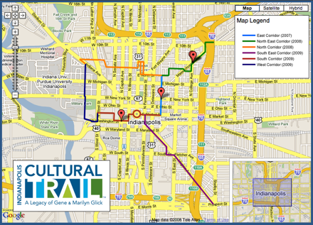


Reply With Quote
     
     
  #931  
Old Posted Apr 28, 2012, 7:41 PM
Private Dick Private Dick is offline
BANNED
 
Join Date: Aug 2010
Location: D.C.
Posts: 3,125
Quote:
Originally Posted by Jonboy1983 View Post
What is this proposed 2nd Avenue line? Where will it run from and to where will it run?
It's been kicked around for a little while now. Councilman Peduto, former County Exec Onorato, and the Allegheny Conference pushed this idea for a connection between downtown and Oakland, among other routes/options. Peduto was/is really in favor of this one, as it would run from the 1st Ave Station, along 2nd Ave (and providing service to the PTC and the new Almono proposal on the former LTV site), and then hooking up with the existing heavy rail ROW around Greenfield Ave, following it up through Panther Hollow to service Oakland, and then continuing along that existing ROW/tracks that parallels the East Busway to Lawrenceville/Strip.

I think it's the most realistic route option for extension of local rail transit into Oakland. Flat land with existing rights of way -- 'nuff said.

And being able to link Downtown, major new Mon riverfront development areas (PTC, ALmono sites), Oakland, Shadyside, Bloomfield, Lower Lawrenceville, and the Strip in a loop would just be huge for Pittsburgh's core.
Reply With Quote
     
     
  #932  
Old Posted Apr 28, 2012, 8:00 PM
Jonboy1983's Avatar
Jonboy1983 Jonboy1983 is offline
Registered User
 
Join Date: Apr 2010
Location: The absolute western-most point of the Philadelphia urbanized area. :)
Posts: 1,721
Quote:
Originally Posted by Private Dick View Post
It's been kicked around for a little while now. Councilman Peduto, former County Exec Onorato, and the Allegheny Conference pushed this idea for a connection between downtown and Oakland, among other routes/options. Peduto was/is really in favor of this one, as it would run from the 1st Ave Station, along 2nd Ave (and providing service to the PTC and the new Almono proposal on the former LTV site), and then hooking up with the existing heavy rail ROW around Greenfield Ave, following it up through Panther Hollow to service Oakland, and then continuing along that existing ROW/tracks that parallels the East Busway to Lawrenceville/Strip.

I think it's the most realistic route option for extension of local rail transit into Oakland. Flat land with existing rights of way -- 'nuff said.

And being able to link Downtown, major new Mon riverfront development areas (PTC, ALmono sites), Oakland, Shadyside, Bloomfield, Lower Lawrenceville, and the Strip in a loop would just be huge for Pittsburgh's core.
I guess that would be a LRT extension? I seem to remember Peduto floating something around that would link Hazelwood, Oakland, and Lawrenceville, and this was a heavy-rail proposal.

I also understand that there is a rather narrow single-tracked tunnel under Oakland. I imagine this would be widened, double tracked? Also, the existing rail there is standard gauge while LRT is PA Trolley gauge (5 foot-2 inches). I'm just wondering how all of this is going to work...

Hey, I have to give it to Peduto. He really knows how to think outside the box! Plus, he wants to merge the city with the county, which would make Pittsburgh a city with over a million residents...
__________________
Transportation planning, building better communities of tomorrow through superior connections between them today...
Reply With Quote
     
     
  #933  
Old Posted Apr 28, 2012, 8:40 PM
Private Dick Private Dick is offline
BANNED
 
Join Date: Aug 2010
Location: D.C.
Posts: 3,125
Quote:
Originally Posted by Jonboy1983 View Post
I guess that would be a LRT extension? I seem to remember Peduto floating something around that would link Hazelwood, Oakland, and Lawrenceville, and this was a heavy-rail proposal.

I also understand that there is a rather narrow single-tracked tunnel under Oakland. I imagine this would be widened, double tracked? Also, the existing rail there is standard gauge while LRT is PA Trolley gauge (5 foot-2 inches). I'm just wondering how all of this is going to work...

Hey, I have to give it to Peduto. He really knows how to think outside the box! Plus, he wants to merge the city with the county, which would make Pittsburgh a city with over a million residents...
Yeah, the original idea was to use the Allegheny Valley RR heavy rail line through Panther Hollow/Oakland between Hazelwood and Lawrenceville as a commuter rail line.

I think that idea is dead -- and I think it makes zero sense anyway. A diesel heavy rail "commuter" train between Hazelwood and Lawrenceville?? Why??

Something that was kicked around by civic reps rather recently instead (and this was in a forum organized by Pitt CONNECT, not publicly really) was using those lines for a T extension, following the route I said above.
Reply With Quote
     
     
  #934  
Old Posted Apr 29, 2012, 12:12 AM
Jonboy1983's Avatar
Jonboy1983 Jonboy1983 is offline
Registered User
 
Join Date: Apr 2010
Location: The absolute western-most point of the Philadelphia urbanized area. :)
Posts: 1,721
Quote:
Originally Posted by Private Dick View Post
Yeah, the original idea was to use the Allegheny Valley RR heavy rail line through Panther Hollow/Oakland between Hazelwood and Lawrenceville as a commuter rail line.

I think that idea is dead -- and I think it makes zero sense anyway. A diesel heavy rail "commuter" train between Hazelwood and Lawrenceville?? Why??

Something that was kicked around by civic reps rather recently instead (and this was in a forum organized by Pitt CONNECT, not publicly really) was using those lines for a T extension, following the route I said above.
The second option does make more sense, but the issue now is I think the trackage of both the existing rail line(s) and the LRT are of different gauges. I'm assuming they'd have to lay different tracks...?
__________________
Transportation planning, building better communities of tomorrow through superior connections between them today...
Reply With Quote
     
     
  #935  
Old Posted Apr 29, 2012, 12:23 AM
Minivan Werner Minivan Werner is offline
Registered User
 
Join Date: Sep 2008
Posts: 497
I could be wrong (and I probably am) but I thought those tracks in question (that go 'under' Oakland) were currently used by Amtrak.
Reply With Quote
     
     
  #936  
Old Posted Apr 29, 2012, 12:28 AM
Jonboy1983's Avatar
Jonboy1983 Jonboy1983 is offline
Registered User
 
Join Date: Apr 2010
Location: The absolute western-most point of the Philadelphia urbanized area. :)
Posts: 1,721
Quote:
Originally Posted by Minivan Werner View Post
I could be wrong (and I probably am) but I thought those tracks in question (that go 'under' Oakland) were currently used by Amtrak.
I think they are, but I also think they're a CSX/NS/AVR line. I think Amtrak's Capitol Limited uses that portion, tho, as it runs from Pittsburgh down to Connelsville on its way to DC and vise versa.

Something else I wanted to add. For kicks I looked up images of the Cambria Suites adjacent to the Consol Energy Center. I agree. What the heck? That thing should have been at LEAST double the height (14 or 15 stories). Granted, the Marriott City Centre (Chatham Center) is right there, too, but I think CONSOL would generate enough demand for just as many rooms as such if not more. Also, I see it looks like there's a surface lot adjacent to Washington Plaza as well as right across the street next to the Crawford Square development. Anyone else forsee any high-rise (or mid-rise) residential buildings going in here, or at least converting the surface lot into some kind of parklet while putting something next to Washington Plaza?
__________________
Transportation planning, building better communities of tomorrow through superior connections between them today...

Last edited by Jonboy1983; Apr 29, 2012 at 2:07 AM. Reason: further comments
Reply With Quote
     
     
  #937  
Old Posted Apr 29, 2012, 4:46 AM
Private Dick Private Dick is offline
BANNED
 
Join Date: Aug 2010
Location: D.C.
Posts: 3,125
Quote:
Originally Posted by Jonboy1983 View Post
The second option does make more sense, but the issue now is I think the trackage of both the existing rail line(s) and the LRT are of different gauges. I'm assuming they'd have to lay different tracks...?
Yeah, new light rail tracks would have to be put down. The main advantage is that flat land with enough space and rail rights of way already exist along the route, and the heavy rail line is not used very often.
Reply With Quote
     
     
  #938  
Old Posted Apr 29, 2012, 11:54 AM
BrianTH BrianTH is offline
Registered User
 
Join Date: Jan 2010
Posts: 6,071
Yeah, Peduto's plan would have used diesel commuter trains on the existing trackage. The obvious advantages to that plan are that it would be relatively cheap and you could continue using that line for freight at night. Incidentally, I doubt there is room for more trackage in the existing tunnel.
Reply With Quote
     
     
  #939  
Old Posted Apr 29, 2012, 4:03 PM
Private Dick Private Dick is offline
BANNED
 
Join Date: Aug 2010
Location: D.C.
Posts: 3,125
Quote:
Originally Posted by BrianTH View Post
Yeah, Peduto's plan would have used diesel commuter trains on the existing trackage. The obvious advantages to that plan are that it would be relatively cheap and you could continue using that line for freight at night. Incidentally, I doubt there is room for more trackage in the existing tunnel.
Which I fail to see the advantage of, much less the need for -- or even interest in. Why would people want or need to travel between Hazelwood and Lawrenceville on a train -- and not a quick light rail option either, but rather a diesel passenger train. Talk about slow inefficiency. It just makes zero sense.

From an old PG article: "Diesel passenger trains could use it during the day, carrying campus researchers and hospital employees between Oakland and Lawrenceville, and potentially driving redevelopment of the coke works site."

What? I just fail to see how this makes any sense whatsoever. The former LTV site has been planned for redevelopment well before this odd idea. And "researchers and hospital employees" sure as hell aren't going to hop on a diesel passenger train to go to Oakland from Lawrenceville or Hazelwood -- especially when the train would go under Oakland anyway! Would it seriously make sense to board a diesel locomotive train in Hazelwood to take it until you get to an area around Neville and Fifth and then have to walk to UPMC campus area?!? It would be quicker to just walk from 2nd Ave/Hazelwood up thru South Oakland to UPMC. I never understood this idea and still fail to... am I missing something?

The LRT route suggested by local leaders in the CONNECT transit forum does not go thru the tunnel, but rather up Boundary St./Neville St. and continues at grade on Neville before rejoining the rail ROW at the East busway ramp at Centre Ave area.
Reply With Quote
     
     
  #940  
Old Posted Apr 29, 2012, 8:33 PM
Jonboy1983's Avatar
Jonboy1983 Jonboy1983 is offline
Registered User
 
Join Date: Apr 2010
Location: The absolute western-most point of the Philadelphia urbanized area. :)
Posts: 1,721
Quote:
Originally Posted by Private Dick View Post
Which I fail to see the advantage of, much less the need for -- or even interest in. Why would people want or need to travel between Hazelwood and Lawrenceville on a train -- and not a quick light rail option either, but rather a diesel passenger train. Talk about slow inefficiency. It just makes zero sense.

From an old PG article: "Diesel passenger trains could use it during the day, carrying campus researchers and hospital employees between Oakland and Lawrenceville, and potentially driving redevelopment of the coke works site."

What? I just fail to see how this makes any sense whatsoever. The former LTV site has been planned for redevelopment well before this odd idea. And "researchers and hospital employees" sure as hell aren't going to hop on a diesel passenger train to go to Oakland from Lawrenceville or Hazelwood -- especially when the train would go under Oakland anyway! Would it seriously make sense to board a diesel locomotive train in Hazelwood to take it until you get to an area around Neville and Fifth and then have to walk to UPMC campus area?!? It would be quicker to just walk from 2nd Ave/Hazelwood up thru South Oakland to UPMC. I never understood this idea and still fail to... am I missing something?

The LRT route suggested by local leaders in the CONNECT transit forum does not go thru the tunnel, but rather up Boundary St./Neville St. and continues at grade on Neville before rejoining the rail ROW at the East busway ramp at Centre Ave area.
Well, you could dig up the tunnel (which is probably a cut-and-cover type tunnel anyway), widen the tunnel, lay additional track AND put an underground station. That all wouldn't cost TOOO much, would it?

Seriously tho, that other idea does makes excellent sense; taking the tracks to grade level through oakland along Nevelle/Boundary streets.

I do like the idea of adding a second standard-gauge track tho. I do forsee a commuter rail line running from Penn Station down through Panther Hollow, through Hazelwood and following the AVR/CSX line through Streets Run toward Washington. Has anyone taken Streets Run Road at rush hour before? Talk about hellish!!

This line actually used to be double-tracked and have passenger service at one point. I think that demand is there for commuter/regional passenger rail service for folks residing in the South Hills commuting either to Pittsburgh or Washington.
__________________
Transportation planning, building better communities of tomorrow through superior connections between them today...
Reply With Quote
     
     
This discussion thread continues

Use the page links to the lower-right to go to the next page for additional posts
 
 
Reply

Go Back   SkyscraperPage Forum > Global Projects & Construction > City Compilations
Forum Jump


Forum Jump


All times are GMT. The time now is 9:44 AM.

     
SkyscraperPage.com - Archive - Privacy Statement - Top

Powered by vBulletin® Version 3.8.7
Copyright ©2000 - 2024, vBulletin Solutions, Inc.