HomeDiagramsDatabaseMapsForum About
     

Go Back   SkyscraperPage Forum > Photography Forums > My City Photos


Reply

 
Thread Tools Display Modes
     
     
  #1  
Old Posted Sep 25, 2012, 4:20 AM
Cirrus's Avatar
Cirrus Cirrus is offline
cities|transit|croissants
 
Join Date: Jul 2001
Location: Washington, DC
Posts: 18,384
Washington DC River City - 2 waterfronts, a ferry ride, and 11 bridges

This post comes in 3 parts. Part 1 will cover the Georgetown waterfront. Part 2 will take you on a ferry ride under many of the city's bridges. Part 3 will cover the Alexandria waterfront. There are lots of other interesting riverfront things in and around DC, but I happened to be at all these locations over this past weekend, so you get a photo thread out of it.

Part 1: Georgetown

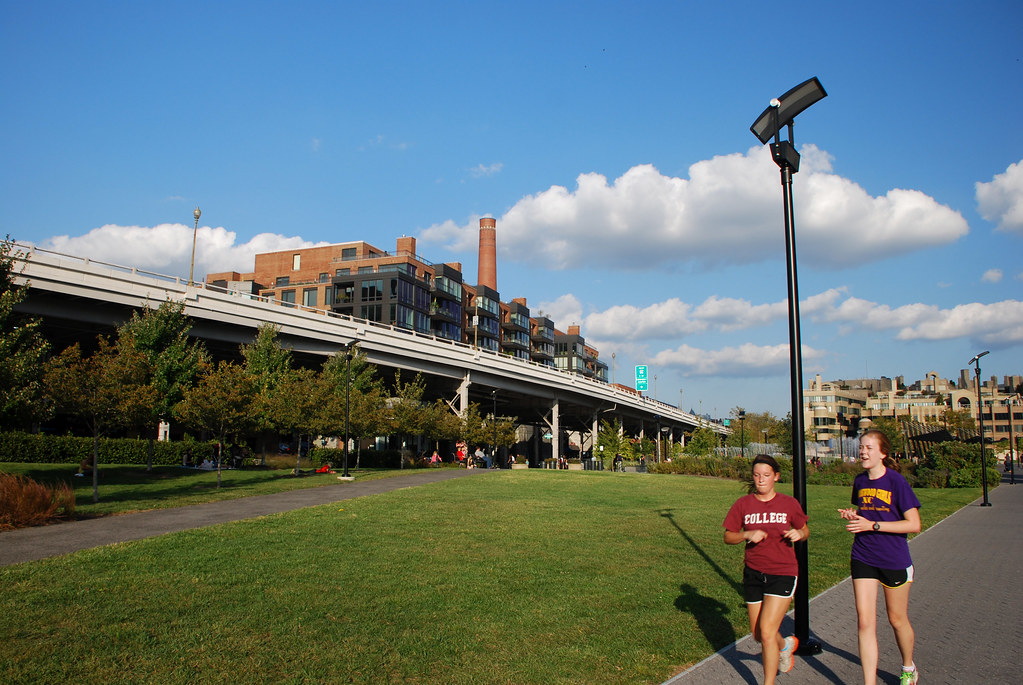
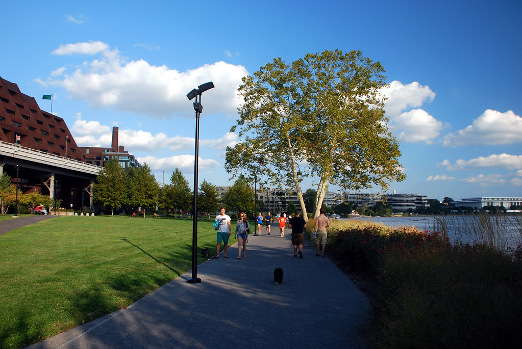
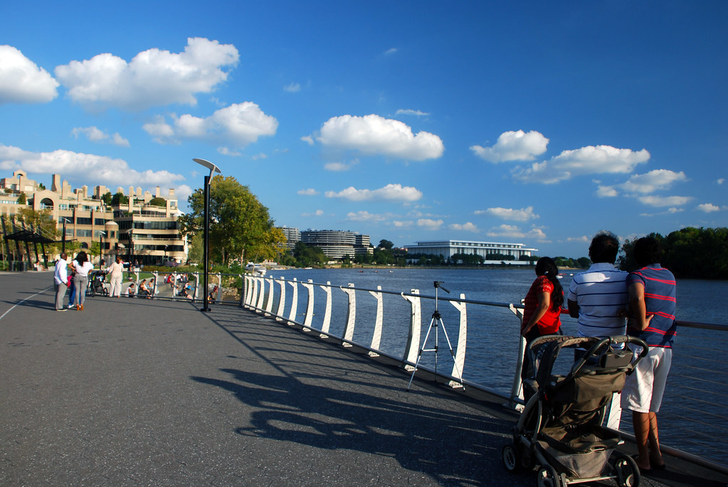
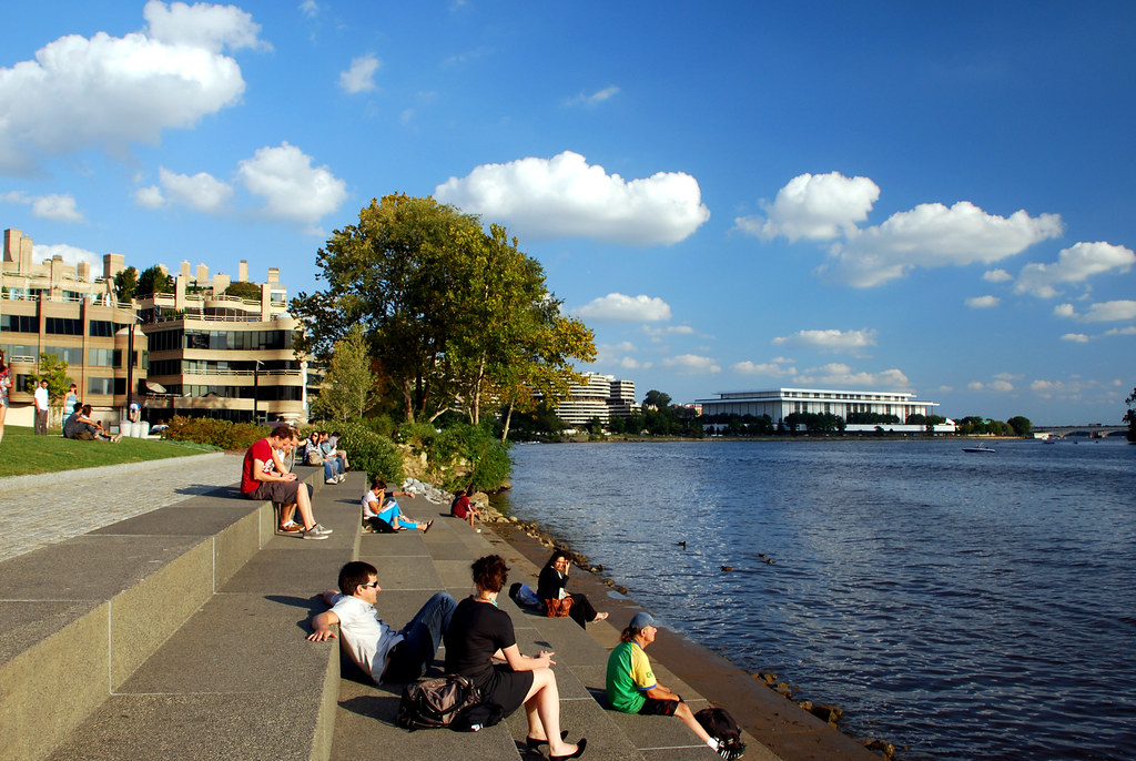
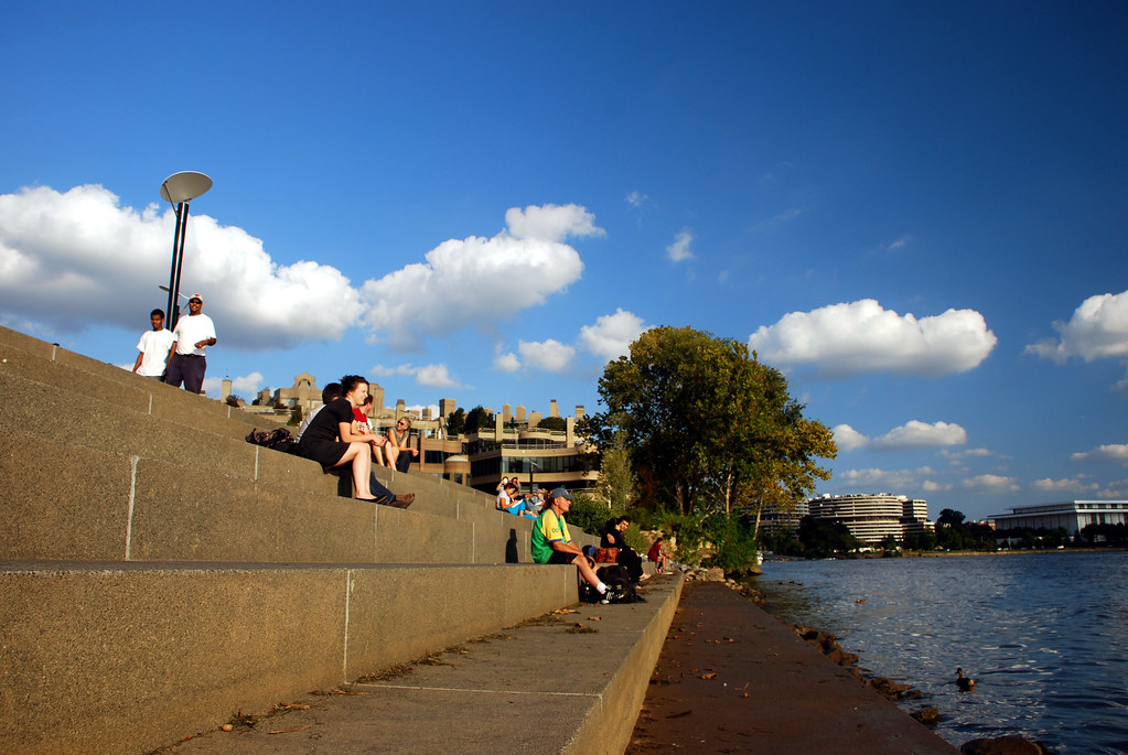
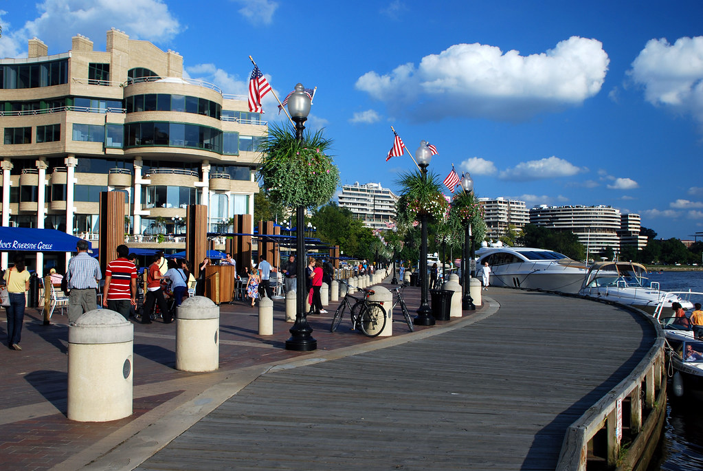
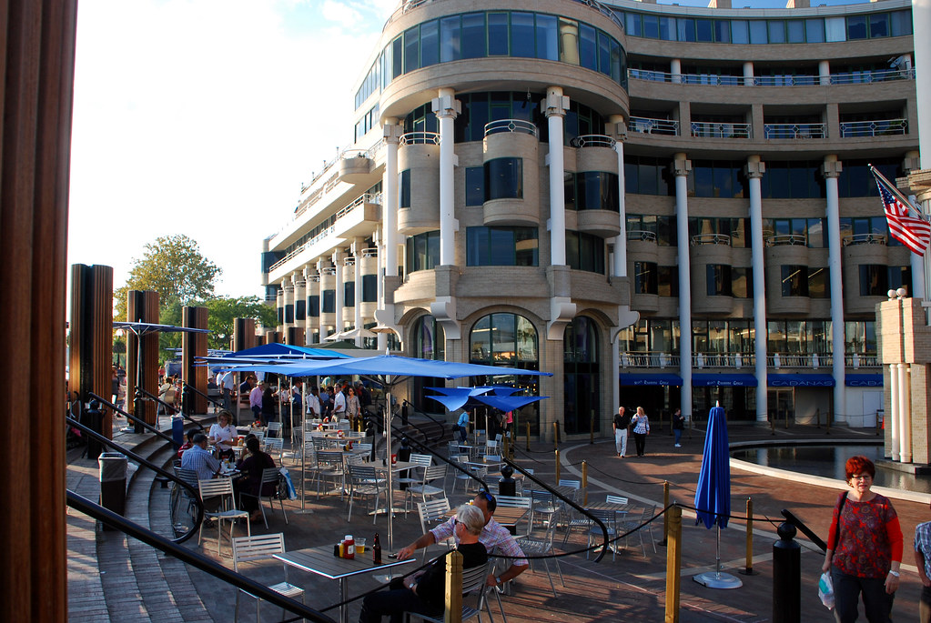
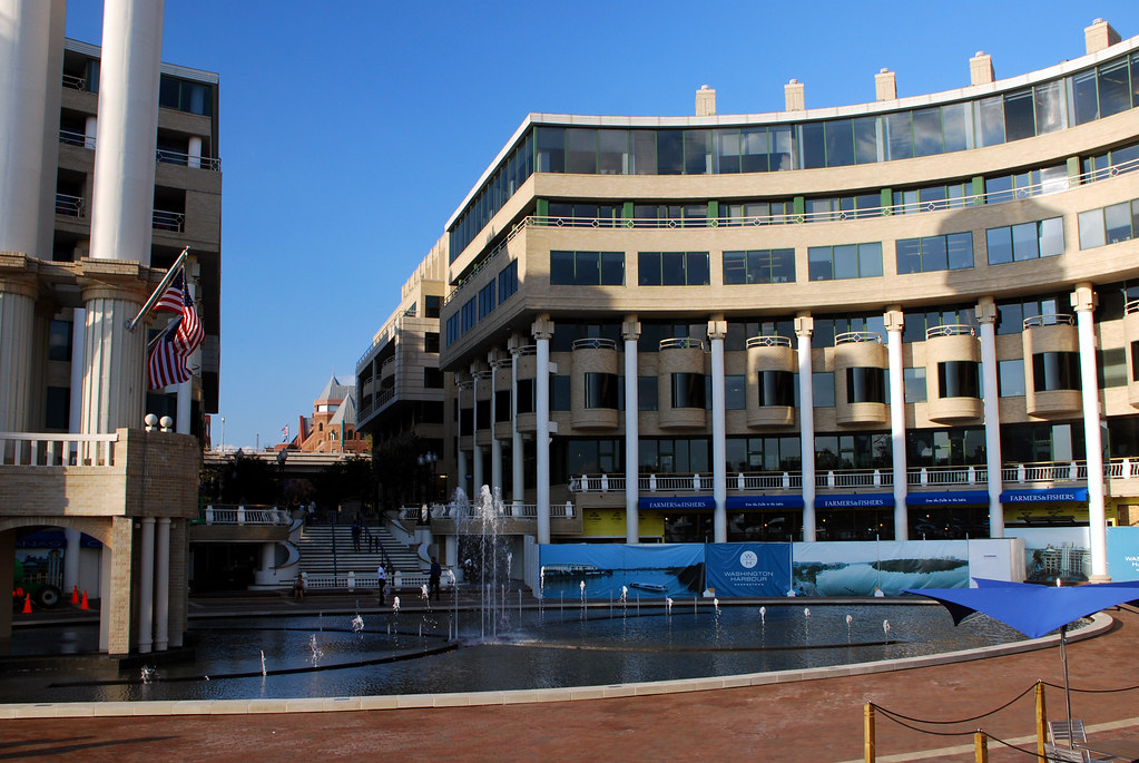
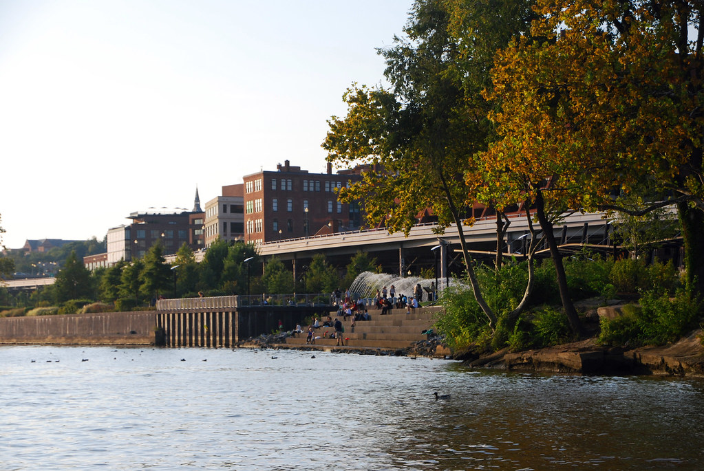
Georgetown's waterfront is part park and part mixed-use. The mixed use part was built in the mid 80s, while the park was just recently completed (replacing a waterfront surface parking lot).

Here's the park:

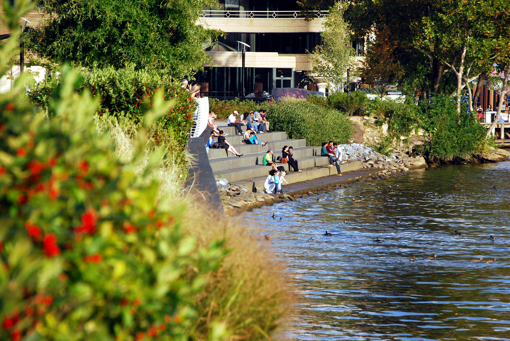
The waterfront is separated from the main part of Georgetown by the elevated Whitehurst Freeway. There are a lot of nice features built in, such as stairs down to the water, fountains, etc.


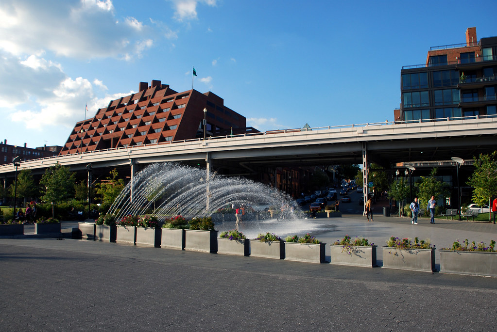
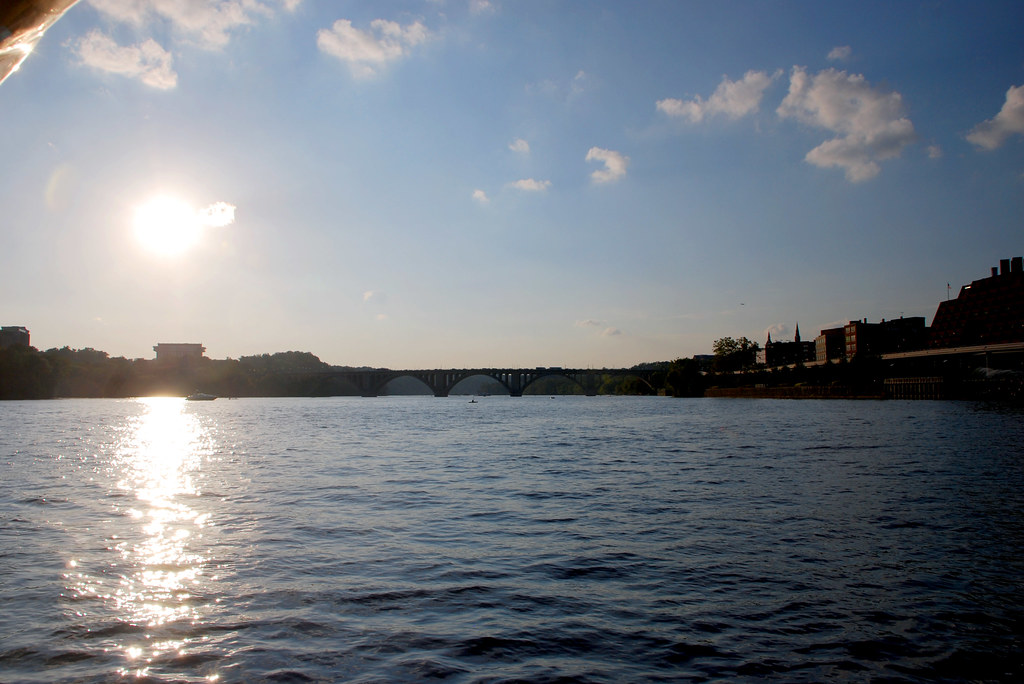
The bridge you see here is the Key Bridge, which goes to Rosslyn VA.


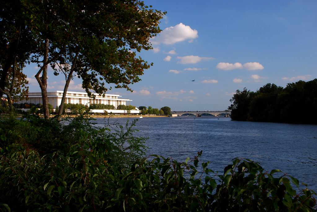
Looking down river, towards the Kennedy Center (Washington's opera house).


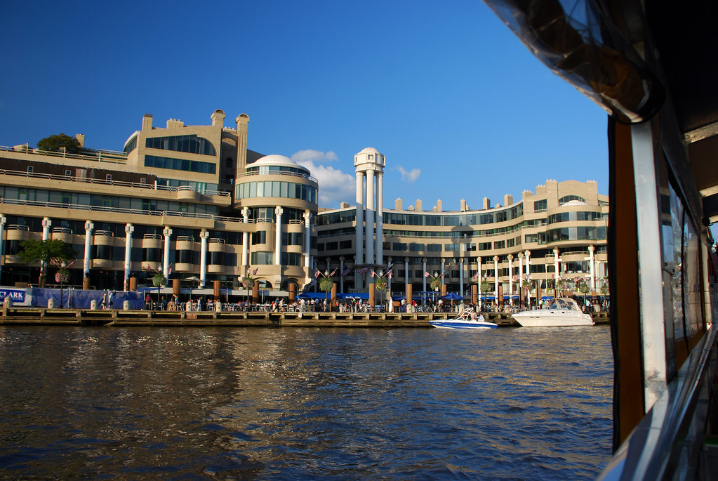
Now coming in to the mixed-use area.


Part 2: Ferry ride

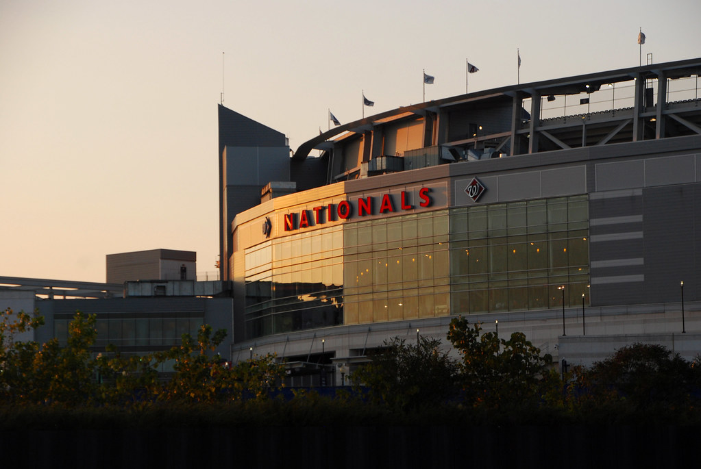
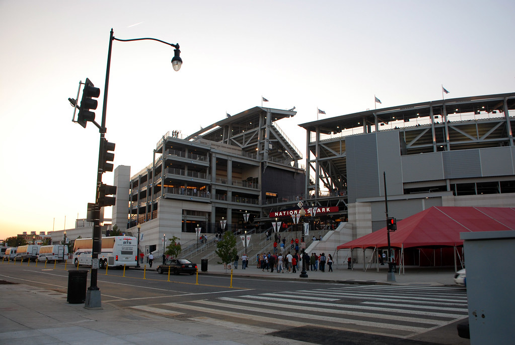
The reason I was at the waterfront, and the reason you're seeing these pictures, is that on Friday my wife and I took a Georgetown-to-Navy Yard ferry to get to Nationals Stadium and watch a ballgame. So here are pictures from the ferry.

It's not a large ferry.


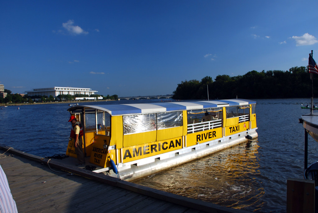
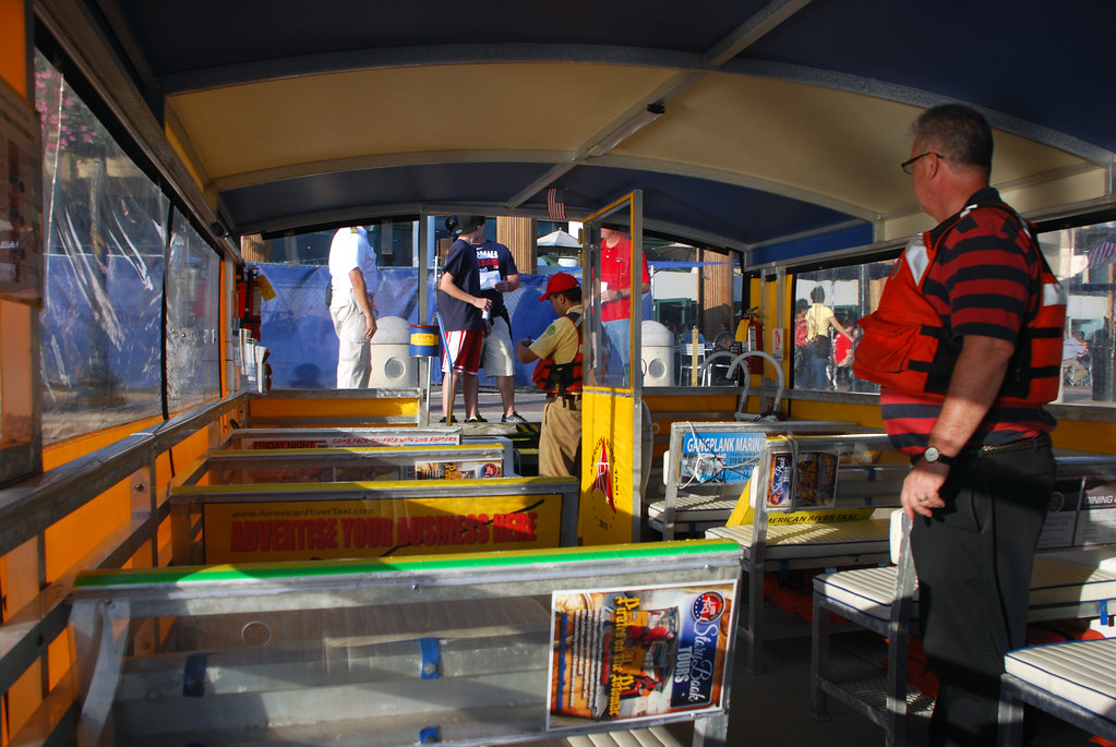
But it gets the job done. Off we go!


Looking back at Georgetown and the Key Bridge.


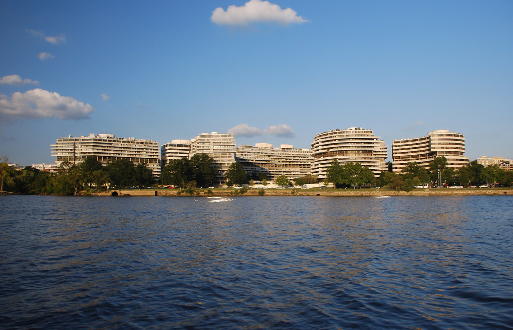
That's upstream. We're not going that way. We're going downstream. First thing we run in to is the famous Watergate, where President Nixon found trouble.


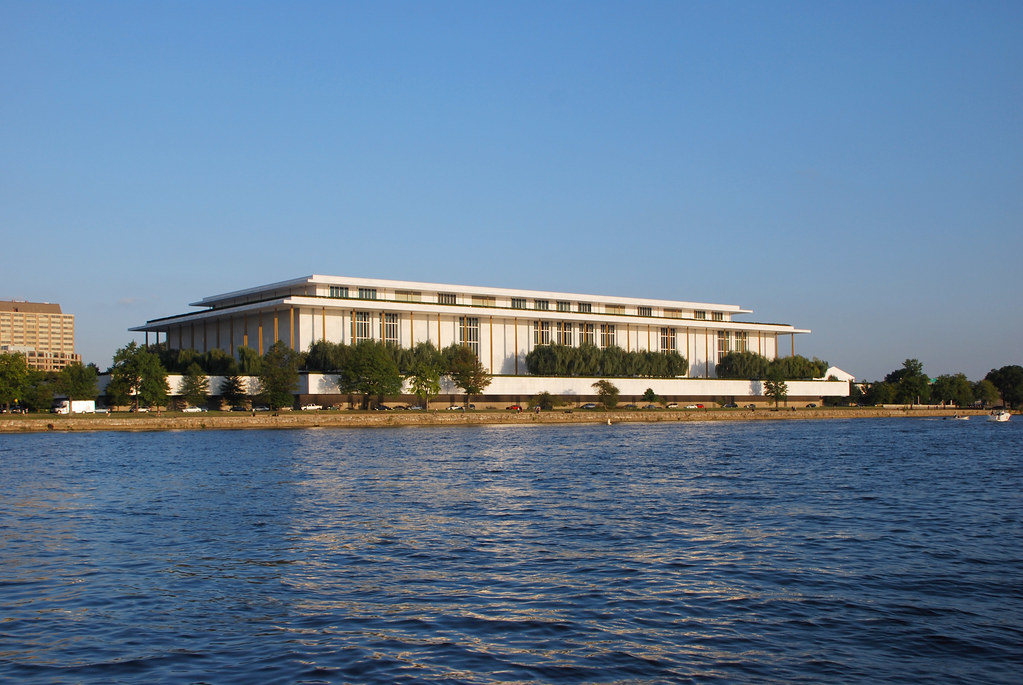
Next, the Kennedy Center.
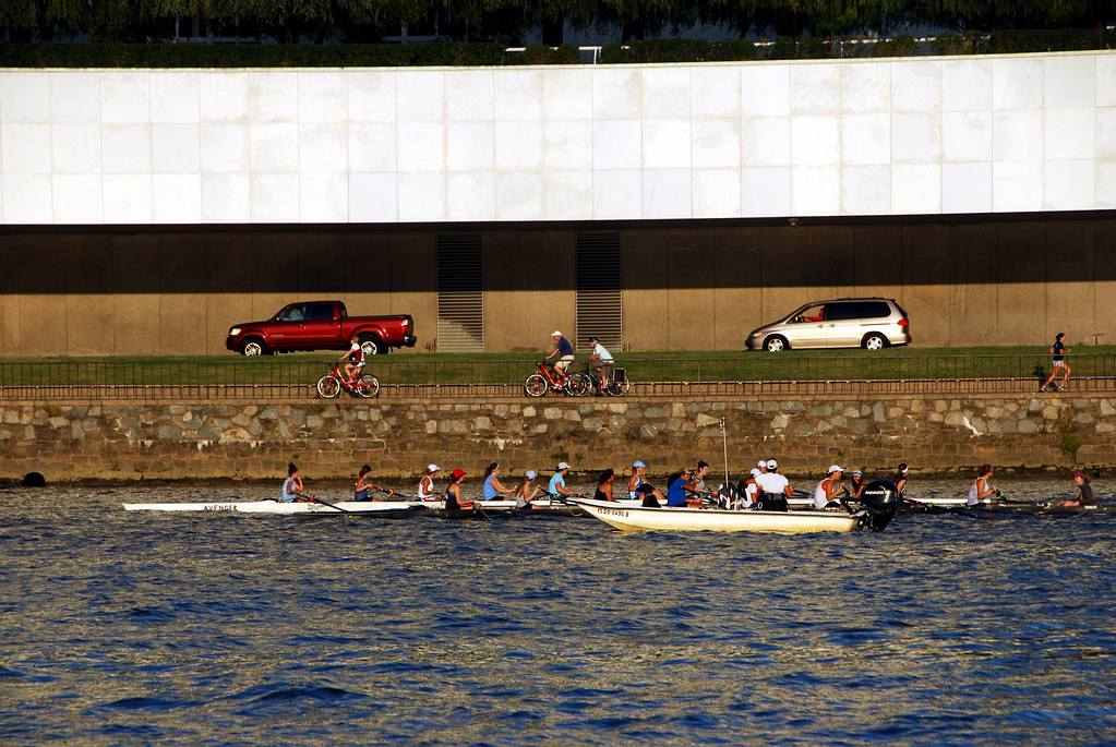


Very multimodal.


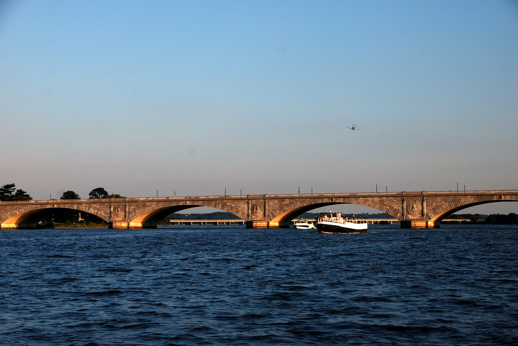
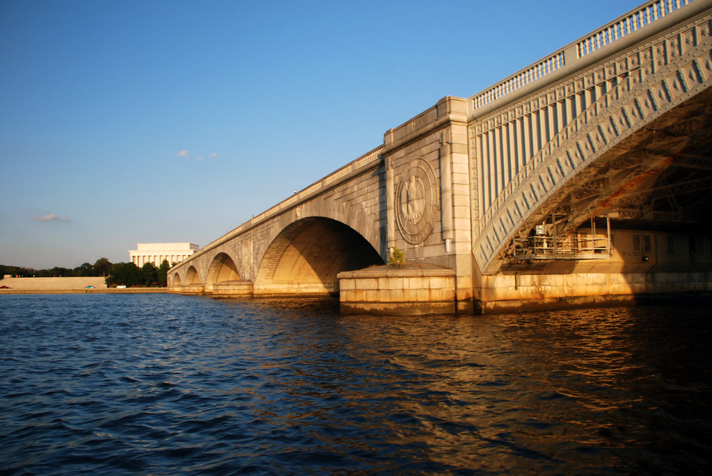
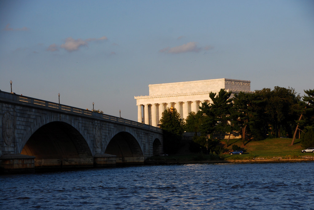
A major feature of the ferry ride will be the several bridges that we go under. The first one is the Roosevelt Bridge, which carries I-66 from Washington to Virginia. In this picture you can also see the Arlington Memorial Bridge, which goes to Arlington Memorial Cemetery.


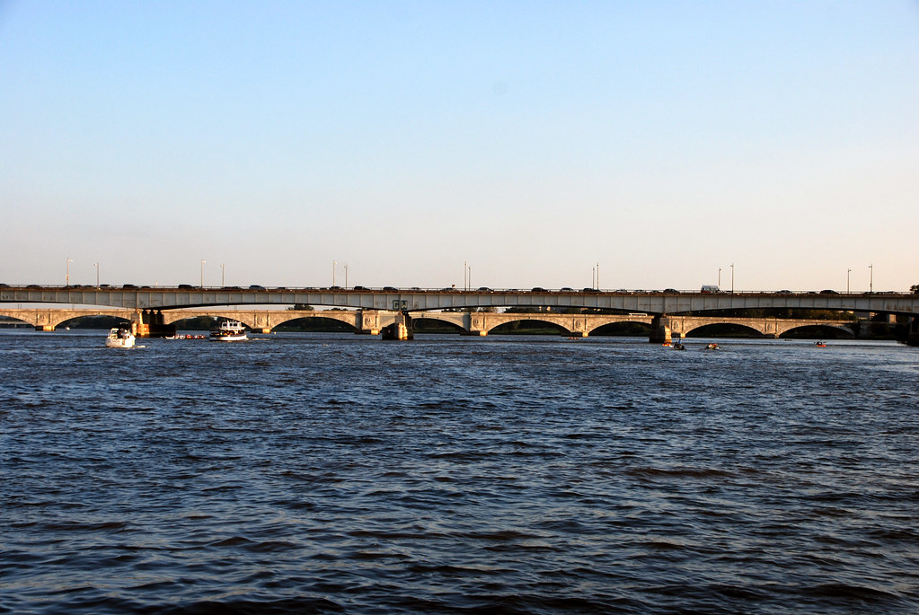
Roosevelt Bridge is not known for its beauty.


Once past Roosevelt Bridge we start to see some of DC's famous monuments.

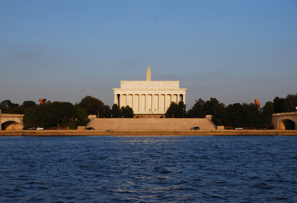
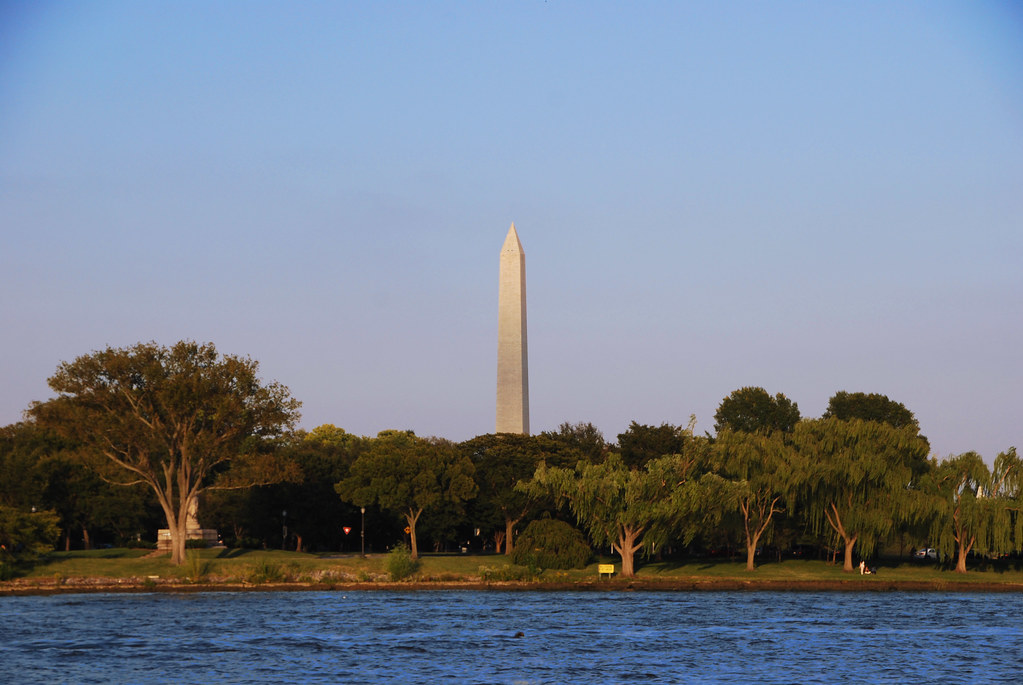
Washington's obelisk peaks above some trees:


Oh hai, Lincoln:


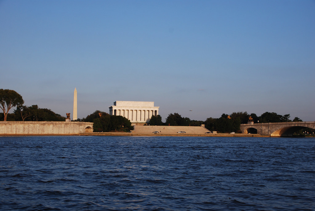
Washington and Lincoln lined up perfectly:


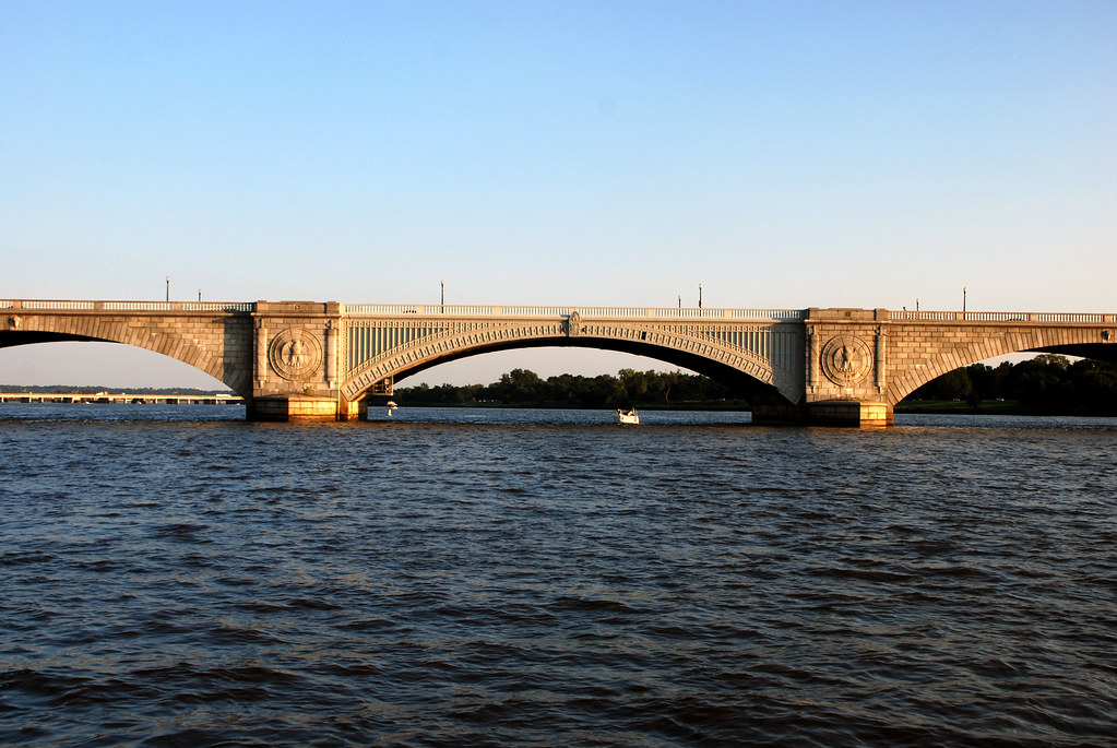
Approaching Arlington Memorial Bridge:


Washington doesn't get a lot of big ship traffic, but it does happen occasionally, and happend more often in the past. The older bridges either open or swing to let in ships.


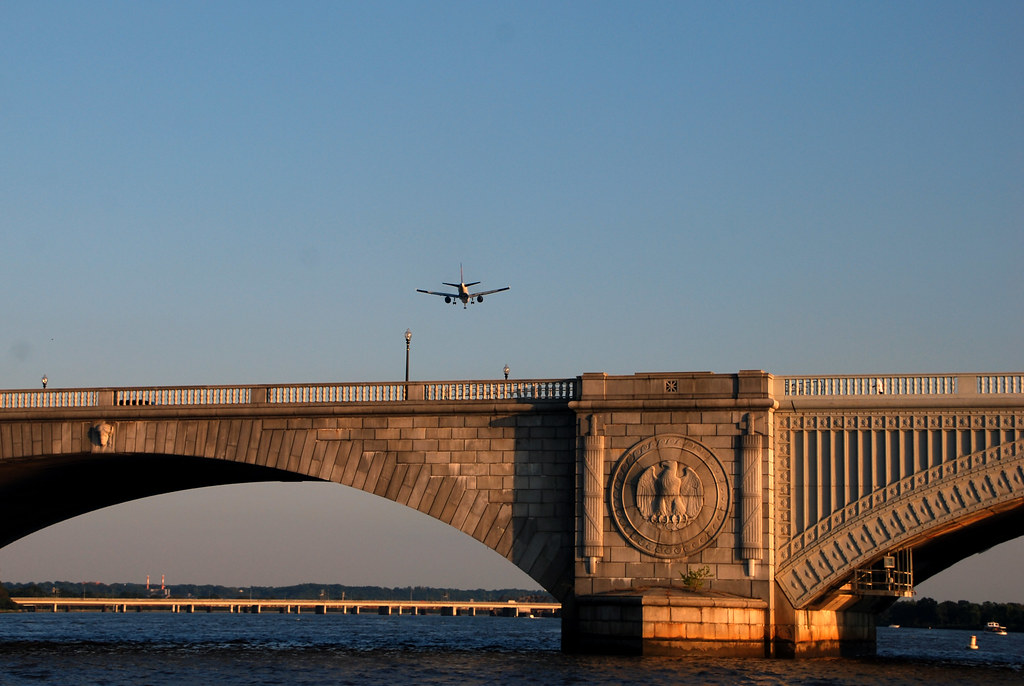
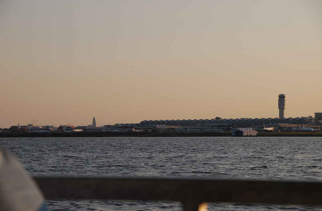
Airplanes on approach to National Airport come in over the river.


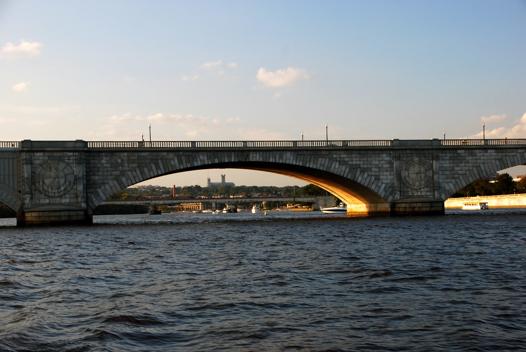
Looking back upstream, National Cathedral is perfectly framed:


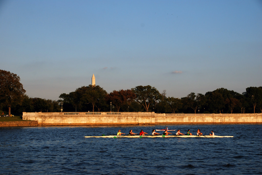
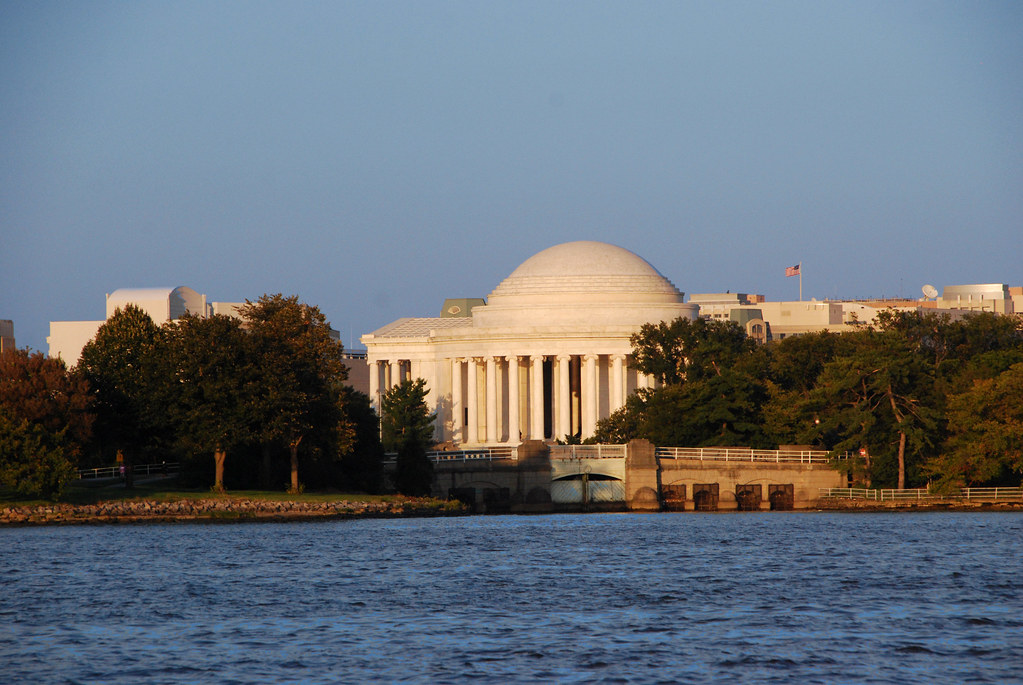
At this point we're sailing along West Potomac Park, which is the part of the National Mall between the Potomac and the Tidal Basin.


Jefferson:


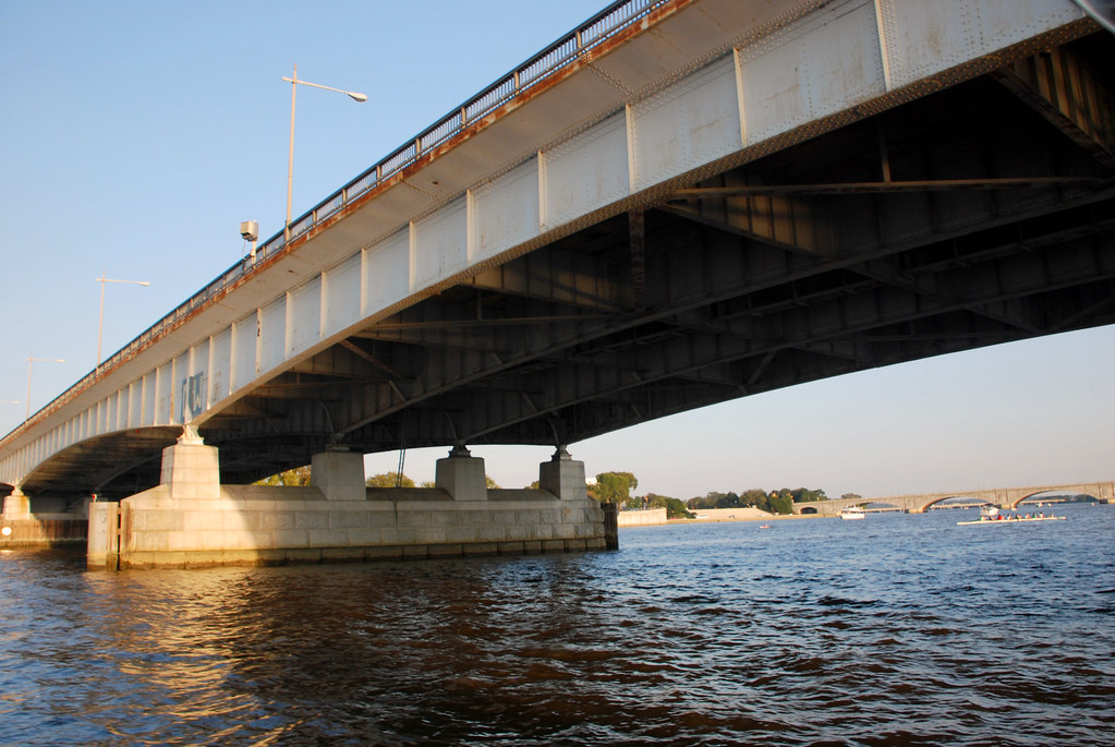
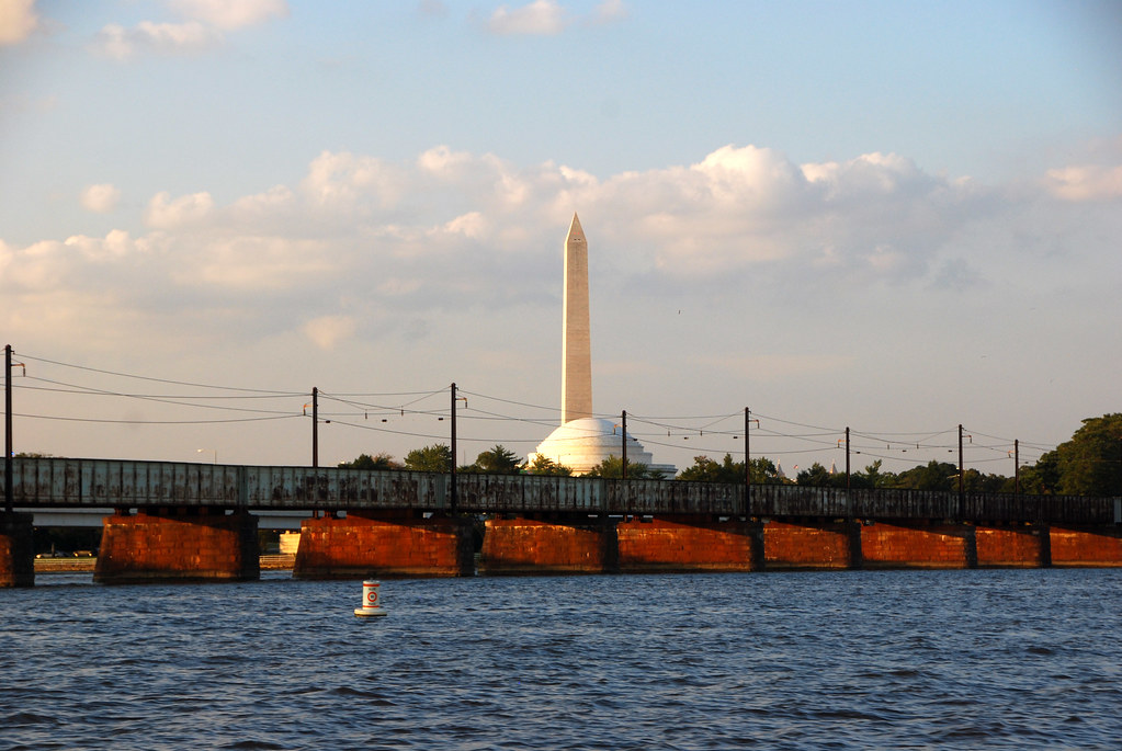
After Jefferson we reach the cluster of 3 bridges known collectively as "14th Street Bridge". They carry I-395 across the Potomac. Each of the 3 has its own name, but they all look alike and they're all part of I-395, so nobody knows the individual names.


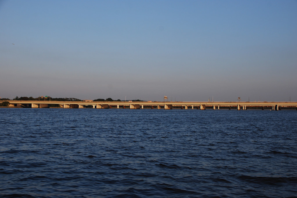
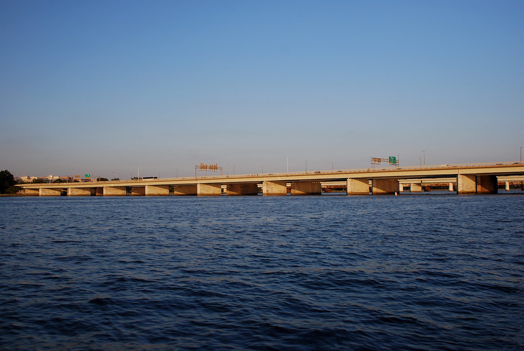
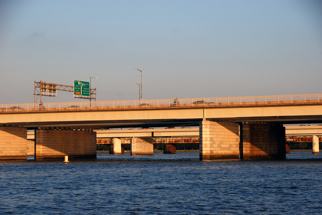
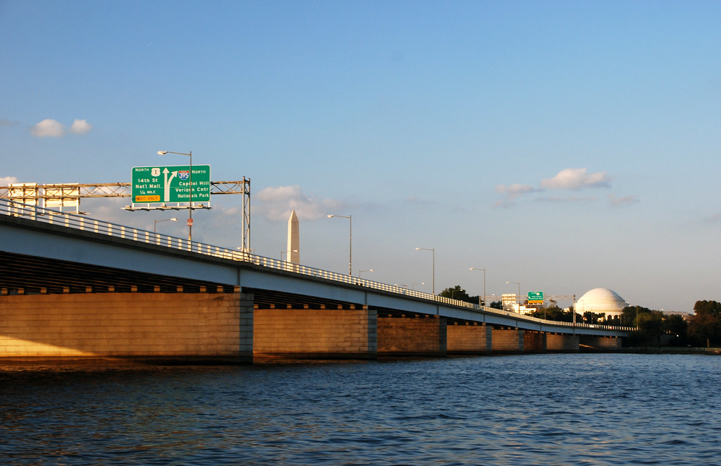
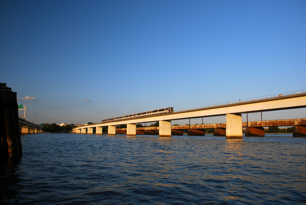
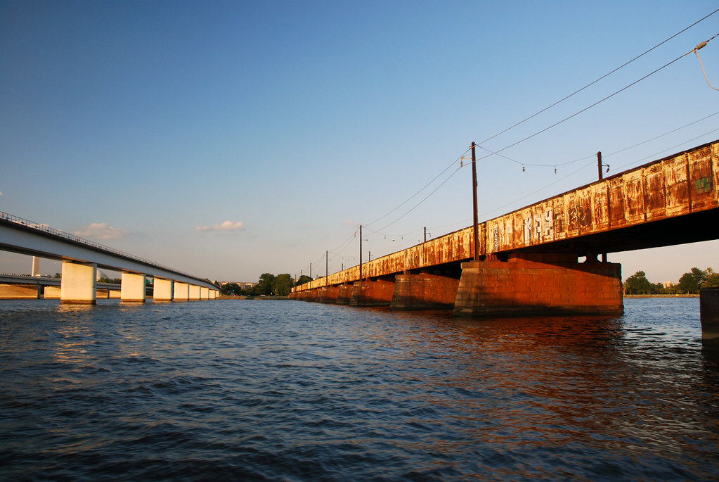
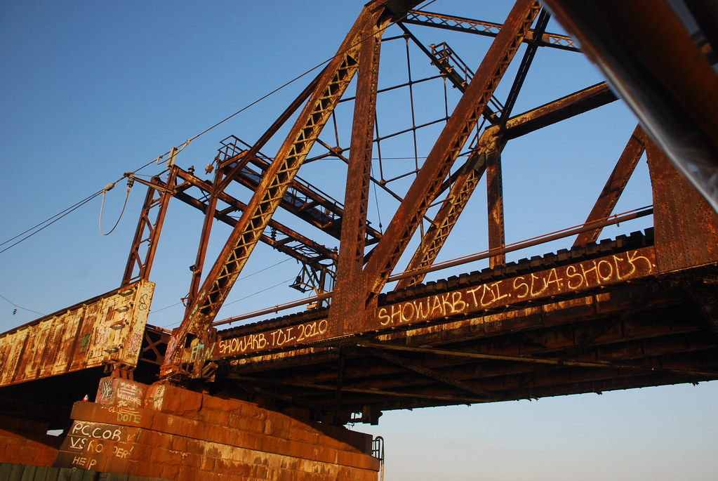
Immediately after 14th Street Bridge comes the Metrorail bridge (carrying the Yellow Line) and then Long Bridge, a 100-year-old span that carries Amtrak, VRE commuter trains, and freight.


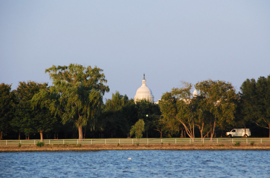
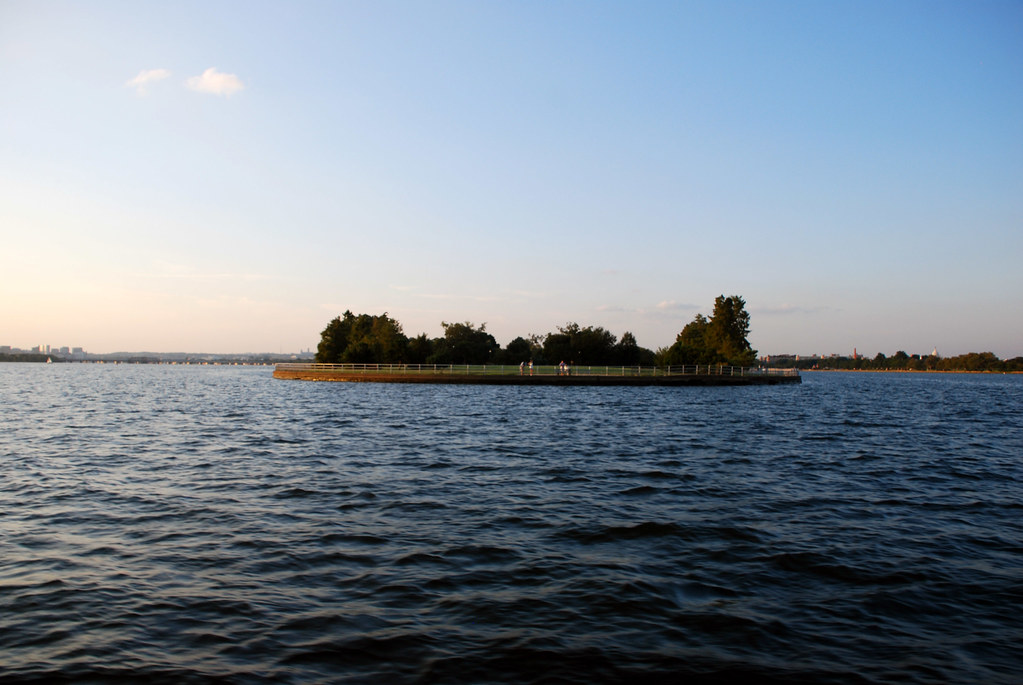
After the bridges we're following East Potomac Park, which is an island. In this image you the island in the foreground, with a famous dome in the background.


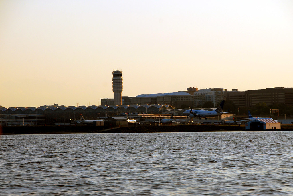
At this point some interesting things start to show up on the Virginia side. The 2 towers you see here are the Alexandria Washington Monument (left) and the National Airport control tower (right):


Landing plane.


The airport has a little light house, which amuses me.


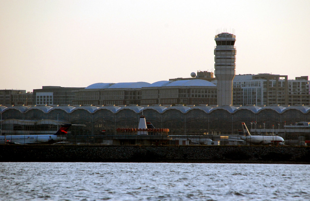
Crystal City, VA is a large business district behind the airport. For decades it had an FAA-imposed height limit, leading to a canopy of midrises that actually looked a lot like Washington. But the height limit was recently lifted, so taller buildings are popping up one by one.


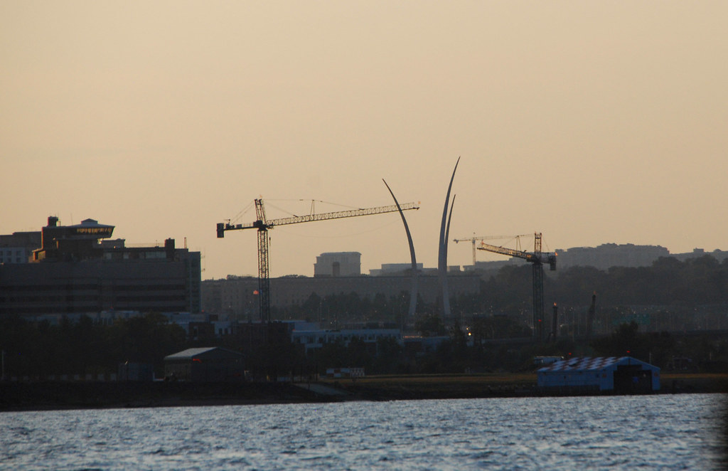
This is the US Air Force Memorial. The cranes are unrelated (they're building a new park).


Looking back upstream, it's clear the river has widened. You can see Rosslyn VA on the left bank, and the Washington Monument on the right. The National Cathedral is inbetween.


Rosslyn VA:


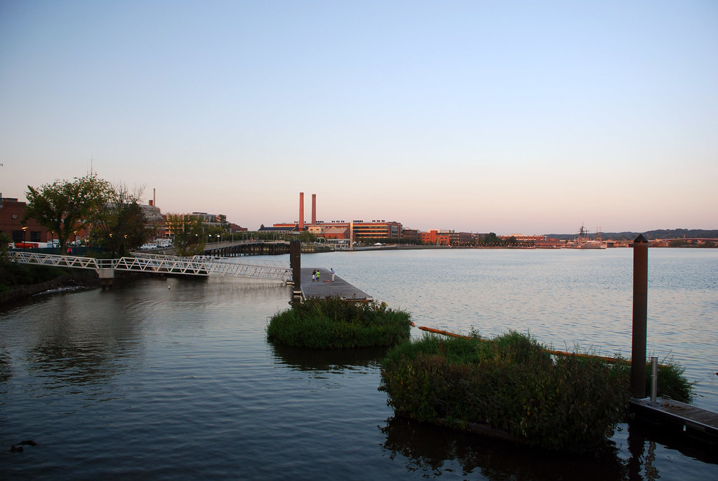
Now we are going to sail up the Anacostia River a little bit, to get to the baseball stadium. This is Hains Point, at the confluence of the rivers. Although in this picture you're not actually seeing the Anacostia yet. Hains Point is the southern tip of East Potomac Park, the island which separates the Potomac River (left) from Washington Channel (right). The Anacostia River is even further to the right, off frame.


Looking up Washington Channel:


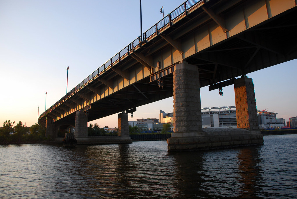
Now here's the Anacostia, and another bridge! This is the Frederick Dougless South Capitol Street Bridge. It's slated to be torn down and replaced soon.


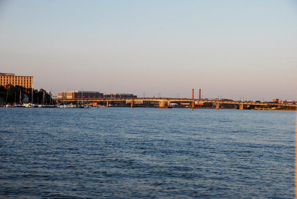
The city hasn't decided on a new bridge design yet, but the idea is it will be a lot prettier.


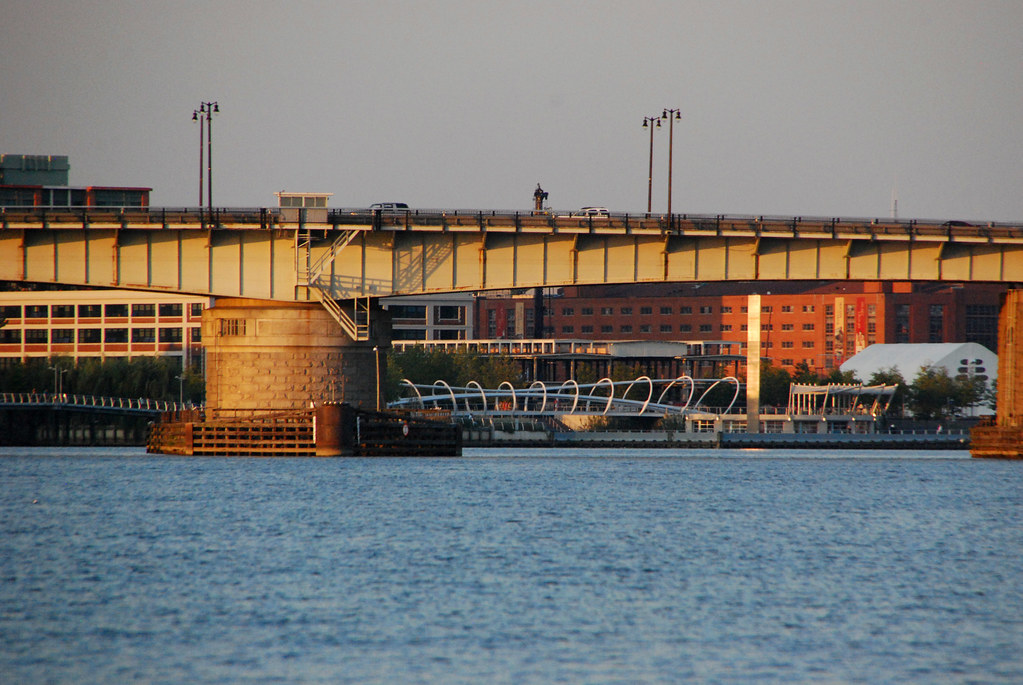
Looking under South Capitol Bridge, we see one final bridge before reaching the dock, the bike/ped Yards Park Bridge, which carries the Anacostia waterfront trail over a small inlet.


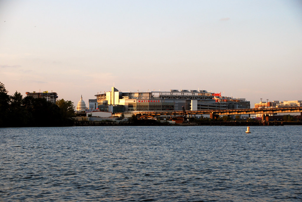
We come around a little curve and voila! Two landmarks:


Pass under South Capitol Bridge and emerge right near the stadium.


Looking upstream at our little docks, and the Anacostia River:


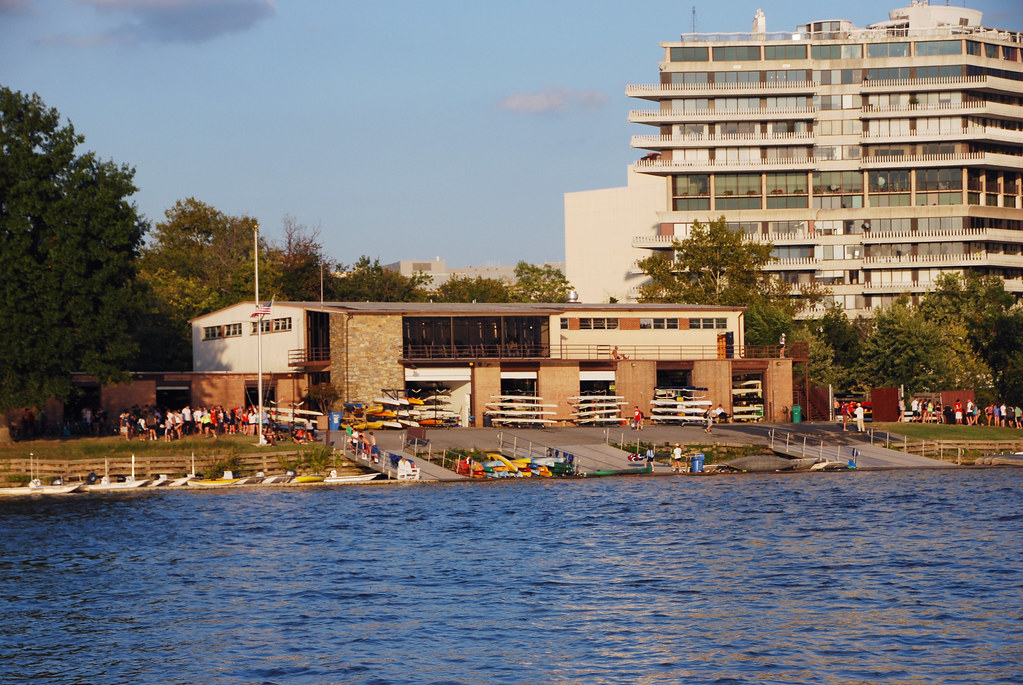
Zooming in on Washington Navy Yard, you can see a couple of ships. Note the historic schooner - more on that later.


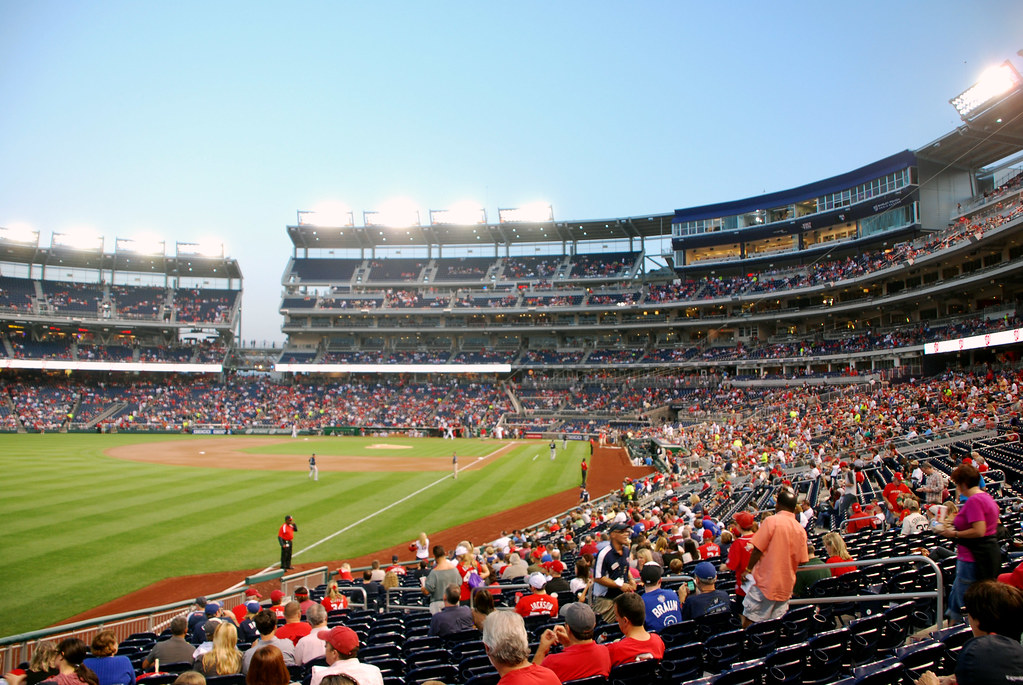
For now, let's dock and find our seats.


Part 3: Alexandria waterfront

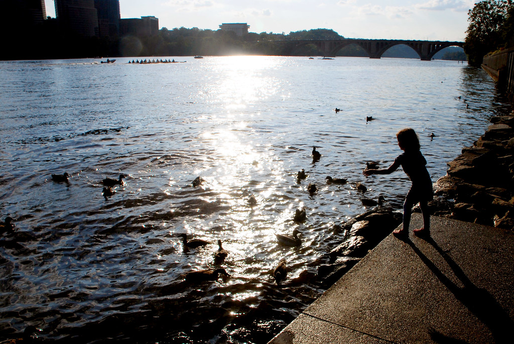
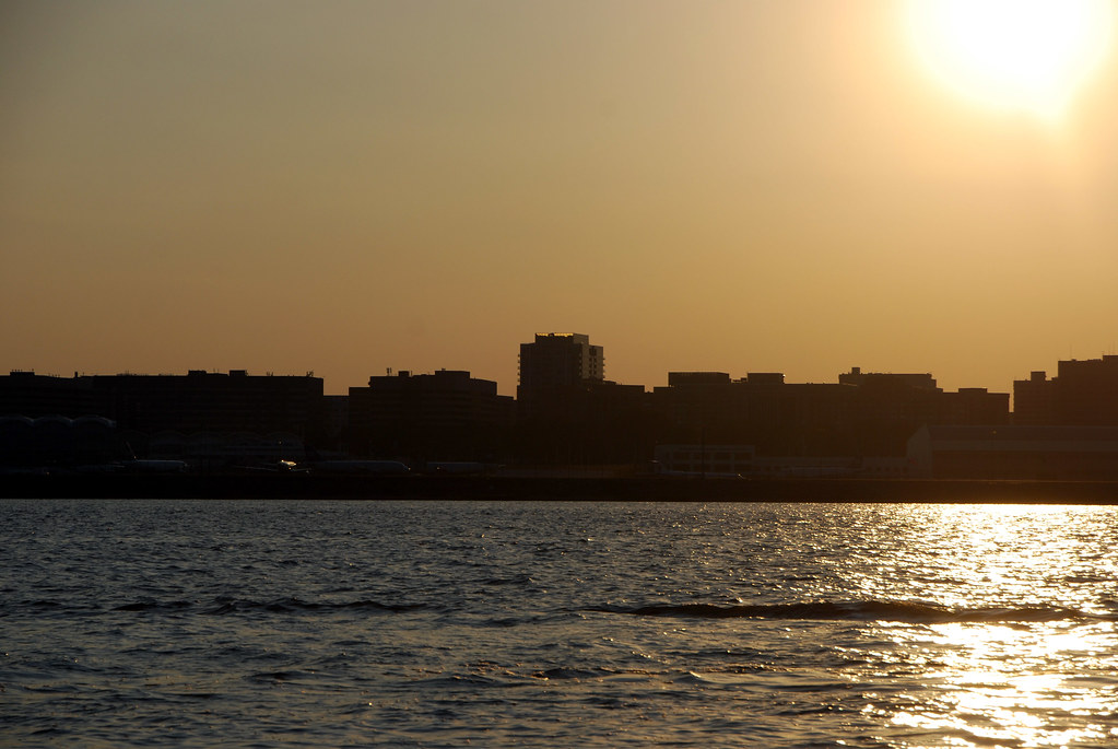
OK. All the pictures up til now were from Friday evening. From here on they're all from Sunday evening. These are "accidental" pictures, that I snapped with my cellphone while I happened to be at the waterfront.

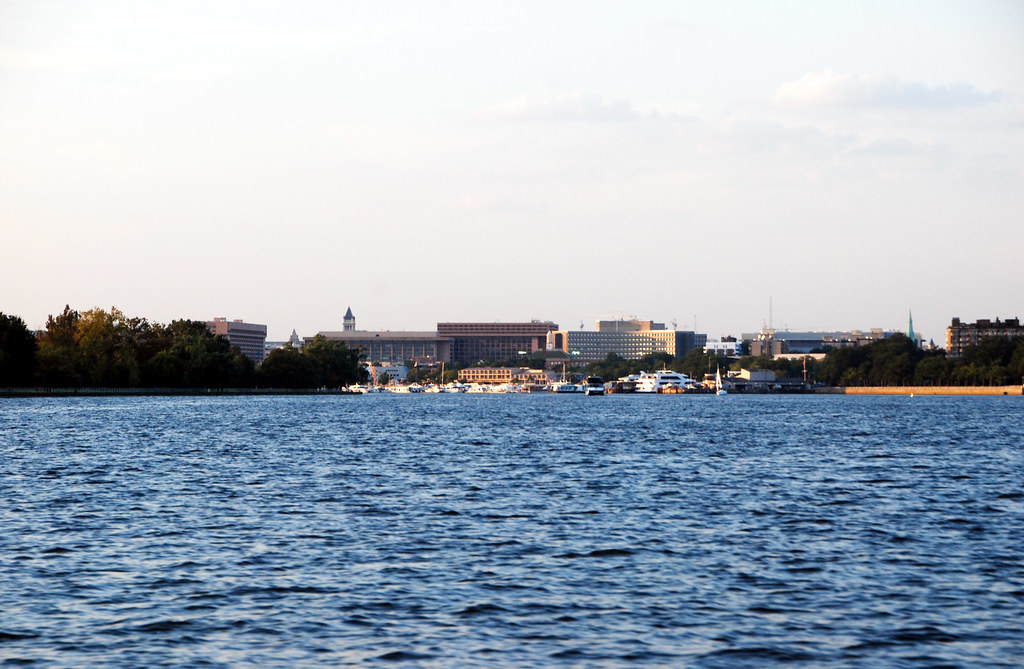
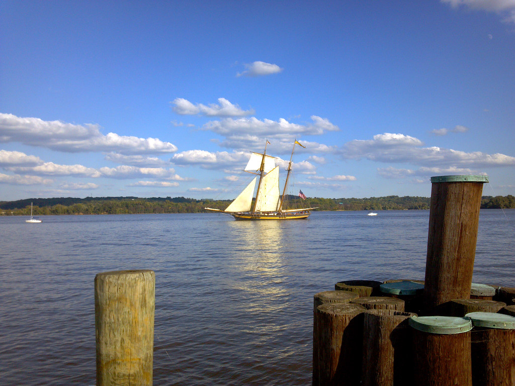
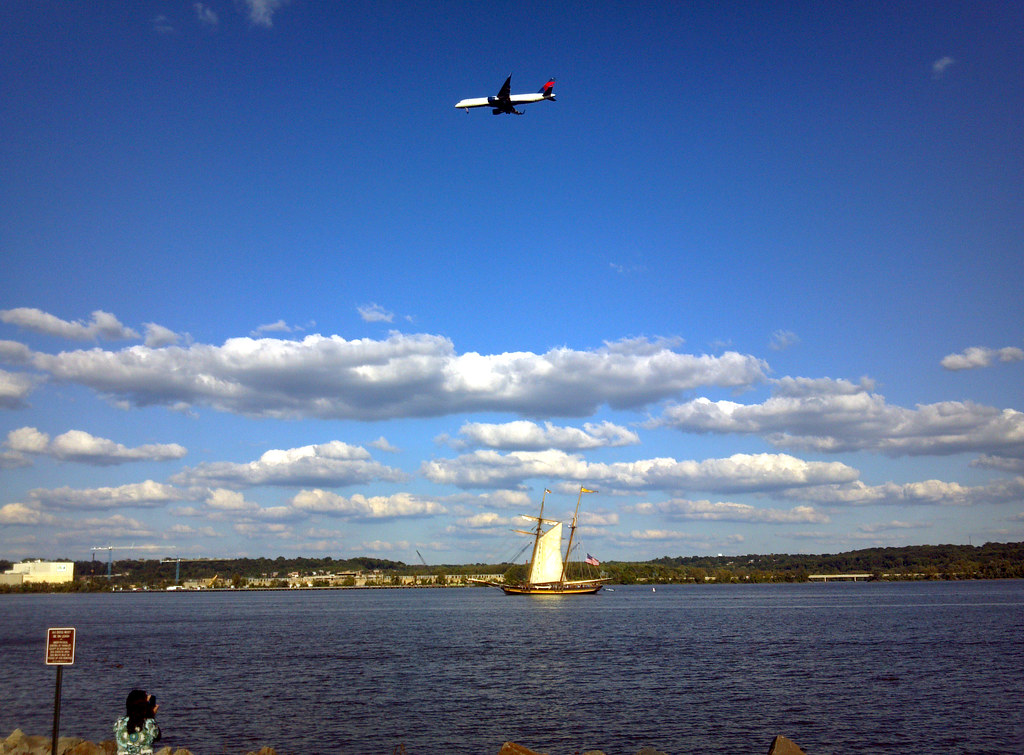
I was in Alexandria on Sunday just hanging out, when lo and behold that schooner from a few pictures ago sailed by. It's the Pride of Baltimore II, which sails around the Chesapeake basically for fun.

The bridge you see is the Wilson Bridge, which carries the Beltway (I-495).


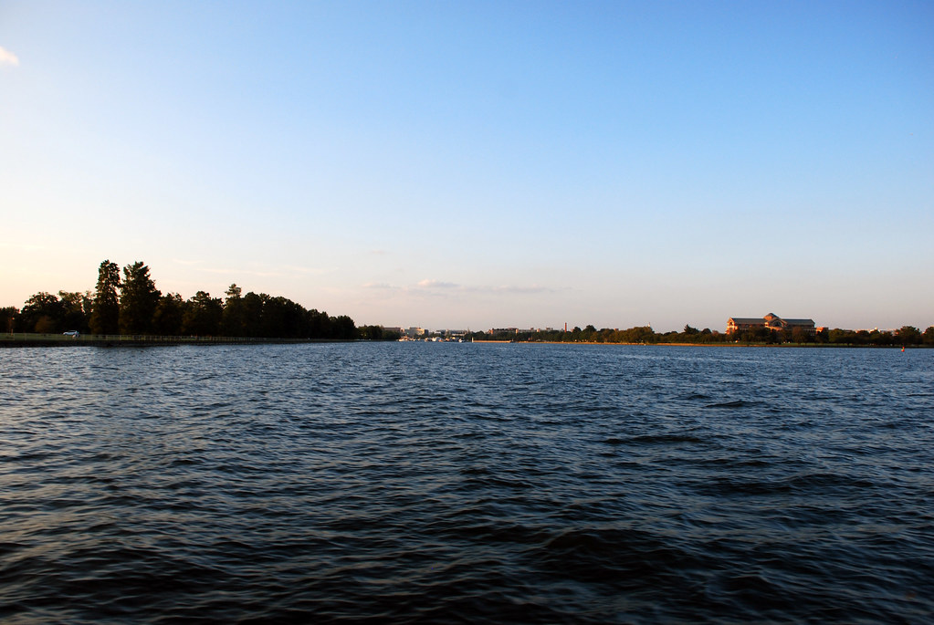
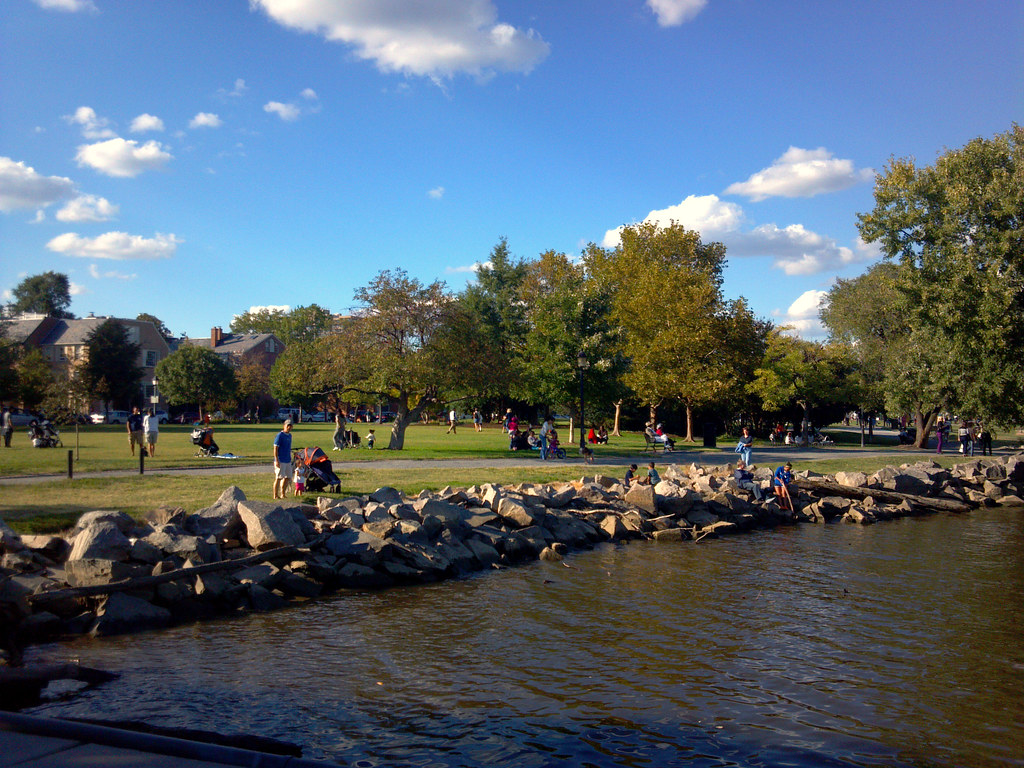
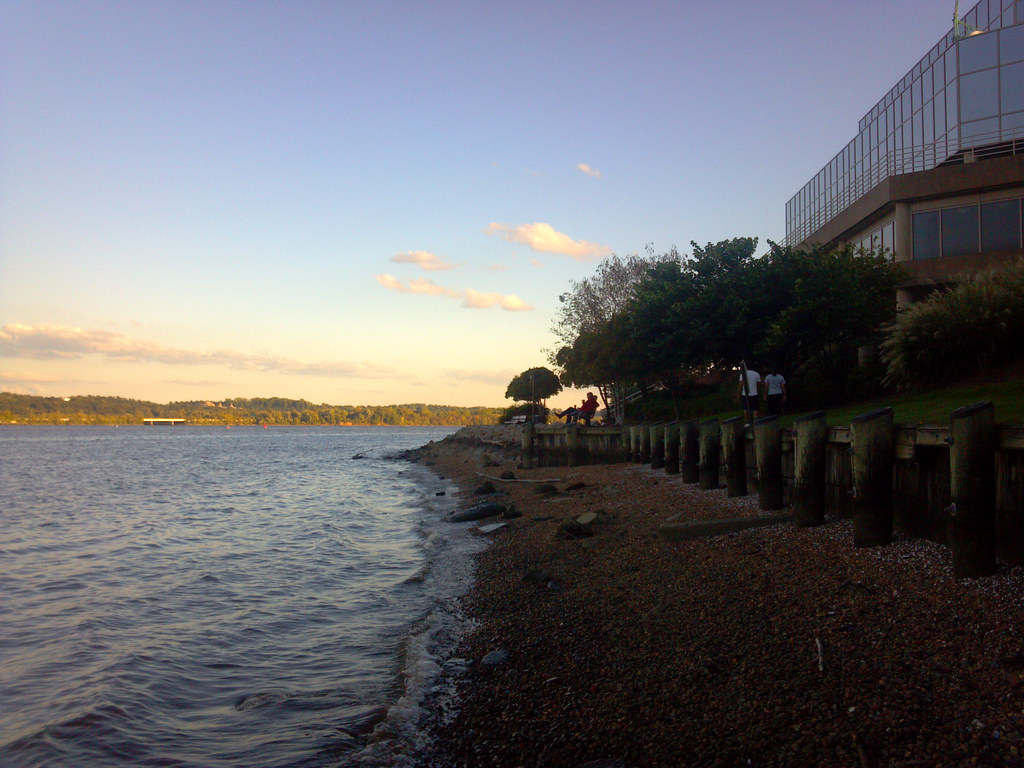
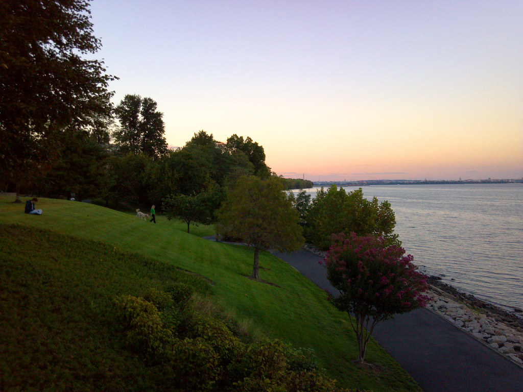
We took a walk a mile or so up the waterfront, which is mostly park.


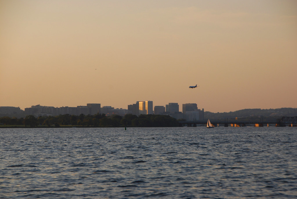
This is how low the planes are:


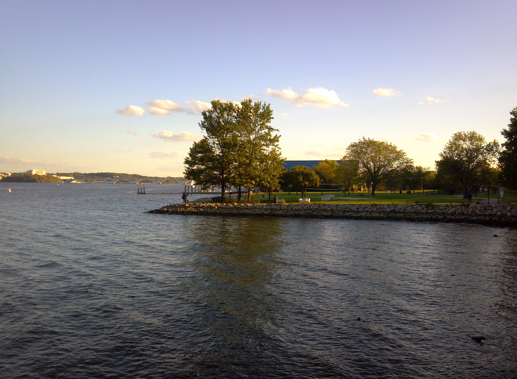
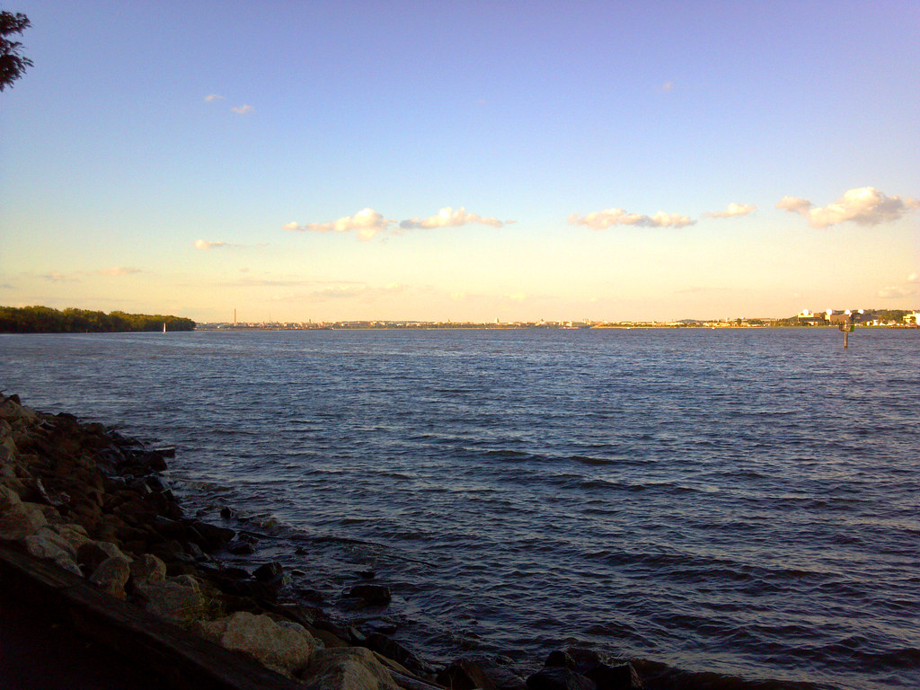
Looking north towards Washington:


That's all, folks!
__________________
writing | twitter | flickr | instagram | ssp photo threads
Reply With Quote
     
     
  #2  
Old Posted Sep 25, 2012, 4:31 AM
jg6544 jg6544 is offline
Registered User
 
Join Date: Feb 2011
Posts: 1,113
Really nice pictures! When I lived in DC (1967-88), the Potomac was so polluted nobody wanted to go near it. The only nice bank was south of the Memorial bridge. The Georgetown waterfront was nonexistent and of course, the whole Anacostia area was unsafe. Times have changed.
Reply With Quote
     
     
  #3  
Old Posted Sep 25, 2012, 5:35 AM
Jelly Roll Jelly Roll is offline
Registered User
 
Join Date: Sep 2011
Location: Philadelphia
Posts: 1,314
Very well done. Brings back a lot of memories of rowing for GW.
Reply With Quote
     
     
  #4  
Old Posted Sep 25, 2012, 2:36 PM
Cirrus's Avatar
Cirrus Cirrus is offline
cities|transit|croissants
 
Join Date: Jul 2001
Location: Washington, DC
Posts: 18,384
Rowing for GW, eh? Here's one I left out:

__________________
writing | twitter | flickr | instagram | ssp photo threads
Reply With Quote
     
     
  #5  
Old Posted Sep 25, 2012, 4:15 PM
202_Cyclist's Avatar
202_Cyclist 202_Cyclist is offline
Registered User
 
Join Date: Feb 2009
Posts: 5,941
Great photos but too bad you don't have any of the Swedish embassy. There is a lot of complaining on this site about how traditional and (to some) boring DC's architecture is. The Swedish embassy is a beautiful modern building.

Hopefully you avoided the 'dudes with boats' at Washington Harbor in Georgetown.

How was the water taxi? I want to bike down Wisconsin Avenue to the water front, take water taxi to the Nationals stadium and then take the Green Line two stops to get to work one morning. It would be twice as long as my regular commute as well as cost more, but it would be fun to try once.

Finally, it's nice to see the photos of the USS Barry and the Yards Park. For those of you in the DC area, the Navy Yard has a great museum that is open to the public and the Barry is open to the public as well (they have a haunted ghost ship for Halloween which I highly recommend). Additionally, the Yards park in the photos above is a great new amenity for DC. We went to most of the Friday concerts there this year-- certainly much better than the Sculpture Garden.
Reply With Quote
     
     
  #6  
Old Posted Sep 25, 2012, 4:16 PM
202_Cyclist's Avatar
202_Cyclist 202_Cyclist is offline
Registered User
 
Join Date: Feb 2009
Posts: 5,941
Quote:
Go Nats! Bring on the Orioles (or the Yankees)!
Reply With Quote
     
     
  #7  
Old Posted Sep 25, 2012, 5:10 PM
novaCJ novaCJ is offline
Stuck in the Suburbs
 
Join Date: Jan 2012
Location: Northern Virginia (DC Suburbs)
Posts: 360
I just realized how long it has been since I've been down to the Alexandria waterfront, considering I grew up not too far from there, and have fond childhood memories of that park. I have also never seen the new Wilson Bridge from ground level, although I've driven over it countless times. It looks better than I would have expected. The Georgetown waterfront also looks better than I remember (It's been a few years since I was over that way, tells you how often I get into the city...) are those water features and canopy things over the benches new?

@jg6544: My parents moved here before you left the area, and they still think DC is some sort of murder capital...
__________________
"The pessimist complains about the wind. The optimist expects it to change. The realist adjusts the sails."
-William A. Ward
Reply With Quote
     
     
  #8  
Old Posted Sep 25, 2012, 5:20 PM
giovanni sasso's Avatar
giovanni sasso giovanni sasso is offline
furified freestyle
 
Join Date: Mar 2002
Location: philadelphia, pa
Posts: 12,294
boooo nats, hooray pics. nice set - love the ones with the watergate and kennedy, and the wide shots that emphasize the length and short heights of the potomac bridges.
__________________
phillyskyline.commauleofamerica.com
a matter of life and death, just like a etch-a-sketch
Reply With Quote
     
     
  #9  
Old Posted Sep 26, 2012, 1:41 AM
ColDayMan's Avatar
ColDayMan ColDayMan is offline
B!tchslapping Since 1998
 
Join Date: Jul 2001
Location: Columbus
Posts: 19,918
Never knew about that Georgetown park.
__________________
Click the x: _ _ X _ _!
Reply With Quote
     
     
  #10  
Old Posted Sep 26, 2012, 4:07 AM
Yorkie Yorkie is offline
Registered User
 
Join Date: May 2012
Location: York PA
Posts: 275
..Most people do not know much about DC other than the tourist checklist. It is sooooo much more than a postcard. The metro reagion has over 5 million people makeing it the 7th largest.........CITY.....in the nation..
Reply With Quote
     
     
  #11  
Old Posted Sep 26, 2012, 4:34 AM
Cirrus's Avatar
Cirrus Cirrus is offline
cities|transit|croissants
 
Join Date: Jul 2001
Location: Washington, DC
Posts: 18,384
ColDay has been here lots of times and knows there's more to the city than the monuments.

He can be excused for not knowing the Georgetown park, because it's new. A few years ago that nice park looked like this:

__________________
writing | twitter | flickr | instagram | ssp photo threads
Reply With Quote
     
     
  #12  
Old Posted Sep 26, 2012, 8:20 AM
LMich's Avatar
LMich LMich is offline
Midwest Moderator - Editor
 
Join Date: Jan 2002
Location: Big Mitten
Posts: 31,745
Really enjoyed this, Cirrus. I always love se city from its river (if it has one). One of my most vivid memories of the city, in fact, is touring the monuments at night along the river in West Potomac Park.
__________________
Where the trees are the right height
Reply With Quote
     
     
  #13  
Old Posted Sep 26, 2012, 10:38 AM
Ex-Ithacan's Avatar
Ex-Ithacan Ex-Ithacan is offline
Old Fart Forumer
 
Join Date: Aug 2002
Location: Live in DC suburbs-Maryland
Posts: 22,154
I really enjoyed this tour. Always fun to see the city from a new angle, in this case the river. I haven't been down to the Georgetown waterfront since before the flood they had a while back. Are all the businesses back open and operating OK?
Thanks for sharing your fun trip.
__________________
Get off my lawn you whippersnappers!!!!!


Retired, now Grandpa Daycare
Reply With Quote
     
     
  #14  
Old Posted Sep 26, 2012, 3:02 PM
Cirrus's Avatar
Cirrus Cirrus is offline
cities|transit|croissants
 
Join Date: Jul 2001
Location: Washington, DC
Posts: 18,384
^
You can see in this picture that Farmers & Fishers is boarded up. I assume it's because of the flood, but don't actually know.
__________________
writing | twitter | flickr | instagram | ssp photo threads
Reply With Quote
     
     
  #15  
Old Posted Sep 26, 2012, 4:08 PM
Ex-Ithacan's Avatar
Ex-Ithacan Ex-Ithacan is offline
Old Fart Forumer
 
Join Date: Aug 2002
Location: Live in DC suburbs-Maryland
Posts: 22,154
^ Thanks Dan, I thought that's what it looked like, just wanted to make sure.
__________________
Get off my lawn you whippersnappers!!!!!


Retired, now Grandpa Daycare
Reply With Quote
     
     
  #16  
Old Posted Sep 26, 2012, 8:05 PM
Austinlee's Avatar
Austinlee Austinlee is offline
Chillin' in The Burgh
 
Join Date: Nov 2004
Location: Spring Hill, Pittsburgh
Posts: 13,095
Great tour. The Potomac is very wide.
__________________
Check out the latest developments in Pittsburgh:
Pittsburgh Rundown III
Reply With Quote
     
     
  #17  
Old Posted Sep 27, 2012, 3:19 AM
Buckeye Native 001 Buckeye Native 001 is online now
E pluribus unum
 
Join Date: Aug 2003
Location: Arizona
Posts: 31,280
Pretty sweet looking photos.

Really want to go back to DC sometime
Reply With Quote
     
     
  #18  
Old Posted Sep 29, 2012, 8:10 PM
mSeattle's Avatar
mSeattle mSeattle is offline
Socialism 4 Extreme Rich?
 
Join Date: Dec 2002
Location: here
Posts: 10,073
Wonderful river tour. I've never been to D.C. This is a perspective I want to enjoy if I ever get to visit.
Reply With Quote
     
     
  #19  
Old Posted Oct 1, 2012, 6:36 PM
brickell's Avatar
brickell brickell is offline
Registered User
 
Join Date: Nov 2003
Location: County of Dade
Posts: 9,379
Great tour. Good luck to your Nats.
__________________
That's what did it in the end. Not the money, not the music, not even the guns. That is my heroic flaw: my excess of civic pride.
Reply With Quote
     
     
  #20  
Old Posted Oct 2, 2012, 2:10 AM
novaCJ novaCJ is offline
Stuck in the Suburbs
 
Join Date: Jan 2012
Location: Northern Virginia (DC Suburbs)
Posts: 360
It's great that the businesses along the waterfront are back up and running, I was actually unaware of the flood. Living in Fairfax, you don't hear much about that area.

@Austinlee: The Potomac widens out at DC because it is located just after the Great Falls of the Potomac and becomes more brackish and tidal below that point, eventually becoming over a mile wide before emptying into the Chesapeake.

@mSeattle: If you ever visit DC, I will be more than happy to show you my perspective of the city (endless suburbs of sprawly-ness and traffic and stuff). No? Okay, I didn't really want to do it either.

All joking aside, too many people visit the area around the mall, treat it like an amusement park and leave, thinking they've seen DC. The political disjointed-ness of the region prohibits effectively promoting the area, keeping people from ever seeing things like Great Falls and almost bringing both tourists and residents alike to forget we have a river. Virginians forget Maryland exists, and vice versa, with DC alienating the 4+ million of us that don't happen to live in DC. It's definitely something we all need to work on.
__________________
"The pessimist complains about the wind. The optimist expects it to change. The realist adjusts the sails."
-William A. Ward
Reply With Quote
     
     
This discussion thread continues

Use the page links to the lower-right to go to the next page for additional posts
 
 
Reply

Go Back   SkyscraperPage Forum > Photography Forums > My City Photos
Forum Jump


Forum Jump


All times are GMT. The time now is 10:19 PM.

     
SkyscraperPage.com - Archive - Privacy Statement - Top

Powered by vBulletin® Version 3.8.7
Copyright ©2000 - 2024, vBulletin Solutions, Inc.