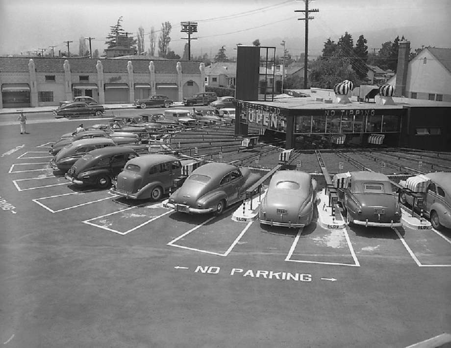

One of the most intriguing L.A. architectural novelties I've ever seen was this take on the drive-in. It's The Track, with "Motormat" technology. You just know the crazy trolley system must have constantly hit snags, with burgers and fries and cokes all over the hoods of cars... and yet there seem to have as many as three in the L.A. area, for however long they lasted.
Here's a description of the operation from
The American Drive-In, by Michael Karl Witzel:
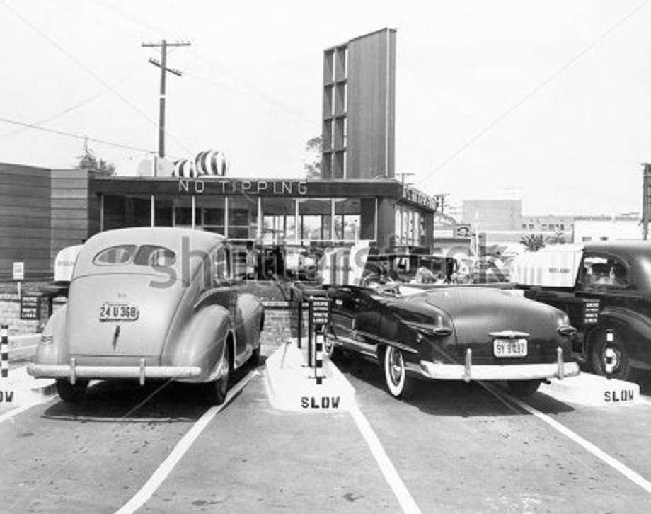
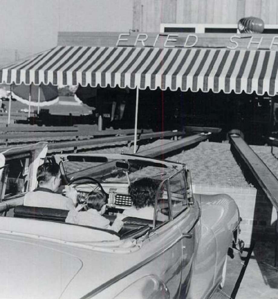
"Debuted in 1949, a Los Angeles innovation promised total elimination of carhops. At a new drive-in called "The Track," it attracted customers from as far as Santa Monica with its unique type of service. Like a group of horses at a trough [there's a gracious image], cars ringed around a central building, forming a circular pattern. Twenty semicircular parking spaces bridged a center kitchen by means of metal tracks. Food and condiments rode the rails within carrying...compartment[s] each powered by a small ½-horsepower motor.
"The mechanical setup was reminiscent of the wackiest Rube Goldberg device. Positioned in a pre-determined [?] parking space, the diner rolled down the car window and was greeted by a stainless-steel bin that could be made flush with the door. Inside the box were plastic cups, a water bottle, menu, order pad, and change tray. It was large, too. Food for six people could be ferried back and forth on the elevated platforms. Patrons would jot down their orders and with the push of a button, the unit scotted a return to the kitchen.
"When the empty bin arrived at the kitchen, an attendant put through the order and added up the bill. As hamburgers and other entrées were prepared, the rail box made its second journey to the automobile to collect the money. By the time it returned to the preparation area, the food was ready to go--loaded into the compartment along with condiments and the customer's change. According to inventor Kenneth C. Purdy, the spoke-and-wheel-track arrangement sped service 20-25 percent."
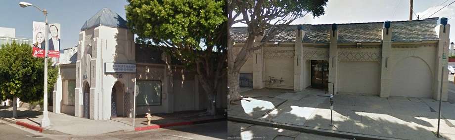
Well, needless to say I wanted to know where this madcap drive-in was. There was a 1951 phone-book listing for a "The Track No 3" at 3816 Sepulveda in Culver City, now the site of a Carl Jr's, but current visual details didn't add up, width of streets, etc. So I squinted at the pics, especially the fourth one above, and decided that the sign on the Herman-Something real estate office at the top right must have said "Herman Shrager"--who, it turns out, dealt in
cemetery real estate, as in plots. Anyway, after more digging I found that Herman had an office at 8152 Beverly Boulevard... and eureka! It all fell into place. At the northwest corner of Beverly and Kilkea was the distinctive Welch's Candy building that still stands...and so across Kilkea from it would have been The Track. It was at 8201 Beverly Boulevard, which by 1956 was Cook's Automotive Service. Looking north today at Beverly and Kilkea:
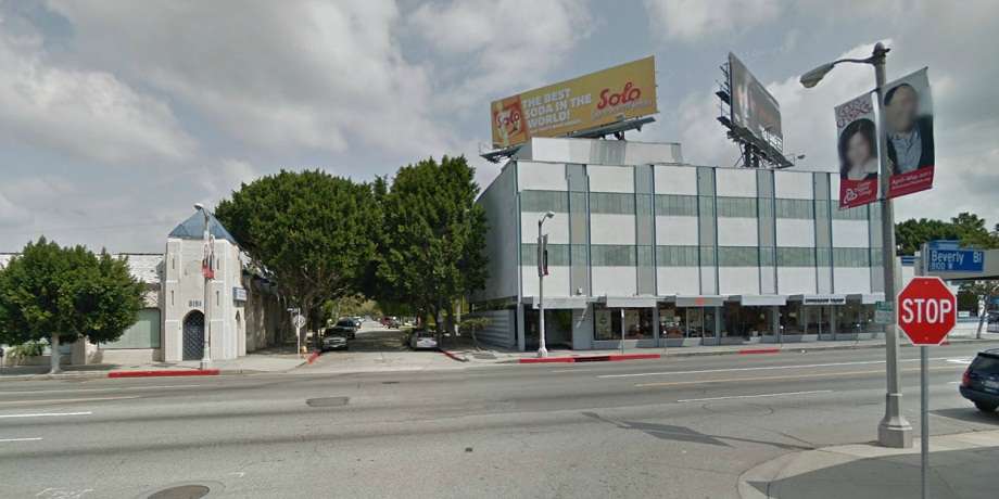

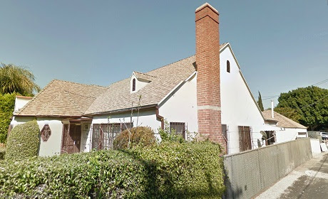
The house in the top shot is also still there, along with Welch's:
First, third, and fourth pics:
The Denver Post; second:
Shutterstock; sixth pic:
LAPL; all others, Google Street View 2011


 Prev
Prev


 )
)


 Linear Mode
