Quote:
Originally Posted by jlousa

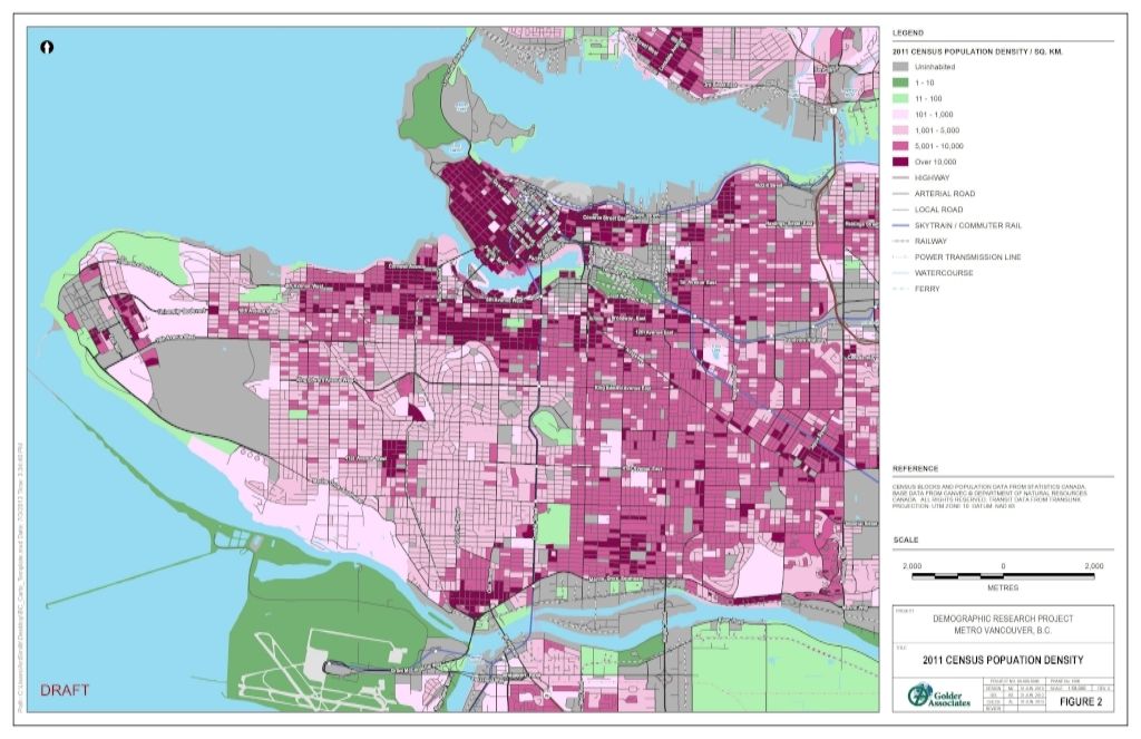
My comment wasn't even directed at you... are you seriously asking for proof of the density numbers for the Joyce area? The least dense areas of Joyce are already posted in this very thread and even those are very dense, then there is the fact the single densest census tract for the whole region is also within Joyce-Collingwood.
Here is a density map to drive home the point. Note that the areas that aren't dark purple are the very areas that are being upzoned to become dark purple. http://healthycitymaps.blogspot.ca/ |
That map is pretty selective by using 10k/sqkm as the upper limit, considering that some of the purple area is upwards of 30k/sqkm. In any case, if we assume that 10k/sqkm is some sort of optimal density target (rather than the 30k or so that the current set of towers East of the station brings), my point is that much more should be in scope of the plan.
I diagrammed on top of that map, indicating in red where the incremental density to 10k would occur. I've added yellow where I think that additional density should have been considered. Again, if we want to pursue "livable density" that excludes towers, we have to get a bit more comfortable with increasing the scope of these plans to include a larger area.
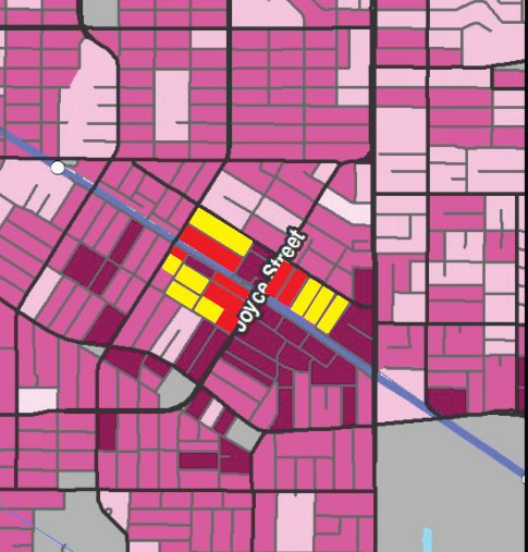
Source: Me +
http://healthycitymaps.blogspot.ca/
My concern is this: You don't build housing for 1m additional people by 2040 by transforming 330 small areas like this across the Metro Vancouver (1m/3,000 incremental housing capacity) - 80 of which could be in the City of Vancouver (330 x 24% of existing population). 2040 is 25 years away - the same amount of time that this neighbourhood has increased its population by 10,000.


 Prev
Prev


 High density nodes at the Burnaby side of Boundary definitely promotes more green areas to be preserved. Joyce-Collingwood should go as high as possible since there aren't a lot of lands around there to be re-developed, unlike Metrotown. The existing parking lots and strip malls around Metro will definitely see further density increases in the near future.


 Linear Mode
