HomeDiagramsDatabaseMapsForum About
     

Go Back   SkyscraperPage Forum > Regional Sections > Canada > Ontario > Toronto


Reply

 
Thread Tools Display Modes
     
     
  #281  
Old Posted Jun 28, 2013, 3:02 AM
Innsertnamehere's Avatar
Innsertnamehere Innsertnamehere is online now
Registered User
 
Join Date: Jan 2010
Location: Hamilton
Posts: 11,573
While they are on a technicality a single line, in reality they aren't. The trains do run through, but very, very, very few people actually ride around the "hump" where union station is. Really the Yellow line is two lines, the Spadina line and the Yonge line. they do through run subway trains, but about .01% of travellers on the line actually use this feature of through running. As for the separation of the Spadina and University lines in internal TTC documents, there is a rather silly archaic reason for it.

The first portion of the University-Spadina line opened in 1963 in advance of the Bloor line in order to keep the load off of Bloor-Yonge. (they knew it would be overloaded with transfers otherwise) When they opened the Spadina extension in 1978, it was a largely political extension (much like the Sheppard line) and they expected extremely low ridership. So much so, that they planned to close the line on Sundays and holidays. Even when it was operating, 1/2 of the trains were planned to turn back at St. George. Because of this key feature, it was referred to as a separate line from the University line. Now of course when the extension opened it exceeded it's ridership projections considerably, and sunday service was added, and the turn back point for 1/2 the trains was switched to St. Clair to deal with the demand. Because of this 35 year old plan to not service the Spadina line on Sundays, the lines are referenced separately.

Last edited by Innsertnamehere; Jun 28, 2013 at 4:23 AM.
Reply With Quote
     
     
  #282  
Old Posted Jun 28, 2013, 3:52 AM
LeeWilson's Avatar
LeeWilson LeeWilson is offline
proboscum
 
Join Date: Nov 2003
Location: Tokyo
Posts: 1,492
Using ridership patterns to determine whether something is a line or not is kind of a weird way to do it. Generally a line is identifiable by some kind of predetermined separation, such as a lack of physical continuity or different management. Anyway, in the end, I suppose calling it one or two or three lines doesn't really change what it is.

As a side note, I used to go around the hump to change to the westbound streetcar at St. Andrew instead of doing it at King for some weird reason that I forget. Maybe it was more crowded at King in the morning when I was going to work.
__________________
Lee

Last edited by LeeWilson; Jun 30, 2013 at 12:59 PM.
Reply With Quote
     
     
  #283  
Old Posted Jun 28, 2013, 12:27 PM
DrNest's Avatar
DrNest DrNest is offline
Registered User
 
Join Date: Jan 2012
Location: Toronto
Posts: 2,119
I would (and still do) often ride 'round the hump' to get to St Andrew's because it's closer to the Rogers Centre when I'm going to a game there. I know a lot of other people do that too.
So I can't see any reason for saying it's two separate lines because a lot of people get off at Union. The same train runs through the station.

A similar analogy would be the GO's Lakeshore East and West lines. They have trains that run through from Oshawa to Hamilton, but also a number of trains terminate and originate at Union, giving them distinct separation.

To break a line up at a station where most people get on and off would make all the lines that run through Times Square in NYC or Kings Cross in London separate lines too. Which obviously isn't the case.
Reply With Quote
     
     
  #284  
Old Posted Jul 6, 2013, 10:13 PM
333609543's Avatar
333609543 333609543 is offline
Registered User
 
Join Date: Jun 2013
Location: Toronto
Posts: 284
Eglinton Station


Just a random thread about Eglinton station. Eglinton Station is one of the 12 original TTC subway stations. Eglinton was the northern terminal of the Yonge subway line until 1973 when York Mills Station was built; and as one of the larger busier stations of the current system, it has some features other stations don't. Some of these features, is an abandoned bus terminal, and entrance. The bus terminal was replaced by the newer one most of us know. To get to the newer terminal you must go through a strange hallway, which used to be the concourse for the older bus terminal. that corridor was made when the older bus bays/bus terminal closed it's doors on April 4 2004. ANd has been closed off from the public since. (will finish July 7th 2013)
Reply With Quote
     
     
  #285  
Old Posted Jul 10, 2013, 7:45 PM
Ottawa superman Ottawa superman is offline
Registered User
 
Join Date: May 2013
Posts: 80
Quote:
Originally Posted by 333609543 View Post
Just a random thread about Eglinton station. Eglinton Station is one of the 12 original TTC subway stations. Eglinton was the northern terminal of the Yonge subway line until 1973 when York Mills Station was built; and as one of the larger busier stations of the current system, it has some features other stations don't. Some of these features, is an abandoned bus terminal, and entrance. The bus terminal was replaced by the newer one most of us know. To get to the newer terminal you must go through a strange hallway, which used to be the concourse for the older bus terminal. that corridor was made when the older bus bays/bus terminal closed it's doors on April 4 2004. ANd has been closed off from the public since. (will finish July 7th 2013)
The older bus bay will be demolished for construction of the Eglinton LRT. Wonder what building will go in it's place after the lRT finishes construction?
Reply With Quote
     
     
  #286  
Old Posted Jul 11, 2013, 1:15 PM
dennis1 dennis1 is offline
Registered User
 
Join Date: Sep 2007
Posts: 1,253
Reply With Quote
     
     
  #287  
Old Posted Jul 12, 2013, 4:09 AM
Dwils01's Avatar
Dwils01 Dwils01 is offline
Urban Fanactic
 
Join Date: Mar 2010
Location: Coquitlam
Posts: 3,246
Since these are all GTA transit projects, I think I'll put these here too.
Union to Pearson rail link.


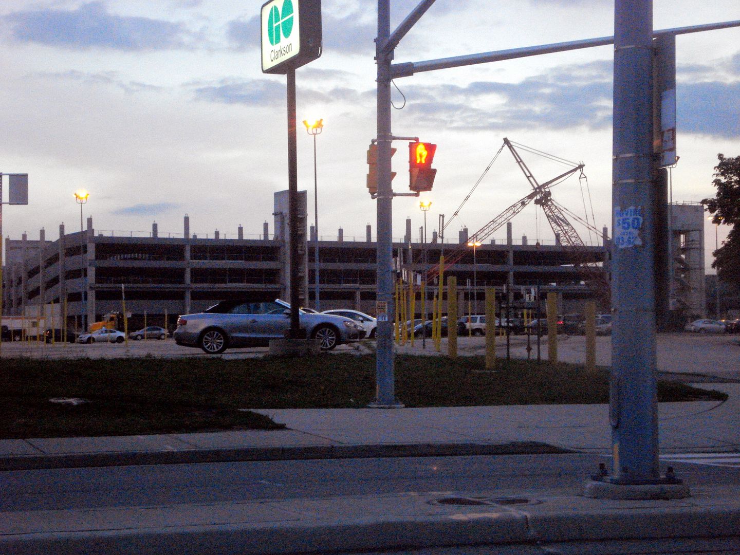
Parking garage under construction at GO Clarkson in Mississauga.


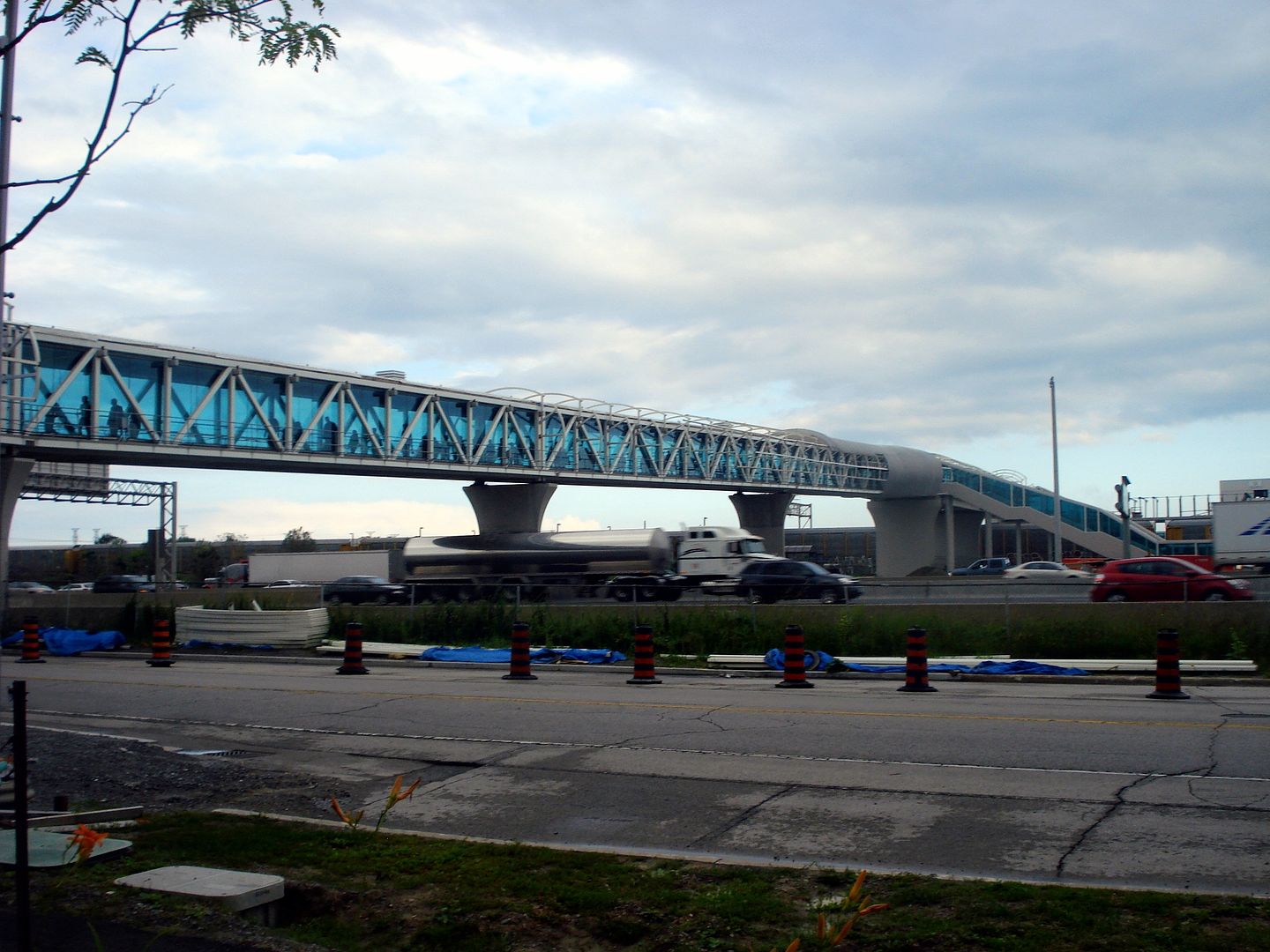
Pedestrian Bridge going over Highway 401 connecting Pickering Town Centre with Go Pickering.


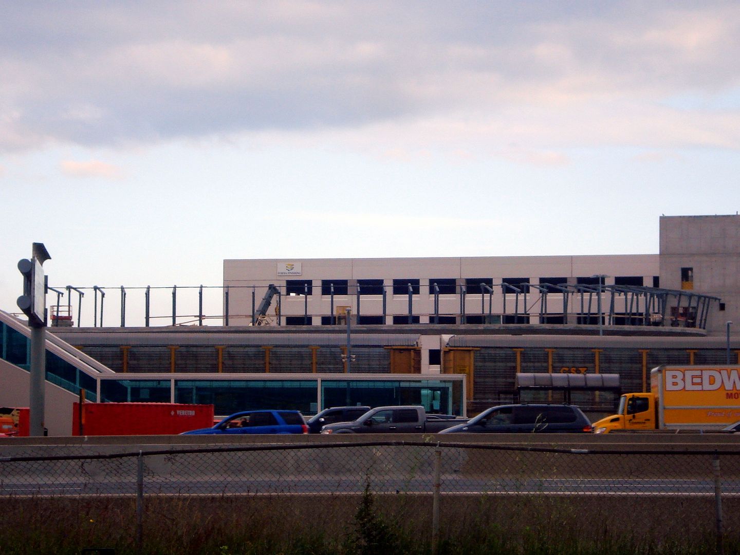
Hwy 7 busway in Markham.


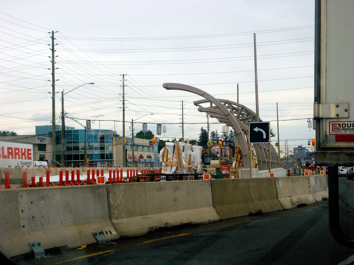
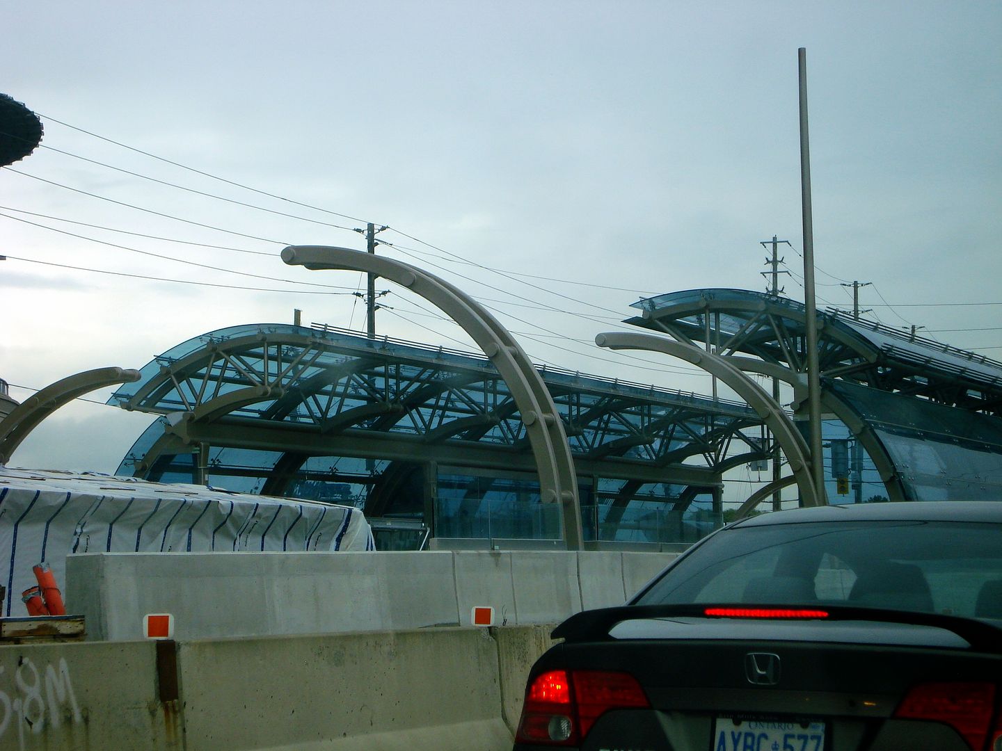
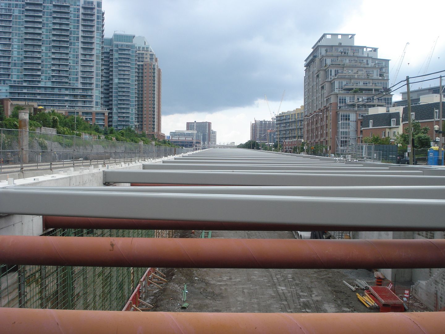
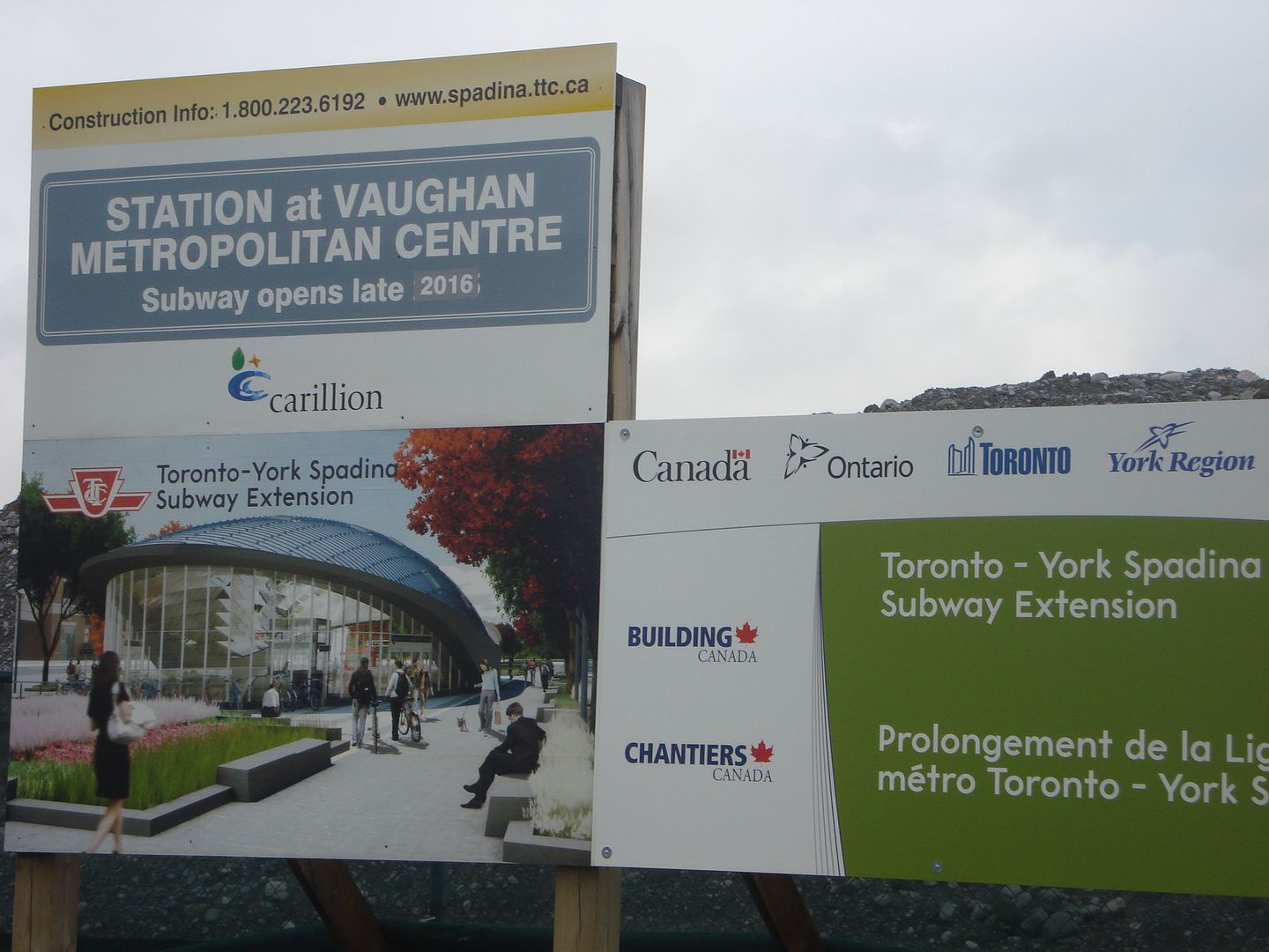
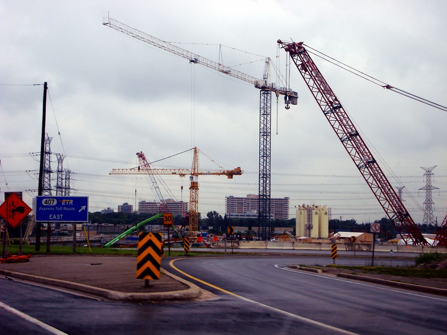
Spadina Subway extension in Vaughan.


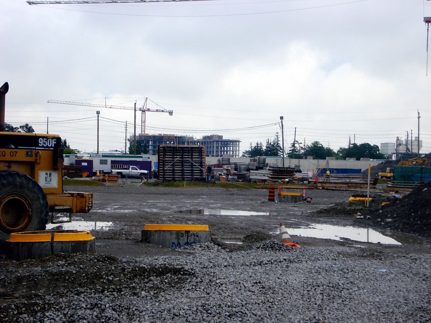
There are more cranes like this for the project on Steeles Avenue, Keele Street, and around York Univeristy.


Pictures by me.
Reply With Quote
     
     
  #288  
Old Posted Jul 15, 2013, 6:31 PM
Ramako's Avatar
Ramako Ramako is offline
Moderator
 
Join Date: Nov 2008
Location: Toronto
Posts: 4,409
I made this map to reflect what the TTC Subway/LRT map could look like around 2020 or so. It includes the extension of the YUS line to Vaughan and the Eglinton Crosstown LRT, in blue, which are both under construction. The grey line is the Finch West LRT and the orange line is the Sheppard East LRT, which are both approved and funded. I haven't included stations for them because they haven't been determined yet. I've also replaced the Scarborough RT with an extension of the Bloor-Danforth line, as that proposal seems to be quickly gaining traction at the municipal and provincial levels. Things seem to change quickly and often when it comes to plans for Toronto transit, so what we get will probably end up looking different than this map, but it's still informative.


Last edited by Ramako; Sep 24, 2013 at 6:51 PM.
Reply With Quote
     
     
  #289  
Old Posted Jul 18, 2013, 1:58 PM
Barnard's Star Barnard's Star is offline
Registered User
 
Join Date: Jun 2013
Posts: 139
Thanks for the map Ramako. A question: given council's vote to move to subways ahead of LRTs in Scarborough don't you think there'll be pressure to switch a potential Sheppard East LRT to subways as well? We'd have three-quarters of a loop around the entire city. Perhaps the current ridership on Sheppard wouldn't justify that.

Anyway, for people interested in the recent council debate, here's a good pic from the Torontoist a few months back (Steve Munro, April 29, http://torontoist.com/2013/04/a-new-...r-scarborough/). The LRT that just got voted down seems to cover more distance and serve more people than the subway replacing it...

Reply With Quote
     
     
  #290  
Old Posted Jul 18, 2013, 8:20 PM
Ramako's Avatar
Ramako Ramako is offline
Moderator
 
Join Date: Nov 2008
Location: Toronto
Posts: 4,409
Quote:
Originally Posted by Barnard's Star View Post
Thanks for the map Ramako. A question: given council's vote to move to subways ahead of LRTs in Scarborough don't you think there'll be pressure to switch a potential Sheppard East LRT to subways as well? We'd have three-quarters of a loop around the entire city. Perhaps the current ridership on Sheppard wouldn't justify that.
I think an extension to the Bloor-Danforth line will severely decrease the likelihood of Sheppard East LRT becoming a subway because they share a lot of same potential ridership. Sheppard East would be totally empty. I would favour converting the existing Sheppard line into an LRT then extending it into Scarborough in order to complete the loop but also eliminate the transfer between the Sheppard Subway and the Sheppard LRT. It would still run underground along the existing subway route so it wouldn't make any difference with respect to speed, and would ultimately be faster and more convenient because there would be no transfer. It would be just like Eglinton; partially underground and partially on the road.
Reply With Quote
     
     
  #291  
Old Posted Jul 18, 2013, 9:24 PM
Doady's Avatar
Doady Doady is offline
Registered User
 
Join Date: Apr 2004
Posts: 4,717
Quote:
Originally Posted by Barnard's Star View Post
Anyway, for people interested in the recent council debate, here's a good pic from the Torontoist a few months back (Steve Munro, April 29, http://torontoist.com/2013/04/a-new-...r-scarborough/). The LRT that just got voted down seems to cover more distance and serve more people than the subway replacing it...
They should build it as BRT instead, it would cover even more distance and serve even more people.
Reply With Quote
     
     
  #292  
Old Posted Jul 18, 2013, 10:57 PM
Barnard's Star Barnard's Star is offline
Registered User
 
Join Date: Jun 2013
Posts: 139
Quote:
They should build it as BRT instead, it would cover even more distance and serve even more people
Good call! Think of the cost savings.
Reply With Quote
     
     
  #293  
Old Posted Jul 22, 2013, 10:15 PM
Dwils01's Avatar
Dwils01 Dwils01 is offline
Urban Fanactic
 
Join Date: Mar 2010
Location: Coquitlam
Posts: 3,246
Union Station Roof


Pictures by me.
Reply With Quote
     
     
  #294  
Old Posted Aug 8, 2013, 2:31 AM
MetroRailRoad MetroRailRoad is offline
Registered User
 
Join Date: Dec 2012
Posts: 50
I have finally uploaded my photos of the Toronto subway I took while in Toronto in May. Photo's are from MetroRailRoad

__________________
My rapid transit site

Last edited by Ramako; Sep 24, 2013 at 6:51 PM. Reason: images too big
Reply With Quote
     
     
  #295  
Old Posted Sep 5, 2013, 1:38 PM
Barnard's Star Barnard's Star is offline
Registered User
 
Join Date: Jun 2013
Posts: 139
A two-stop subway for Scarborough? Seriously?

What's the province's angle here? I assume they either want to present a subway plan so embarrassingly inadequate the city reverses direction back to an LRT or present a subway plan so embarrassingly inadequate the Feds have no choice but to put up their own money. It's exceedingly cynical in either case.
Reply With Quote
     
     
  #296  
Old Posted Sep 8, 2013, 2:11 AM
GoTrans GoTrans is offline
Registered User
 
Join Date: Jan 2010
Posts: 687
I think Toronto needs to wait until the Eglington LRT is built so that the naysayers can see that LRT works and it is not a streetcar before building subways in Scarborough. The Downtown Relief Line needs to be built long before a subway in Scarborough. Part of the problem is that Toronto has the lowest property tax rates in the GTA and wants the everybody else in the province to pay for gold plated transit dreams. If the province is going to pay for transit construction everywhere that would be different.Why should the rest of us pay for transit that is not required in Scarborough? Toronto needs to stop extending subway lines to the outerlimits and build additional lines in the core of the city so there is an actual network.
Reply With Quote
     
     
  #297  
Old Posted Sep 23, 2013, 6:09 AM
Ottawa superman Ottawa superman is offline
Registered User
 
Join Date: May 2013
Posts: 80
Quote:
Originally Posted by Innsertnamehere View Post
While they are on a technicality a single line, in reality they aren't. The trains do run through, but very, very, very few people actually ride around the "hump" where union station is. Really the Yellow line is two lines, the Spadina line and the Yonge line. they do through run subway trains, but about .01% of travellers on the line actually use this feature of through running. As for the separation of the Spadina and University lines in internal TTC documents, there is a rather silly archaic reason for it.

The first portion of the University-Spadina line opened in 1963 in advance of the Bloor line in order to keep the load off of Bloor-Yonge. (they knew it would be overloaded with transfers otherwise) When they opened the Spadina extension in 1978, it was a largely political extension (much like the Sheppard line) and they expected extremely low ridership. So much so, that they planned to close the line on Sundays and holidays. Even when it was operating, 1/2 of the trains were planned to turn back at St. George. Because of this key feature, it was referred to as a separate line from the University line. Now of course when the extension opened it exceeded it's ridership projections considerably, and sunday service was added, and the turn back point for 1/2 the trains was switched to St. Clair to deal with the demand. Because of this 35 year old plan to not service the Spadina line on Sundays, the lines are referenced separately.
You are right. Also, important to remember is that with the opening of subway from Woodbine to Keele, in 1965, service was interlined with Yonge-University; creating Yonge-University-Bloor and Yonge-University-Danforth and Bloor-Danforth.

Quote:
Originally Posted by LeeWilson View Post
Using ridership patterns to determine whether something is a line or not is kind of a weird way to do it. Generally a line is identifiable by some kind of predetermined separation, such as a lack of physical continuity or different management. Anyway, in the end, I suppose calling it one or two or three lines doesn't really change what it is.

As a side note, I used to go around the hump to change to the westbound streetcar at St. Andrew instead of doing it at King for some weird reason that I forget. Maybe it was more crowded at King in the morning when I was going to work.
It may be weird, but many refer to Yonge and University separately, saying "take Yonge line to St Clair", especially tourist. Some refer to Bloor and Danforth separately too.
Reply With Quote
     
     
  #298  
Old Posted Sep 23, 2013, 6:19 AM
Ottawa superman Ottawa superman is offline
Registered User
 
Join Date: May 2013
Posts: 80
Federal Funding for Danforth extension

Federal funding for Scarborough Subway

http://www.theglobeandmail.com/news/...ticle14453152/

"The announcement included no information on the amount of funding or any conditions that may be attached." [...]"But the announcement raises a number of questions, including whether Ottawa’s contribution will amount to the $660-million council said it needed, when it backed the plan this summer, and whether this is new money or funds taken from another transit project."

Now, the mayor has to find his part of the funding. Anymore gravy left?

Ironically since the map showed an Sheppard LRT, it seems the mayor has endorsed an LRT on Sheppard!

http://o.canada.com/2013/09/22/scarb...subway-subway/
Reply With Quote
     
     
  #299  
Old Posted Sep 24, 2013, 6:32 PM
Dr Nevergold Dr Nevergold is offline
Registered User
 
Join Date: Jun 2000
Location: Winnipeg
Posts: 20,104
This may very well be the only good thing to come of the Ford era, I am happy its getting completed. It also proves that when the proper desire is there, funding for very important projects will be there. Subways are most certainly not too expensive build.
Reply With Quote
     
     
  #300  
Old Posted Sep 24, 2013, 6:52 PM
Ramako's Avatar
Ramako Ramako is offline
Moderator
 
Join Date: Nov 2008
Location: Toronto
Posts: 4,409
Looks like my fantasy map is coming to fruition:


Quote:
Originally Posted by Ramako View Post
I made this map to reflect what the TTC Subway/LRT map could look like around 2020 or so. It includes the extension of the YUS line to Vaughan and the Eglinton Crosstown LRT, in blue, which are both under construction. The grey line is the Finch West LRT and the orange line is the Sheppard East LRT, which are both approved and funded. I haven't included stations for them because they haven't been determined yet. I've also replaced the Scarborough RT with an extension of the Bloor-Danforth line, as that proposal seems to be quickly gaining traction at the municipal and provincial levels. Things seem to change quickly and often when it comes to plans for Toronto transit, so what we get will probably end up looking different than this map, but it's still informative.


Reply With Quote
     
     
This discussion thread continues

Use the page links to the lower-right to go to the next page for additional posts
 
 
Reply

Go Back   SkyscraperPage Forum > Regional Sections > Canada > Ontario > Toronto
Forum Jump


Thread Tools
Display Modes

Forum Jump


All times are GMT. The time now is 9:06 PM.

     
SkyscraperPage.com - Archive - Privacy Statement - Top

Powered by vBulletin® Version 3.8.7
Copyright ©2000 - 2024, vBulletin Solutions, Inc.