Here’s a fantasy idea:
Since Kanata-North wants to be a leader in Autonomous Vehicles, how about having one (or more) companies create autonomous buses that circulate around Kanata-North.
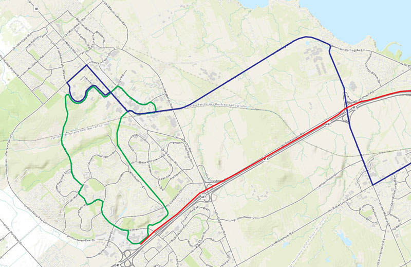
The Green Line is the autonomous ‘circulator’. A single loop should be sufficient. The blue is the modified Baseline BRT. (I don’t understand the desire to take that BRT to Bayshore.)
In this case, I have added a transit pathway for the ‘circulator’ through the golf course. Since the golf course is being reconfigured and housing added, let’s make it more transit-oriented and add less roads. (Maybe only narrow, one-way, roads?) Pathways could be added to existing neighbourhoods on each side.
This same concept of autonomous circulators could be applied to Kanata-South:
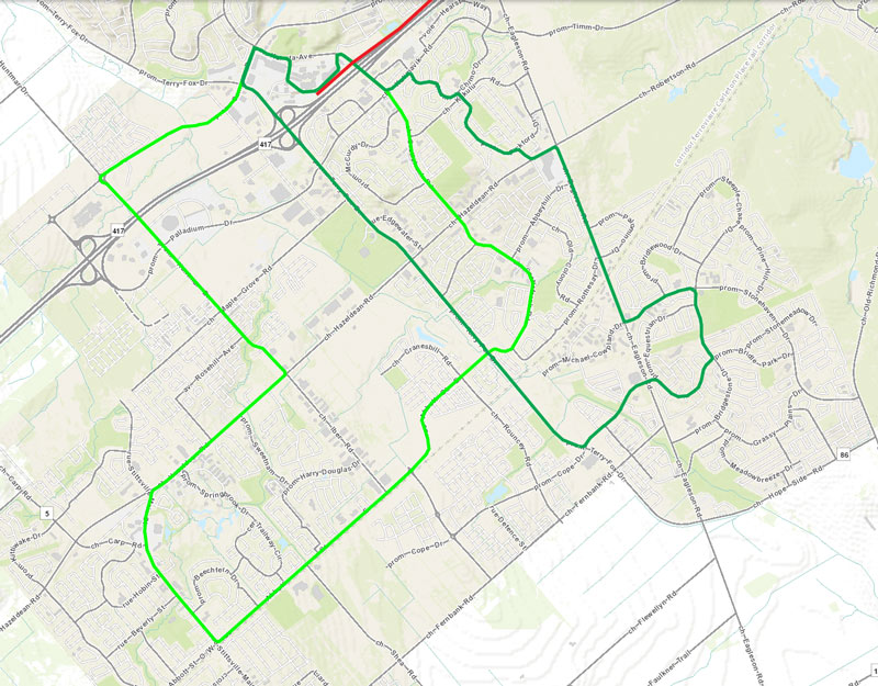
Here, I have added two circulator loops to shuttle people to/from the LRT-Line 3 Terry Fox Station. With the circulators, there would be no need to extend the LRT past Terry Fox Station.
In Barrhaven, there would be three circulator loops, connecting to LRT-Line 1 at both Barrhaven Town Centre and Fallowfield stations. All three of the circulators also pass the recreational centre in Barrhaven west:
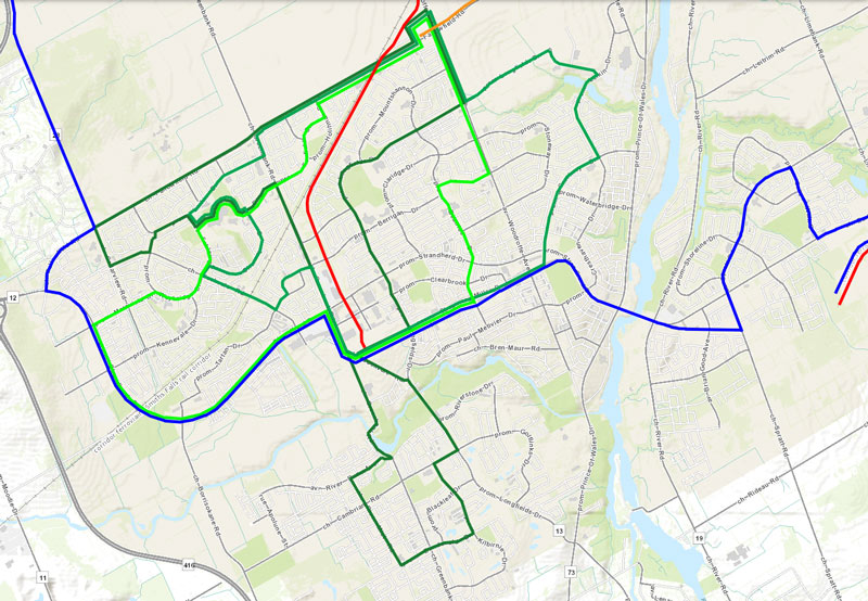
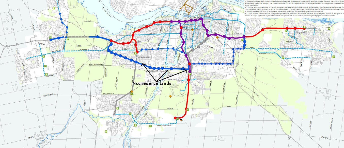
Around Barrhaven, I have added a BRT that connects Bowesville Station, in Riverside South, with the north-west of the city. Perhaps, this BRT makes use of the Baseline BRT, west of the Queensway-Carleton Hospital, or it might go past Bayshore on its way to Carling and then join the Baseline BRT on Carling, heading on to Kanata-North.
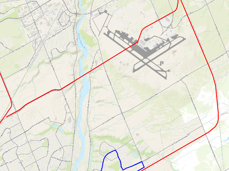
Those with sharp eyes will also notice a short red line meeting the Fallowfield Station. This is an extension of LRT-Line 4, which would run under the airport and over the river. This is, likely, the biggest fantasy part of this idea:
Continuing LRT-Line 2 & 4 north, these two lines are inter-lined as the Bank Street Subway:

In this case, I have truncated the existing Trillium LRT-Line 2 at Billings Bridge. This means that there will be stores for the University students and the land around Billings Bridge can be developed with residential towers for students. Billings Bridge Station would be a major transfer station and could even support a VIA station.
Comments?


 Prev
Prev


 Linear Mode
