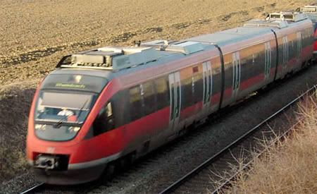
well i had a bit of time today so i created a quick map of a Vancouver to Chiliwack express line. This line would have electrified high speed trains(200-350km/ph). The stations are generarly atlest 20km apart to maximize the speed of the trains because they require to speed up and slow down.
http://maps.google.com/maps/ms?ie=UT...4414&z=10&om=0
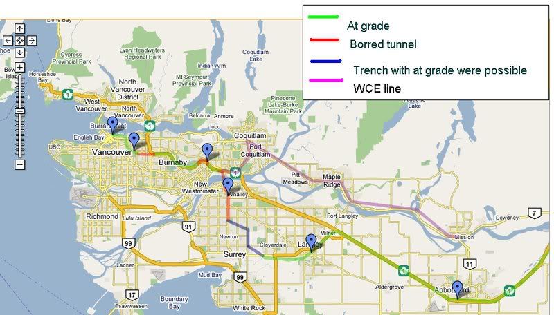
1)Basicly the line starts at Waterfront and travels along the rail line up to the Grandview cut were there would be a station at Broadway.
2)It then continues through the cut to just past Nanaimo where it goes in to a bored tunnel under neath the southern hillside and emerges at the highway were it continues down the middle until it goes back in to a bored tunnel under Goverment st and Keswick park with a station at Lougheed.
3)After the station it continues in a bored tunnel and turns back to the highway were it follows the railway up to around King Edward street were it goes back in to a bored tunnel under the Fraser. This tunnel can also have capacity for freight rail to replace the New Westminster crossing. The bored tunnel then continues south along the power line right of way up to King George highway were it goes in to a station at Surrey central.
4)It then continues in a bored or cut and cover tunnel under King George station until it reaches the power line right of way south of Bear creek park were it takes a turn to the east and continues in a trench or at grade(were possible). It goes just past 152st were it turns south and continues through the farmland t link up with the railway again. It follows its right of way at grade through Langley and another station and continues along it(next to Glover rd) up to the number 1.
5)There it goes back in to the midle and continues all the way to Chiliwack at grade with a station and park and ride facility in Abotsford and Chiliwack.
*)Also the current WCE would stop running along Burrard inlet and would turn south at Coquitlam station and merge with this line. People in Poert moody can just take the Evergreen line to Lougheed station or Coquitlam station to get on a express train to downtown.
A majority of the line is at grade and almost all of it follows either a rail right of way, a highway right of way or a power line right of way. The only pricy tunnels would be 1.5 or so km one in Vancouver, a 1.5 or so km one by lougheed station(this can also be eliminated and the station moved to Braid), and a new tunnel for a crossing under the fraser. The only long tunnel cut and cover would be down King George for a few km.
***There can alos be more stations along the line with tracks to allow other trains to by pass them while their in a station. A station on 152 for White rock commuters and a few more along the number one between Langley and Chiliwack would be usefull to maximize the coverage of the line. A station around Willingdon would also be good. But all these stations should be able to be bypassed by express trains that can pick up and maintain a decent speed for longer distances in stead of having to come to a stop and reacelerate to 200+km and hour.


 Prev
Prev


 Linear Mode
