San Antonio has codified design guidelines for building heights keyed to setbacks for various zones as well as informal guidelines for various districts subject to historic and design review by various governing boards. These are all meant to preserve certain notions of what should be the appropriate "character" of the impacted neighborhood or district, but developers can seek exceptions, waivers, and zoning changes. Residential areas seem to generate to the most contentious uproar when exceptions are sought.
More formal height restrictions exist for the city's historic Spanish colonial missions and the landmark Alamo. The World Heritage sites of Mission San José, Mission Concepción, Mission San Juan Capistrano, and Mission Espada in a chain of suburban national parks stretching south of downtown fall under special
Mission Protection Overlay Zoning Districts that progressively restrict building heights within a radius of 1500 feet of the individual missions, intended to prevent the appearance of structures from projecting over the missions or their park grounds and tree lines when seen from within the missions sites. The restriction area is shaped like an inverted cone with its apex at eyelevel over a monument marker within the protected mission site such that the closer to the mission, the more restrictive the allowable height.
An example with Mission Concepción:

(Image from
City of San Antonio on WorldHeritageSA)

(Image from
City of San Antonio hosted on The Rivard Report)

(Image from
City of San Antonio hosted on The Rivard Report)
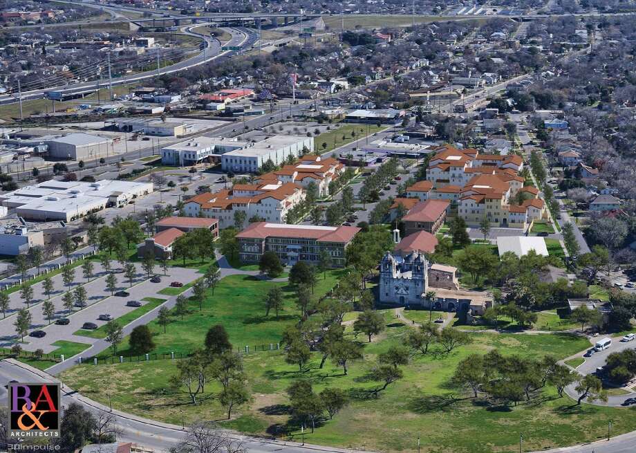
There had recently been some controversies with new developments, particularly with the new Villa Concepción apartment project behind the historic Mission Concepción:
(Image from
R&A Architects hosted on the San Antonio Express-News mySA)

(Image from
B&A Architects hosted on The Rivard Report)

(Image from
210 Development Group hosted on The Rivard Report)
__________
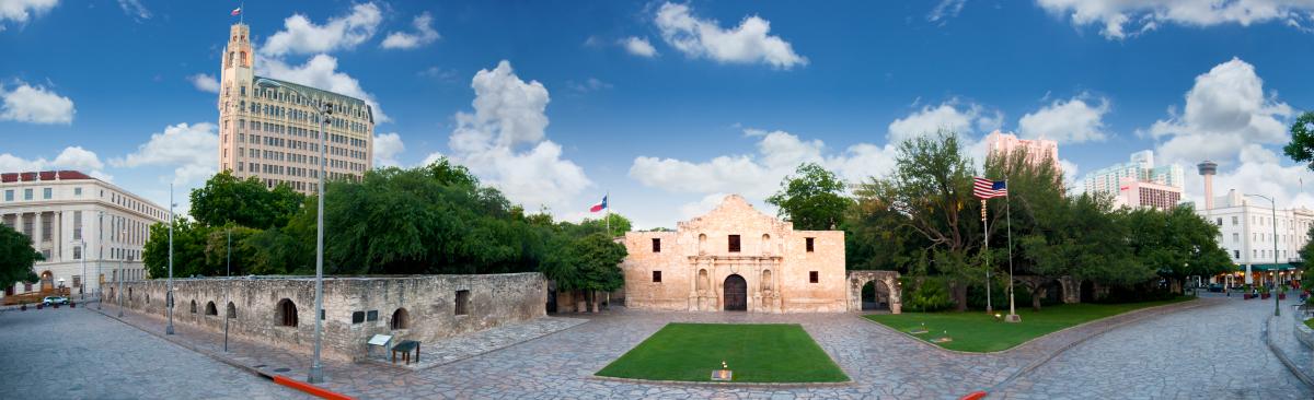
The famous landmark Alamo shrine within downtown San Antonio falls under a special
Alamo Viewshed protection district that formally restricts building heights behind the shrine within an inclining swath intersecting the upper corners of the shrine such that structures cannot be seen over the shrine when seen from point near eyelevel over a monument marker in front of the Alamo. The restricted area stretches from the Alamo marker eastwards over 1,400 feet to the edge of the I-37 highway.
(Photo from
Real Texas Blog)
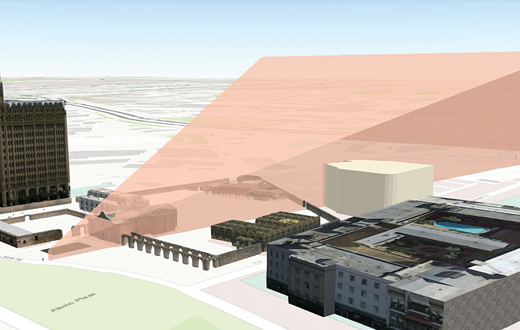
(Image from
Esri)
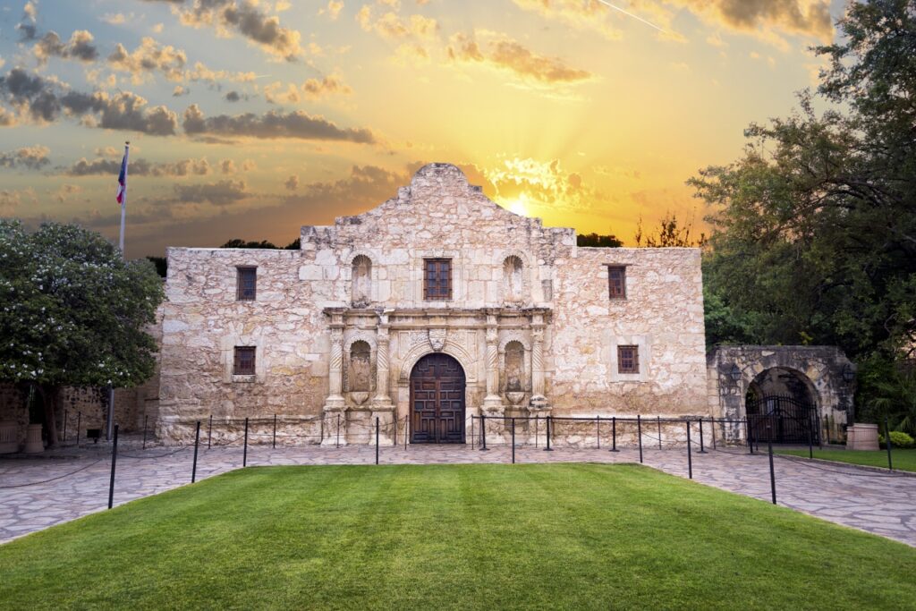
While it has successfully preserved the open sky and sunrises behind the Alamo and prevented buildings from towering up directly behind the photogenic shrine and ruining beautiful tourist photographs...
(Stock image on
Cariloha)
...it has also seemingly inadvertently overly barred development beyond the grandfathered Crockett Hotel behind the Alamo grounds such that the only practical use for the area has been as a vast ground parking lot for the hotel and neighboring mall.

(Image from Google Earth)
It has been suggested with the redesign of Alamo Plaza that the underutilized area behind the Alamo grounds might be a good location for the proposed Alamo Museum, but state redevelopers clearly prefer demolishing or repurposing the historic commercial building on Alamo Plaza itself. I like ideas to extend out the Alamo gardens into a broader Alamo Park, perhaps with even some of the former acequia water channels recreated. The sea of parking can be moved underground, following the example expected to be used for the nearby Hemisfair Civic Park.
An informal building height restriction apparently now loosely exists for the area around the Alamo outside of the formal restriction and which is subject to imposition by the city's Historic and Design Review Commission. This was most dramatically seen in 2013 with the blocked proposal for a Joske's Tower addition to the historic art deco Joske's Building on the southern end of Alamo Plaza.

(Image from Overland Partners)

(Image from Overland Partners)
It was feared that its 31-story, 410-foot height would cast shadows onto the Alamo, that the tower was too tall in comparison to other already existing towers, that the tower could be seen from the Alamo doorway, and the character of the plaza would be changed.

(Image from Overland Partners)

(Image from
Overland Partners hosted on The Rivard Report)
While the architects produced studies showing how these fears were unfounded or exaggerated, the ultimate defeat of the project came when UNESCO warned that the development could impact their then upcoming decision to proclaim the San Antonio missions as World Heritage Sites. With that threat against the city's decades-long international project, the proposed Joske's Tower was swiftly axed. However, the old Joske's Building was still internally rebuilt with the structure needed for an additional tower, and the developer this year has a resurrected the idea for a smaller addition.
Interestingly, San Antonio's admittedly small downtown has something of an inverted cone shape when in comes to skyscraper development, with a core of historically persevered low-rise buildings that progressively gets taller the further outward it spreads. San Antonio's tallest and newest buildings are generally on the peripheries of the preserved core, with each generation taller and more peripheral than the last, and beyond which building heights sharply drop off with the inner ring industrial areas and suburbs.
__________
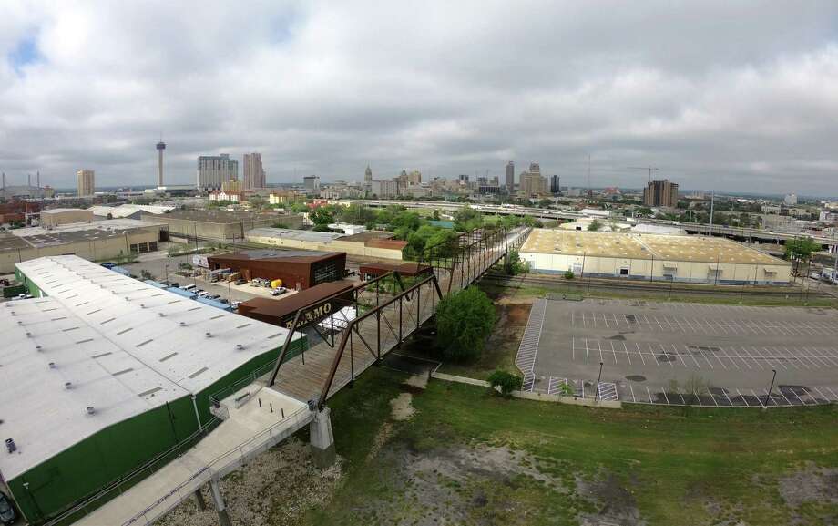
This year's controversy over the obstruction of views of the historic Hays Street Bridge by a proposed neighboring apartment building has pushed the city towards developing an additional viewshed protection initiative covering landmarks beyond the current five mission sites.
The Rivard Report article "
Viewshed Proliferation Leaves Little Room for Infill Development" (April 1, 2018) mentions suggested sites include the Hays Street Bridge, the Tower Life Building, the Tower of the Americas, the Arneson River Theatre, Mission Marquee Plaza, Woodlawn Lake, and the Japanese Tea Garden. An expanded list of 20 sites was recommended by the Historic and Design Review Commission, while only 4 actually were submitted to the full City Council for further consideration. These were the San Fernando Cathedral, the Tower Life Building, the Hays Street Bridge, and the Basilica of the National Shrine of the Little Flower.
For many of the suggested sites I definitely embrace view corridors such as those in Austin or overlays such as with the missions, but I am suspicious of some suggested sites as they are being proposed as a reactionary backdoor means to outright block any development in a proxy battle of the ongoing war against gentrification. That is a misuse of a powerful design tool, as are similar NIMBY tactics involving dubious uses of historic designations to impede development. Advocates in the Hays Street Bridge controversy had actually demanded that the view protections for the old industrial bridge should not only be of 360° views
from, but that views
of the bridge from 360° around it must also be preserved--absurdly putting an effective moratorium on all downtown development.
(Photo by
Billy Calzada on the San Antonio Express-News)
It's a very local landmark loved by its community, but it is not the Alamo nor the Texas Capitol and certainly does not warrant the 360° viewshed like we might grant the Parthenon or Cristo Redentor along with a citywide building moratorium. I'd much rather focus on ensuring the achievable preservation of narrower iconic views like this:
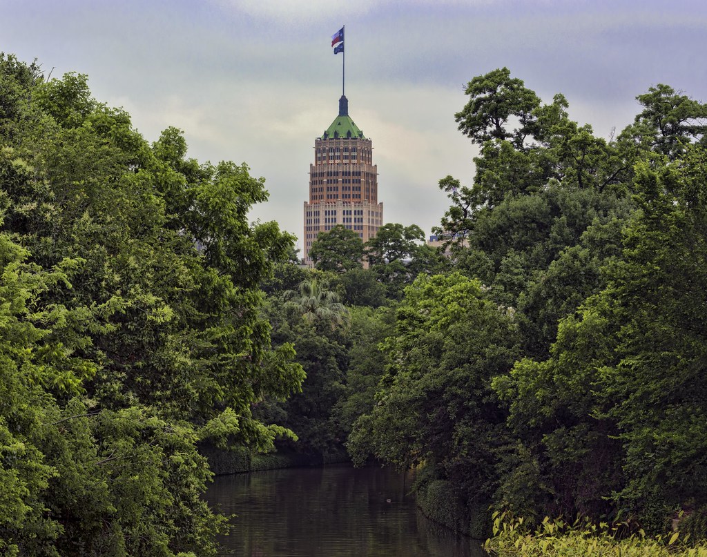
(Photo by
C.C. Rider on Flickr)
City staffers are working on the details specifying the four new landmark viewshed protections. The Tower Life Building seen above will likely have sightline-based view corridors similar to Austin's Capitol View Corridors, and its interesting that the currently proposed Hemisfair Civic Park redevelopment already suggests how such sightlines might work:
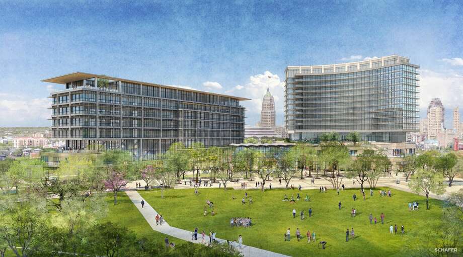
[Rendering by
Zachry Corp. hosted on the San Antonio Express-News)
The San Fernando Cathedral, already deep in downtown and surrounded by tall buildings, will likely get a backdrop height restriction similar the Alamo so as to preserve the open sky and western sunsets behind the cathedral when seen from the Main Plaza in front of the cathedral. Protection plans for the Basilica of the National Shrine of the Little Flower in the inner ring suburbs are often connected with protections for its neighboring Woodlawn Lake, and they will likely receive a broad overlay protection district similar to those already placed over the four Spanish colonial heritage missions. Despite the more zealous external activists having called for a 360° total building suppression field, the Hays Street Building really should instead have inclined view corridors from the public promenade deck looking towards downtown as well as view corridors from certain popular public points in its immediate neighborhood to the bridge.


 Prev
Prev


 Linear Mode
