HomeDiagramsDatabaseMapsForum About
     

Go Back   SkyscraperPage Forum > Regional Sections > United States > Pacific West > Portland > Downtown & City of Portland


Reply

 
Thread Tools Display Modes
     
     
  #1581  
Old Posted May 29, 2012, 5:24 AM
tworivers's Avatar
tworivers tworivers is offline
Registered User
 
Join Date: Feb 2006
Location: Portland/Cascadia
Posts: 2,598
Can you at least use the thing? Or is it blocked off somehow?
Reply With Quote
     
     
  #1582  
Old Posted May 29, 2012, 6:02 AM
65MAX's Avatar
65MAX 65MAX is offline
Karma Police
 
Join Date: Jun 2006
Location: People's Republic of Portland
Posts: 2,138

No, they have it completely fenced off with lots of "No Trespassing" signage.
Reply With Quote
     
     
  #1583  
Old Posted May 29, 2012, 6:47 AM
tworivers's Avatar
tworivers tworivers is offline
Registered User
 
Join Date: Feb 2006
Location: Portland/Cascadia
Posts: 2,598
Interesting. Sounds like an invitation for a self-guided tour to me.
Reply With Quote
     
     
  #1584  
Old Posted Jun 4, 2012, 12:40 AM
philopdx philopdx is offline
Registered User
 
Join Date: Feb 2008
Location: Deep South
Posts: 1,275
Coming along nicely! Taken 5-28-2012:

Reply With Quote
     
     
  #1585  
Old Posted Jun 6, 2012, 8:12 PM
tworivers's Avatar
tworivers tworivers is offline
Registered User
 
Join Date: Feb 2006
Location: Portland/Cascadia
Posts: 2,598
Going up fast...

(photos taken yesterday by me.)


edit: fixed photo mistake.

Last edited by tworivers; Jun 6, 2012 at 10:45 PM.
Reply With Quote
     
     
  #1586  
Old Posted Jun 6, 2012, 10:15 PM
Grantenfuego's Avatar
Grantenfuego Grantenfuego is offline
Registered User
 
Join Date: Feb 2012
Location: San Francisco
Posts: 108
wow. They're not wasting any time.
Reply With Quote
     
     
  #1587  
Old Posted Jun 15, 2012, 4:07 AM
tworivers's Avatar
tworivers tworivers is offline
Registered User
 
Join Date: Feb 2006
Location: Portland/Cascadia
Posts: 2,598


First building planned for Zidell redevelopment in South Waterfront

POSTED: Thursday, June 14, 2012 at 10:39 AM PT
BY: Lee Fehrenbacher, DJC

The first building is in the works for redevelopment of the former Zidell site in Portland’s South Waterfront.

The Bureau of Development Services’ Design Review Commission last week gave its unanimous approval to ZGF Architect’s design for the seven-story apartment complex planned for Southwest Moody Avenue. The $20 million, 118-unit, mixed-use building will be the Zidell’s first foray into developing the newly cleaned, 33-acre waterfront site.

“Our team paid a lot of attention to the early comments in the (pre-application conference) and it really kind of speaks to the care and craftsmanship that ZGF and Project Ecological (Development) put into the project,” said Matt French, managing director of ZRZ Realty, the real estate arm of Zidell. “We really put a lot of care and effort into making sure it was high-quality and an innovative design, and we really put our best foot forward.”

The building’s ambitious design features a tilting façade reminiscent of a ship’s bow, in which the floor plans increase in size from the ground floor to the top. The exterior also employs a rusty, bronze metal material called Corten to suggest an industrial hull – a nod of the head to Zidell’s barge-building roots.

French said the company plans to apply for a building permit within the next few weeks and hopes to break ground on the project in late August.
Reply With Quote
     
     
  #1588  
Old Posted Jun 15, 2012, 4:15 AM
tworivers's Avatar
tworivers tworivers is offline
Registered User
 
Join Date: Feb 2006
Location: Portland/Cascadia
Posts: 2,598
Speaking of Zidell, I was down there about a week ago and took this shot:


I really hope that when they get around to removing the barge-building facility they do something creative like leave the arched crane -- I like the way it complements the tram terminal.
Reply With Quote
     
     
  #1589  
Old Posted Jun 15, 2012, 4:30 PM
Shilo Rune 96's Avatar
Shilo Rune 96 Shilo Rune 96 is offline
PearlHelp.com
 
Join Date: Feb 2010
Location: SE Portland
Posts: 334
Quote:
Originally Posted by tworivers View Post
I really hope that when they get around to removing the barge-building facility they do something creative like leave the arched crane -- I like the way it complements the tram terminal.
Ah that would be cool. Perhaps they could move it North for a park under/near the Ross Island?
Reply With Quote
     
     
  #1590  
Old Posted Jun 18, 2012, 9:34 PM
MarkDaMan's Avatar
MarkDaMan MarkDaMan is offline
Moderator
 
Join Date: May 2005
Location: Portland
Posts: 7,517
From: http://gibbsbridge.org/

Quote:
Grand Opening is rescheduled

The Portland Bureau of Transportation is rescheduling the June 23 Grand Opening of the Gibbs Street Bridge to July or August, with a specific date to be determined in the coming weeks.

The opening was rescheduled to accomodate a new timeline for certification of the bridge's elevator. Having a certified elevator that is open to the public is the top priority for PBOT staff and contractors working to complete the project.

The Transportation Bureau thanks Portlanders for thier patience as we work to reconnect Lair Hill and the Willamette River with a pedestrian and bicycle bridge that is both functional and attractive. Details on when and how the bridge will open - possibly opening the bridge with signs indicating that the elevator is not in service-will be communicated as soon as possible.

For more information, please contact Jean Senechal Biggs. Thank you.
__________________
make paradise, tear up a parking lot
Reply With Quote
     
     
  #1591  
Old Posted Jun 19, 2012, 4:30 AM
philopdx philopdx is offline
Registered User
 
Join Date: Feb 2008
Location: Deep South
Posts: 1,275
Lame. Glad we don't have these project managers working for our firm.
Reply With Quote
     
     
  #1592  
Old Posted Jun 23, 2012, 5:39 PM
cronked cronked is offline
Registered User
 
Join Date: May 2008
Posts: 200
I received an email from those in charge that the Gibbs St. Bridge will open "within the next two weeks". I think they received enough feedback about the disappoinment that the opening was delayed due to the elevator situation. So it looks like the bridge will open first and the grand opening will be later this summer. Good news though. It would have been a shame to watch this finished, unused bridge sit there all summer!
Reply With Quote
     
     
  #1593  
Old Posted Jul 4, 2012, 12:16 AM
tworivers's Avatar
tworivers tworivers is offline
Registered User
 
Join Date: Feb 2006
Location: Portland/Cascadia
Posts: 2,598
Shot a few Sowa photos from across the river yesterday. It looks like they are working on the riverfront south of the barge facility. Could this be the trail/park upgrade in progress?


Reply With Quote
     
     
  #1594  
Old Posted Jul 5, 2012, 6:02 PM
cronked cronked is offline
Registered User
 
Join Date: May 2008
Posts: 200
Yes, this is the cleanup and redesign of the greenway that we have been waiting so long for. The greenway will be closed until June 2013. Unfortunately, they are still short $2 million so they are now doing it in phases. See the email I received below:


The good news is that the design was approved by the design commission earlier this month and all permits for complete construction of the Greenway have been submitted.

Unfortunately, after several years of earnestly working to fill the almost $2.0 million funding gap, we have not been successful. At this time, Portland Parks & Recreation Director, Mike Abbaté decided to phase the project. We are moving forward with the environmental restoration work as phase 1. We are hopeful to continue on to phase 2 next year if funds are available.

http://www.portlandonline.com/parks/index.cfm?c=45643


Quote:
Originally Posted by tworivers View Post
Shot a few Sowa photos from across the river yesterday. It looks like they are working on the riverfront south of the barge facility. Could this be the trail/park upgrade in progress?


Reply With Quote
     
     
  #1595  
Old Posted Jul 6, 2012, 10:43 PM
tworivers's Avatar
tworivers tworivers is offline
Registered User
 
Join Date: Feb 2006
Location: Portland/Cascadia
Posts: 2,598
Reply With Quote
     
     
  #1596  
Old Posted Jul 13, 2012, 2:34 AM
MarkDaMan's Avatar
MarkDaMan MarkDaMan is offline
Moderator
 
Join Date: May 2005
Location: Portland
Posts: 7,517
New pedestrian and bicycle bridge across Interstate 5 opens Saturday in Southwest Portland
Published: Thursday, July 12, 2012, 10:00 AM
By Rebecca Koffman, Special to The Oregonian

http://www.oregonlive.com/portland/i...cycle_bri.html

Quote:
It’s been a long wait, about half a century in fact, but Saturday, with the opening of the Gibbs Street pedestrian bridge, residents of Portland’s Corbett/Lair Hill district will at last be reconnected to the city’s waterfront.

The building of Interstate 5 in the early 1960s cut off parts of what is now called the South Portland neighborhood from the Willamette River. It’s only a short distance from Lair Hill to South Waterfront, but pedestrians and cyclists trying to get between the two must negotiate the freeway and other hard-to-cross, high-traffic areas such as Macadam Boulevard, Naito Parkway and the ramps for the Ross Island Bridge.

But after Saturday, instead of making a circuitous, unpleasant one-mile-plus trip, pedestrians and cyclists can walk or ride over the freeway on the span of the new bridge, the official name of which is the U.S. Congresswoman Darlene Hooley Pedestrian Bridge at Gibbs Street. The bridge is being named for the retired U.S. representative who was instrumental in securing funding for the bridge and pushing the project through.

Her reaction on learning that the bridge would be named after her? “I’m shocked, surprised and pleased as punch.”

The bridge was supposed to be built at the same time as the Portland Aerial Tram, but that didn't materialize because of tram cost overruns.

The wait, said David Snyder, a member of the bridge project’s Citizen Advisory Committee, “has been agonizing.”

Snyder lives on Southwest Kelly Avenue, a couple of blocks from the west end of the new span. “We’ve been desperately cut off. We can see the river but can’t get to it,” he says. He and his wife, both keen walkers and bikers, always drive to their gym at the base of the tram near the bridge’s east end because getting there by other means is too difficult and dangerous.

He's excited to see the bridge open and looking forward to the access to the river greenway and to public transit. There are streetcar, bus and tram connections at the bridge's east end and bus connections at the west end.
On a recent tour, Portland Bureau of Transportation project manager Jody Yates showed off the $13 million structure. Federal funds provided $10 million, the Portland Development Commission kicked in $578,000 and the rest came from citywide system development charges.

The steel box girder bridge was designed by Kevin Peterson of Peterson Design and engineered by CH2MHill. The contractor is Wildish. The span runs 700 feet from Southwest Moody Avenue in the east to Southwest Kelly Street in the west, curving around the tram tower as it goes. Its silver-painted steel complements the color of the tram structures.

Starting at the east end, anyone can ride the Kone elevator up 70 feet from the Moody Plaza to the deck of the bridge, taking about 30 seconds. There's time to enjoy River Wrap, a series of photographic images on glass panels set into the elevator tower and created by artist Anna Valentina Murch. Each panel is suffused with the myriad colors of river water dappled by sunlight.

Yates points out that the elevator’s pull-through design -- enter one side and exit the other -- makes it easy to use for cyclists and people with strollers. It’s long enough to accommodate a bike with a trailer.

Don’t want to take the elevator? There are 132 stairs with benches to rest along the way. The stairs have a wheel trough along one side so bicycles can be wheeled smoothly up. There is also an extensive, multi-terraced bioswale to admire.

“It’s kind of a pilot project for the Bureau of Environmental Services, “ said Yates, who explained that it’s the first time a bioswale has been designed for such a steep slope.
At the top, there’s space to take in the expansive view: the Zidell shipyard, South Waterfront and the northern tip of Ross Island. From there, it’s a 700-foot walk over I-5 to Kelly on a 14-foot-wide walkway. Solid steel rings are set at intervals into the deck.
“Rescue rings, requested by the Fire Bureau,” explains Yates. "They can use them to tie off if they have to rescue people from the tram.”

The noise increases as you walk over Interstate 5. “The bridge walls are canted outwards,” Yates pointed out, “so that it doesn’t feel like a prison.”

On the west end, a painted crosswalk and other safety improvements have been added at Kelly. A crosswalk has also gone in on nearby Barbur Boulevard, and in a separate project scheduled to begin soon, a crosswalk with a rapid flashing beacon will be installed on Southwest Naito Parkway at Whitaker Street.

Yates said it’s estimated there will be between 400 and 800 daily pedestrian and bike crossings of the bridge.

And there will be an opening celebration this Saturday.

“We’re proud of it," Yates said, "and ready to show it off.”
Quote:
Opening celebration

What: Mayor Sam Adams hosts a grand opening of the new bridge. Former congresswoman Darlene Hooley and neighborhood representatives will give speeches.

After the ceremony there will be tours of the bridge as well as walking and cycling tours of the area.

When: Saturday, July 14, 10 a.m to 2 p.m. Free tram rides all day.

Where: The bridge plaza at Southwest Moody Avenue and Gibbs Street. The bridge plaza is at the eastern end of the new bridge where the elevator is located.
__________________
make paradise, tear up a parking lot
Reply With Quote
     
     
  #1597  
Old Posted Jul 15, 2012, 5:46 PM
philopdx philopdx is offline
Registered User
 
Join Date: Feb 2008
Location: Deep South
Posts: 1,275
I went to the grand opening of Gibbs St. bridge and took one of the engineering tours. Fascinating stuff. For instance:

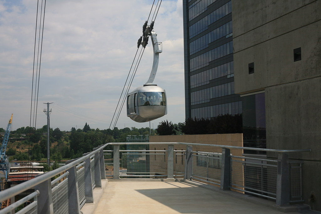
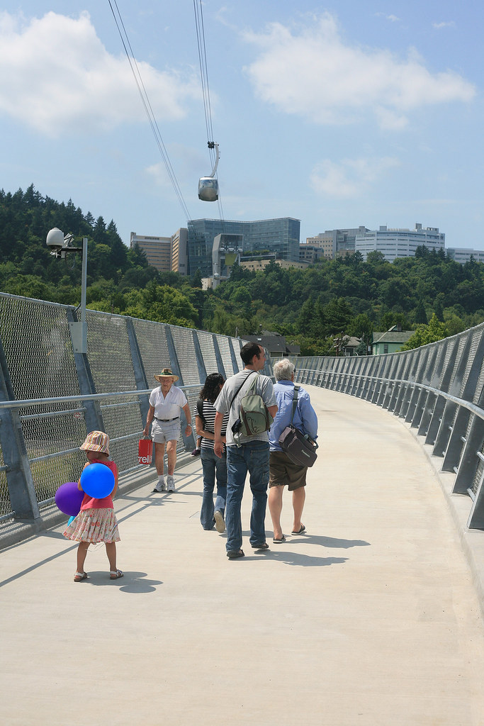
-The bridge has a curve because they had to have a certain amount of clearance from the tram tower's foundation. They couldn't move the South Waterfront landing to the north, since that would encroach on private property.
-There was a consideration to make a straight bridge with a kink at the end, but that was considered pedestrian and cyclist unfriendly.
-It was a conscious decision to have the bridge match the theme of the tram and the south waterfront, in terms of color scheme and material.
-The material is galvanized steel, with weathered steel (the rusted kind) only being used in the bioswales.
-The west end of the bridge was purposefully toned down to make it more modest to fit the character of Lair Hill
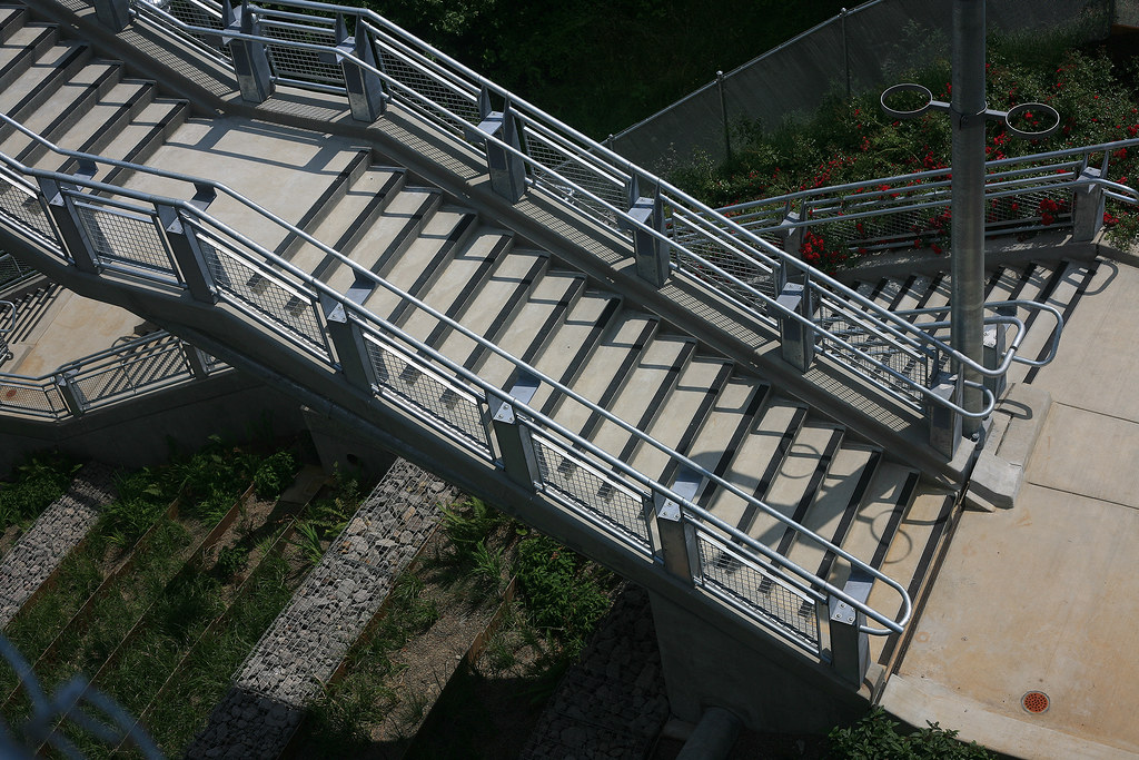
-The bridge only has one expansion joint on the far west end
-The bridge is tilted a couple degrees to south to help drainage
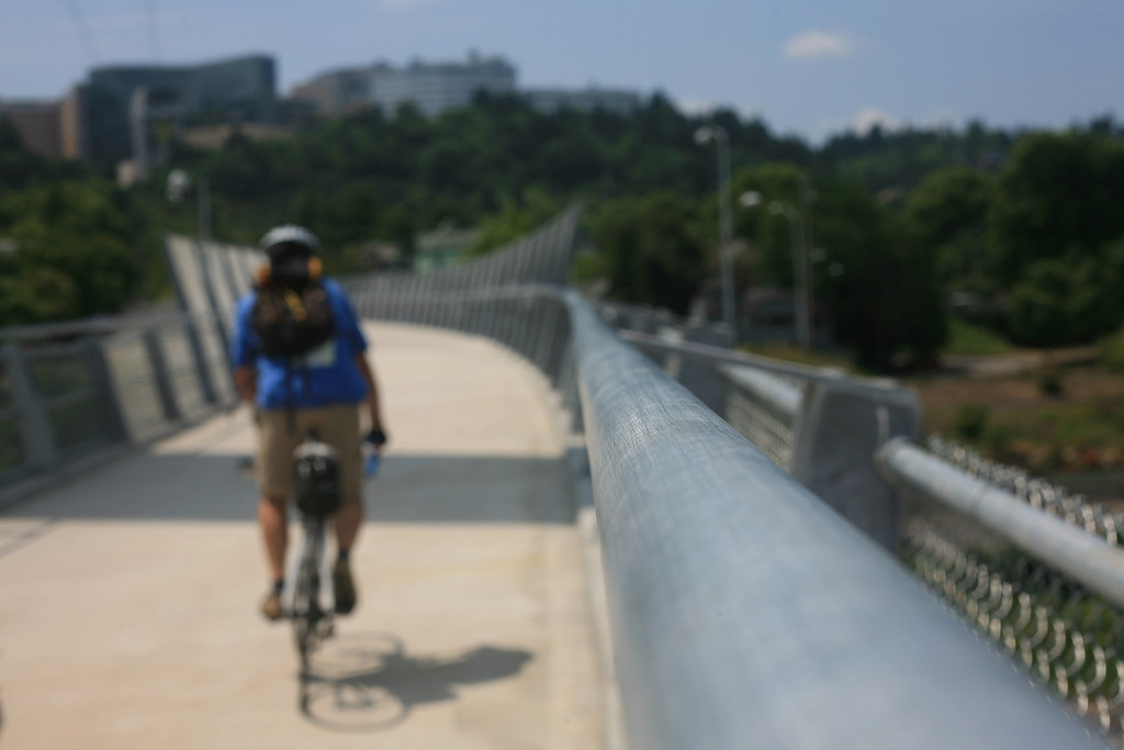
-The bridge also has a 3.5% slope down from west to east, which was a necessity since no slope would put the east terminus of the bridge even higher, and too close to the path of the tram.
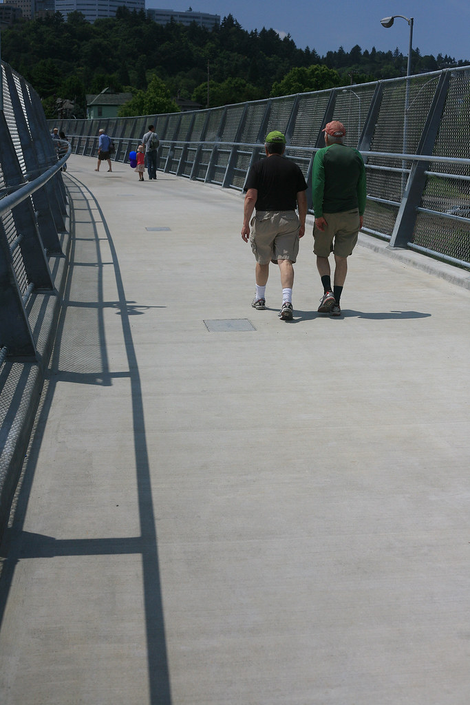
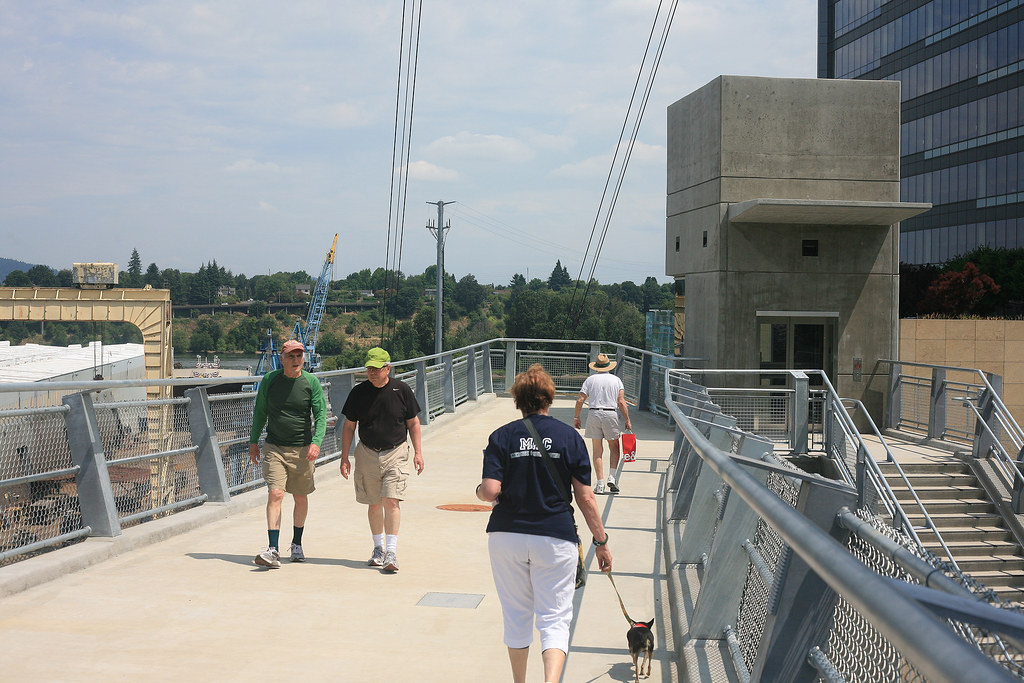
-The outward facing arms meant to foster a sense of openness and lightness.
-The path lights are only on the south side of the bridge, and use off the shelf parts.
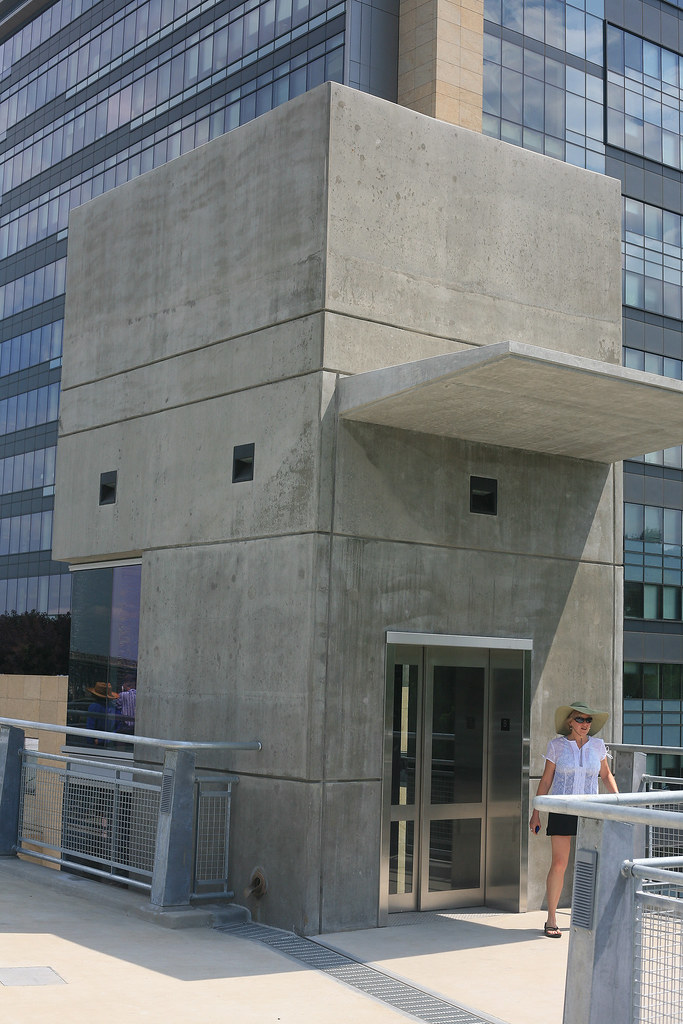
-LED's are used in the elevator (which is also air conditioned)
-LED's are not used on the bridge. The reason is that the standards are changing so fast, you have to keep many versions of the bulbs in stock, so a future retrofit to LED may happen, once standards are settled
-The bridge is designed to have panels affixed to the outward facing walls, to replace the wire mesh. They could be sound deadening or glass, it all depends on budget some day in the far future.
-There was a mistake in the fabrication of the steel tube, and part of the bridge is out of camber. They corrected that by pouring the concrete in a different way to maintain the camber on the path. You can see it by the concrete lip of the curb varying from 2-4 inches in the center of the bridge.
-The architect had some pointed commentary for the river glass art installation at the east end of the bridge, and thought the panel "significantly altered" the idea of being able to see the river when riding the elevator.
-BTW, the artist was brought on very late in the process
-The terminus at the east end of the bridge looks directly at Mt. Hood. They purposely designed the bridge this way (to the angle!) so that it will become a prime touristy spot to have your picture taken in Portland.


Reply With Quote
     
     
  #1598  
Old Posted Jul 15, 2012, 7:08 PM
PacificNW PacificNW is offline
Registered User
 
Join Date: Jul 2001
Location: Arizona
Posts: 3,116
Thanks!
Reply With Quote
     
     
  #1599  
Old Posted Jul 15, 2012, 11:08 PM
2oh1's Avatar
2oh1 2oh1 is offline
9-7-2oh1-!
 
Join Date: May 2007
Location: downtown Portland
Posts: 2,482
+1 on the Thanks! Great job on the info! I'm so glad to see this bridge completed.
Reply With Quote
     
     
  #1600  
Old Posted Jul 19, 2012, 4:47 PM
urbanlife's Avatar
urbanlife urbanlife is offline
A before E
 
Join Date: Aug 2001
Location: Milwaukie, Oregon
Posts: 11,782
It looks like an okay looking bridge, nothing amazing about it, but nothing really bad about it either. I like it.
Reply With Quote
     
     
This discussion thread continues

Use the page links to the lower-right to go to the next page for additional posts
 
 
Reply

Go Back   SkyscraperPage Forum > Regional Sections > United States > Pacific West > Portland > Downtown & City of Portland
Forum Jump


Forum Jump


All times are GMT. The time now is 2:20 PM.

     
SkyscraperPage.com - Archive - Privacy Statement - Top

Powered by vBulletin® Version 3.8.7
Copyright ©2000 - 2024, vBulletin Solutions, Inc.