Quote:
Originally Posted by 1ajs

whats golden horse shoe?
|
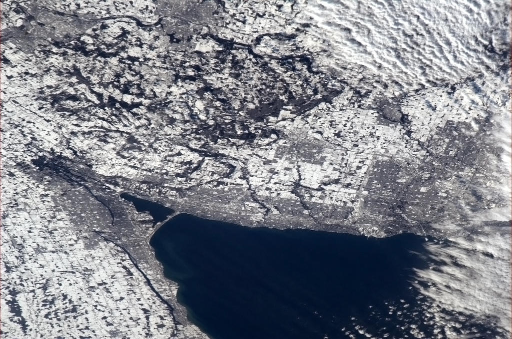
That image should just say Hamilton as it doesn't show the entire Horseshoe.
A: The Golden Horseshoe is a subregion of Southern Ontario, Canada which lies at the western end of Lake Ontario with outer boundaries stretching south to Lake Erie and north to Georgian Bay. The region is densely populated and industrialized. Most of it is also part of the Greater Toronto and Hamilton Area, Quebec City–Windsor Corridor and the Great Lakes Megalopolis. With a population of 8.76 million people in 2011, the Golden Horseshoe makes up over 26% of the population of Canada and contains more than 68% of Ontario's population,[1][not in citation given] making it one of the largest population concentrations in North America. Although it is a geographically named sub-region of Southern Ontario, the Greater Golden Horseshoe is also used today to describe the metropolitan region that stretches across the area in totality, including smaller centres outside of the core region.
The core of the region starts from Niagara Falls at the eastern end of the Niagara Peninsula and extends west, wrapping around the western end of Lake Ontario at Hamilton and then turning northeast to its anchor city Toronto (on the northwestern shore of Lake Ontario), before finally terminating at Oshawa, just east of Toronto. The wider region spreads inland in all directions away from the Lake Ontario shoreline, southwest to Brantford, west to the Kitchener-Waterloo area, north to Barrie, and northeast to Peterborough. The whole region's area covers approximately 33,500 km2 (13,000 sq mi), out of this, 7,300 km2 (2,800 sq mi) or approximately 22% of the area is covered by the environmentally protected Greenbelt.(wiki)


 Prev
Prev


 Linear Mode
