HomeDiagramsDatabaseMapsForum About
     

Go Back   SkyscraperPage Forum > Regional Sections > Canada > Atlantic Provinces > Halifax > Halifax Peninsula & Downtown Dartmouth


Reply

 
Thread Tools Display Modes
     
     
  #9401  
Old Posted Sep 4, 2019, 6:04 PM
OldDartmouthMark OldDartmouthMark is online now
Registered User
 
Join Date: May 2010
Posts: 8,482
Quote:
Originally Posted by midasmull View Post
Jeep-only parking
Reply With Quote
     
     
  #9402  
Old Posted Sep 5, 2019, 5:55 AM
pblaauw pblaauw is offline
Registered User
 
Join Date: May 2010
Location: Halifax, Nova Scotia
Posts: 529
Quote:
Originally Posted by midasmull View Post
Jeep-only parking
Smart Cars, mostly.
Reply With Quote
     
     
  #9403  
Old Posted Sep 5, 2019, 8:26 PM
OldDartmouthMark OldDartmouthMark is online now
Registered User
 
Join Date: May 2010
Posts: 8,482
Quote:
Originally Posted by pblaauw View Post
Smart Cars, mostly.
4 wheel drive Smart Cars?
Reply With Quote
     
     
  #9404  
Old Posted Sep 6, 2019, 6:37 AM
pblaauw pblaauw is offline
Registered User
 
Join Date: May 2010
Location: Halifax, Nova Scotia
Posts: 529
Quote:
Originally Posted by OldDartmouthMark View Post
4 wheel drive Smart Cars?
Yeah, okay.
Reply With Quote
     
     
  #9405  
Old Posted Sep 6, 2019, 10:13 PM
OldDartmouthMark OldDartmouthMark is online now
Registered User
 
Join Date: May 2010
Posts: 8,482
I guess this qualifies as "news"...

The blow-by-blow of what to expect from Hurricane Dorian

Quote:
Along and to the right of Dorian's track ⁠— from the South Shore through Halifax and central Nova Scotia to eastern regions, Cape Breton ⁠and P.E.I. — winds gusts will likely reach 110 to 130 km/h, with exposed areas of the coast possibly reaching 150 km/h. Power outages are very likely.

The heaviest rain will fall along and to the left of Dorian's track. A widespread area from central and western Nova Scotia to P.E.I. and southeastern New Brunswick will likely see rainfall of between 50 to 100 millimetres.
Should be interesting...
Reply With Quote
     
     
  #9406  
Old Posted Sep 9, 2019, 4:23 PM
OldDartmouthMark OldDartmouthMark is online now
Registered User
 
Join Date: May 2010
Posts: 8,482
Follow-up article:

https://www.cbc.ca/news/canada/nova-...rian-1.5275182

And a storm summary from Environment Canada:

Quote:
For Post-tropical Storm Dorian.

This is a special meteorological summary for Post-tropical Storm Dorian.

This is the final information statement for this storm.

1. Full discussion of the event.

On August 23rd, a tropical wave formed between the Cape Verde Islands and the Lesser Antillies. One day later on August 24th, the National Hurricane Center in Miami declared the system a Tropical Depression and not long after Tropical Storm Dorian. The storm remained relatively weak until August 28th, when it reached hurricane status and made landfall in the US Virgin Islands. A few days after, Dorian began to rapidly intensify and reached Category 5 status on September 1st as it approached the northwestern Bahamas. Dorian made landfall on Elbow Bay with winds of 295 km/h. The next day Dorian moved over Grand Bahama and stalled just north of the island for a staggering 36 hours. Dorian weakening to a Category 2 storm while stationary before finally moving off to the northeast towards Florida. Dorian caused catastrophic damage to the northwestern Bahamas, making it the strongest hurricane to impact that region since modern records began.

On September 3rd, Dorian began moving northwestward towards Florida but made a turn more northward and remained offshore, paralleling the Florida coast. The Canadian Hurricane Centre began issuing tropical statements on September 4th as model consensus became clear that the storm was going to have an impact on Atlantic Canada.

On September 5th, Dorian regained some strength back to a Category 3 hurricane while grazing the Carolina coasts, making landfall over Cape Hatteras on the morning of September 6th. Dorian then got picked up in the mid latitude westerlies and began accelerating northeastward towards Atlantic Canada. The Canadian Hurricane Centre began issuing Hurricane and Tropical Storm watches and warnings early on September 6th.

Early on September 7th, Dorian weakened to a Category 1 as it approached the southwestern marine waters. Dorian began transitioning into a post-tropical system as the wind field expanded considerably from the storm centre and the rain shifted to the left of the track. Conditions over Nova Scotia quickly deteriorated mid morning on the 7th as torrential rains and strong wind gusts spread further north and east. Dorian began interacting with a mid to high level trough that was approaching the Maritimes and, with the help of baroclinic influences, was able to increase in strength just as it approached the southwestern shore of Nova Scotia. Dorian was designated post-tropical at 6 pm ADT, and soon after made landfall in Sambro Creek, south of Halifax at near 7pm as a hurricane strength post-tropical cyclone with a pressure of 958 millibars.

Dorian continued quickly toward the northeast, tracking over northern Nova Scotia, just east of Prince Edward Island, and over the Gulf of St. Lawrence by the morning of September 8th. Dorian weakened to tropical storm strength as it moved northeastward towards the Great Northern Peninsula of Newfoundland the evening of September 8th. The storm continues to track out over the Labrador Sea and towards Europe.

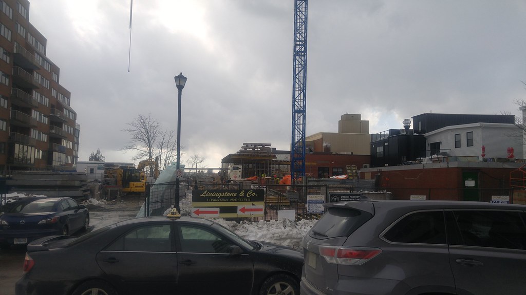
The effects of Dorian were felt over a large area due to the expanding wind field and rain shield to the left of Dorian's track. Nova Scotia encountered destructive hurricane force wind gusts of up to 145 km/h along the Atlantic coast from Yarmouth to Cape Breton. Peak power outages over Nova Scotia, Prince Edward Island and New Brunswick reached over 500,000 customers. Damage included many uprooted trees, downed power lines, and flying debris. A construction crane fell from a building in downtown Halifax just prior to the storm making landfall. Strong winds with gusts up to 100 km/h were also experienced over eastern New Brunswick, Prince Edward Island, the Magdalen Islands, western and northeastern Newfoundland, and the Lower North Shore Quebec.

A heavy swath of rain just to the left of the track produced rainfall rates of over 30 mm/h over central and northern Nova Scotia. Total rainfall amounts of 50 to 140 mm were seen over south and eastern New Brunswick, southwestern to central Nova Scotia, and western Prince Edward Island.

Finally, storm surge and rough pound surf had a considerable impact for areas along the Atlantic coast of Nova Scotia and southwestern Newfoundland, Northumberland Strait, the Magdalen Islands, and parts of the Lower North Shore Quebec from Blanc Sablon to Chevery. The Halifax tide guage reported a water level of 2.9 metres with a surge of 1.5 metres. Lower Escuminac on the east coast of New Brunswick reached 2.6 metres which broke their prior record of 2.44 metres. Marine waves were also substantial as the storm tracked over Georges Bank northeast along the Atlantic coast of Nova Scotia toward the southwestern coast of Newfoundland. The slope waters experienced wave heights of 12 to 15 metres with periods of 12 to 14 seconds.

2. Summary of rainfall in millimetres:

Oxford: 138
Lower Sackville: 138
Hammonds Plains: 133
Baccaro Point: 131.2
Belmont: 129
Moncton: 121
St. Paul: 120
Mechanic Settlement: 117
Miramichi: 115
Kentville: 110.4
St. Ignace: 110
Bonshaw: 103
Berwick: 98
Dorchester: 97
Big Tracadie: 96
Bedford: 96
Scots Bay: 94
New Ross: 93
Doaktown: 92
Bordon: 91
Halifax(Downtown): 90
Summerside: 90
Spring Valley: 86
Sussex: 86
Sandy Cove: 84
Norton: 84
Greenwood: 82
Saint John: 82
Middleton: 79
Lake Major: 78
Dartmouth: 77
Parrsboro: 76.2
Red Pines: 76
Fredericton Airport: 75
Nappan: 74
Halifax International Airport: 70.8
Kejimkujik: 64
Yarmouth: 62
Bathurst: 62
Gagetown: 56


3. Summary of peak wind gusts in km/h:

Wreckhouse: 157
Beaver Island: 145
Green Island - Fortune Bay: 143
Sluce Point: 143
Osborne Head: 141
Grand Etang: 137
Yarmouth: 130
Heath Point: 128
Port aux Basques: 128
North Cape: 122
East Point: 120
Halifax Kootenay: 120
Hart Island: 120
Magdalen Islands: 120
Baccaro Point: 119
Caribou Point: 119
Stephenville Airport: 117
McIvers: 116
Cape St. Mary's: 116
Summerside: 115
Blanc Sablon: 113
Cape Whittle: 113
Burgeo: 111
Daniel's Harbour: 111
Pass Island: 109
North Mountain: 107
Halifax Dockyard: 107
Bonavista: 107
Deer Lake: 107
Brier Island: 106
Miscou Island: 106
Pool's Island: 106
St. Lunaire-Griquet: 105
Sydney Airport: 104
Twillingate: 104
Lunenburg: 102
Shearwater Jetty: 102
Eskasoni: 102
Saint John: 102
Charlottetown Airport: 102
Halifax International Airport: 100
Moncton: 100
McNabs Island: 100
St. Peters: 98
Rocky Harbour: 98
Grates Cove: 96
Tracadie: 95
St. John's Int'l Airport: 94
St. Pierre: 94
St. Anthony Airport: 94
Greenwood: 93
Stanhope: 93
Ingonish Beach: 91

Forecaster: McArthur.
Reply With Quote
     
     
  #9407  
Old Posted Sep 19, 2019, 1:58 AM
someone123's Avatar
someone123 someone123 is offline
hähnchenbrüstfiletstüc
 
Join Date: Nov 2001
Location: Vancouver
Posts: 33,694
I thought this was a nice picture of downtown. But it also makes it apparent that a lot of the construction projects downtown are wrapping up. I wonder if any big ones will start up next? Cunard? Skye? The Ralston development? Dennis Building? The highrise that's part of Scotia Square along Duke Street, or maybe those other developments proposed along Brunswick Street?

And will Cogswell finally start in 2019, or will it slip to 2020?


Source
Reply With Quote
     
     
  #9408  
Old Posted Sep 19, 2019, 9:52 AM
Keith P.'s Avatar
Keith P. Keith P. is offline
Registered User
 
Join Date: Mar 2006
Posts: 8,018
Once the Centre Plan passes completely, all the development action will occur in suburbia. It will have a chilling effect on the peninsula.
Reply With Quote
     
     
  #9409  
Old Posted Sep 19, 2019, 3:08 PM
OldDartmouthMark OldDartmouthMark is online now
Registered User
 
Join Date: May 2010
Posts: 8,482
That sounds a little too doom-and-gloom, Keith.

Keep your chin up! There are still lots of great heritage sites downtown that can be leveled and replaced with new glass boxes.
Reply With Quote
     
     
  #9410  
Old Posted Sep 19, 2019, 3:22 PM
someone123's Avatar
someone123 someone123 is offline
hähnchenbrüstfiletstüc
 
Join Date: Nov 2001
Location: Vancouver
Posts: 33,694
That is not what happened with HRM by Design, and I don't think the HRM by Design area is covered by the Centre Plan. The Centre Plan covers the parts of the urban core that are outside of HRM by Design.

When the Centre Plan comes into effect I think we'll see fewer tall proposals (over the Centre Plan limits of 27 storeys or whatever was settled on) but more development overall. It will be more profitable to propose medium-sized developments because there will be more clarity around whether they'll be allowed or not and the approval process will be quicker.
Reply With Quote
     
     
  #9411  
Old Posted Sep 19, 2019, 6:12 PM
Keith P.'s Avatar
Keith P. Keith P. is offline
Registered User
 
Join Date: Mar 2006
Posts: 8,018
Quote:
Originally Posted by someone123 View Post
That is not what happened with HRM by Design, and I don't think the HRM by Design area is covered by the Centre Plan. The Centre Plan covers the parts of the urban core that are outside of HRM by Design.

When the Centre Plan comes into effect I think we'll see fewer tall proposals (over the Centre Plan limits of 27 storeys or whatever was settled on) but more development overall. It will be more profitable to propose medium-sized developments because there will be more clarity around whether they'll be allowed or not and the approval process will be quicker.
My understanding is that virtually all of the currently-underway development in the HRMxD area was approved prior to it coming into effect via development agreements. The lack of new proposals in the area may be instructive to what is likely to occur with this badly flawed Centre Plan. By artificially limiting not only height but also using a foolish "floor area ratio" metric to limit the size and hence profitability of proposed developments, there will be a chilling effect on such proposals. Developers will go to where the most profit is found. That is not in the downtown or areas now under the CP, but rather in suburbia.
Reply With Quote
     
     
  #9412  
Old Posted Sep 20, 2019, 3:12 AM
Querce Querce is offline
Registered User
 
Join Date: Jul 2017
Posts: 129
wow keith, you should've been there at the public hearing so you could tell all those developers what they really should've been worried about
Reply With Quote
     
     
  #9413  
Old Posted Sep 20, 2019, 10:48 AM
Keith P.'s Avatar
Keith P. Keith P. is offline
Registered User
 
Join Date: Mar 2006
Posts: 8,018
Quote:
Originally Posted by Querce View Post
wow keith, you should've been there at the public hearing so you could tell all those developers what they really should've been worried about
They were the ones informing me. They did not want to expose themselves to the usual "greedy developers" diatribes from the anti-development mob at a public circus. But that same mindset infests a large section within the HRM Planning Dept and some on Council which is what led to this.
Reply With Quote
     
     
  #9414  
Old Posted Sep 20, 2019, 11:25 AM
IanWatson IanWatson is offline
Registered User
 
Join Date: Feb 2013
Posts: 1,227
Quote:
Originally Posted by Keith P. View Post
My understanding is that virtually all of the currently-underway development in the HRMxD area was approved prior to it coming into effect via development agreements.
Your understanding is quite wrong. The three projects that predated HRMxD are The Roy, Discovery Centre, and The Alexander. Every other development has been a result of HRMxD.
Reply With Quote
     
     
  #9415  
Old Posted Sep 20, 2019, 10:04 PM
Jonovision's Avatar
Jonovision Jonovision is offline
Registered User
 
Join Date: Sep 2003
Posts: 5,004
Quote:
Originally Posted by IanWatson View Post
Your understanding is quite wrong. The three projects that predated HRMxD are The Roy, Discovery Centre, and The Alexander. Every other development has been a result of HRMxD.
I think Virtue Suits was in that mix and you could count the Nova Centre too. But ya, the vast majority of construction downtown has all been since the changes to the downtown bylaws.
Reply With Quote
     
     
  #9416  
Old Posted Sep 21, 2019, 1:48 AM
Keith P.'s Avatar
Keith P. Keith P. is offline
Registered User
 
Join Date: Mar 2006
Posts: 8,018
What is included in this vast number of HRMxD projects underway?
Reply With Quote
     
     
  #9417  
Old Posted Sep 21, 2019, 9:18 PM
Jonovision's Avatar
Jonovision Jonovision is offline
Registered User
 
Join Date: Sep 2003
Posts: 5,004
Quote:
Originally Posted by Keith P. View Post
What is included in this vast number of HRMxD projects underway?
  • TD Bank Spring Garden
  • TD Bank Barrington
  • Scotia Square Barrington Addition
  • The Pearl on Gottingen
  • 19Twenty Brunswick
  • Brunswick St Retail Additions
  • Espace on Barrington
  • Queens Marque
  • The Maple
  • NFB Redevelopment
  • The Dillon on Sackville
  • The Paviliona and The Curve
  • South Park Lofts
  • Brenton Suites
  • The Doyle
  • Grafton Park
  • BMO on Spring Garden
  • The Sister Sites
  • Flynn Flats

A sample of projects completed under the HRM By Design bylaw changes. And I know I have missed some and there are others that are approved but yet to start.
Reply With Quote
     
     
  #9418  
Old Posted Sep 23, 2019, 12:36 AM
Dmajackson's Avatar
Dmajackson Dmajackson is offline
Moderator
 
Join Date: Feb 2008
Location: B3K Halifax, NS
Posts: 9,355
LeMarchant - St Thomas Elementary School


Halifax Developments Blog (Photo by David Jackson)
Reply With Quote
     
     
  #9419  
Old Posted Sep 24, 2019, 1:44 AM
hoser111's Avatar
hoser111 hoser111 is offline
Registered User
 
Join Date: Oct 2005
Posts: 341
Quote:
Originally Posted by Jonovision View Post
The new building going up in Dartmouth on Prince street is only taking up half of the empty street frontage. This still leaves an entire lot that runs through to Alderney Dr. Hopefully that produces a nice building than this one.

20190306_133546 by Jonovision23, on Flickr

Zzzzzzzzz...

Reply With Quote
     
     
  #9420  
Old Posted Sep 24, 2019, 11:36 AM
Keith P.'s Avatar
Keith P. Keith P. is offline
Registered User
 
Join Date: Mar 2006
Posts: 8,018
I hear the the old central Post Office on Queen St in Dartmouth is closing and postal services are being relocated to Moffat's Pharmacy a few blocks away. That in itself is a bad move but the bigger question is what happens to the building? It is on a large nicely landscaped lot and is an attractive design.

https://goo.gl/maps/qXtstKay5F5p11sEA
Reply With Quote
     
     
This discussion thread continues

Use the page links to the lower-right to go to the next page for additional posts
 
 
Reply

Go Back   SkyscraperPage Forum > Regional Sections > Canada > Atlantic Provinces > Halifax > Halifax Peninsula & Downtown Dartmouth
Forum Jump


Forum Jump


All times are GMT. The time now is 1:59 PM.

     
SkyscraperPage.com - Archive - Privacy Statement - Top

Powered by vBulletin® Version 3.8.7
Copyright ©2000 - 2024, vBulletin Solutions, Inc.