Quote:
Originally Posted by MonctonRad

Shhhh - don't show someone123 this, he'll have a stroke!!!  |
I post a lot sometimes but I don't get worked up about SSP.
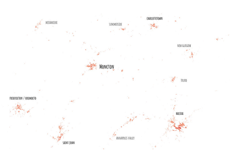
I don't deny that Moncton is in a good spot, is fairly central to the highway system, and is likely to do well in the future, though probably not just because of where it happens to be located. I think it is a good candidate for this thread (well, I think it will grow, but I don't think there will be any large cities in the Maritimes anytime soon).
However, the visualization above is a bit misleading since it doesn't indicate where the bodies of water are or where the different types of roads are. For example you can't go directly from the Annapolis Valley to Moncton and driving from PEI to Moncton costs nearly $50 in tolls.
As an exercise, where would you put the connecting lines, and what point along those lines would have half the population on one side and half on the other? Also, how much does it matter? Truro claims to be the "hub of Nova Scotia".


 Prev
Prev


 Linear Mode
