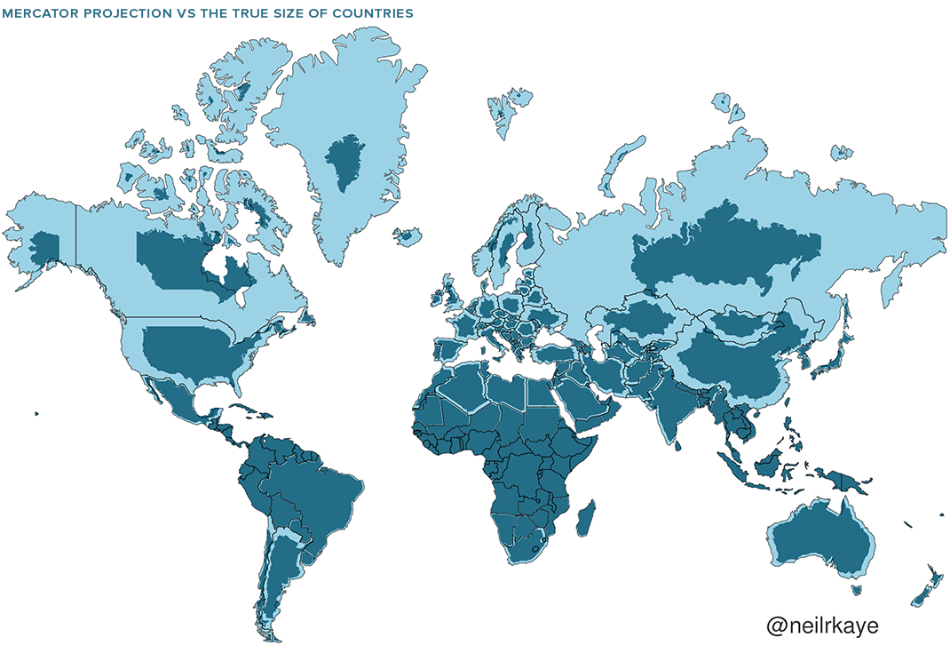
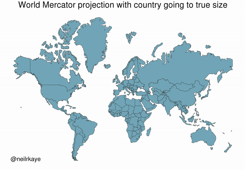
What is so special about 64 deg, 20 min west longitude?
Many people assume (rightly) that Canada is a horizontal country oriented along the long axis of the northern US border - kind of a horizontal Chile.
There is however one narrow strip in Canada where the country has some north-to-south heft:

Along a narrow strip centred at about 64 deg 20 min W, a north/south line will pass through
five Canadian provinces and one territory.

In order south to north, such a line would pass through NS, NB, PE, QC, NL and finally NU.
Neat eh........


 Prev
Prev


 Linear Mode
