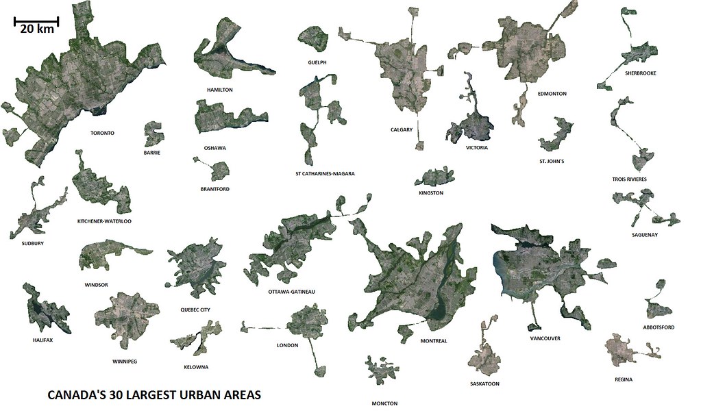
With a little more local knowledge, this is the mess you can get for St. John's, middeljohn:

This is basically all of the urban areas in the St. John's CMA. I accidentally cut out a few built-up areas, but likewise couldn't get rid of all the green space - so it evens out.
The massive white section in the centre of the city is Pippy Park. It's not just wilderness, there are campgrounds, a fluvarium, etc. But I still whited it out.
To the southwest is Conception Bay South, and in the centre are Paradise, and Mount Pearl, etc.
To the east is St. John's, Goulds, Petty Harbour-Maddox Cove, etc.
To the north is Torbay, Logy Bay-Middle Cove-Outer Cove, Flatrock, etc.
I didn't include Wabana since it's on an island off the coast.
EDIT: Just read
Cyro's post above and wanted to clarify: what you had is right, and includes just about anywhere that looks urban. The rest are, at best, subdivisions a few streets deep. Just crunched the numbers and what you circled accounts for 85% of the CMA's population, so look at all I added, and that only adds the last 15% of the people.


 Prev
Prev


 Fascinating to see the ones with bedroom communities joined by highways.


 Awesome.


 Linear Mode
