My understanding is that the buses will be running in the outside curb lanes. The outside lanes of Heron Road will be re-purposed from general traffic lanes to Bus-only lanes between Data Centre Road (Bronson on the south side) and Prince of Wales Drive. This is in the works now, I believe.
Baseline, between Prince of Wales and Navaho, will get new lanes added but I don't know the timing of those.
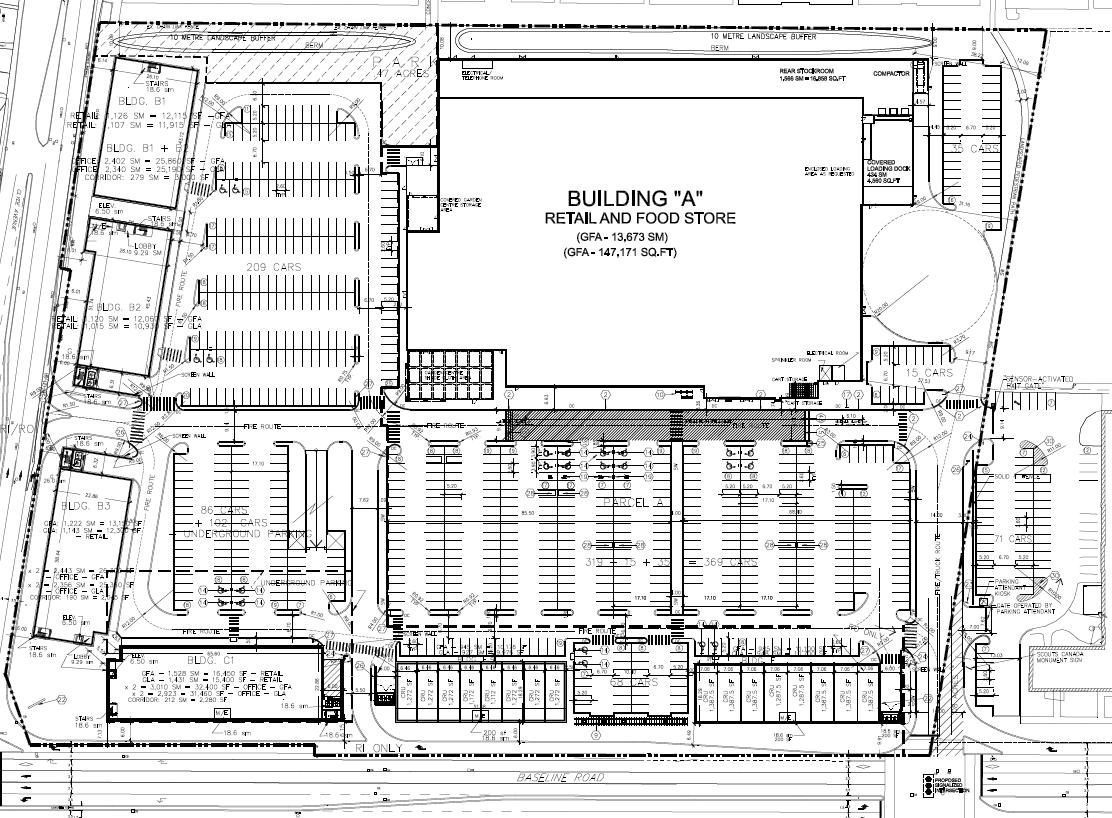
As for the short segment of Bus-only lanes shown in the site plan, I would guess that it is only across the front of that property. The Google Earth view of the area still shows the Laurentian High School (LHS)
http://maps.google.com/maps?t=h&hl=e...,0.009602&z=17 and in that view, there is a widening of Baseline for a right turn onto the property. That turn lane starts at the eastern edge of the LHS property. So we will likely pick up about 630 metres of Bus-only lane along the north side of Baseline from the Scout Shoppe almost to Henry Farm Drive.
Recall that they added a short length of Bus-only lane along the north side of Baseline where the bus turns west from the new intersection at Constellation. I have the feeling that the Bus-only lanes along Baseline will be built piece-meal until, like the Transitway, it is missing only a few crucial segments.

Of course, it is possible that since Baseline was scheduled for a re-build (delayed because of this construction) that they will take this opportunity to move back the north side curb to stretch the lane all the way to Merivale; but wouldn't they need to do an EA to make such a large change as adding a lane?


 Prev
Prev


 Linear Mode
