HomeDiagramsDatabaseMapsForum About
     

Go Back   SkyscraperPage Forum > Regional Sections > Canada


Reply

 
Thread Tools Display Modes
     
     
  #141  
Old Posted Mar 18, 2016, 1:05 AM
Dwils01's Avatar
Dwils01 Dwils01 is offline
Urban Fanactic
 
Join Date: Mar 2010
Location: Coquitlam
Posts: 3,246
Quote:
Originally Posted by Ramako View Post
Do these modded & downloaded buildings actually interact with the city like the original buildings? In other words, do sims actually live and work in them and travel to them, and do they get built or decay based on the wealth of a neighbourhood, or are they technically more like static landmarks?
Some building are just static landmards but most of them come with a static landmard version, a ploppable version that contains jobs, and a growable version. There is no residential ploppables because they will abandon so they just come as growables or static landmarks. When you download a building usually on Simtopolis or SC4Devotion. The description will say what types of buildings are in the download.
Reply With Quote
     
     
  #142  
Old Posted Mar 30, 2016, 4:39 PM
Dwils01's Avatar
Dwils01 Dwils01 is offline
Urban Fanactic
 
Join Date: Mar 2010
Location: Coquitlam
Posts: 3,246
Today we follow Highway 550 through the western edge of the Sault Ste. Marie CMA. We will go from the southern point of the peninsula to the northern point.

This is the town of Gros Cap the southern tip is where the St. Mary's River meets up with Lake Superior. The communities here are narrow because they are grown between the Lake and the hillside. Gros Cap is home to 10,465 people.


This is where the highway begins in Gros Cap.


Following the highway north the town of Gros Cap turns into the town of Round Rock. Round Rock is home to 5,207 people.


The highway leaves the urban area and travels through the hillside for 12km before we reach the urban area of Red Rock. Midway between the two towns, we reach their boundaries at this curve shown below.


Just south of this picture is one of the four roads going to the Prince Wind Farm. After a 12km trip through the wilderness, you end up in the town of Red Rock where Goulais Bay and Lake Superior meet. Red Rock is home to 15,405 people.


This is the town of Red Rock situated next to the City of Goulais Bay which is the high-tech capital for the region.


Downtown Red Rock.


On top of the hill where the highways curves around is the Prince Wind Farm. It has 200 wind turbines which generate 216MW of power for the region. This is the freight station where the smaller parts of the wind turbines are delivered will the tower pieces and blades are brought up here by transports.


Reply With Quote
     
     
  #143  
Old Posted Apr 14, 2016, 1:10 AM
Dwils01's Avatar
Dwils01 Dwils01 is offline
Urban Fanactic
 
Join Date: Mar 2010
Location: Coquitlam
Posts: 3,246
Today's update is some of the cities in the northern part of the Sault Ste. Marie CMA.

The city of Heyden is home to 21,395 people.


Heyden's industrial areas.


Heyden's downtown area.


The City of Searchmont is home to 62,395 people.


Searchmont industrial area and railyard.


Searchmont Resort and ski hill.


This is the eastern suburbs of the city of Goulais River. Going from south to north.


One of five commuter train station in the city of Goulais River.


Goulais River to be continued later.
Reply With Quote
     
     
  #144  
Old Posted Apr 14, 2016, 2:54 PM
harls's Avatar
harls harls is offline
Mooderator
 
Join Date: Jan 2002
Location: Aylmer, Québec
Posts: 19,699
Haha..

"Sewnami"


Video Link
Reply With Quote
     
     
  #145  
Old Posted Apr 14, 2016, 4:36 PM
MolsonExport's Avatar
MolsonExport MolsonExport is offline
The Vomit Bag.
 
Join Date: Oct 2003
Location: Otisburgh
Posts: 44,909
^i just started playing CS, but I hate the interface.
__________________
The whole problem with the world is that fools and fanatics are always so certain of themselves, and wiser people so full of doubts. (Bertrand Russell)
Reply With Quote
     
     
  #146  
Old Posted May 7, 2016, 7:01 PM
Dwils01's Avatar
Dwils01 Dwils01 is offline
Urban Fanactic
 
Join Date: Mar 2010
Location: Coquitlam
Posts: 3,246
This is the City of Goulais River. We saw the eastern portion of the city last time but these are the main areas. It's home to 293,000 people. It has a small downtown but it's mainly a suburban commuting city. The city has a height limit of ten floors for commercial buildings except in the downtown area. There is only low density residential zoning allowed in the city except for the downtown area and around transit stations were the height limit is 16 floors.

Downtown Goulais River.


An overview of the southern area of Goulais River.


An overview of the northern (central) area of Goulais River.


Reply With Quote
     
     
  #147  
Old Posted May 13, 2016, 6:28 PM
Dwils01's Avatar
Dwils01 Dwils01 is offline
Urban Fanactic
 
Join Date: Mar 2010
Location: Coquitlam
Posts: 3,246
Some overviews of the city of Goulais Bay.
Southwest Goulais Bay.


Continuing north we get to South Goulais Bay.


From the top of the last pic going west we get to the Goulais Bay Islands.


Going north from the first island we get to the second and third islands.


Close up on the islands.


Reply With Quote
     
     
  #148  
Old Posted May 27, 2016, 1:01 AM
Dwils01's Avatar
Dwils01 Dwils01 is offline
Urban Fanactic
 
Join Date: Mar 2010
Location: Coquitlam
Posts: 3,246
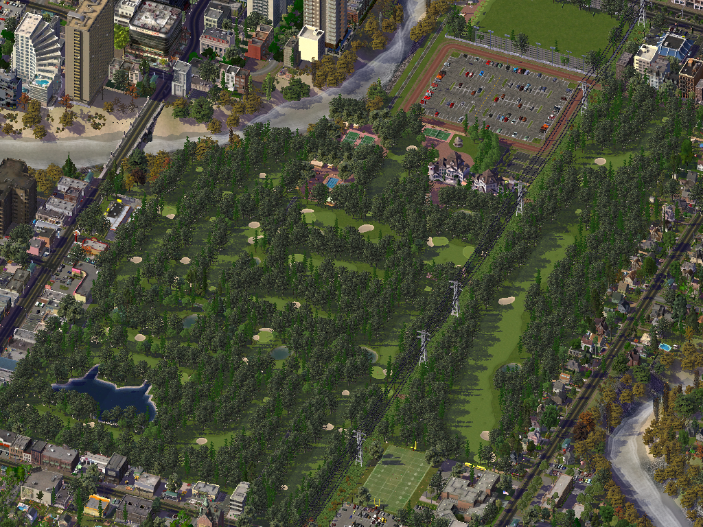
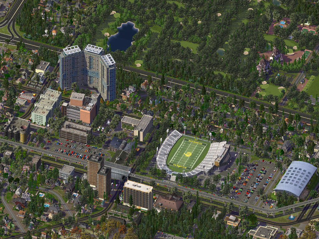
Goulais River Golf and Country Club.


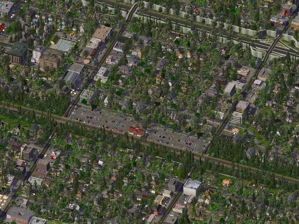
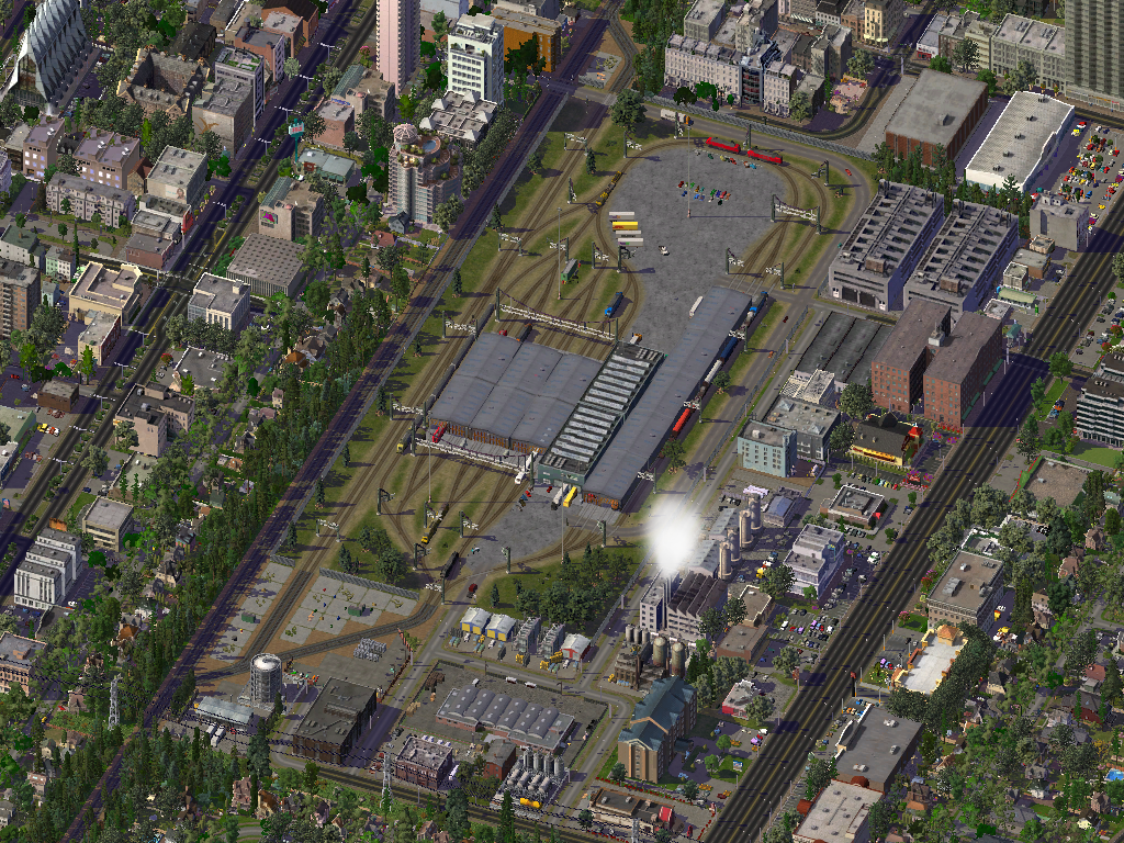
Some commuter train stations in Goulais Bay.


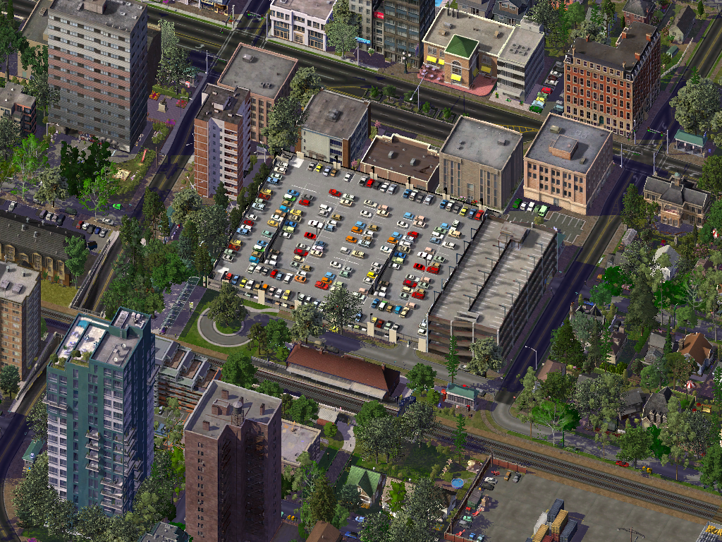
One of four commuter train maintenance facilities in the region.


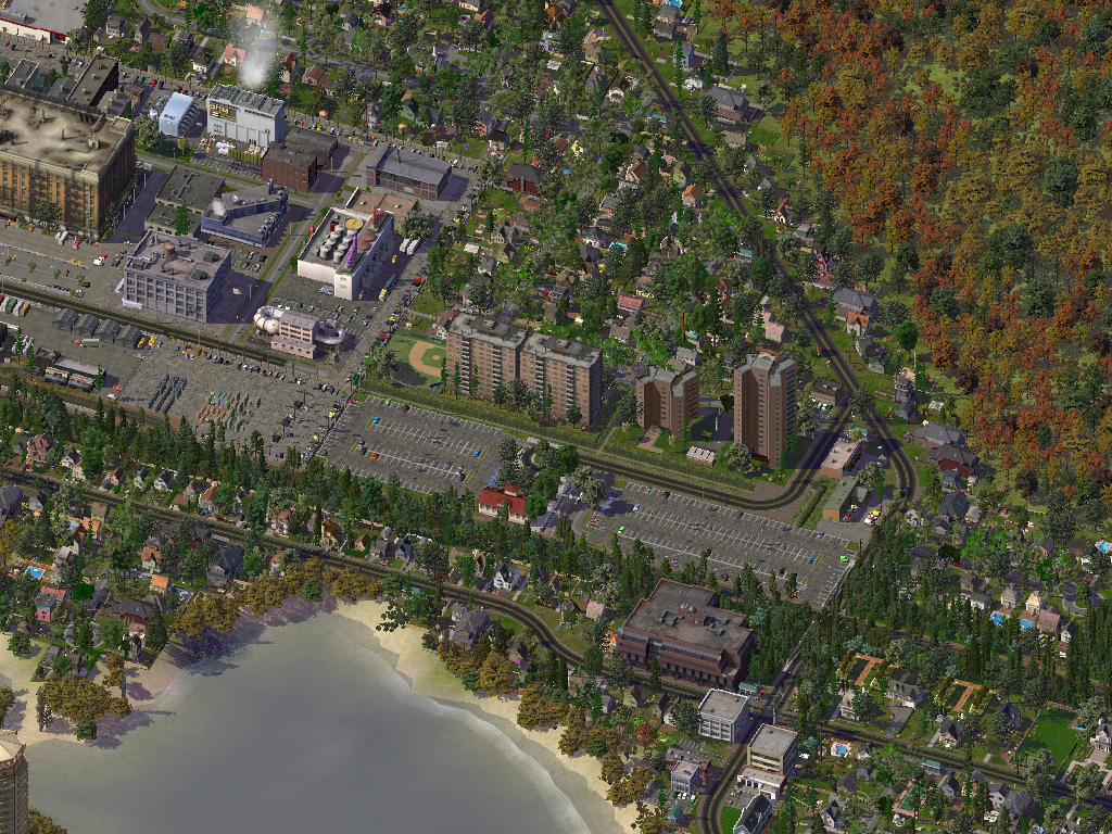
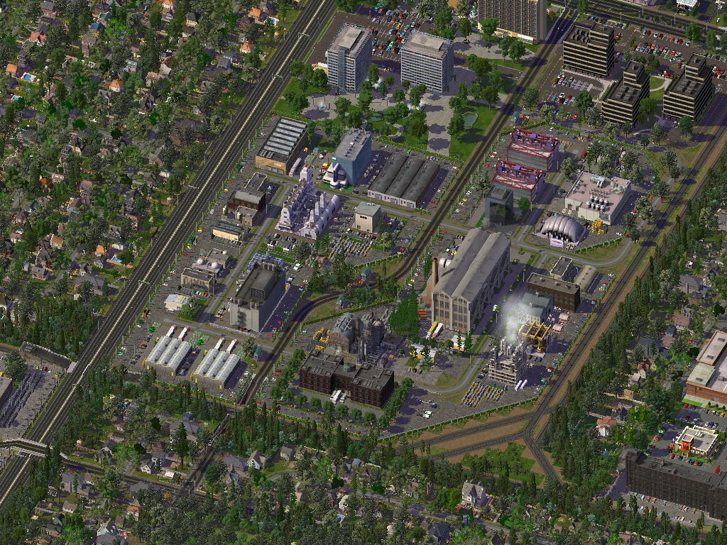
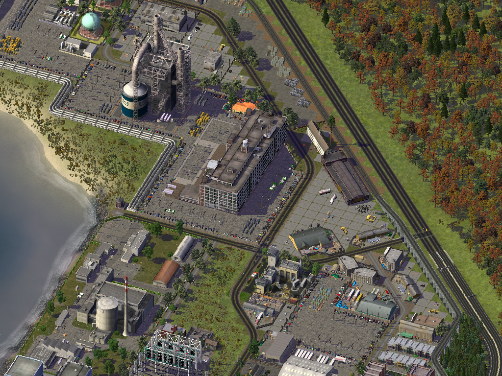
Some industrial areas in Goulais Bay.
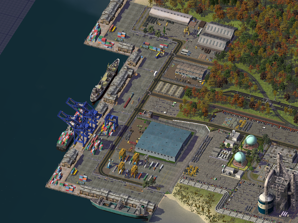


Goulais Bay Port.


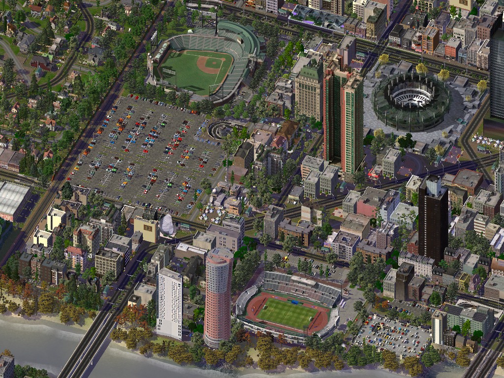
Apple Field (Bottom), and Microsoft Field (Top).


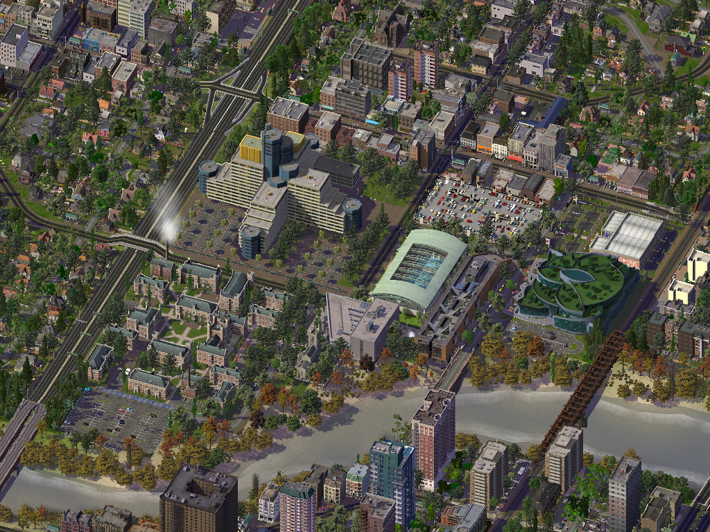
Sault College Goulais Bay Campus.


Clergue University.


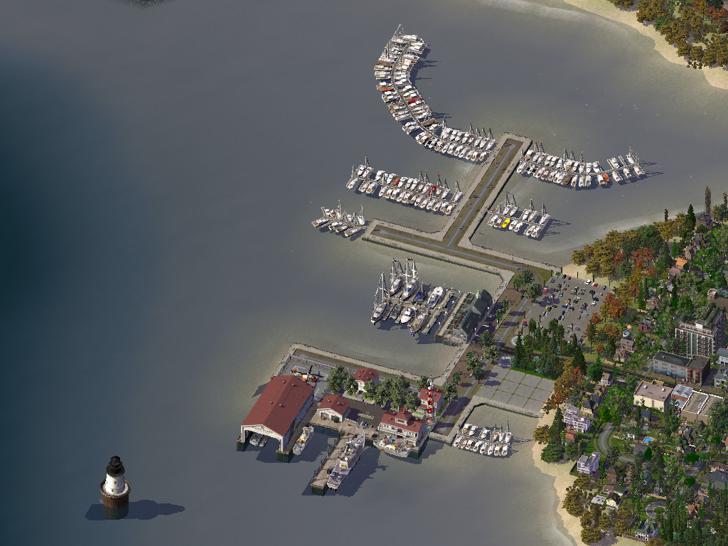
Goulais Bay Marina and Coast Guard Station.


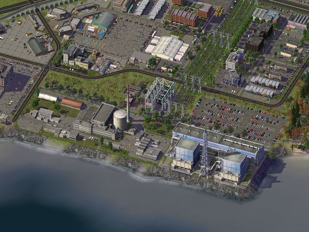
Cloverland Nuclear Power Plant. Currently it's the only one in the region but a second one is being built to replace the ten coal power plants in the region.


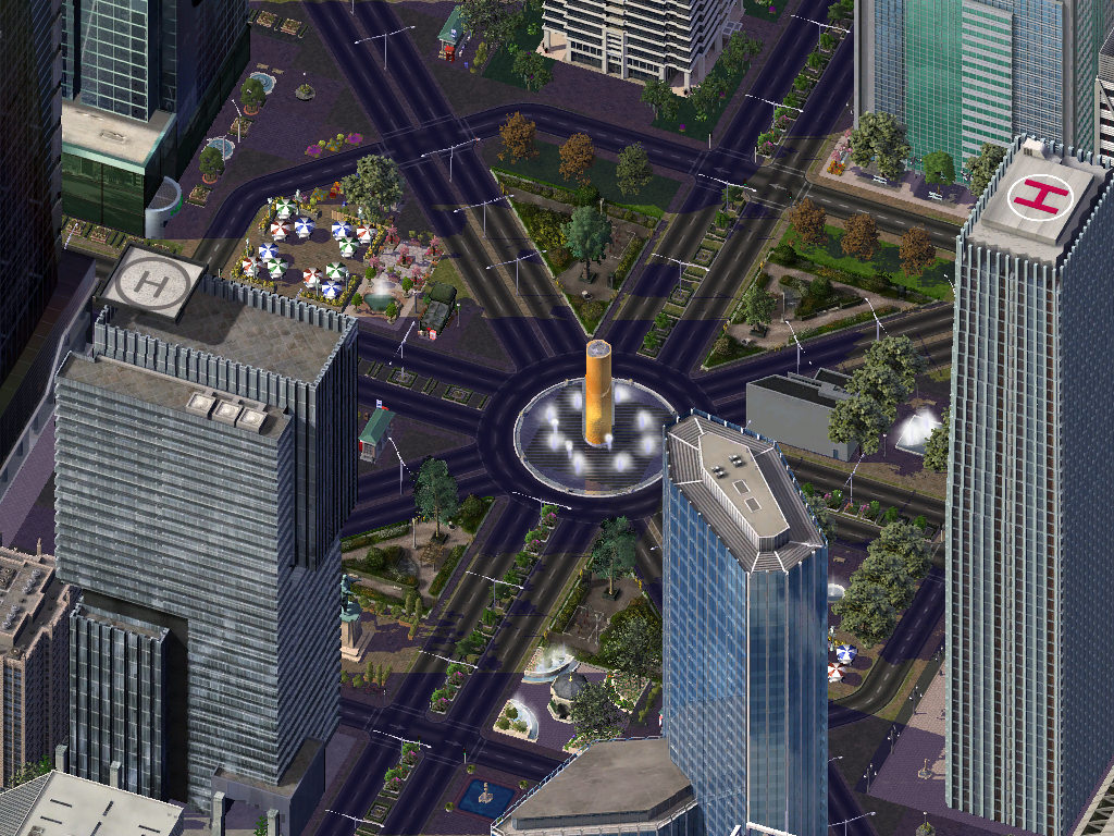
An eight way roundabout...


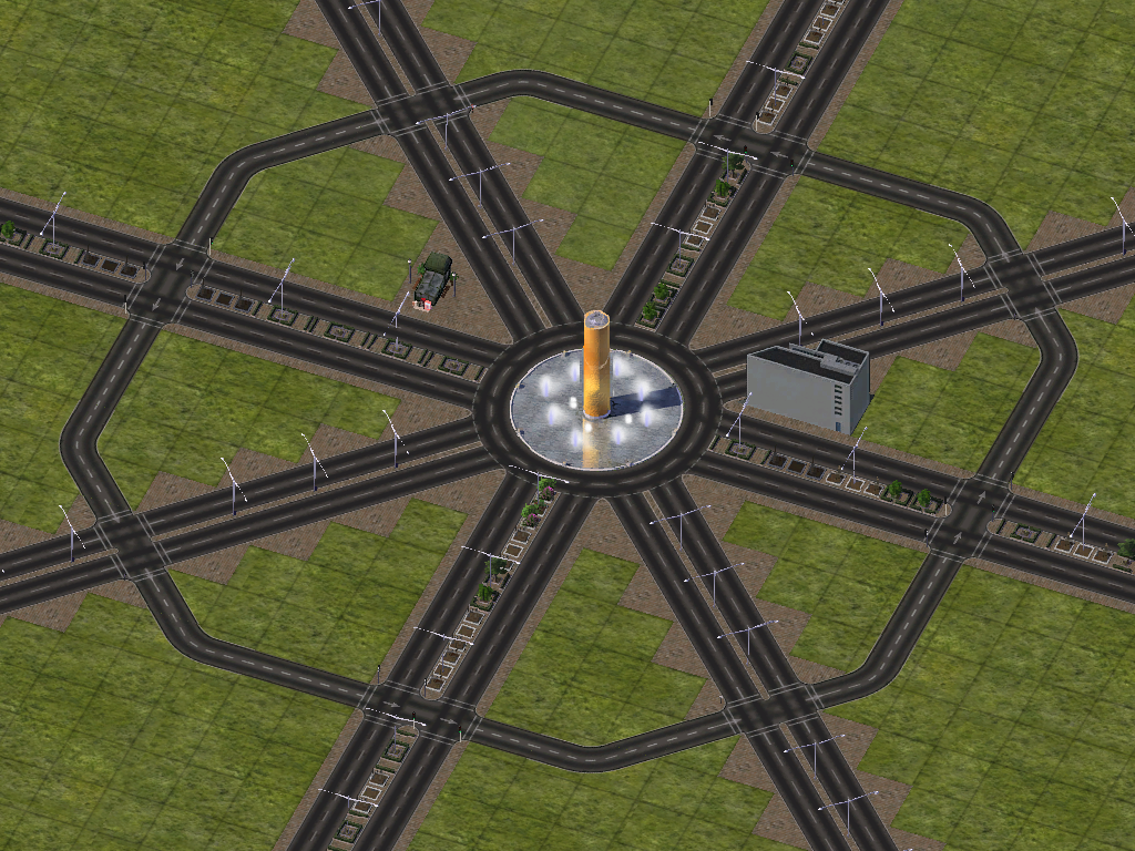
turns into the centre of downtown Goulais Bay.


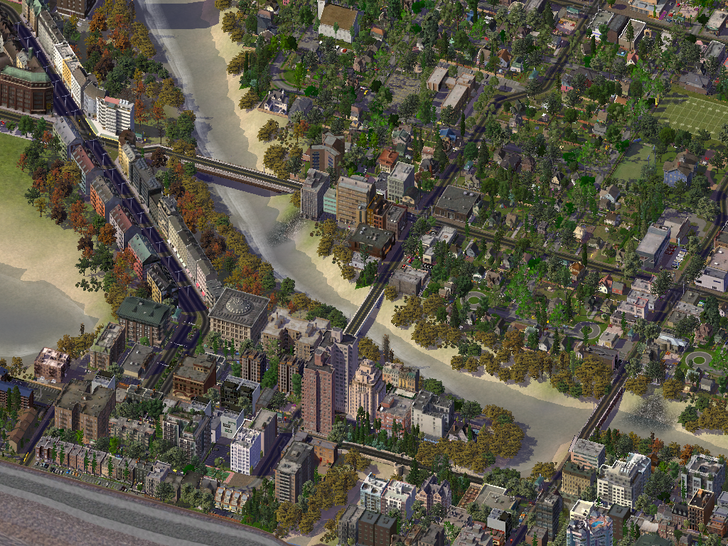
Some districts in Goulais Bay.
The Islands District.


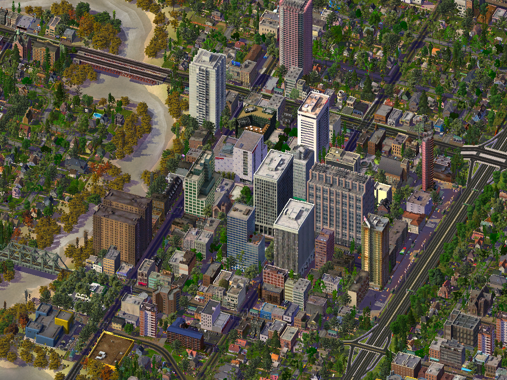
The Uptown District.


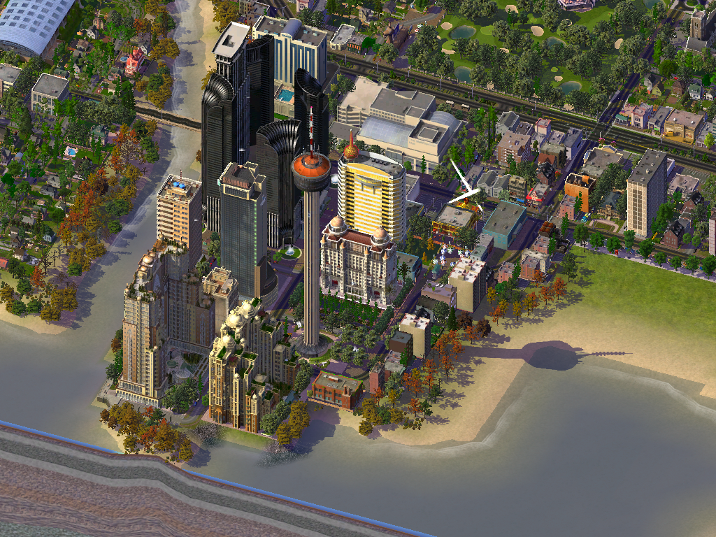
The Entertainment District which has many hotels and casinos, a mall, a golf course, a beach, restaurants, nightclubs, and an observation tower.
Reply With Quote
     
     
  #149  
Old Posted May 27, 2016, 1:14 AM
Dr Awesomesauce's Avatar
Dr Awesomesauce Dr Awesomesauce is offline
Registered User
 
Join Date: Jan 2010
Location: BEYOND THE OUTER RIM
Posts: 5,889
Awesome but why design a city with surface parking, elevated highways and commie blocks? Shouldn't the idea be to improve upon what we already have?

I suppose that's up to the designer...
Reply With Quote
     
     
  #150  
Old Posted May 27, 2016, 1:40 AM
Loco101's Avatar
Loco101 Loco101 is offline
Registered User
 
Join Date: May 2013
Location: Timmins, Northern Ontario
Posts: 7,710
I love the maps of the areas around Sault Ste. Marie!!! Gros Cap, Prince Wind Farm, etc.!!! LOL I've spent a lot of time at Pointe-des-Chenes as my Grandparents lived there and my Mom is originally from the Sault.
Reply With Quote
     
     
  #151  
Old Posted May 27, 2016, 2:11 AM
Dwils01's Avatar
Dwils01 Dwils01 is offline
Urban Fanactic
 
Join Date: Mar 2010
Location: Coquitlam
Posts: 3,246
I'm like to have a mix of different things in my cities. I'm going for a more realistic real world approach than a move futuristic type of city building.

The Sault map does have some interesting features to work around and the Pointe-des-Chenes area is one of the few spots that I have to still work on.
Reply With Quote
     
     
  #152  
Old Posted May 30, 2016, 7:19 PM
Dwils01's Avatar
Dwils01 Dwils01 is offline
Urban Fanactic
 
Join Date: Mar 2010
Location: Coquitlam
Posts: 3,246
Downtown Goulais Bay
Old Downtown


Goulais Bay is the Tech Hub for the region and has many companies headquarted here.
Starting from the top right and going clockwise around: Intel, Sony, Microsoft, Dell, Samsung, LG Electronics, Toshiba, and Apple.


A dark, gloomy, and rainy day over downtown.


Entertainment District at Night.


Downtown at night.


Goulais Bay at night.


Some overviews of the city of Goulais Bay. Population of the city is. 346,033.


Reply With Quote
     
     
  #153  
Old Posted Aug 17, 2016, 2:21 AM
Dwils01's Avatar
Dwils01 Dwils01 is offline
Urban Fanactic
 
Join Date: Mar 2010
Location: Coquitlam
Posts: 3,246
After a little break I made the northern part of a few cities.
Northern Sunset Point.


Northern Sault Ste. Marie.


Reply With Quote
     
     
  #154  
Old Posted Sep 12, 2016, 3:18 AM
Dwils01's Avatar
Dwils01 Dwils01 is offline
Urban Fanactic
 
Join Date: Mar 2010
Location: Coquitlam
Posts: 3,246
Grandview Gardens Shopping Plaza in East Sault Ste. Marie.


An overview of some farming areas on Sugar Island, Sugar Village along the St. Mary's River and Hiawatha in the top left.


East Sault Ste. Marie (bottom left), West Cambrian (top left), Hiawatha (top right), and Sugar Village (bottom right).


More of East Sault Ste. Marie.
Reply With Quote
     
     
  #155  
Old Posted Sep 23, 2016, 3:39 PM
Dwils01's Avatar
Dwils01 Dwils01 is offline
Urban Fanactic
 
Join Date: Mar 2010
Location: Coquitlam
Posts: 3,246
Sault Ste. Marie Golf and Country Club.


Sunset Point Golf and Country Club.


An industrial area in east Sault Ste. Marie.


Some industrial areas in Sunset Point.


Downtown Sunset Point.


An overview of south Sunset Point.


Central Sunset Point. City population: 74,800.


Reply With Quote
     
     
  #156  
Old Posted Oct 10, 2016, 4:36 AM
haljackey's Avatar
haljackey haljackey is offline
User Registered
 
Join Date: Apr 2010
Location: London, Ontario
Posts: 3,205
I made a connection

__________________
My Twitter

My Simcity Stuff
Reply With Quote
     
     
  #157  
Old Posted Nov 15, 2016, 2:51 PM
Dwils01's Avatar
Dwils01 Dwils01 is offline
Urban Fanactic
 
Join Date: Mar 2010
Location: Coquitlam
Posts: 3,246
One of Quigley's industrial areas.


Sault College Quigley Campus.


Quigley sport facilities.


Quigley Marina.


Meridian Park in downtown Quigley.


Cliffside Park, the biggest park in Quigley.


The densest neighbourhood in Quigley.


A typical downtown block in Quigley.


Downtown Quigley.


An overview of Quigley. The city of Quigley is home to 287,384 people.


Quigley and Pointe Des Chenes across the river.
Reply With Quote
     
     
  #158  
Old Posted Jan 28, 2017, 9:07 PM
Dwils01's Avatar
Dwils01 Dwils01 is offline
Urban Fanactic
 
Join Date: Mar 2010
Location: Coquitlam
Posts: 3,246
Downtown Prince.


An overview of Prince Township with a population of 35,518.


Some industrial areas in Pointe Des Chenes.


The area around Sault Ste. Marie International Airport.


The Marnia District in Pointe Des Chenes.


The Hotel District for the airport.


An overview of Pointe Des Chenes with a population of 87,720.


Reply With Quote
     
     
  #159  
Old Posted Feb 4, 2017, 1:27 AM
TownGuy's Avatar
TownGuy TownGuy is online now
Registered User
 
Join Date: May 2013
Location: Cobourg, ON
Posts: 3,070
Highly realistic!
Reply With Quote
     
     
  #160  
Old Posted Feb 4, 2017, 12:21 PM
DrJoe's Avatar
DrJoe DrJoe is offline
Registered User
 
Join Date: Aug 2002
Location: TO, ON
Posts: 2,626
Those look great dwils. It's been awhile since I've play Simcity.
__________________
*
Reply With Quote
     
     
This discussion thread continues

Use the page links to the lower-right to go to the next page for additional posts
 
 
Reply

Go Back   SkyscraperPage Forum > Regional Sections > Canada
Forum Jump


Forum Jump


All times are GMT. The time now is 11:10 AM.

     
SkyscraperPage.com - Archive - Privacy Statement - Top

Powered by vBulletin® Version 3.8.7
Copyright ©2000 - 2024, vBulletin Solutions, Inc.