Walking down stairs at U.N. police station. Front- Eve Miller followed by- Dorothy Guay and Cecilia Fargo. Eve certainly held her head up high. Doesn't look ashamed at all.
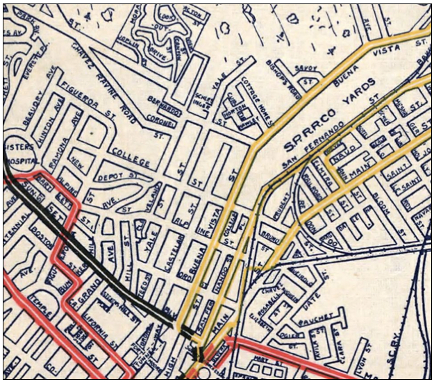
This link will take you to a very good zoom-able, scroll-able Map of L.A. from 1906. It's actually a rail line map but has excellent detail of streets and other features.
In honor of some recent weather: even Hollywood can get tornado's: Tornado hits Hollywood (north), 01 April 1958. Mrs. Ertha Lomtodze; Mrs. Dorothy Jeschke; General view of damage.
The following are from tornado, Normandie and 130th Street. 40: Jim Staten and Jess Ruby pick up bricks from wall blown over by the mild tornado. Ruby's trailer was lifted by the wind and slammed against the wall. 45: Mrs. E.B. Gravette peeks through debris in search of some of the items contained in the garage. 46: General view of east end of garage. 77-78: General view of garage moved by tornado, with Mrs. E.B. Gravette in background, her husband in wheel chair in foreground. Stove in picture shows relative position of where garage originally stood. 83-84: Mrs. E.B. Gravette view damage. Note garage wall in foreground, 150 feet from garage".
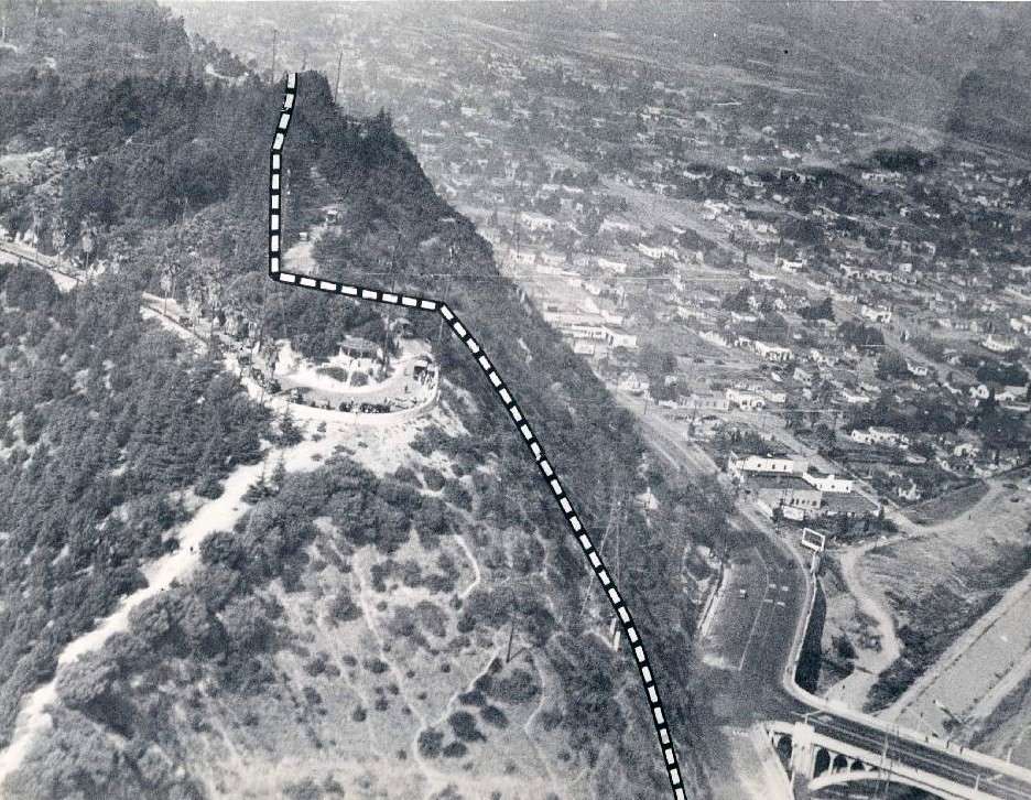
Here's an associated press photograph I found the other day on ebay. I am confused by the circular 'lookout' area that's located
just to the left of the dotted line (a probable landslide area).
found on ebay
above: Does anyone know the name of this 'turnabout' lookout area?
below: The information on the reverse side of the associated press photograph doesn't mentioned this 'lookout' point.
ebay
___
Last edited by ethereal_reality; Apr 9, 2012 at 4:20 AM.
Here's an associated press photograph I found the other day on ebay. I am confused by the circular 'lookout' area that's located
just to the left of the dotted line (a probable landslide area)...
___
Hmm, that's a toughie. Thought I could nail it without too much trouble but I've been staring at various maps for a while now, and still not sure. My best guess is Grand View Drive, where it doubles back, overlooking the Figueroa St. bridge. (Or maybe it was called Dayton Ave. at the time?) Figueroa/Dayton's alignment doesn't quite seem to match the photo, but the junctions around there were reorganized several times. Anyone else?
Here's an associated press photograph I found the other day on ebay. I am confused by the circular 'lookout' area that's located
just to the left of the dotted line (a probable landslide area).
found on ebay
above: Does anyone know the name of this 'turnabout' lookout area?
below: The information on the reverse side of the associated press photograph doesn't mentioned this 'lookout' point.
ebay
___
That was an incredible landslide... I think I read somewhere there was a water main break that caused the slide. But that may have been another event in the same location a few years later.
In November, 1937, a landslide of large proportions took place in Elysian Park near Riverside Drive and Dayton Avenue. Because this earth movement occurred in a residential area close to the downtown district, it
attracted national attention and received a great deal of publicity in newspapers throughout the country. This slide crushed the Crystal Springs conduit which feeds the Buena Vista Reservoir, and a portion of the 40·inch
main conduit siphon feeding into the Elysian Park Reservoir. Both of these reservoirs supply water to the downtown business area, as well as to a portion of the residential district. Our construction forces responded
to the emergency in their customary prompt manner by laying a 30·inch main around the slide area, and water was again flowing into the Buena Vista and Elysian Park Reservoirs within 48 hours after the catastrophe, and
without any inconvenience to consumers.
I think westcork and 3940dxer have the location correct.
On the 1906 railroad map (recently provided by 3940dxer, thank you) you can see Dayton Drive (I circled it) coming to a dead end at the scene of the slide.
Grand View Dr was called Baxter St. back then.
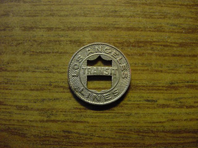
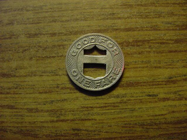
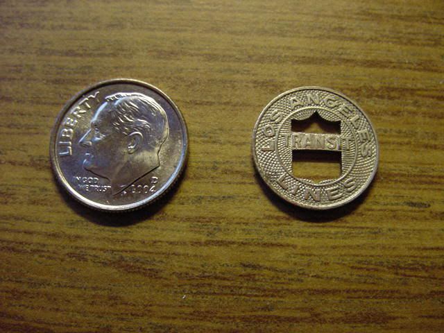
Here are a couple pictures of my Los Angeles Transit token, given to me by my Grandmother, I thought some of you might like to see what it looks like. She used to live in Highland Park and ride the streetcar to work in downtown Los Angeles. She saved this for years and years and gave it to me about 8 years ago. She was riding the rails in the 30s and 40s, so i'd imagine this is from the 1940s.
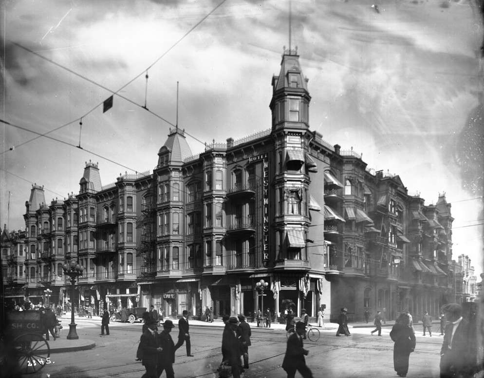
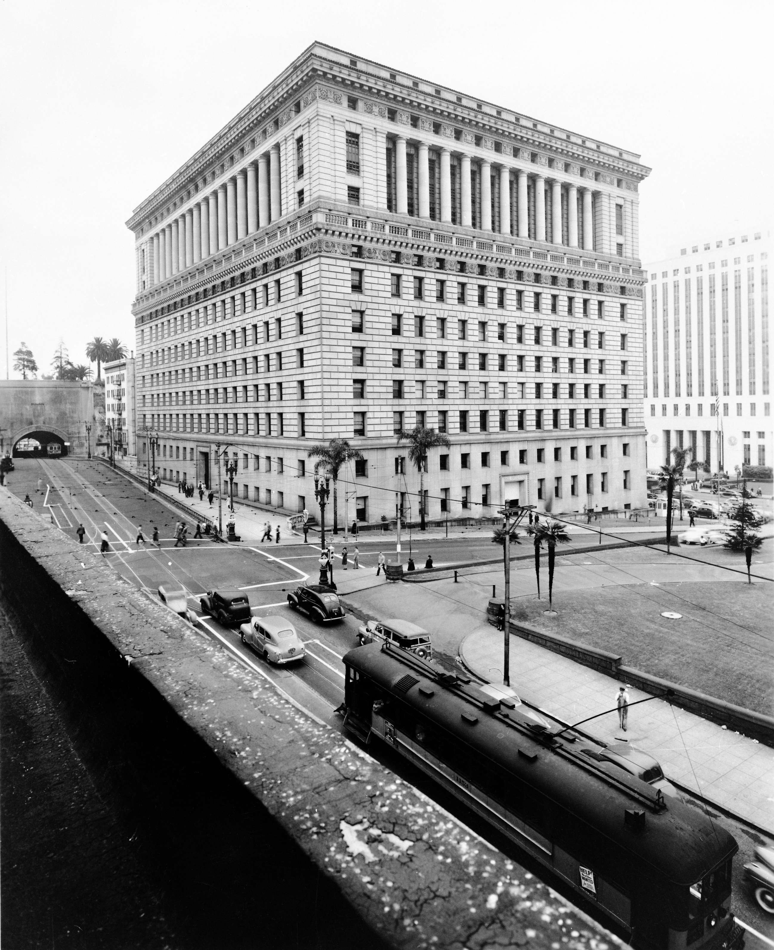
above: The sheer size of this building tells me that there must have been a light court in the center. Does anyone know?
I'm going to dig up some aerials and see what I can find out.
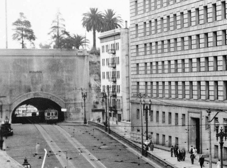
below: I've never noticed this building 'squeezed' between the Hall of Justice and the tunnel.
calisphere detail
They tore down the last remaining walls of the rear building last week.
Thanks for placing 'Grand View Point' David/3940dxer, westcork and FredH. Little mysteries like this are always fun to solve
...more fun when I solve it.
Really? I'm surprised. Did you read this somewhere or see it in action? -just curious.
Witnessed it for myself as I walked past. They had a number of heavy equip knocking down the walls, pounding them to smaller bits then hauling it away.


 Prev
Prev


 Wow...that map is great! Thanks David.


 Linear Mode
