First off, glad to see my drawings made it over here. Thank you @
TorontoDrew for posting them, very much appreciated, and feel free to continue to doing so! (I'm rarely on SSP anymore, nothing personal, just way too much happening over on UT as is).
To those unaware, the original thread where these graphics are regularly posted is here:
https://urbantoronto.ca/forum/posts/1295373/
High resolution versions are all located here:
http://flickr.com/stevevephotostream
Quote:
Originally Posted by Biff

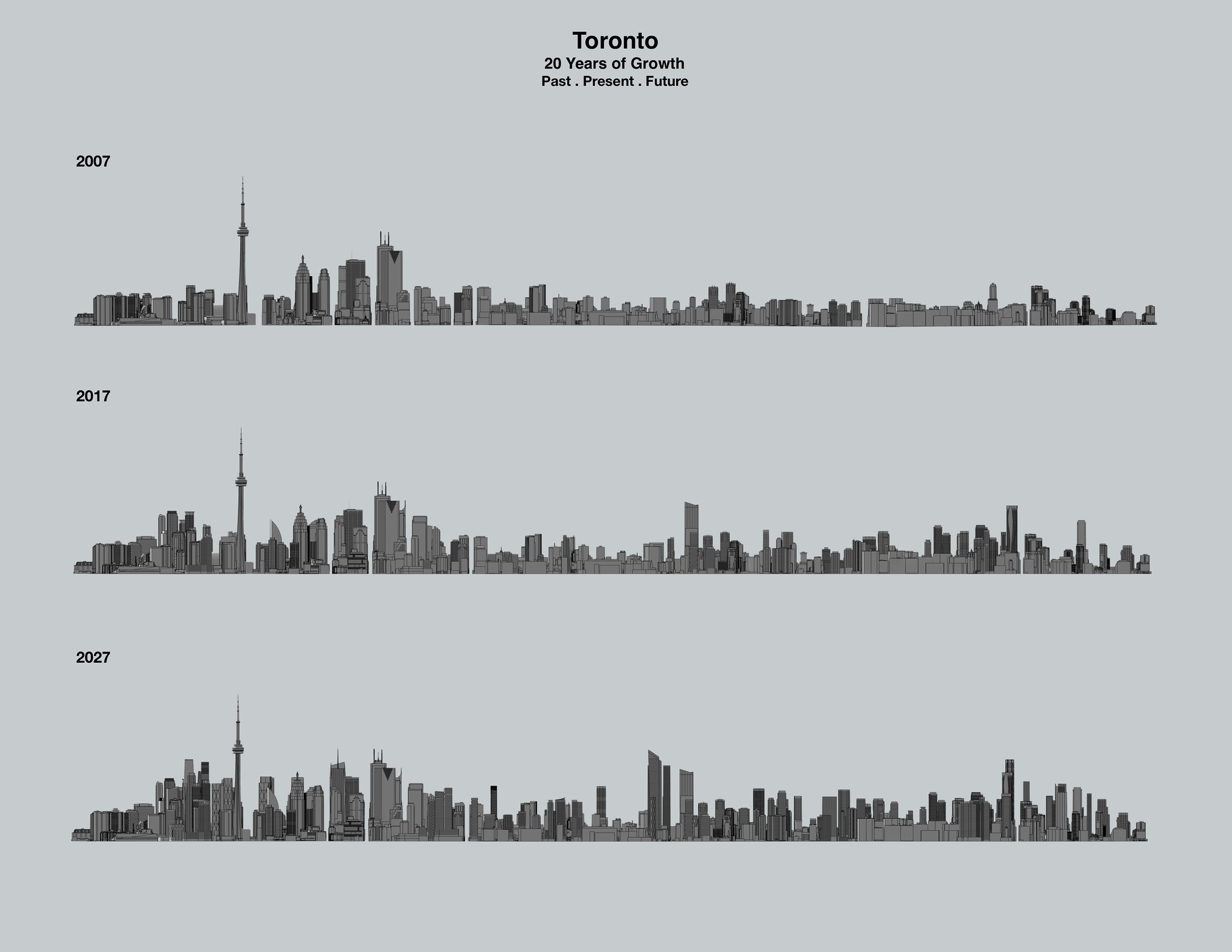
Very cool. 2027 view from the east really resembles Chicago from the lake to me.
The CBD resembles the Sears Tower peak (minus the CN Tower), the area around Aura resembles the Trump Tower/Chicago River area and the area with The One reminds me of the Hancock Peak.
|
Quote:
Originally Posted by DrNest
I'm not sure what it is exactly, but I kinda found it underwhelming.
Maybe because I've spent a lot of time in New York and am subconsciously comparing the density and bulk of downtown and midtown with these images.
Sure, there's a lot of tall buildings in Toronto, but I can't but help feel it's also lacking some oomph too.
|
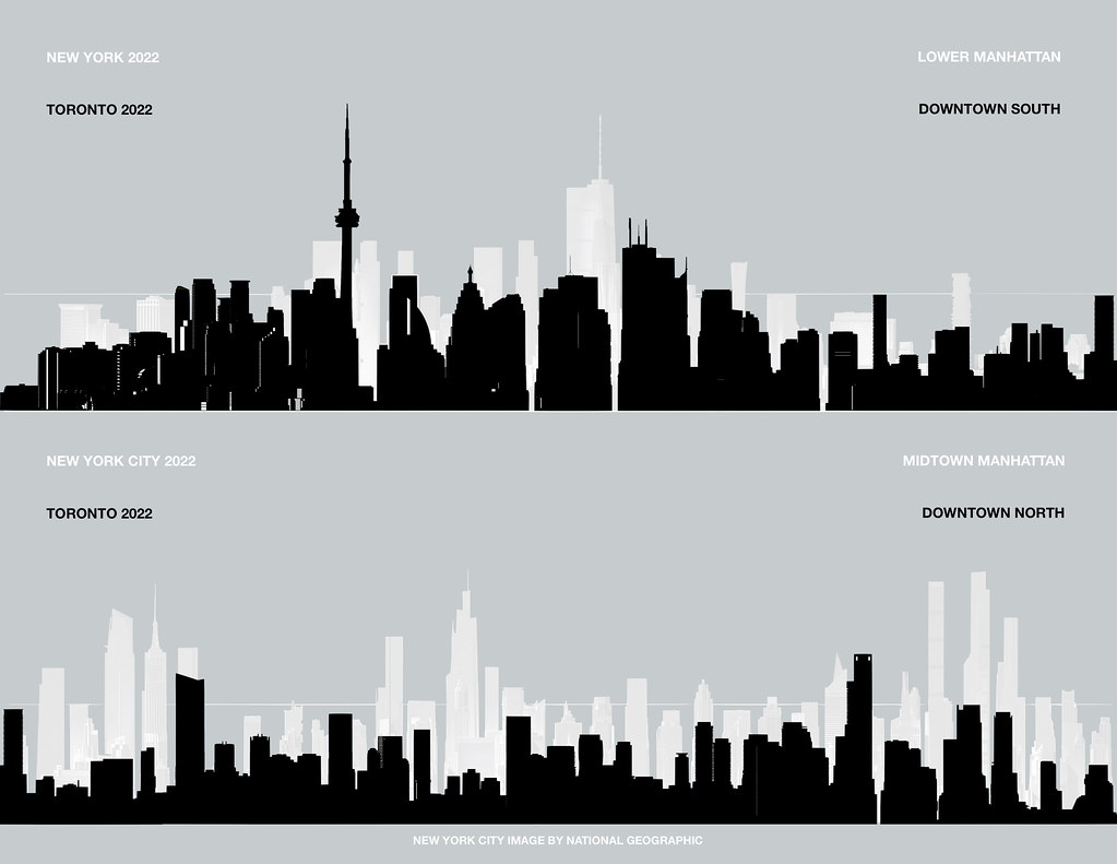
Personally, I see more indirect parallels to the Manhattan skyline (although Manhattan is on another level). Scale-wise we're definitely more Chicago though.
Yorkville/The One cluster is our 57th Street.
Aura/YSL is our Hudson Yards/Empire State peak.
CN Tower/CBD is our Lower Manhattan/1WTC peak.
Funny because I drew this exact comparison in December:
*Height is relatively accurate, but New York is compressed on the horizontal axis approx 25% (distance) and also taken out of context.
Quote:
Originally Posted by caltrane74
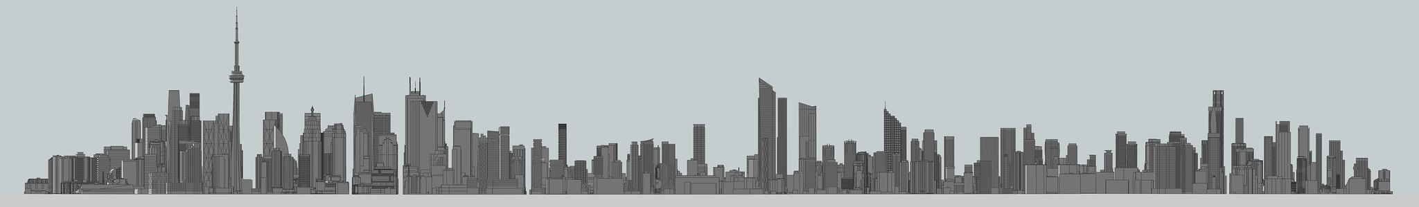
The concentration of towers in Southcore, Gerrard/Yonge and Yorkville is overwhelming.
415 Yonge is not in the rendering?
|
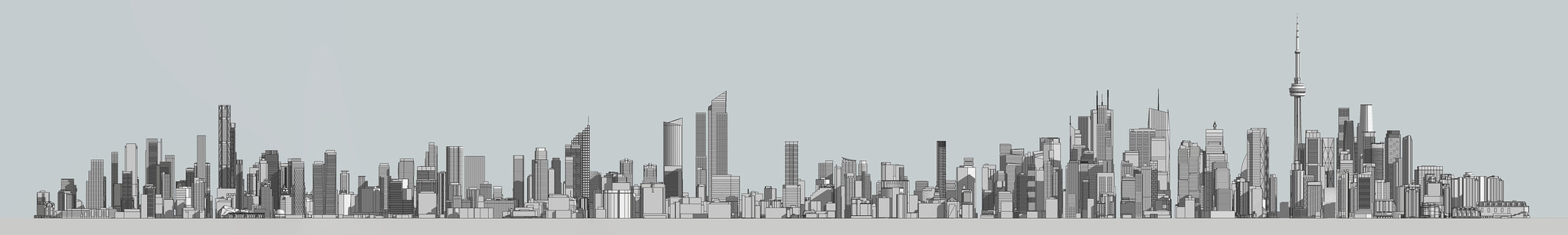
Here's the updated 2028 view with 415 Yonge + others:


 Prev
Prev


 Linear Mode
