Quote:
Originally Posted by Metro-One

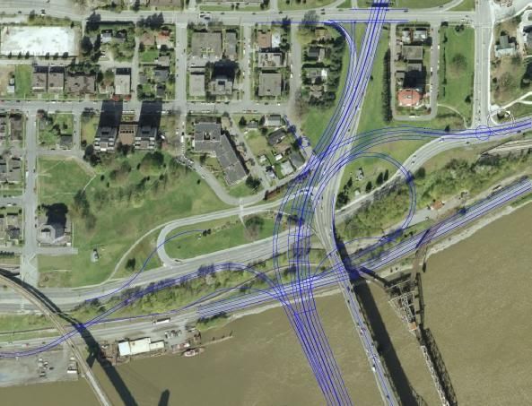
If Translink is smart they will develop the south side approach similar to how they built the GEB, with extensive use of viaducts. It could free up some land for industrial / park and ride use.
Essentially, there is no need for the roadway to land on the river flats, it should be elevated straight to the escarpment.
With a price tag of 800 million to 1 billion, one would think something along these lines may be in the plans? (I believe the entire Golden Ears project, including all of the roadways built / modified (over 15km worth) cost less than 900 million)
|
First of all, Scott Road is big enough, I don't know if there is demand to expand that park and ride lot, especially with the 202 Street being built in the next several years.
I like the viaduct idea definitely. I just want a full interchange with the SFPR, with no left turns anywhere.
In relation to the Golden Ears Bridge, the only problem I have with the Pitt Meadows side is the fact you have to turn left at a signalized intersection when coming off the bridge and you want to head west on Lougheed Highway. Don't know why they couldn't have put a loop ramp instead (it looks like it's just greenspace)
Not a big deal, definitely have more problems with it on the Langley side anyways.
I like the idea of a viaduct to be honest. to meet somewhere on King George Blvd just east of 128 Street. I think aligning it on 112A Avenue would be the best, with preservation of the existing King George Blvd to access Scott Road up to the merge point.


 Prev
Prev


 Linear Mode
