Quote:
Originally Posted by SF Thomas

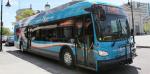
I am wondering the same thing as 1overcosc, how they are going to implement it since the preferred plan calls for median bus lanes. In particular I am curious about how it will work since all of the current buses in Ottawa only have doors that open on the right (the normal curb side).
I see three potential options:
1. Buy a set of buses with doors on both sides exclusively for the Baseline route, though this makes it harder to ensure there are enough buses for the route in the event of mechanical failures or if there is a need for a service frequency increase.
|
If the buses have doors on both sides, you would loose a lot of seats. It would also make it harder for buses from other routes to use the busway. Given those limitations, you would be just as well off going with LRT.
Quote:
|
2. Have the median bus lanes run side by side and two individual island platforms at each stop by the traffic lights. The problem here is that the platforms may end up being very thin, which could either limit the number of people that can be at a bus stop or end up being a bit of a safety hazard for people.
|
You can see an image of how they are planning on handling this in Montreal at
TVA Nouvelles. The platforms are staggered, so each platform can be full width. The buses need to swerve a bit, but being near a station, they will be traveling slowly.
Quote:
|
3. Less likely than the other two; have buses go the opposite direction from traditional traffic flow. Theoretically should not be a problem if the bus lanes are segregated but would probably require a physical barrier to prevent collisions with cars. This may be awkward for bus drivers to get used to and might be a minor issue at traffic lights since people wouldn't be used to checking for buses going the "wrong way".
|
A possibility, but it would cause confusion. I think option 2 with staggered stations is most likely.


 Prev
Prev


 Linear Mode
