HomeDiagramsDatabaseMapsForum About
     

Go Back   SkyscraperPage Forum > Regional Sections > Canada > Ontario


Reply

 
Thread Tools Display Modes
     
     
  #201  
Old Posted Apr 12, 2015, 2:03 PM
BenTheGreat97's Avatar
BenTheGreat97 BenTheGreat97 is offline
Registered User
 
Join Date: Sep 2013
Location: Ottawa
Posts: 165
Quote:
Originally Posted by 1overcosc View Post
Neat way to distribute traffic evenly.

Those signs are popping up all over, there's a bunch that went up in Ottawa on the 417 not too long ago.
They took around a year to get up and running though, and now that they're on, all I ever see them display is "drive sober".
__________________
Check out my Flickr photostream!
http://www.flickr.com/photos/photosbybensenior/
Reply With Quote
     
     
  #202  
Old Posted Apr 12, 2015, 2:14 PM
sonysnob sonysnob is offline
Registered User
 
Join Date: Aug 2011
Posts: 1,657
Quote:
Originally Posted by BenTheGreat97 View Post
They took around a year to get up and running though, and now that they're on, all I ever see them display is "drive sober".
The MTO just opened a new COMPASS facility on Arrow Road in Toronto, with the hope of consolidating some of their regional operations. I am not sure, but I suspect that some of the delays bringing their new signs into operation may have been related to their new facility and associated upgrades.
Reply With Quote
     
     
  #203  
Old Posted Apr 12, 2015, 5:24 PM
1overcosc's Avatar
1overcosc 1overcosc is offline
Registered User
 
Join Date: Jun 2013
Location: Kingston, Ontario
Posts: 11,482
Quote:
Originally Posted by BenTheGreat97 View Post
They took around a year to get up and running though, and now that they're on, all I ever see them display is "drive sober".
Seriously? (I don't drive anymore so I haven't got the chance to ever see them). Kind of a waste.
Reply With Quote
     
     
  #204  
Old Posted Apr 12, 2015, 9:24 PM
sonysnob sonysnob is offline
Registered User
 
Join Date: Aug 2011
Posts: 1,657
Quote:
Originally Posted by 1overcosc View Post
Seriously? (I don't drive anymore so I haven't got the chance to ever see them). Kind of a waste.
Congestion information is typically sent to COMPASS signs automatically using traffic data generated by in pavement loop detectors. Given the amount and status of construction that is ongoing throughout the eastern section of Ottawa, the loops probably aren't installed yet. Meaning that the signs aren't yet being fed any traffic data that they can in turn relay to motorists.
Reply With Quote
     
     
  #205  
Old Posted Apr 12, 2015, 10:30 PM
haljackey's Avatar
haljackey haljackey is offline
User Registered
 
Join Date: Apr 2010
Location: London, Ontario
Posts: 3,207
Quote:
Originally Posted by sonysnob View Post
A new COMPASS sign has been erected in Woodstock in advance of the 401/403 interchange. Apparently once it has been brought online this sign will be able to show travel time comparisons between the 401 and 403 to Toronto:

Odd how this isn't an overhead design.

It's always a guessing game which route is best to get to Toronto, especially downtown. I'll check traffic before I leave, and maybe again at the OnRoute between Ingersoll and Woodstock. If I'm traveling with others I'll get them to check when we near the split.

Once the decision is made you're committed.

Nice photo!
__________________
My Twitter

My Simcity Stuff
Reply With Quote
     
     
  #206  
Old Posted Apr 13, 2015, 1:41 PM
sonysnob sonysnob is offline
Registered User
 
Join Date: Aug 2011
Posts: 1,657
Quote:
Originally Posted by haljackey View Post
Odd how this isn't an overhead design.

It's always a guessing game which route is best to get to Toronto, especially downtown. I'll check traffic before I leave, and maybe again at the OnRoute between Ingersoll and Woodstock. If I'm traveling with others I'll get them to check when we near the split.

Once the decision is made you're committed.

Nice photo!
Thanks.

I am not sure how they determine which style of VMS sign to use, whether it be the full width or pole mounted. The pole mounted signs seem to becoming more common though, as there is a new one in Durham Region now too.

They have just started signing travel time estimates along the 401 in Toronto as well, using pole mounted VMS signs. They don't however, differentiate the travel time between the express and collector lanes.
Reply With Quote
     
     
  #207  
Old Posted Apr 13, 2015, 4:32 PM
haljackey's Avatar
haljackey haljackey is offline
User Registered
 
Join Date: Apr 2010
Location: London, Ontario
Posts: 3,207
Maybe they just got cheap? There's a big overhead changeable message sign on the WB 401 in London between the VMP and Highbury and it rarely shows anything interesting. Was built to show wait times to border at Windsor and Sarina.
__________________
My Twitter

My Simcity Stuff
Reply With Quote
     
     
  #208  
Old Posted Apr 13, 2015, 8:15 PM
sa230e sa230e is offline
Registered User
 
Join Date: Jun 2012
Location: Windsor, ON
Posts: 453
Maybe the fact that it's located on a curve in the road gives it enough visibility from the inside lanes to not need a gantry?

They're starting to light up the COMPASS signs here in Windsor. The one near the new North Talbot overpass was on the last time I drove through there. It said "Herb Gray Parkway test message" or something like that.
Reply With Quote
     
     
  #209  
Old Posted Apr 13, 2015, 8:31 PM
sonysnob sonysnob is offline
Registered User
 
Join Date: Aug 2011
Posts: 1,657
^ The Parkway must almost be finished now. There really wasn't much work remaining in December. Have they started placing any temporary concrete barriers directing traffic from the 401 to Hwy 3 at the Labelle Tunnel? Once those (and the associated striping) are in place, that should be a good indication that the extension is nearly open.
Reply With Quote
     
     
  #210  
Old Posted Apr 13, 2015, 11:01 PM
sa230e sa230e is offline
Registered User
 
Join Date: Jun 2012
Location: Windsor, ON
Posts: 453
Quote:
Originally Posted by sonysnob View Post
^ The Parkway must almost be finished now. There really wasn't much work remaining in December. Have they started placing any temporary concrete barriers directing traffic from the 401 to Hwy 3 at the Labelle Tunnel? Once those (and the associated striping) are in place, that should be a good indication that the extension is nearly open.
The HG parkway website and facebook page have been kind of mum on the details. Most of the updates have been about controlled burns and closures for construction on the pedestrian bridges. However they did bury this little tidbit in the march newsletter (which few people probably bothered to read):

Quote:
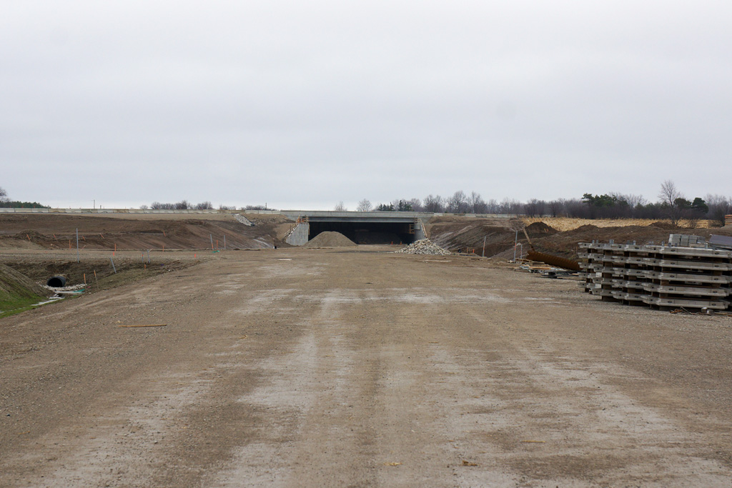
Preparatory works through December, January and February have allowed crews to begin the final phase of paving. Drivers will experience a number of closures through April and May as this asphalt work is completed.
As part of the construction staging for the Parkway, a portion of Highway 401 between North Talbot Road Bridge and Labelle Street is expected to open later this spring. This opening will allow for traffic to be shifted from Highway 3 while surface course work is finished. The traffic shift will keep traffic moving around areas being paved. “Surface course” relates to the final layer of asphalt that is placed on the top of the road. Much of Highway 3 will see the surface course laid this spring.
http://hgparkway.ca/sites/default/fi...Newsletter.pdf

That's big news. Surprisingly they're not making a big deal out of it.

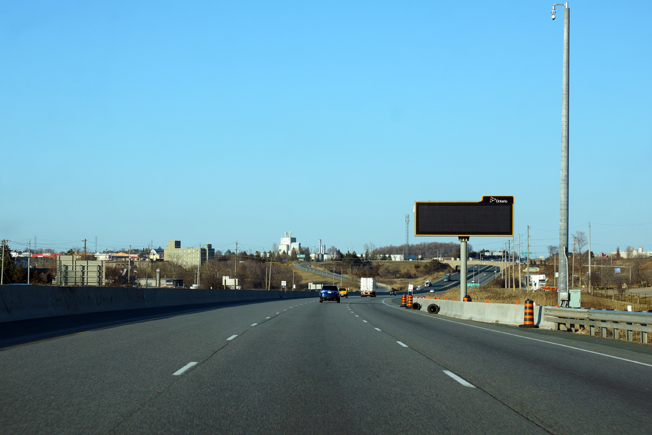
The ramp from Huron Church south to 401 East at Labelle street is currently blocked off with pylons and I haven't had a good look at it but it looks pretty close to being ready. The other one from 401 West to Huron Church North at Labelle looks like they just paved it. It hasn't been striped yet and it looks like there's still work to do to make it fit in with the existing road.

I haven't been able to get out there with a camera since last year. Hopefully I'll be able to make a new video later this month or in May. In the meantime, new aerial photos are up on the project flickr page.

Last edited by sa230e; Apr 13, 2015 at 11:34 PM.
Reply With Quote
     
     
  #211  
Old Posted Apr 14, 2015, 12:26 PM
sonysnob sonysnob is offline
Registered User
 
Join Date: Aug 2011
Posts: 1,657
The plan is to only open the 401 as far as Labelle Street until the new International Bridge has been completed -- so the portion of completed highway west of Labelle will remain closed for several additional years. I'd think the contractor would be pretty eager to complete and open the remainder of the highway as I think they are paying late penalties because the highway was not completed before the end of 2014.
Reply With Quote
     
     
  #212  
Old Posted Apr 14, 2015, 2:19 PM
haljackey's Avatar
haljackey haljackey is offline
User Registered
 
Join Date: Apr 2010
Location: London, Ontario
Posts: 3,207
It would be nice to get the 401 open one more interchange down the road so it links up with the E.C. Row Expressway. That would be a fine terminus until the bridge opens (needs to get built first).

Also I was looking around and it seems like the Wonderland Road Interchange is planned to open this year instead of 2016. Maybe not fully open until then possibly.

Source: http://apps.london.ca/RightOfWay/Det...px?GIS_ID=3567
-Also some prep work may be underway to widen Wonderland towards the 402: http://apps.london.ca/RightOfWay/Det...px?GIS_ID=3592. A new 402 overpass is needed to widen towards the 401.
__________________
My Twitter

My Simcity Stuff
Reply With Quote
     
     
  #213  
Old Posted Apr 14, 2015, 3:38 PM
sonysnob sonysnob is offline
Registered User
 
Join Date: Aug 2011
Posts: 1,657
I took this photo of the Wonderland Road grade separation last winter. I realize it's not the best photo, but it shows the completed westbound Hwy 401 underpass.

Reply With Quote
     
     
  #214  
Old Posted Apr 25, 2015, 3:37 PM
sonysnob sonysnob is offline
Registered User
 
Join Date: Aug 2011
Posts: 1,657
Improvements conceptualized for Napanee:

Quote:
9. Description of Project:
The objective of this TPM Preliminary Design assignment is to develop a preliminary design plan for two interchanges that provides interim and long-term operational improvements that meets the current MTO standards for freeway safety.

The study will include the planning, preliminary design and environmental assessment to determine interim and ultimate operational improvements for the two interchanges; this will include Hwy 401 median improvements between the interchanges.

Structures at both interchanges need major rehabilitation in the near future that cannot be constructed while accommodating two lanes of Highway 401 traffic and maintain ramp configurations at these interchanges. Between the two interchanges a preliminary design plan is required that addresses median improvements where there is a temporary median barrier system and median drainage system that is currently not functioning. The preliminary design study will obtain two separate EA approvals to proceed to detail design. The plans will provide interim and long-term improvements for each interchange that shall meet the current MTO standards for freeway safety and accommodate growing traffic volumes on Highway 401 and allow major structural rehabilitations or replacements while accommodating Highway 401 traffic.

The Service Provider shall be responsible for development of alternatives for both interchange locations. The work shall include the identification of deficiencies at interchanges and the development / course screening / detail evaluation of alternatives to address these deficiencies. Develop / finalize alignments (Technical Preferred Alternative), prepare property request, identify utilities impacts and develop detouring and staging requirements for both projects is anticipated. This includes all staging required for mainline widening and structural modifications and/or rehabilitation/widening or replacement work.

The Technical Preferred Alternative shall be completed to a preliminary design level and shall be documented in separate preliminary design reports (PDRs).

Traffic requirements will generally be traffic analysis, an operational review of the freeway interchange area, ramps and ramp terminals including capacity considerations, lane configurations and vehicular storage requirements.
Determine LOS etc. of sufficient detail for the assessment of alternatives.
Review the collision history (spreadsheet) that will be provided by the Ministry and identify problem areas.
For the selected TPA assess and determine the traffic signals modifications and impacts to three existing locations for these Interchanges and provide new traffic signal layouts.
Construction staging for TPA, pavement marking and overhead sign needs.
Document all traffic engineering reviews and analyses in the Traffic Report.

Expertise is required in conducting foundation investigation for replacement and/or widening of bridge structures, concrete culvert extensions, overhead signs and the associated earth and rock works, materials sampling and testing and experience in preparation of foundation design reports.

This project will include the above mentioned specialities and all work necessary to produce two separate TESR and Preliminary Design Study reports suitable for completing the detail design process for preparation of tender package for implementing these improvements.
The environmental planning activities for this assignment shall been undertaken following a planning/preliminary design process in accordance with Class Environmental Assessment for Provincial Transportation Facilities. The process shall be document in two separate Transportation Environmental Study Reports, one report for each interchange. These reports shall present the study process that shall satisfy Ministry’s obligations for obtaining the environmental clearance.

The staff identified for the Specialty "Fisheries Assessment" must be registered/approved in RAQS for this specialty.

The Service Provider shall assess options for any new bridge(s) or bridge widening/rehabilitation design alternatives identified and select the preferred alternative for each bridge. The Service Provider shall provide preliminary Sketch Plan drawings showing plan/profile, cross-section, vertical clearances, span opening, number of spans and structural depth, life cycle cost comparisons and replacement and/or rehabilitation options. This shall be documented in the Structural Planning Report.

The Ministry will provide survey information to the successful Service Provider.

BACKGROUND
GWP 4459-04-00 Highway 401 Interchange (579) at County Rd. 41:
A Preliminary Design Report (PDR) with no EA component was completed in 2001(WP 31-99-00). This report identified short, mid and long-term improvements but did not obtain EA clearance.

Contract 2004-4016 widened the existing Highway 401 Structure over Sucker / Selby Creek for a new E-N ramp.

Contract 2003-4015 completed various median barrier and drainage improvements between the two interchanges.

GWP 4197-13-00 Highway 401 Interchange (582) at Palace Rd.:
A Value Engineering Study was completed in March 2009 to determine the Hwy 401/Palace Rd. Structure rehabilitation/replacement strategy. The VE Team strongly recommended that a Preliminary Design Study be initiated for this section of Hwy 401 to define the future highway and interchange requirements, and that any future decisions be based on these requirements. The VE team identified minimal rehabilitation solution as the preferred scenario to extend the service life of the existing structures and to allow the Ministry time to complete sufficient planning and preliminary design to define long-term configuration of Hwy 401 interchange.


10. Assignment approximate start and completion dates:
Pre-contract engineering phase: September 2015 to February 2017
Construction administration phase: (tentative timing) N/A
Reply With Quote
     
     
  #215  
Old Posted May 3, 2015, 2:37 AM
sonysnob sonysnob is offline
Registered User
 
Join Date: Aug 2011
Posts: 1,657
Reply With Quote
     
     
  #216  
Old Posted May 3, 2015, 4:12 PM
TownGuy's Avatar
TownGuy TownGuy is offline
Registered User
 
Join Date: May 2013
Location: Cobourg, ON
Posts: 3,071
Needs more lights.
Reply With Quote
     
     
  #217  
Old Posted May 5, 2015, 2:32 AM
haljackey's Avatar
haljackey haljackey is offline
User Registered
 
Join Date: Apr 2010
Location: London, Ontario
Posts: 3,207
Twinkle twinkle.

See that stretch at night 4:00 in

Video Link


Another view, 5:45 in: https://www.youtube.com/watch?v=-7J_ZCs6aoM

[hr]

Highway 401's new western terminus nearly open


A road to nowhere until a new bridge to USA is built.
__________________
My Twitter

My Simcity Stuff
Reply With Quote
     
     
  #218  
Old Posted May 5, 2015, 3:09 PM
1overcosc's Avatar
1overcosc 1overcosc is offline
Registered User
 
Join Date: Jun 2013
Location: Kingston, Ontario
Posts: 11,482
^ In the interim until the new bridge is finished, where will the 401's new terminus be? Presumably somewhere in Windsor near the river?
Reply With Quote
     
     
  #219  
Old Posted May 5, 2015, 4:01 PM
north 42's Avatar
north 42 north 42 is offline
Registered User
 
Join Date: Apr 2011
Location: Windsor, Ontario/Colchester, Ontario
Posts: 5,813
Quote:
Originally Posted by 1overcosc View Post
^ In the interim until the new bridge is finished, where will the 401's new terminus be? Presumably somewhere in Windsor near the river?
It will probably end at the EC Row Expressway, not too far from the bridge entrance.
__________________
Windsor Ontario, Canada's southern most city!
Reply With Quote
     
     
  #220  
Old Posted May 5, 2015, 10:45 PM
sonysnob sonysnob is offline
Registered User
 
Join Date: Aug 2011
Posts: 1,657
The temporary terminus of the 401 is going to be at Hwy 3 at Labelle Street, a few hundred metres south of the current Hwy 3/EC Row Expwy interchange.

I have to say, I am pretty pumped to see the 401 extension finally open. As nerdy as it is, I check the HGParkway everyday to see if the opening date has been announced that day or not.
Reply With Quote
     
     
This discussion thread continues

Use the page links to the lower-right to go to the next page for additional posts
 
 
Reply

Go Back   SkyscraperPage Forum > Regional Sections > Canada > Ontario
Forum Jump


Forum Jump


All times are GMT. The time now is 11:33 AM.

     
SkyscraperPage.com - Archive - Privacy Statement - Top

Powered by vBulletin® Version 3.8.7
Copyright ©2000 - 2024, vBulletin Solutions, Inc.