Quote:
Originally Posted by Tetsu

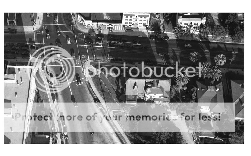
Here's an aerial view (probably a close up) of 3rd & Alvarado, dated July 16th, 1936. e_r posted another photo from this aerial in post #1105.
Does anyone know anything about the house at the SW corner? Or have any other photos, for that matter?
 USCDL USCDL
The two apartment buildings at the top, on the east side of the 300 S. block of Alvarado, are still there, though they have seen better days.
 GSV |
As
GW foretold, 321 S. Alvarado was built by Frank Garbutt:
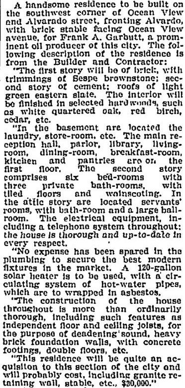
September 21, 1900
Los Angeles Times @ LAPL
Here's the house on the 1906 Sanborn. There was no 3rd Street, and Ocean View continued east of Alvarado:
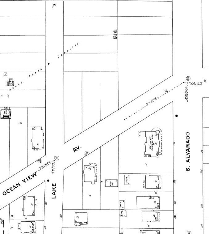
LAPL
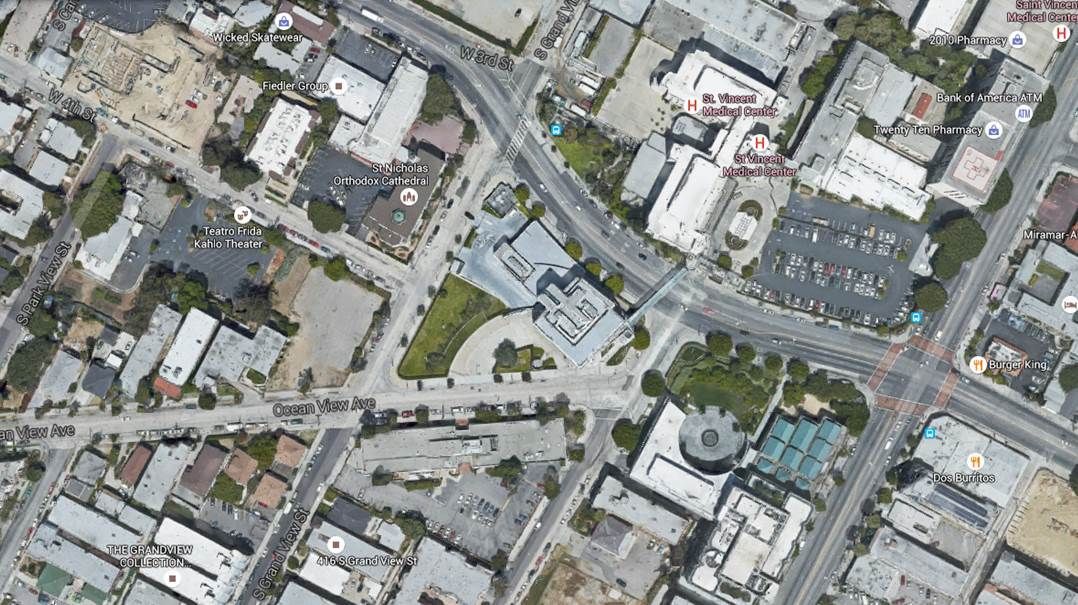
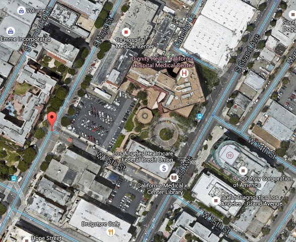
A recent Google Earth view shows how much the area has changed. Ocean View now stops at Lake. The intersection
of 3rd and Alvarado is at right, marked by the four red crosswalks. The Burger King is on the NE corner, so
321 S. Alvarado was kitty-corner from that:
As
GW also advised, there don't seem to be any good photos of the house. Here it is a little closer from that 1936 aerial:
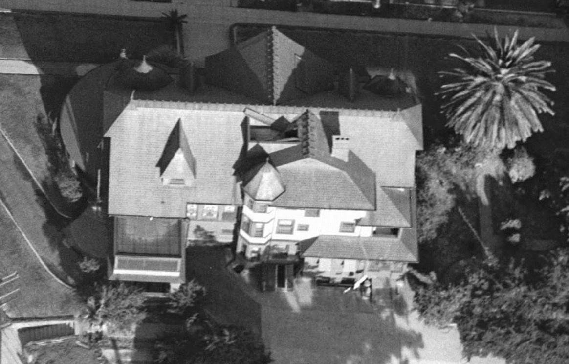
USCDL --
http://digitallibrary.usc.edu/cdm/si...id/1414/rec/98
You can see a little of the roof in the lower right corner of this January 1930 shot from St. Vincent's Hospital across the street,
along with those two apartment buildings -- 310 and 320 S. Alvarado -- you pointed out:
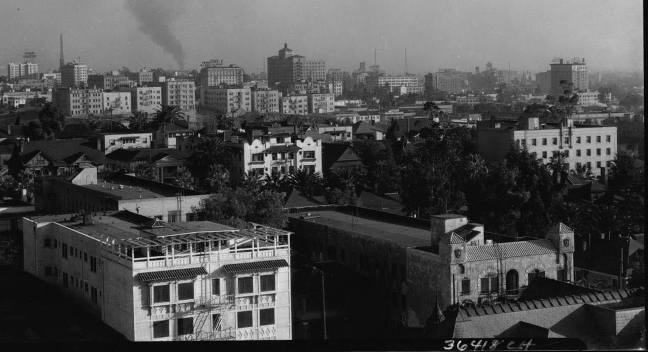
USCDL --
http://digitallibrary.usc.edu/cdm/si.../id/3784/rec/6
BTW, the apartment building in the left foreground of the above photo is the Westbrook. You can see
a 1912 photo of the Westbrook in my post here:
http://forum.skyscraperpage.com/show...ostcount=19697
The only street-level view of the house I could get was by lightening and zooming in on this 1928 shot facing west at
3rd, Alvarado and Ocean View:
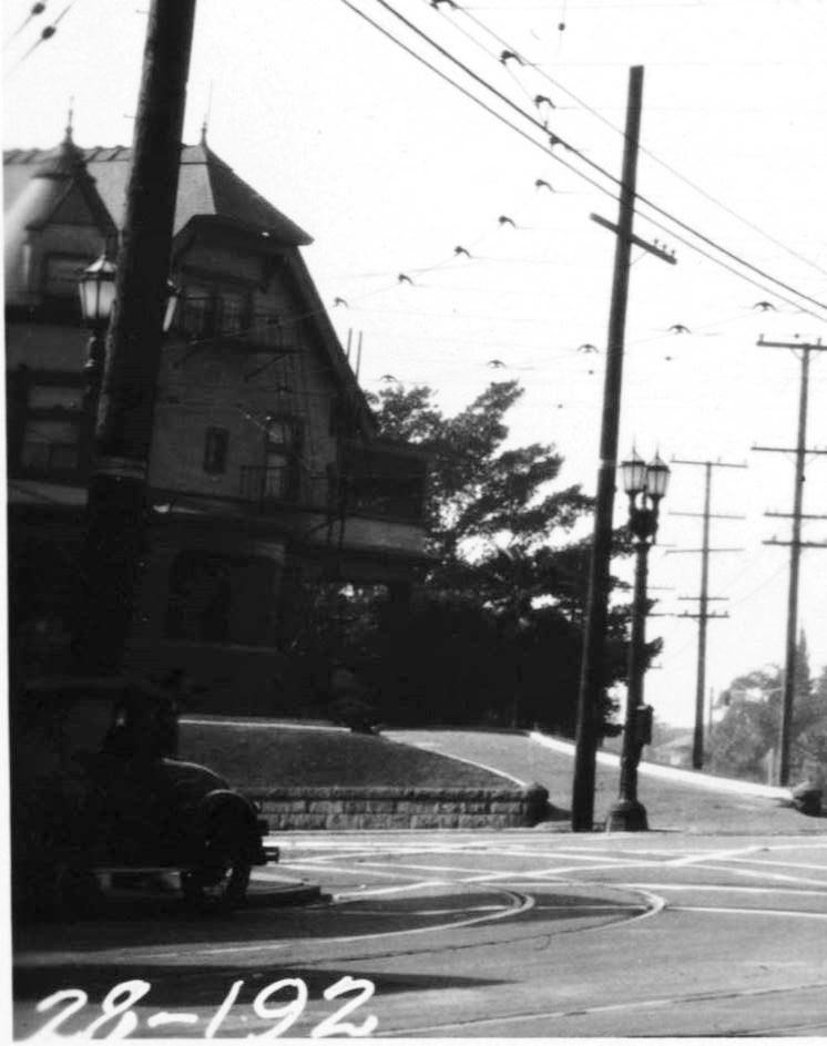
USCDL --
http://digitallibrary.usc.edu/cdm/si...9/id/796/rec/3
A 1948 aerial photo at HistoricAerials.com shows a gas station at the site of 321 S. Alvarado.


 Prev
Prev


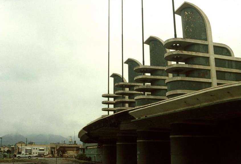
 It's really impressive; let's try to dig up some information on it.


 I tried looking over that fairly high wall on several occasions.


 Linear Mode
