For Montréal, I think we have to separate downtown from the other dense inner city neighbourhoods. Downtown, i.e. where there is a feel of centrality (scale, presence of important institutions, etc.) would mostly lie between Jacques-Cartier and Victoria bridges, and would stretch from the river to Des Pins Ave to the north. It would also include parts of downtown Westmount, Jeanne-Mance and Mont-Royal parks. However, it would not include parts of Le Village (north of Ontario), La Petite-Bourgogne or Pointe-Saint-Charles, that feel more like proper local neighbourhoods. Here's a map showing these areas :
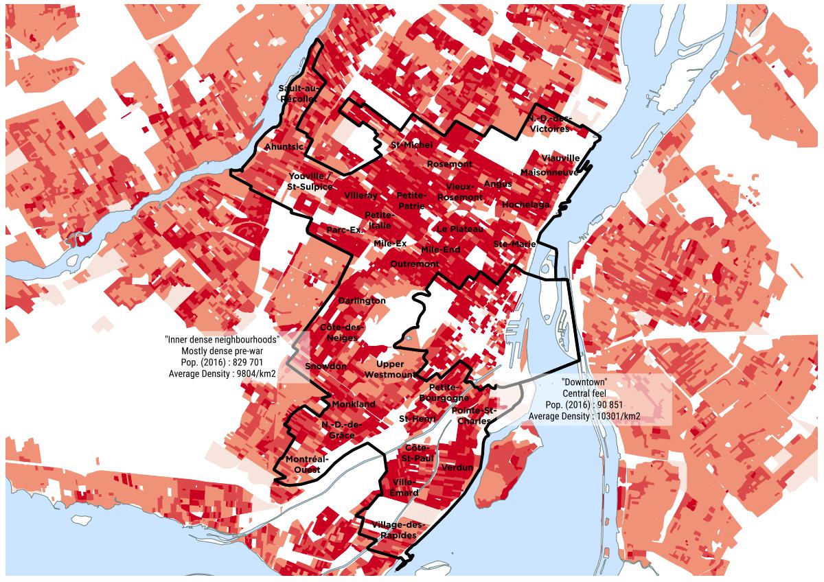
Dense neighbourhoods form a kind of belt around downtown and correspond mostly to what was developed before SWW or around those years. These areas are generally exempt of SFHs.
Around the belt, we could characterize some neighbourhoods as dense suburbia (non-SFH parts of : Saint-Laurent, Bordeaux, Cartierville, Côte-Saint-Luc, Lachine, LaSalle, Île-des-Soeurs, Mercier, Tétraultville, Anjou, Saint-Léonard and Montréal-Nord). Outside of that, the urban fabric looks more like ordinary suburbia.


 Prev
Prev


 Linear Mode
