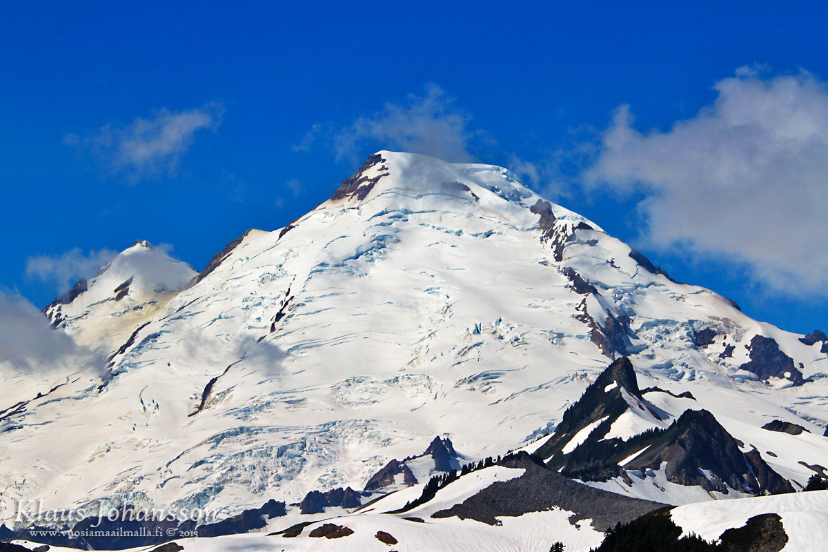
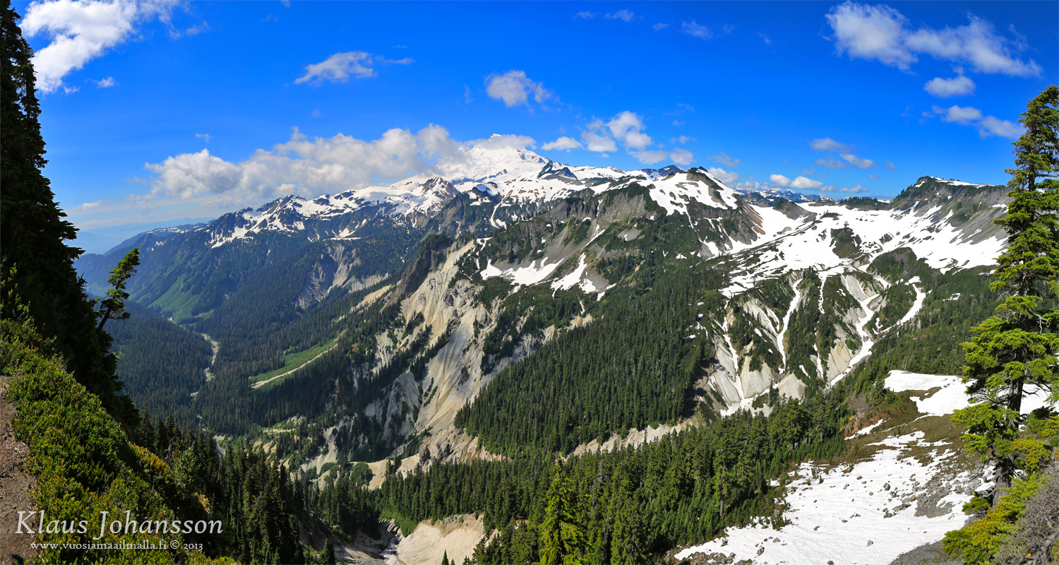
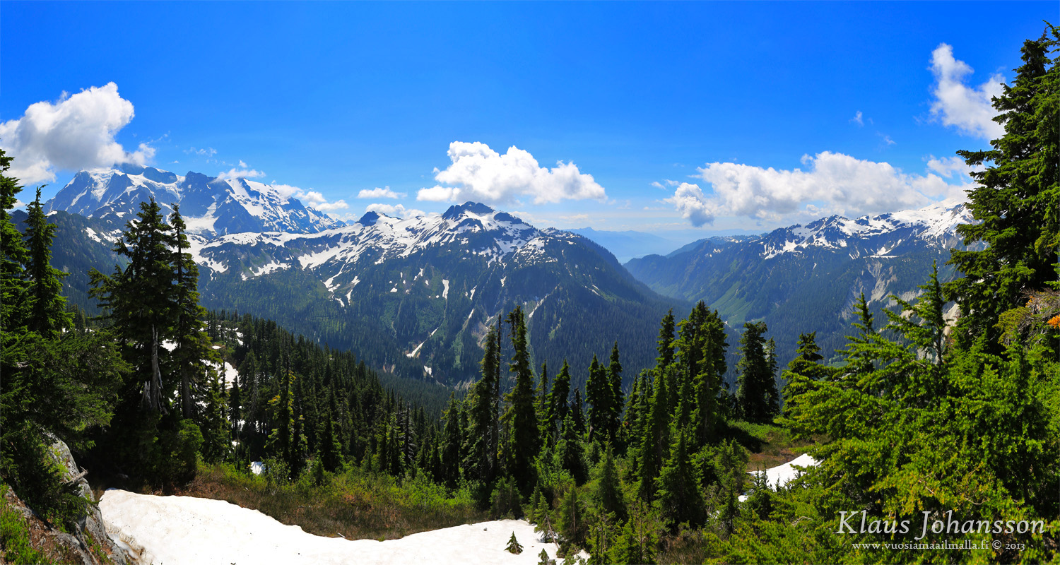
The 3286 meter tall Mount Baker is the majestic backdrop of Metro Vancouver, so here are few photos from the drive up there (in Mid-July). More photos in here.
I really love the views you´ve captured in your drive up to those mountains. I observe the great amount of snow in the mid of July, something ncredible for me!
One thing i did notice though, the panorama overlooking metro vancouver isn't taken from mt baker. where did you take that picture?
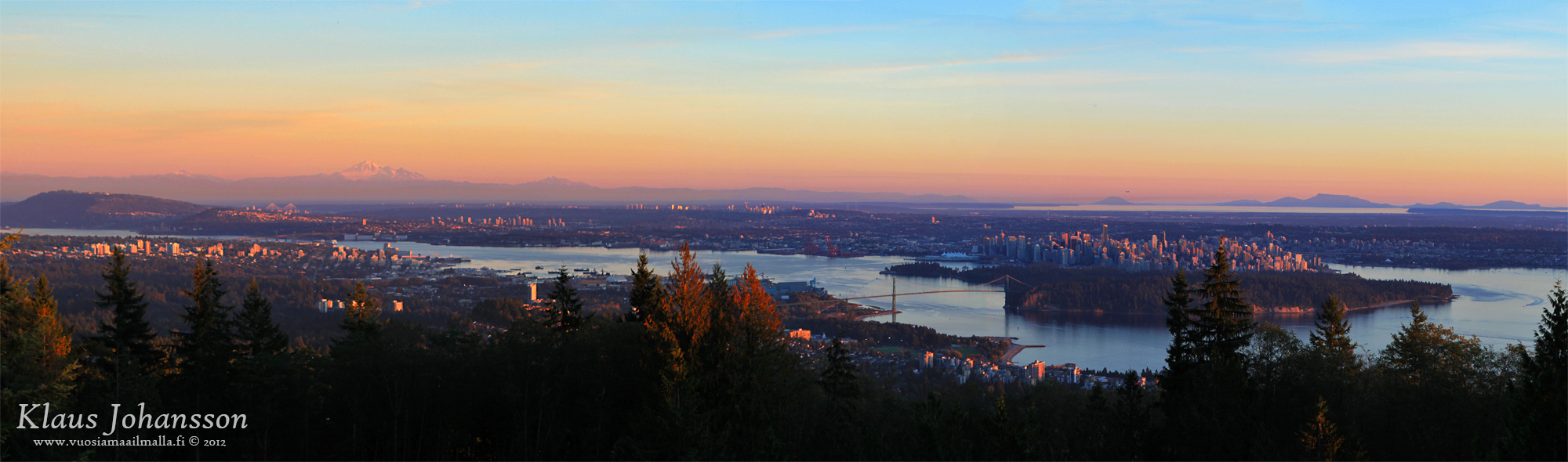
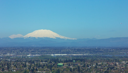
It's taken from Cypress Mountain outlook in West Vancouver. Snowtop Mt. Baker can be seen on the left.
Quote:
Originally Posted by jg6544
Is Mt. Ranier visible from Vancouver or is it too far south?
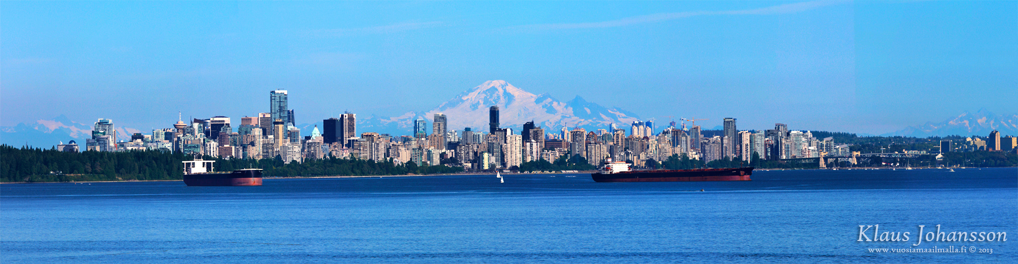
I have seen some photos from top of North Shore Mountains (1300 meters above sea level) where one can barely see Mt. Rainier some 250 kilometres away. Mt. Baker is only 100km from Vancouver and easily visible.
I'm pretty sure I saw Mt. Baker from West Seattle.
__________________
"You need both a public and a private position." --Hillary Clinton, speaking behind closed doors to the National Multi-Family Housing Council, 2013
Truly stunning scenery and photos. Thank you for sharing. It's a pity that I only got up there once in my time at WWU in Bellingham. The North Cascades Scenic Highway is nice too.
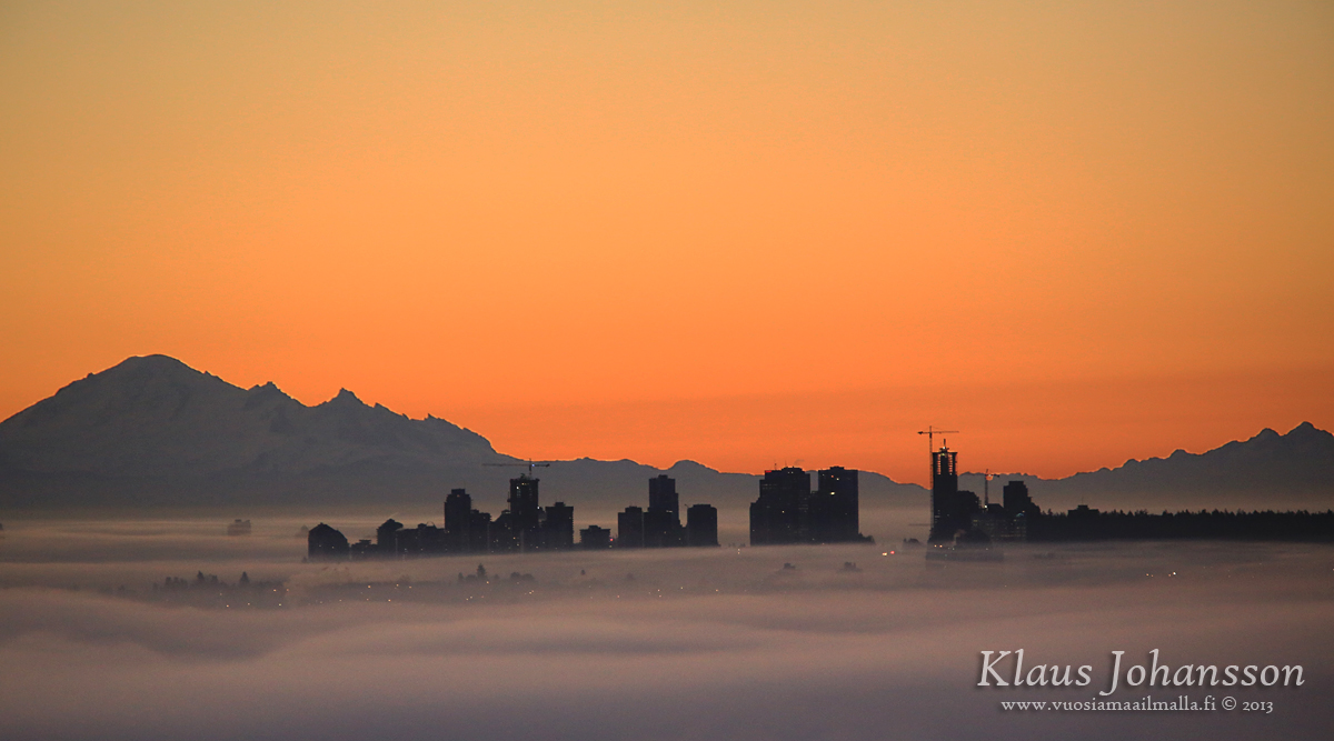
Is that Rainier low on the horizon of that sunset skyline shot?
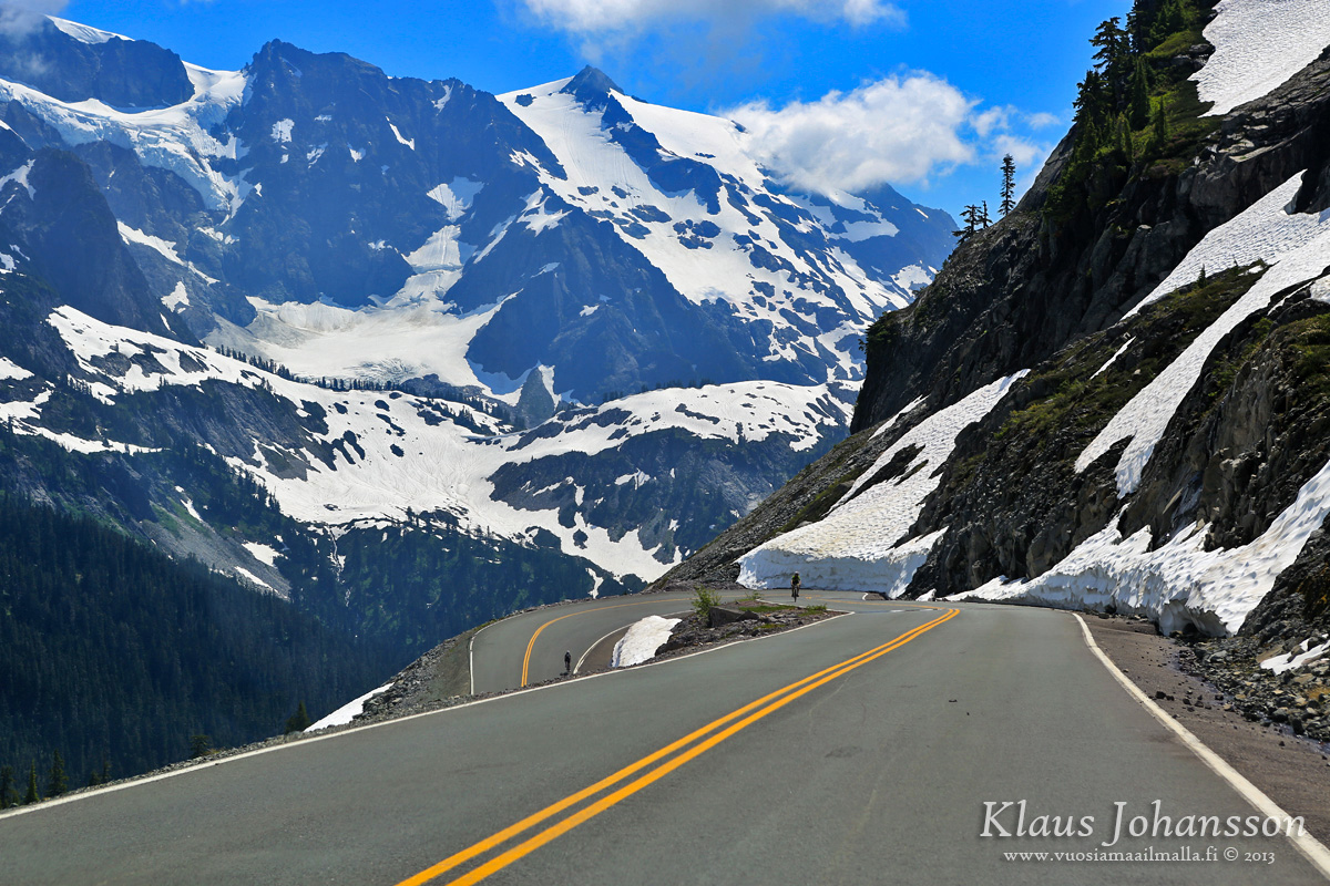
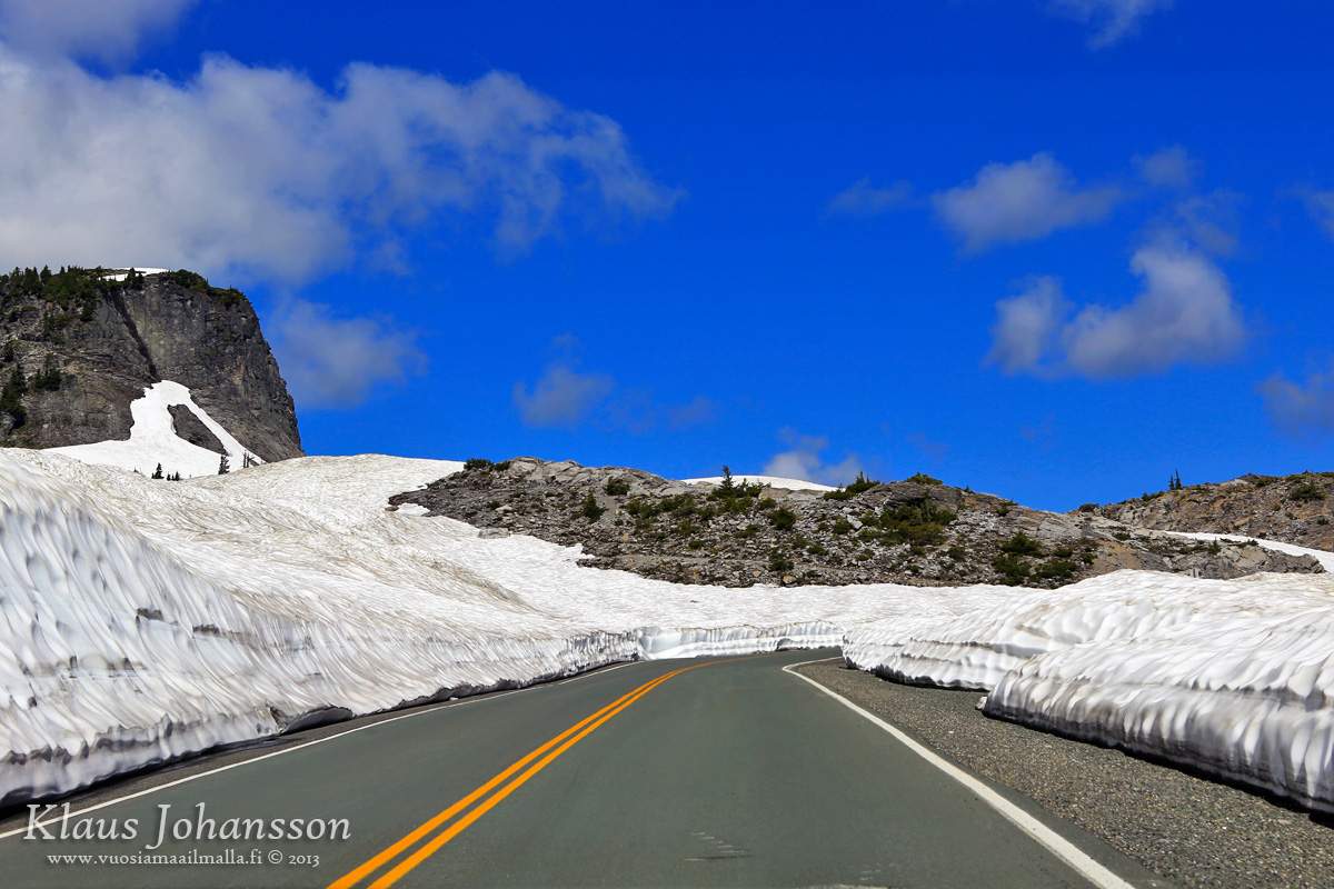
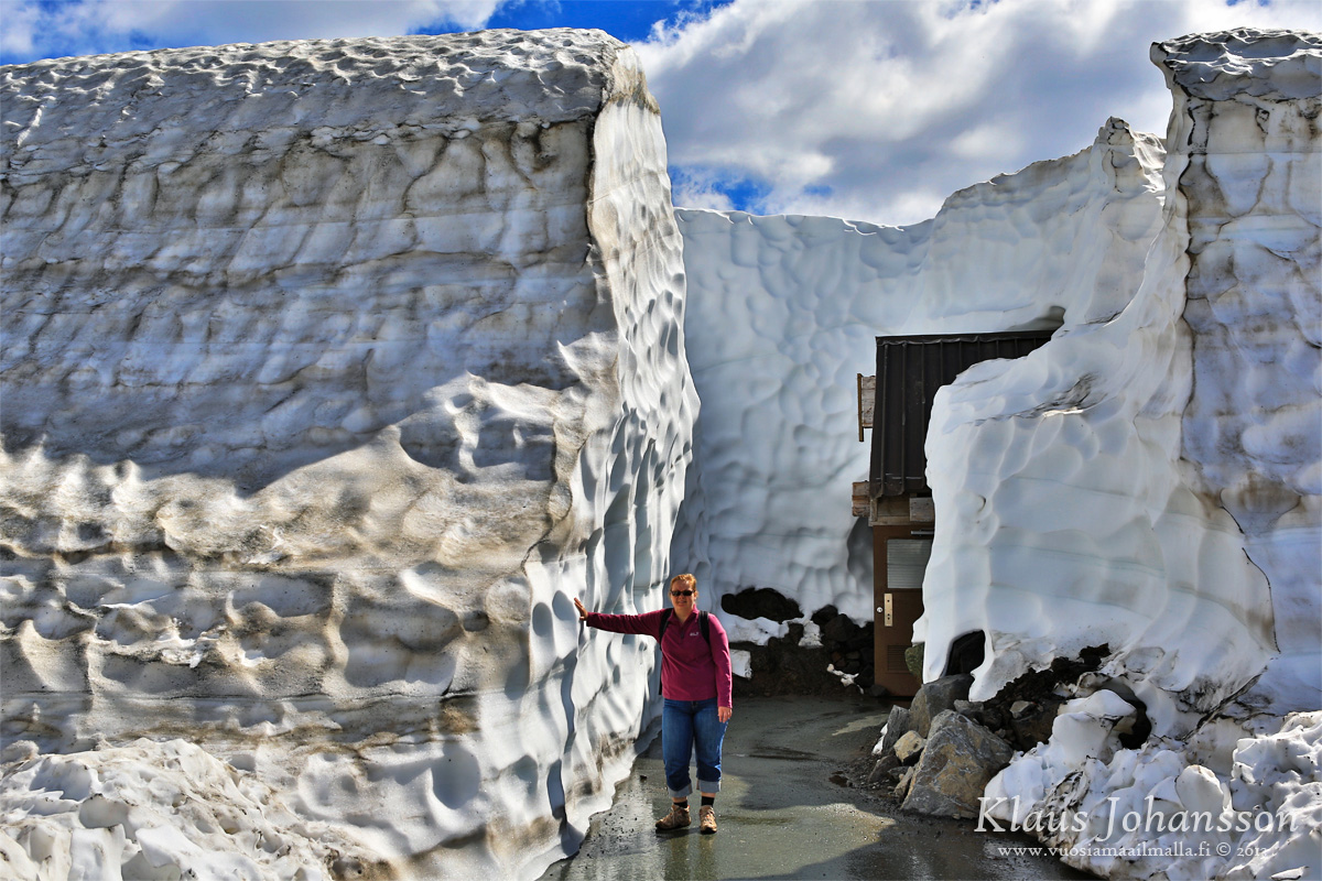
As mentioned, those photos were taken in Mid-July and there was still crazy amounts of snow up there! Mount Baker receives world record amounts of snow in a winter, so I am really looking forward to checking the place out this coming winter!
Nice photos, beautiful area indeed. And yes, you can most certainly see Mt. Baker from Seattle but only on an exceptionally clear day-usually mid summer.
I'm pretty sure I saw Mt. Baker from West Seattle.
Yeah, West Seattle seems to be the place for peak spotting. I'm guessing because of its distance from the city and hills on the east side of Elliott Bay.
EDIT: Klazu, I forgot to mentioned how great your pictures are. I got lost in the one looking back down the valley.


 Prev
Prev


 Linear Mode
