Just responding to a couple of earlier posts...
Quote:
Originally Posted by Deez

bahaha.
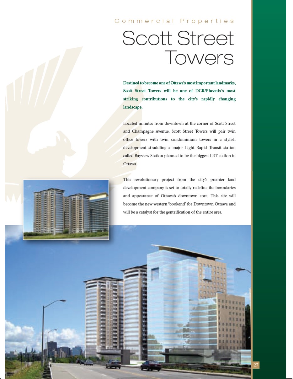
This thing is an absolute abomination of urbanism...some of which is the City's fault and some the developer's.
First of all...why on earth are the property lines set so frigging far back from Scott (Albert?)? This development is steps from the CBD yet the setbacks are similar to new single family home subdivisions in Avalon. And what abuts the property line? A surface lot? At the intersection of what could be an N-S-E-W transit transfer location? Give me a break.
|
Quote:
Originally Posted by jeremy_haak
Usually they would just zone it Hazard or something similar to prevent development on that part of the land (at least where I work). Obviously the road ROW is particularly wide along Scott Street/Wellington in that area. I'd be curious to find out why.
It seems a little bit premature to begin developing Bayview. There should really be a more comprehensive plan for the area before development should proceed.
|
If you look on Google it's pretty clear that when the overpass of the railway was built they departed from the Scott/Wellington/Albert road RoW to get a more perpendicular bridge. The services however remain in the original road alignment, so there is this odd arc of a circle chunk of land encompassing the original road alignment south of the current one that's a challenge to deal with.
The City, naturally, hasn't completed the CDP for the area (which should have been done *before* the NS-LRT EA but after the 2003 OP&TMP - it's now underway again) so they don't know what to do with it, nor did they buy the property itself from the NCC when the latter sold it (which they should have for the NS-LRT).
The fact that the developer has no idea what the city would like to see there just adds to the problems (whether that's because the City doesn't know, or they didn't ask, or both, is hard to say - but probably both). The proposal also seems to be done in complete isolation from anything on the City Centre site, whereas I would think that one would wish to develop (or at least plan) the entire area between the O-Train, Somerset, Champagne and Scott/Wellington/Albert in one shot, which would allow for addressing issues of servicing, LRT routing/integration and making the two overpasses (Scott & Somerset) more pedestrian friendly environments.
It's pretty much typical planning in Ottawa, I guess. Why plan years ahead when you can plan in a disorganized unfocused frenzy at the last minute? It's so much more exciting this way.


 Prev
Prev


 Hybrid Mode