Sorry about not putting it on the thread, but 382 pages is too long for me to read.
 RED Line:
 Follows Parts 1 and 2 of the current SW Corridor Plan, PLUS an extension from Balmoral Terminal (or underground station perhaps if LRT), to Polo Park via St. Matthews Avenue. Should free up alot of bus routes, which could then service "suburbia", or the two other BRT lines
BLUE Line: It'd start at Headingley with a Park and Ride station (and bus route servicing RM of Headingley). keeps on going down Portage, with stops in Unicity, Westwood, Moray and Assiniboine Park. Brief stop at Polo, and continuing on towards the Airport.
ORANGE Line: Cheif Peguis, down Main. Stops down Portage, and keeps going down Osborne. Then, it'd go into St. Vital, and continue down Bishop Grandin to the Sage Creek area, incase of any future development.
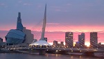
GREEN Line: Transcona, though the Marion industrial park, then underground near the future CMHR. Spur line off of Union Station, which would go onto (or under) Graham til about Cityplace. It'd then go north, using the CP Yards (due to maybe be moved WAY NW of Winnipeg, which means LOTS of transit-oriented development opporitunites). Go up Keewatin, and end at Inkster. Should service the maples region, along with Amber Trails and any other development
ALSO!!! THOUGHTS ON FUTURE BUS ROUTES (mwahahah):
4: Central Park - The Forks
5: Maples - Airport
6: Waverley West - U of M (or Bison LRT Station)
7: Headingley BRT Shuttlebus (30 foot bus most likely)
8: CentrePort Canada - Corydon Avenue Busloop
9: CentrePort Canada - Charleswood
13: Waverley West - St. Vital Centre
23: CentrePort Canada - Unicity
73: Oak Bluff - Unicity (Super-Express)
SERVICE CHANGES:
11: Kildolnan - Downtown ONLY
16: Island Lakes - St. Marys BRT Station
18: Assiniboine Park - Downtown ONLY
25: Strauss/Murray Industrial Park - Polo Park (pretty much the ness avenue version of the 21 during peak hours)
27: Red River College - Inkster Gardens
"30s" University Routes: ABOLISHED! Use those buse's for improved commute time and stuff
40s Transcona Routes: Re-routed to Feed from Transcona and East Winnipeg only, towards the LRT route or BRT across the Red River.
50s St. Vital Routes: Keep those, but emphasize service in Aldgate and area
62: Turnbull - Bison LRT
65/66: HEAVY addition of buses to these routes
77: Improved Service
80/81: More Buses
82: St. Charles - Crestview - Westwood
83: More Buses
DART System: Abolish
Any additional thoughts? Go ahead and comment haha. Could use others opinions!


 Prev
Prev


 Linear Mode
