Georgia Avenue is DC's longest street, and one of its main neighborhood retail corridors. It's on the edge of the gentrified part of town, so some parts of it are booming and look very wealthy, while others are not and do not.
Here are some pictures. They're mostly from 2014, but I've never posted them before so pretend they're new, and think back to that simpler pre-Trump time.
Let's start at Petworth Metro station. If you look at a map of DC, Petworth is near the geographic center. But it's near the northern end of the genuinely urban part of DC. South of Petworth, apartments and rowhouses grow denser and denser towards downtown. North of here, rowhouses gradually give way to bungalows and then, eventually, to suburbia.
Near the Metro station, DC-style midrises dominate. Many are recent infill.
Looking south towards downtown, the density along Georgia declines because the Metro veers west under a different street. A block off Georgia amid the rowhouses the density goes up, but along Georgia itself, the density clusters most by the Metro.
This is the land of rowhouse-scaled retail.
We reach the campus of Howard University, a prominent HBCU, and the character changes. Intimate sidewalk-hugging retail gives way to large setback institutional buildings on one side, and parks and parking lots on the other.
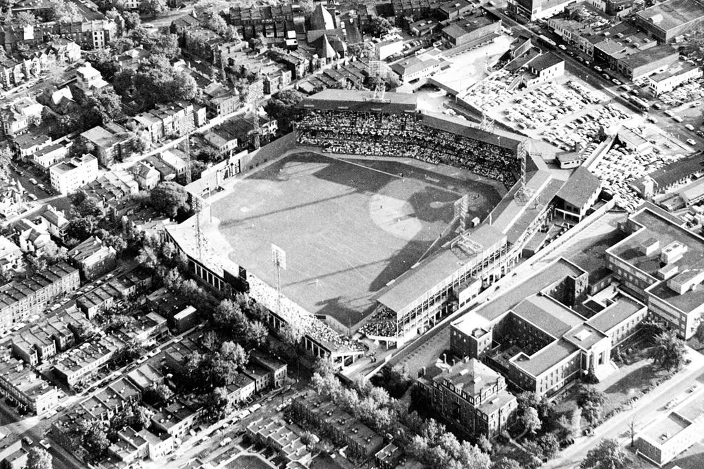
The old Washington Senators used to play here, at a stadium long gone.
Between Howard and U Street, the city has recently installed DC's first red-carpet bus lanes. The red gives car drivers no excuse, and drastically cuts down on illegal use.
We reach U Street and the activity picks up a lot.
South of U Street, Georgia Avenue becomes 7th Street. It's the same street, but a different name. This also marks the spot where the Metro rejoins Georgia/7th and runs under it on the way to downtown. This is Shaw Metro station.
The density increases again, as rowhouse-scale gives way to midrise-scale more permanently.
The old O Street Market, now a modern supermarket.
Continuing south, we reach the DC convention center. This stretch of road was burned during riots in 1968, following the assassination of MLK, and then completely rebuilt in the later 20th Century during urban renewal. It's not high quality urbanism.
But looking downtown you can see that the central city is getting close.
South of the urban renewal zone, the buildings get nicer. And eventually larger, as we enter into Chinatown.
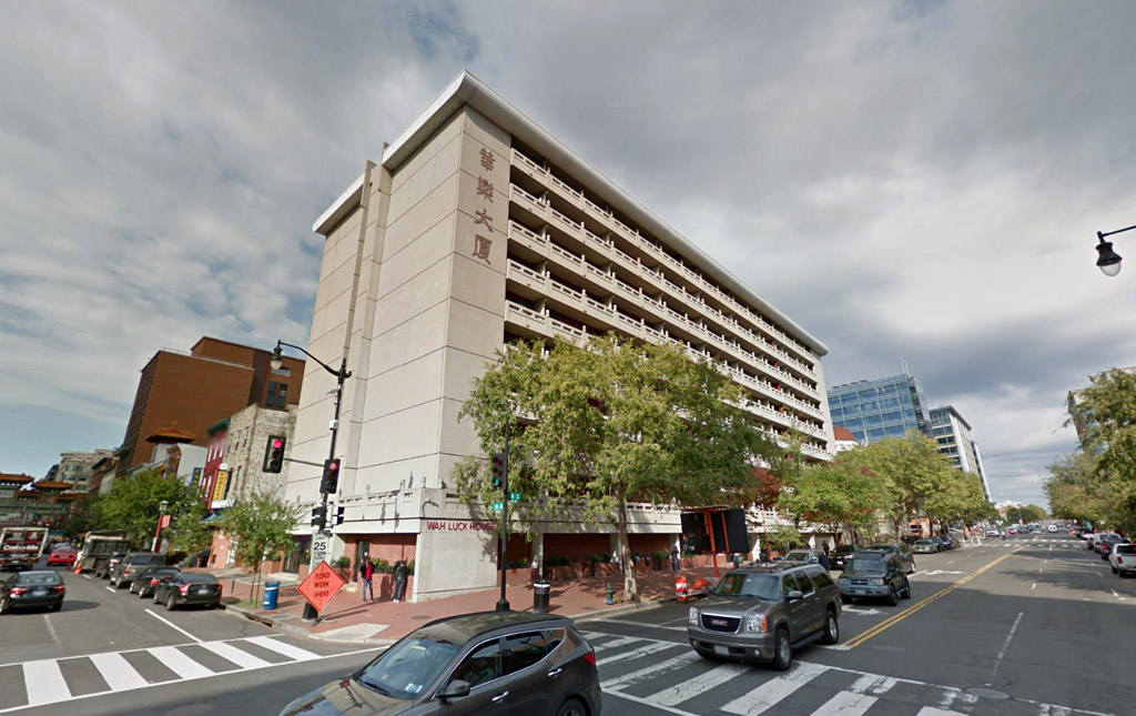
DC's Chinatown is, well, unique. There's not much about the old Chinese neighborhood that's left. Instead, you get DC's version of Times Square: Extremely active, filled with national chains. It's a fun area with a lot of vitality, but aside from a handful of leftovers, it's Chinese in name only.
The arena for the NBA Wizards and NHL Capitals is here. It was the anchor that made this neighborhood what it is, for both good and ill.
Across the street from the arena is the National Portrait Gallery, a Smithsonian museum.
The Portrait Gallery's steps serve as a defacto park.
But if you venture inside, the Portrait Gallery's interior courtyard is one of DC's best indoor public spaces.
 photo by bassel mudarris on flickr; all other photos in this thread are mine
South of the arena/museum block, you're go through a short stretch of downtown DC called Penn Quarter, before reaching the National Mall.
We reach Pennsylvania Avenue, where local DC becomes federal DC. At the intersection, Indiana Plaza, with its double-peaked pink building and Civil War memorial.
Beyond that, Pennsylvania Avenue, the National Mall, and all the famous monuments you've seen 1,000 times before.


 Prev
Prev


 Linear Mode
