Grand Canyon Village is an unincorporated community in Coconino County. The population is around 2,000. It is located inside Grand Canyon National Park, and is along the South Rim. The village is the administrative center for the national park.
While most people who visit Grand Canyon National Park naturally bolt for the canyon rim and its spectacular scenery, Grand Canyon Village is worth exploring for its architectural heritage. Among other things, the village has the largest concentration of buildings designed by Mary Jane Colter, whose propensity to use Native American and American Southwestern architectural styles in Arizona and New Mexico redefined American architecture.
Grand Canyon Village was master-planned by the National Park Service beginning in 1910, after development began at the terminus of the Grand Canyon Railway with the El Tovar Hotel and Hopi House just uphill. A "village square" concept was used, centered on where the railroad met up with the road coming into the area from the east. A second square was planned to the east, where the entrance road met the South Rim, but plan never really materialized. Most notable was the concept of automobile access to the rear for Park Service houses. Houses instead faced a central communal area. This Garden City concept actually predates more famous examples in the United States, like Radburn, New Jersey.
Today, Grand Canyon Village is best-known for providing different services to millions of tourists. From hotels and campgrounds, to dining options, to transportation, to park administration services, tourists are able to stay in the park without having to "rough it" too much.
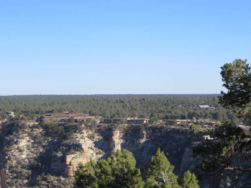
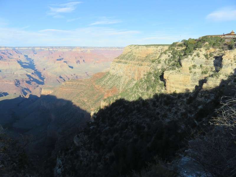
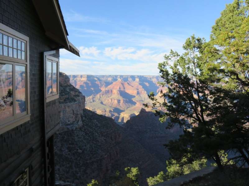
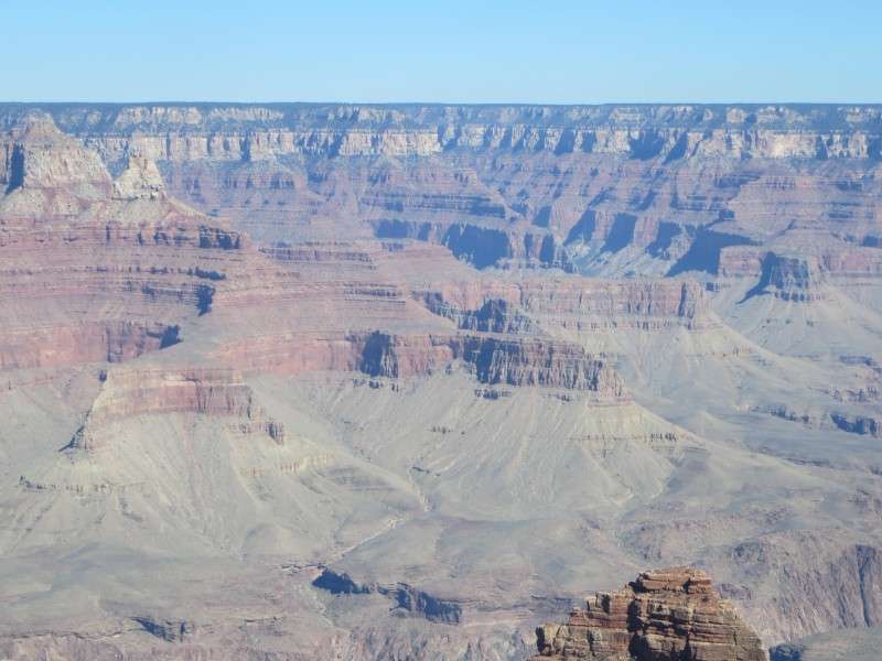
Grand Canyon Village from Trail View Point. Towards the left is El Tovar Hotel, the centerpiece of the village.
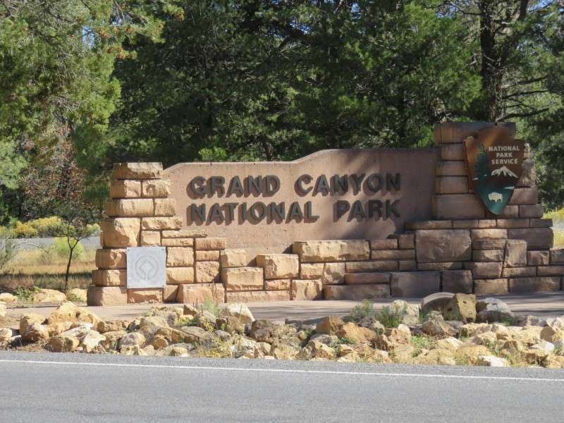
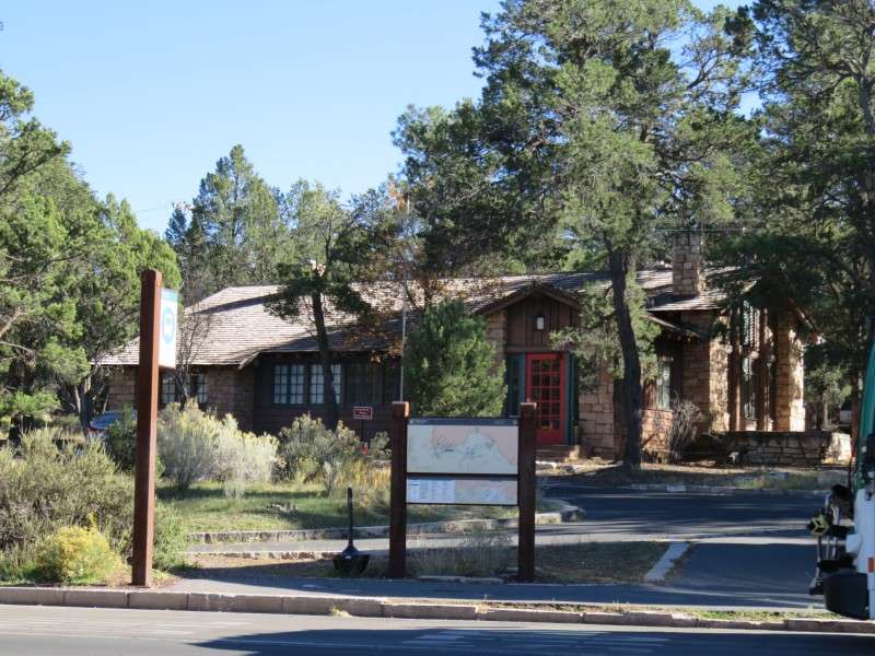
The sign board for the south entrance of Grand Canyon National Park is along Arizona Route 64, about 2 miles north of Tusayan.
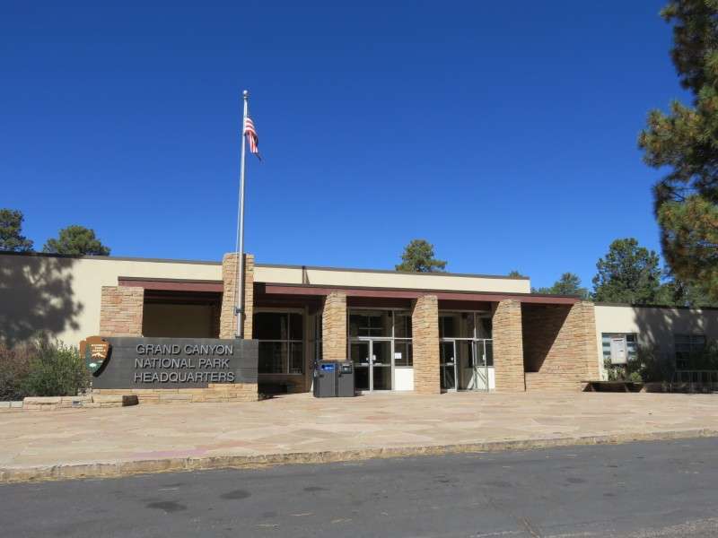
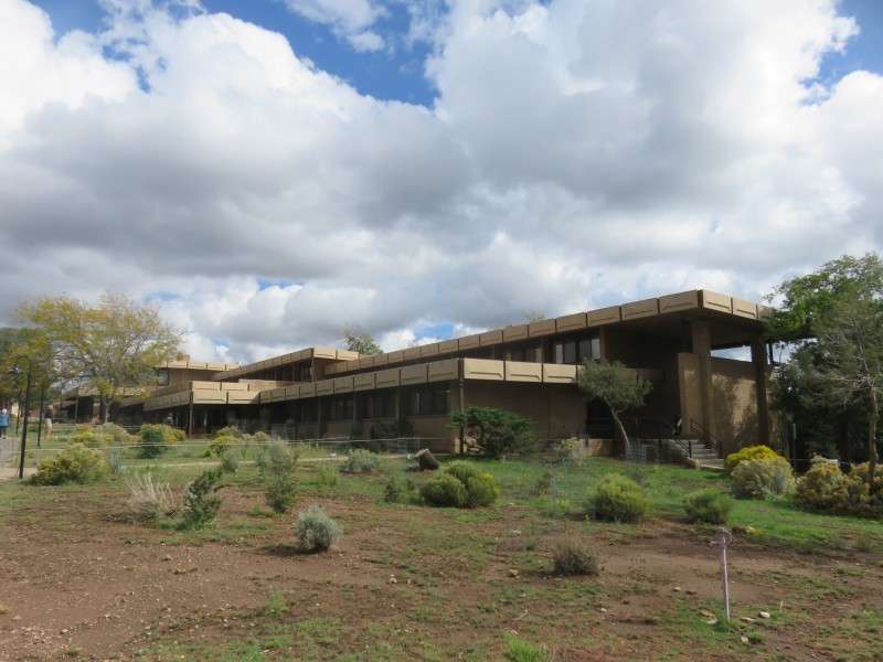
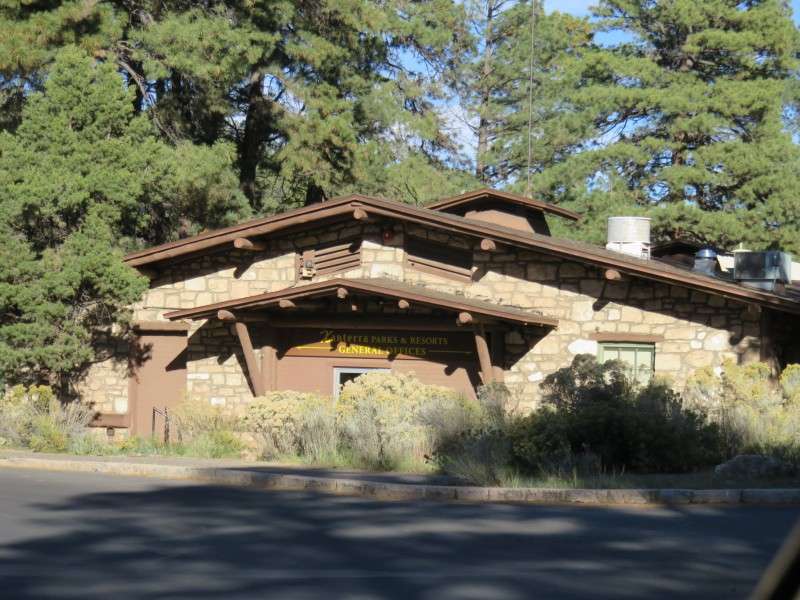
The Grand Canyon National Park Headquarters, on Entrance Road at Yavapai Lodge Road. The structure was built in 1967.
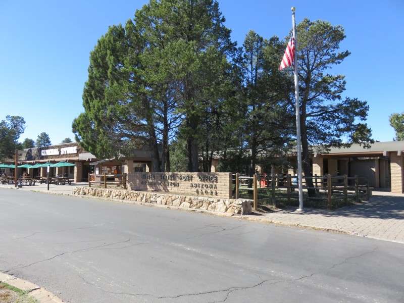
The Grand Canyon Post Office, off of Yavapai Lodge Road.
Shrine Of The Ages, on Entrance Road by Zuni Way. The building was constructed in 1970, and served as an event space for concerts and demonstrations, as well as offering a multi-denominational worship space for locals.
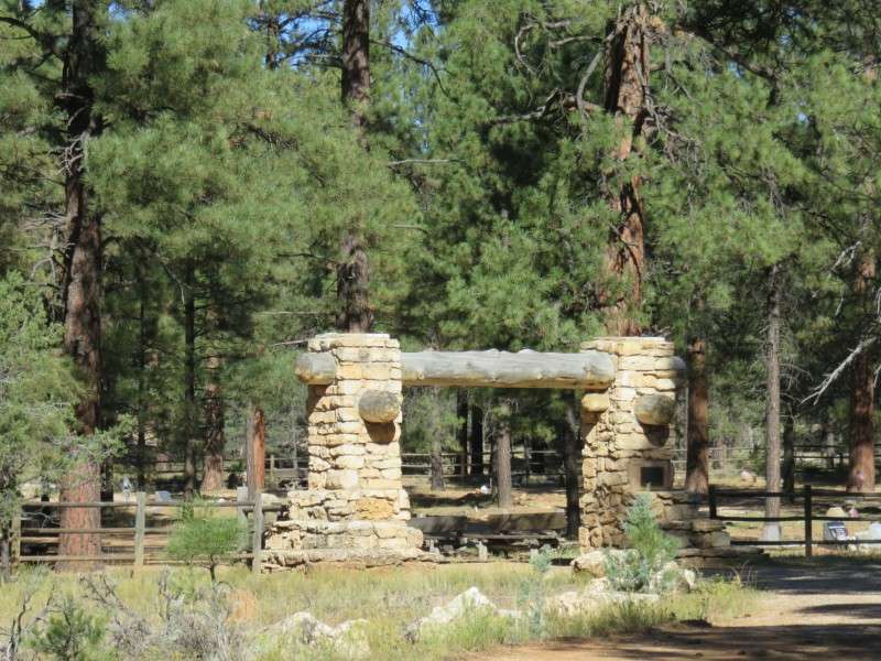
Pioneer Cemetery, on Entrance Road west of Zuni Way. The cemetery was started in 1928, and the gate was donated the same year by the American Legion. Many notable village residents are now buried here.
The Yavapai Geology Museum, off of Entrance Road at Yavapai Point. The structure was built in 1928 as the Yavapai Point Trailside Museum, using indigenous Kaibab limestone and ponderosa pine in order to make the building blend into the landscape.
Originally windowless, it was transformed into the Yavapai Observation Station, and was meant to take advantage of the views showcasing the geology of the canyon.
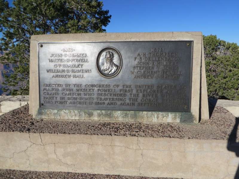
The Powell Memorial, on Powell Point off of Hermit Road. The memorial was dedicated in 1912 to Maj. John Wesley Powell, who lead an expedition down the Virgin and Colorado Rivers in 1869. It was the first government-sponsored trip through the Grand Canyon.
The Superindendent's Residence, on Entrance Road at Village Loop Drive. The structure was built in 1921, and was originally the park headquarters. It became the superindendent's house in 1931.
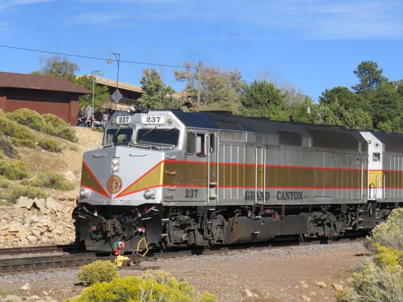
The Grand Canyon Railroad Station, on Village Loop Drive. The station was built in 1910 for the Atchison, Topeka, & Santa Fe Railway, which had the rights to develop part of the South Rim of the Grand Canyon.
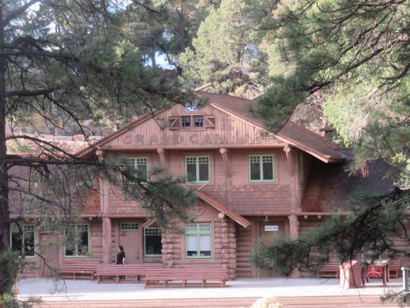
The railroad designed the depot in the Rustic architectural style, before the style was used in the National Park, and is one of three remaining railroad stations where logs are the principle building material.
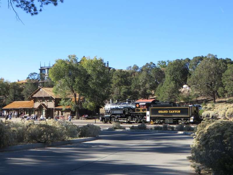
The Grand Canyon Railway itself was built in 1901 by the Atchison, Topeka & Santa Fe Railway as a branch line from Williams to the Grand Canyon. It was intended to serve tourists who were beginning to visit the Grand Canyon at this time period.
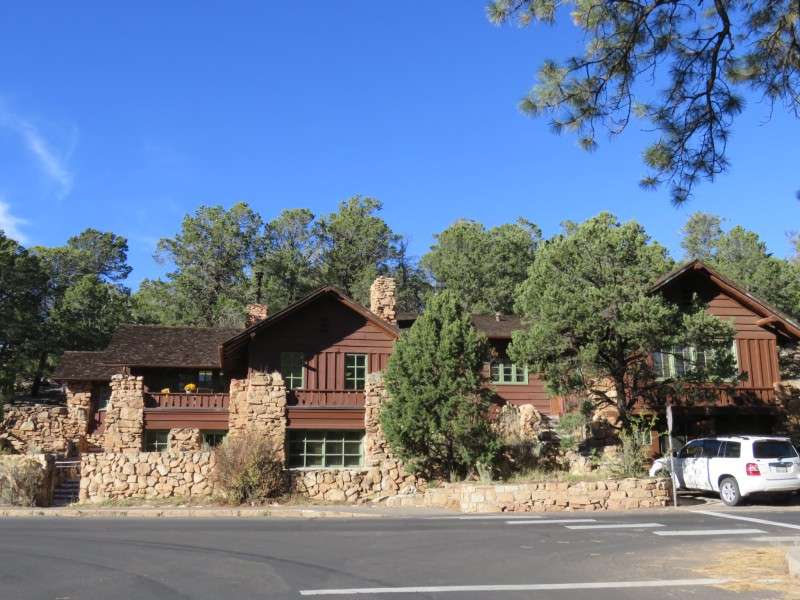
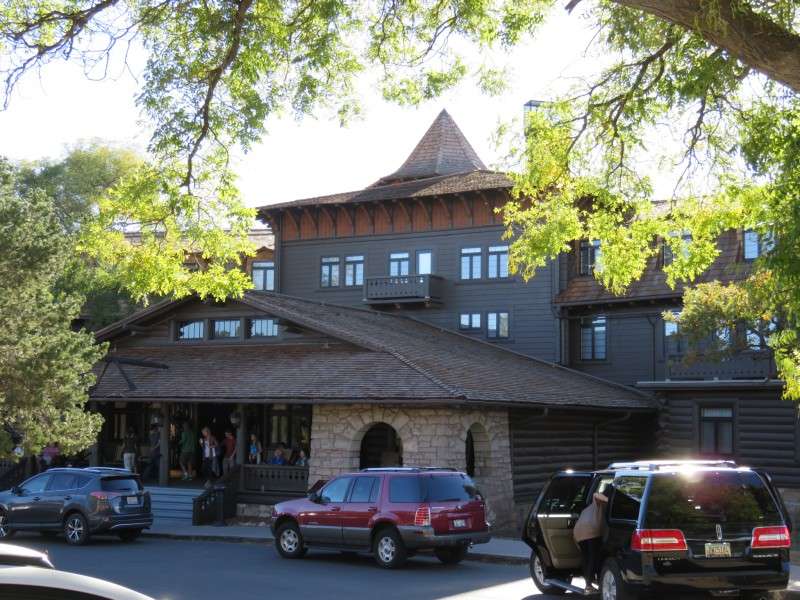
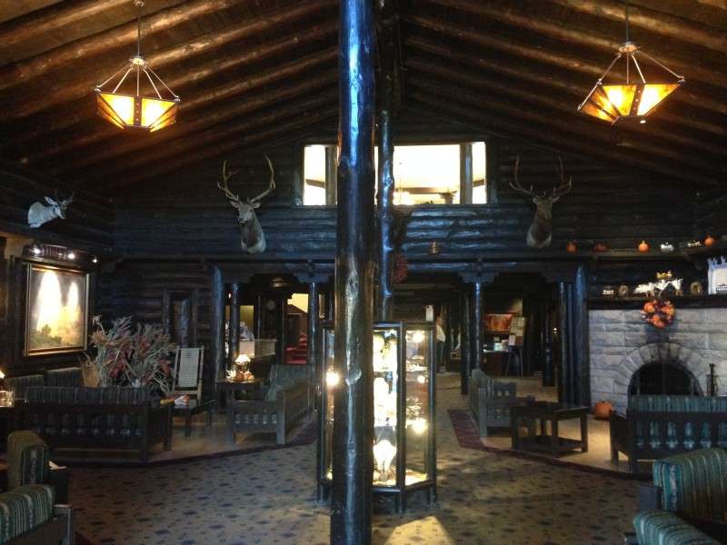
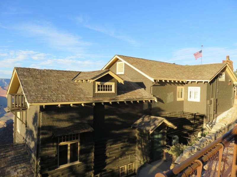
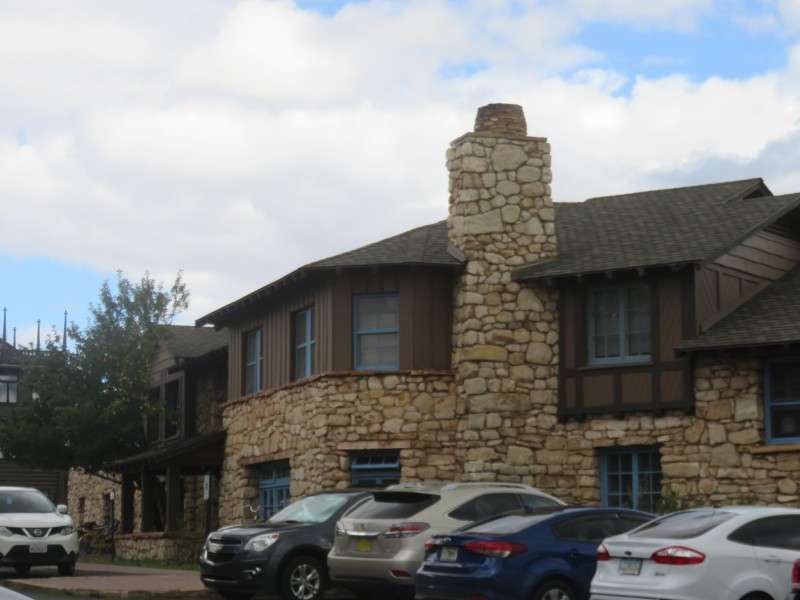
El Tovar Hotel is the centerpiece of the village, and is located right on the rim of the canyon. The hotel was named after Pedro de Tobar, who reported rumors of a large river in the area. This inspired the expedition of Garcia Lopez de Cardenas, who discovered the Grand Canyon.
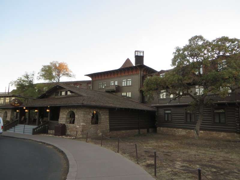
The hotel was built by the Fred Harvey Company, and was opened in 1905.
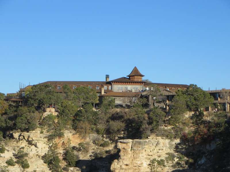
El Tovar borrows styles from Swiss chalets and Norwegian villas. It was considered the most luxurious hotel west of the Mississippi River by many when it opened.
The main room of El Tovar is the Rendezvous, and like the hotel's exterior, is in the National Park Service Rustic style.
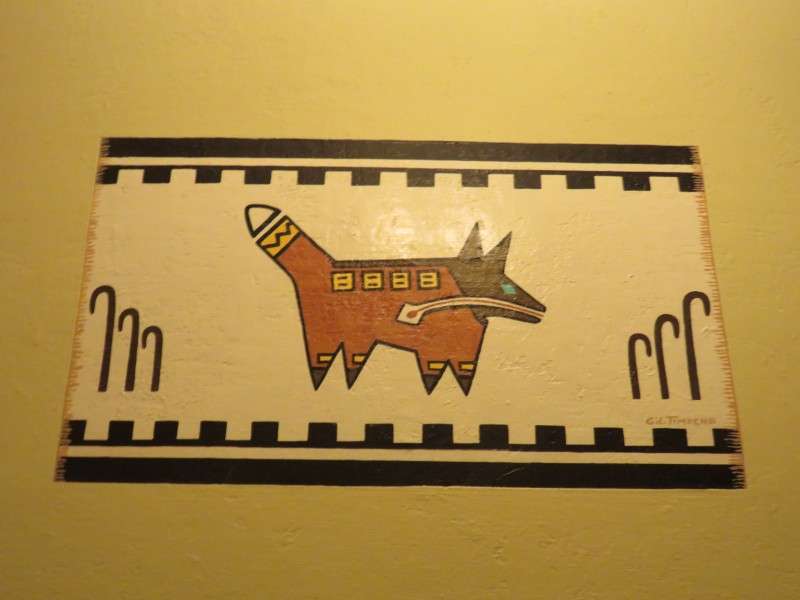
The hallways of El Tovar Hotel are decorated with Native Southwestern-inspired paintings.
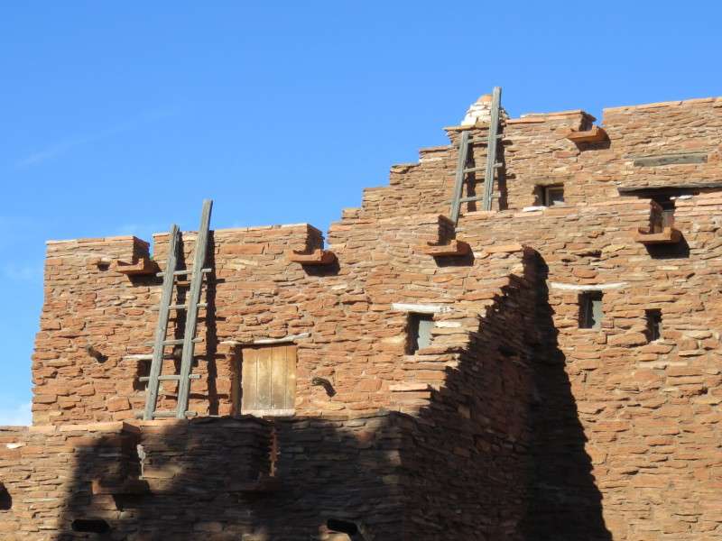
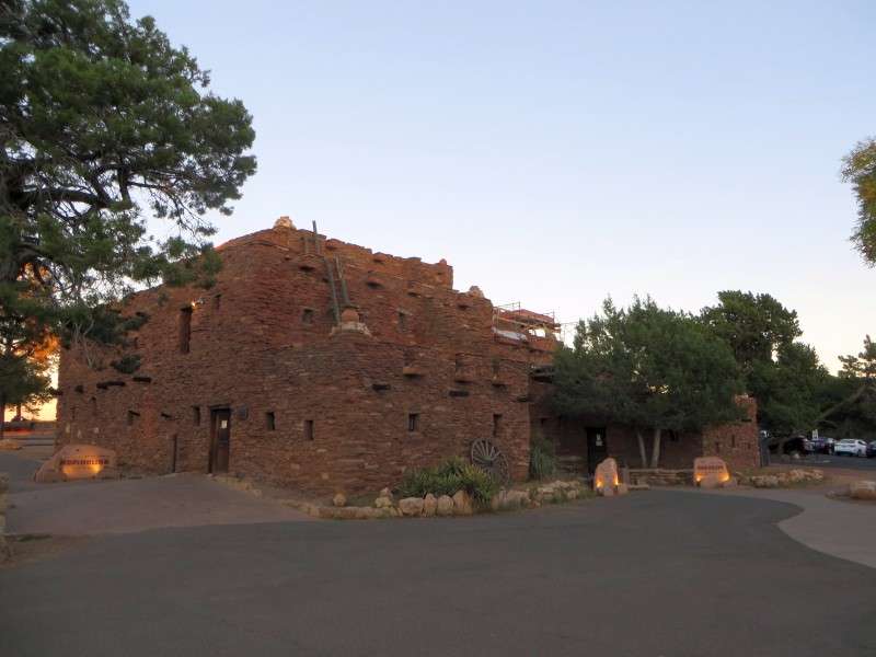
The Hopi House is across the driveway from El Tovar Hotel, and was built in 1905. The building was originally used for Hopi artisans to produce and sell their work.
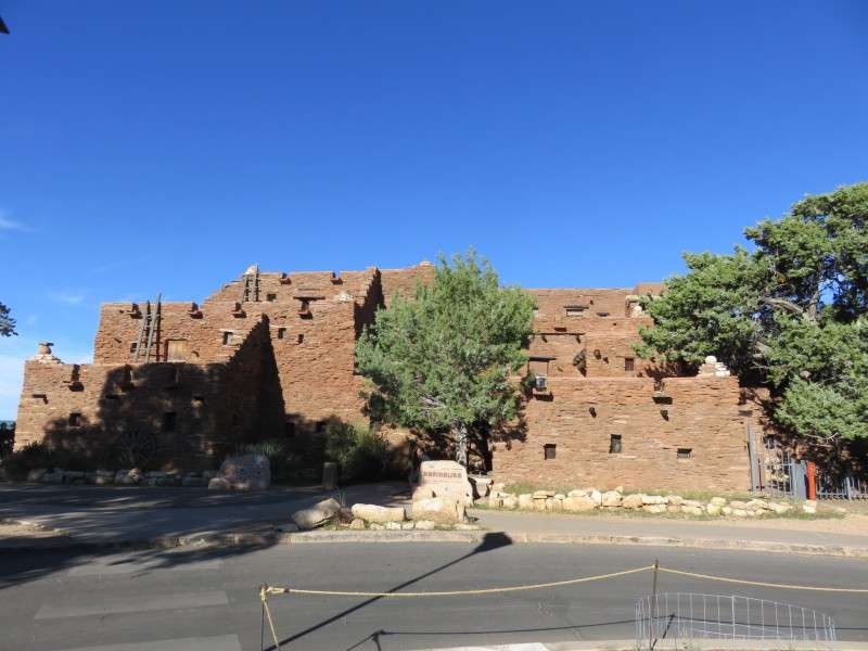
The building was designed by Mary Jane Colter, and is based on the Hopi village of Old Oraibi, which is one of the oldest continuously-inhabited settlements in the United States, having been founded before 1100.
Hopi House is still used to sell Native American arts and crafts, and Navajo rugs.
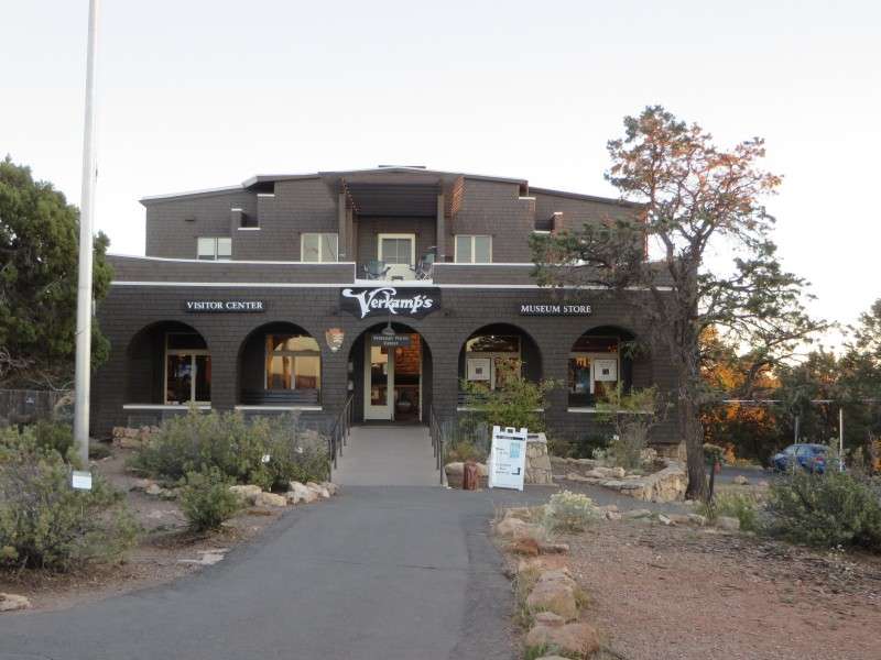
Verkamp's Visitor Center, about 500 feet east of the El Tovar Hotel on the Rim Trail. The structure was originally Verkamp's Curio Store, built in 1906. The store opened up in a tent in 1898.
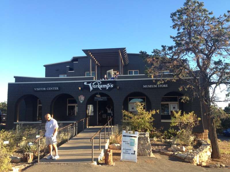
The visitor center was built in a modified Mission style, resembling an adobe building but not using adobe as a building material.
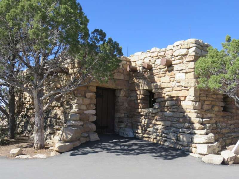
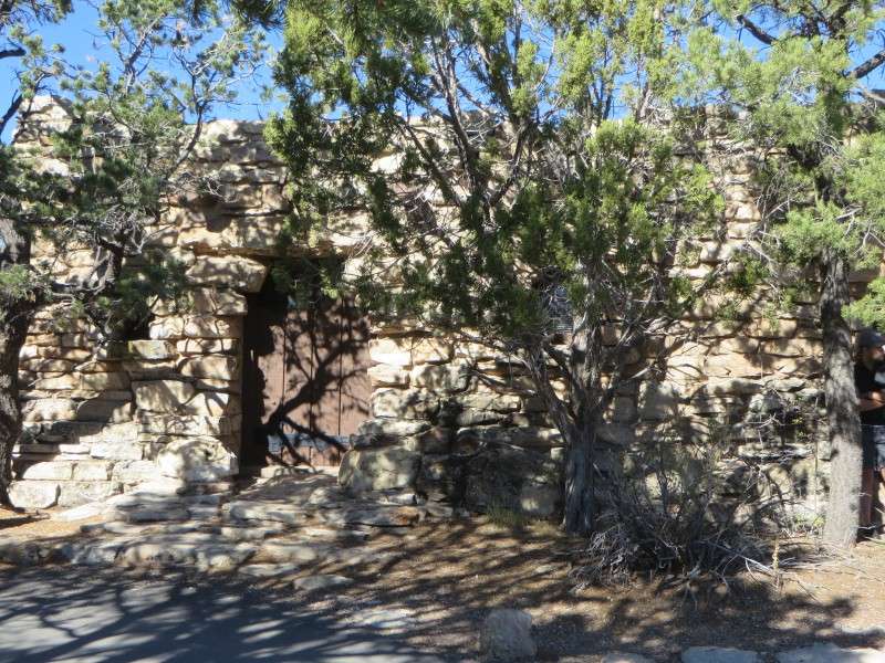
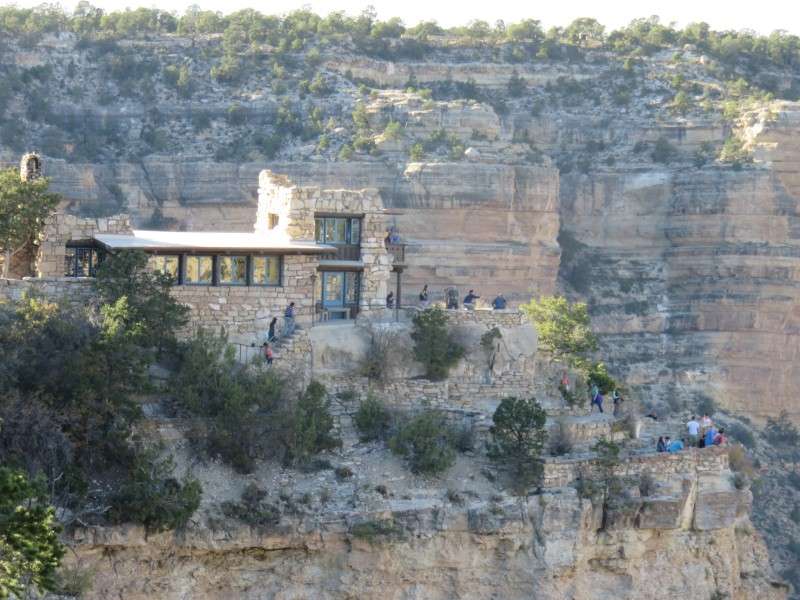
Lookout Studio, built on the rim of the canyon, northwest of the center of the village.
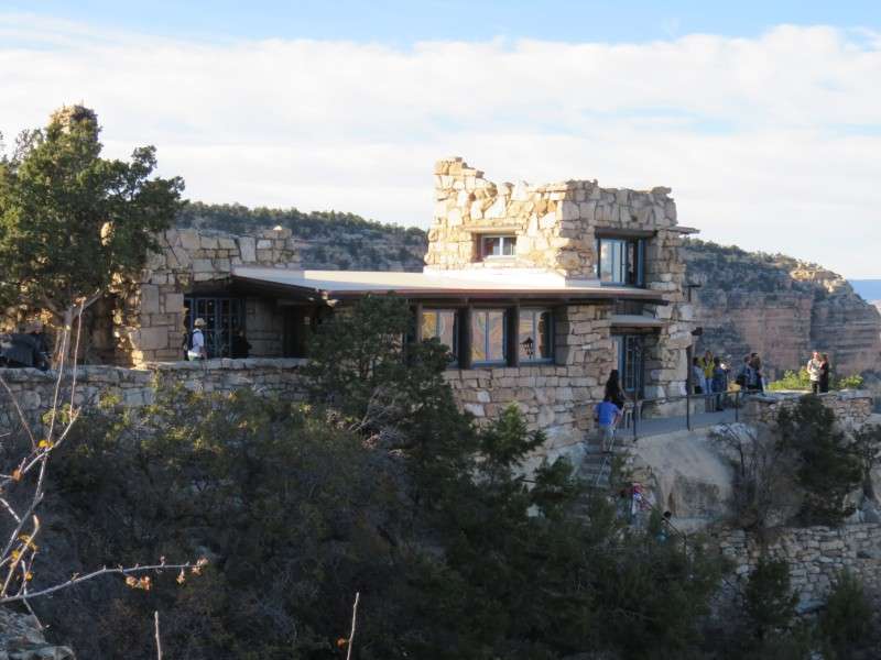
Lookout Studio was designed by Mary Jane Colter.
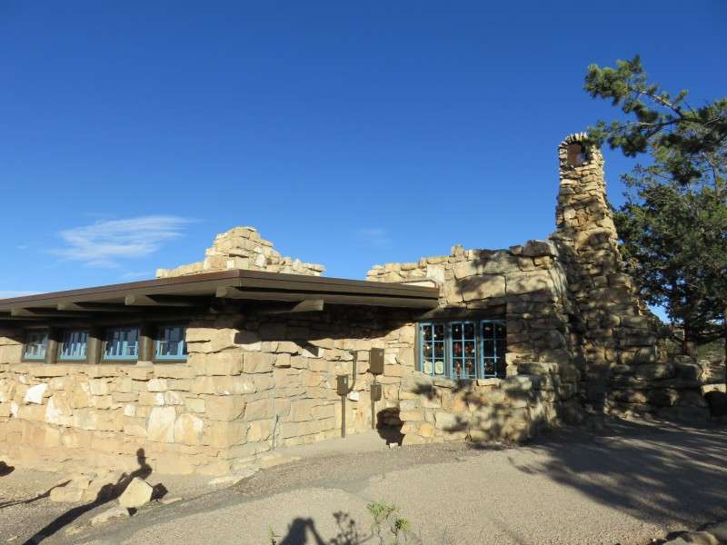
The studio was built in 1914 by the Fred Harvey Company to compete with the Kolb Studio, about 300 feet to the west.
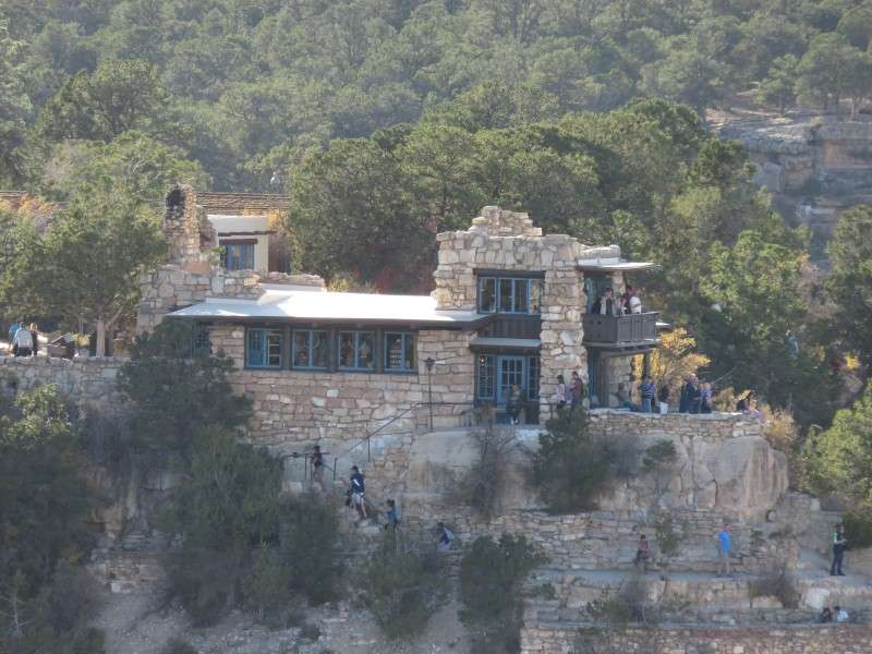
Rough-cut limestone was used as a building material, and was meant to blend in with the surrounding Kaibab limestone.
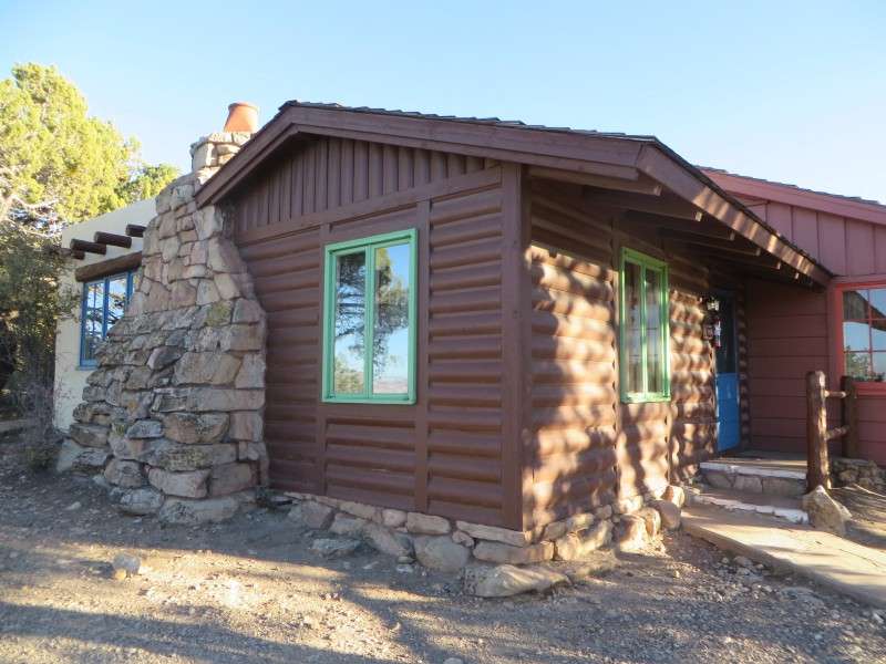
Bright Angel Lodge, on Village Loop Drive.
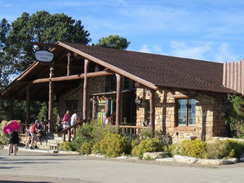
The lodge was built in 1935 and was designed by Mary Jane Colter.
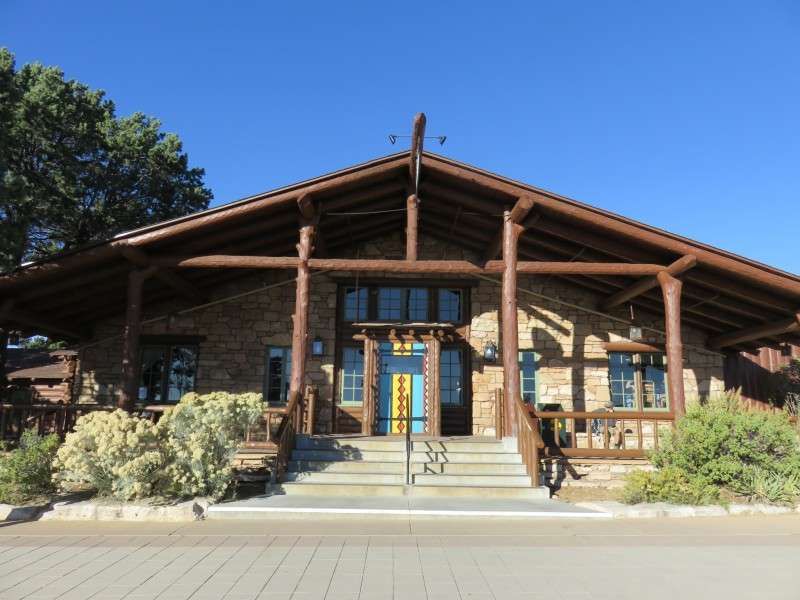
The Bright Angel Lodge utilizes the National Park Service Rustic style, like the El Tovar Hotel and other buildings in the park.
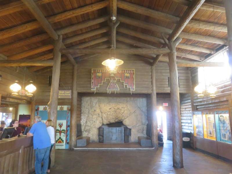
The fireplace is notable for recreating the strata found in the Grand Canyon along the Bright Angel Trail, in their correct sequence. Rocks at the top of the fireplace are those found at or near the canyon rim, and rocks at the bottom of the fireplace are those found in the inner canyon and by the Colorado River.
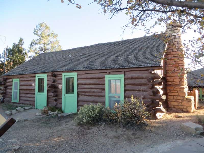
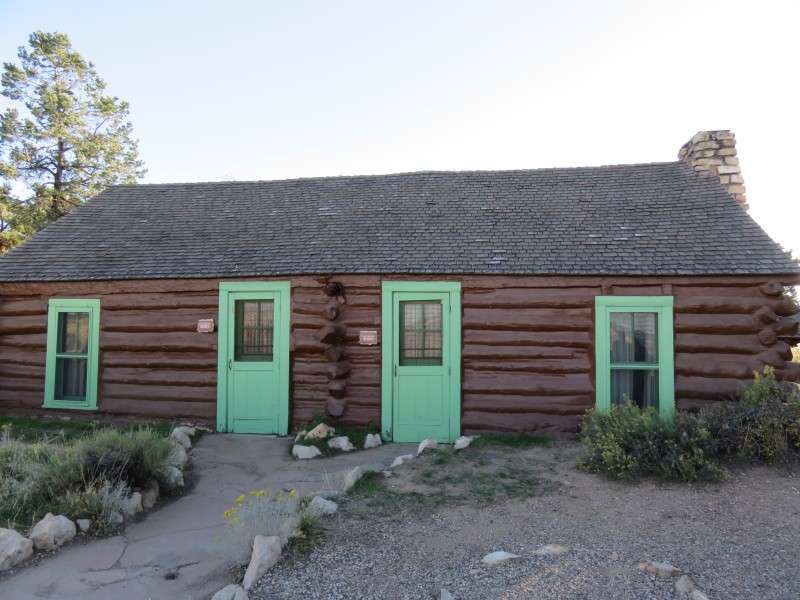
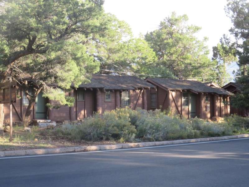
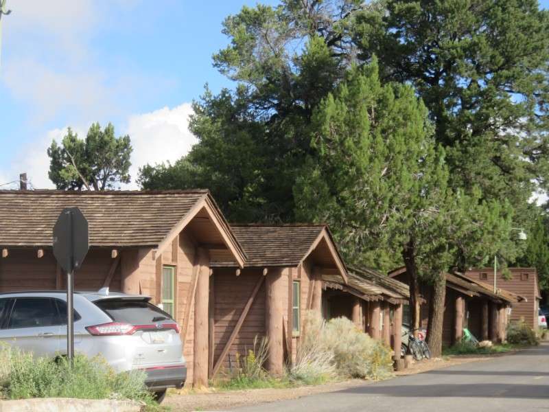
Cabins at the Bright Angel are available for rental, and surround the main lodge.
The cabins were mainly built in 1935, when the Bright Angel Lodge opened.
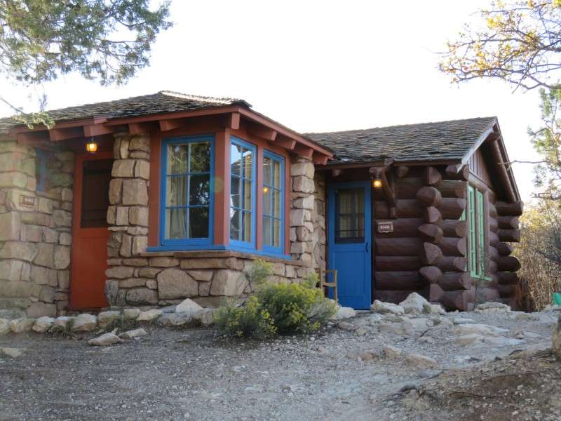
Most cabins are to the west of Bright Angel Lodge, and reach the Bright Angel Trail head, about 500 feet away.
Some cabins, like this one, are right on the Rim Trail.

The cabins along the trail have this view of the Grand Canyon.
Other cabins are closer to Village Loop Drive, but are still a short walk away from the canyon rim and Bright Angel Trail.
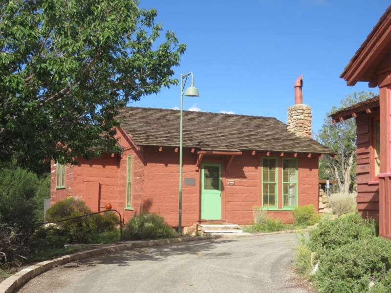
Red Horse Cabin, off of Village Loop Drive, in the Bright Angel Lodge complex. The cabin, built in 1890, is the oldest structure on the South Rim, along with Bucky O'Neill Cabin. The cabin was originally at Red Horse Ranch, 35 miles away, and was moved here in 1902 for guest accommodations. It served as the Grand Canyon's post office from 1910 to 1935. In 1935, the cabin was incorporated into the Bright Angel Lodge complex.
The Buckey O'Neill Cabin, along the Rim Trail.
The cabin was built in 1895 by O'Neill, who was a judge, sheriff, and mayor in Arizona, and was also a Rough Rider in the Spanish-American War, being killed in Cuba. The cabin is the oldest extant building on the South Rim of the Grand Canyon.
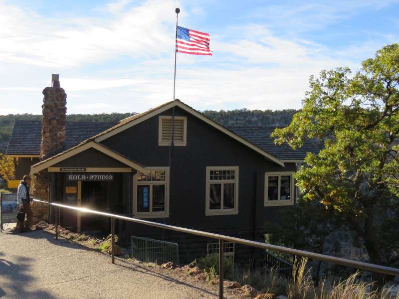
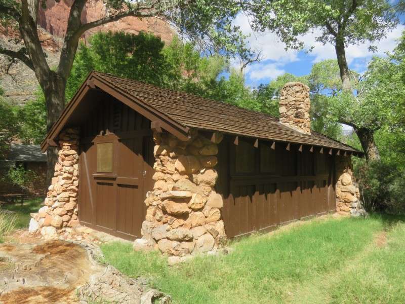
Kolb Studio, on the Rim Trail just west of Bright Angel Lodge.
Kolb Studio was built in 1904 by Ellsworth and Emery Kolb, who originally used it both as a family home, and a photographic studio.
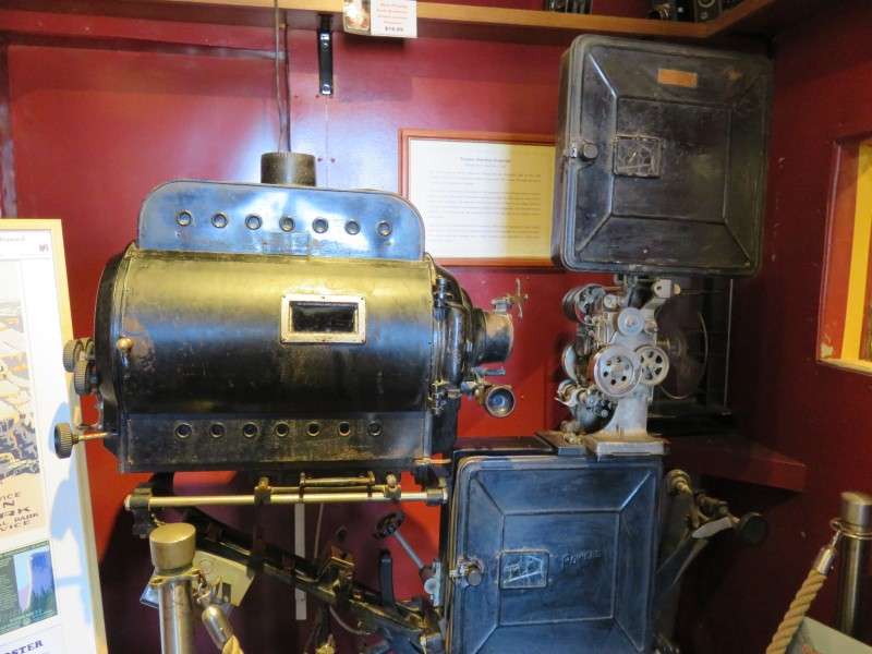
The Kolb Brothers' video equipment is housed in a small room in the studio. Ellsworth and Emery Kolb would use this projector to show the film of their trip down the Green River and Colorado River, which was during the winter of 1911-1912. The video was first shown in 1915, and was shown until 1976 with accompanying lectures, making it the longest-running film of all time.
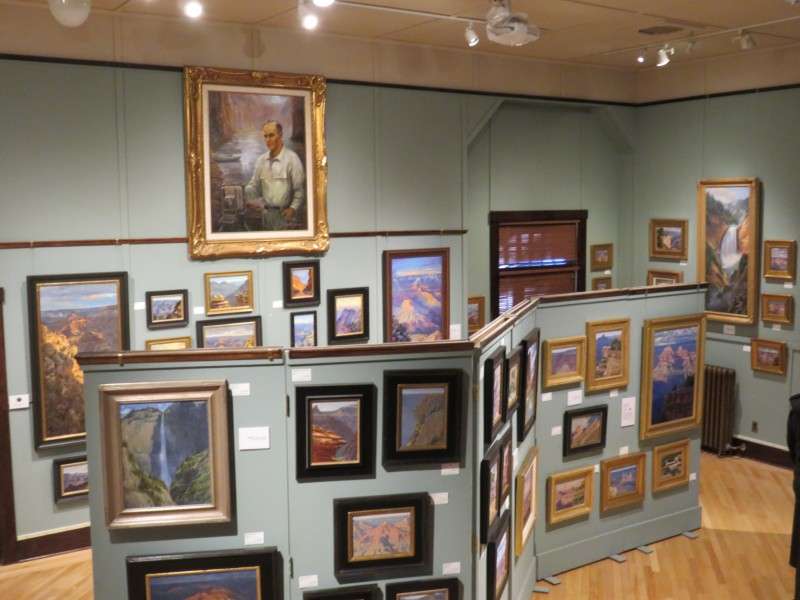
Kolb Studio is now used as a gift shop, and paintings and other works of art are available in the main studio area.
The studio hangs out over the edge of the canyon rim.
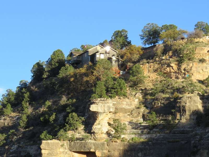
Because Kolb Studio is on the edge of the rim, it has a spectacular view of the canyon.
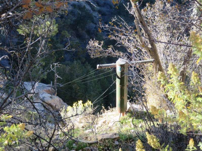
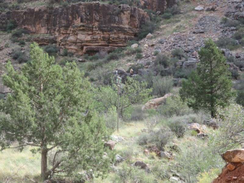
The Trans-Canyon Telephone Line begins just to the east of the Bright Angel Trail, and connects the South Rim with the North Rim. The telephone line was installed in 1934, and a second circuit was added in 1939 by the Civilian Conservation Corps. The phone line has been unaltered since, and is a rare surviving example, in some spots, of open-wire, copper-weld technology.
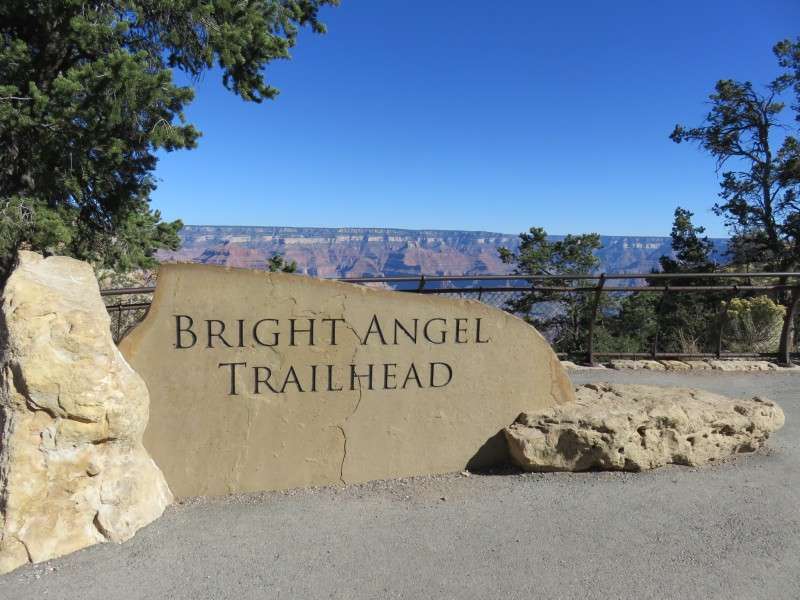
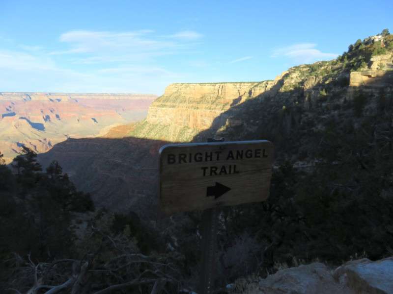
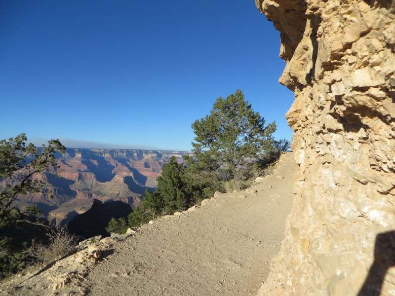
A trailhead sign marks the beginning of the Bright Angel Trail, along the rim of the canyon.
Bright Angel Trail has been used for millennia by Native American groups. It was a way for the Havasupai to get from the canyon rim to Indian Garden, where there was a constant stream of water. The Havasupai wore down a small, crude path over time.
The trail was formally laid out and improved in 1891 by Pete Berry, Niles Cameron, and Ralph Cameron, by following the natural break in the cliffs from the Bright Angel Fault. The trail was originally used to get to mining claims in the canyon, but it was soon realized that the trail was more useful for tourism.
The trail was registered as a toll road, and extended to the Colorado River. Tolls were collected until the trail was turned over to the National Park Service in 1928. The trail was improved by the Civilian Conservation Corps from 1933 to 1942.
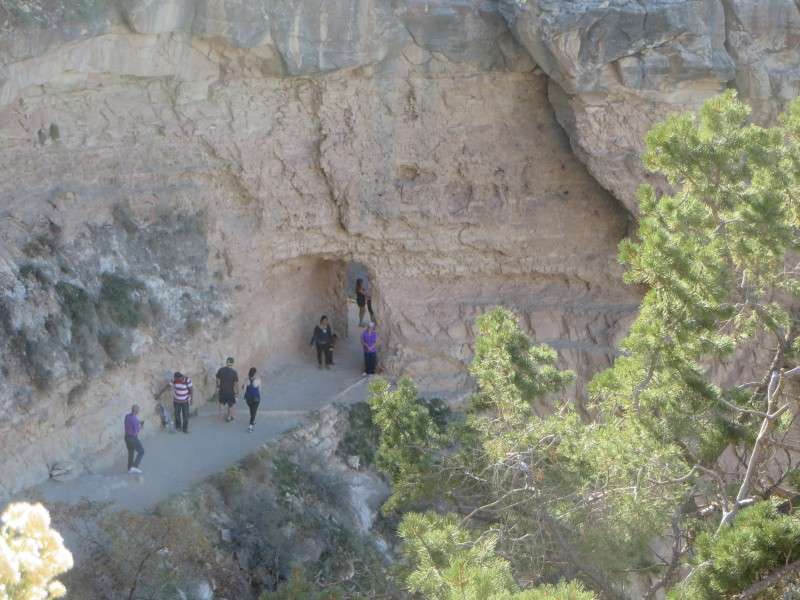
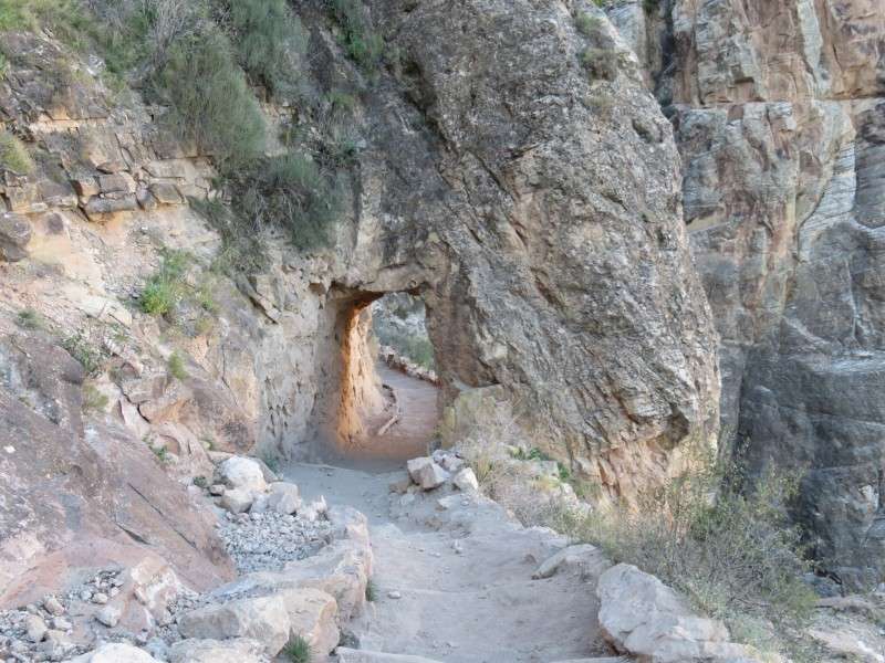
About one-fifth of a mile down the Bright Angel Trail is the first of two tunnels. Many tourists walk down the trail to this point, get their pictures taken in this photogenic spot, and turn around from here.
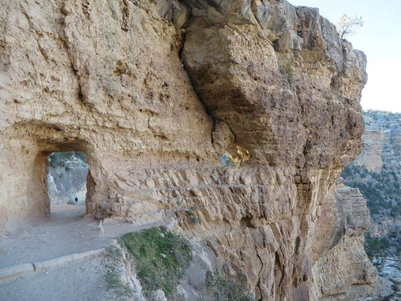
The Upper Tunnel was built between 1907 and 1912 by Ralph Cameron, who improved the trail after granting himself control of the toll road as chairman of the Coconino County Board of Supervisors.
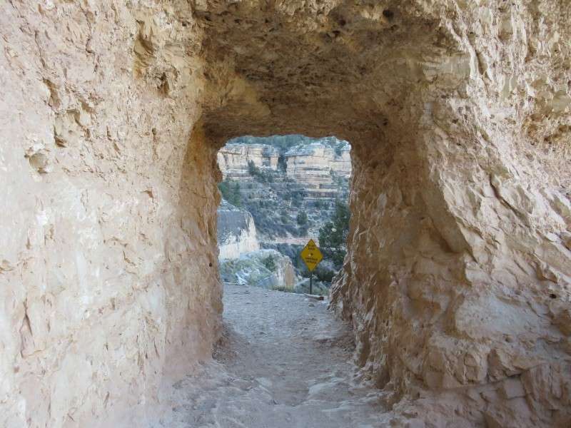
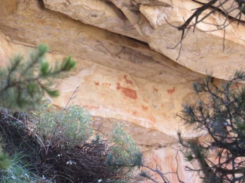
Pictographs can be found on the underside of a rock ledge after you cross through the Upper Tunnel on the Bright Angel Trail. This area past the tunnel is known as Mallery's Grotto.
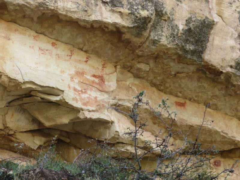
The meaning of the pictographs is not known, but scientists suspect that they may have been used as markers or signs for sources of food, or depicted successful hunts.
The Lower Tunnel, located three-quarters of a mile down the Bright Angel Trail, was created at the same time as the Upper Tunnel.
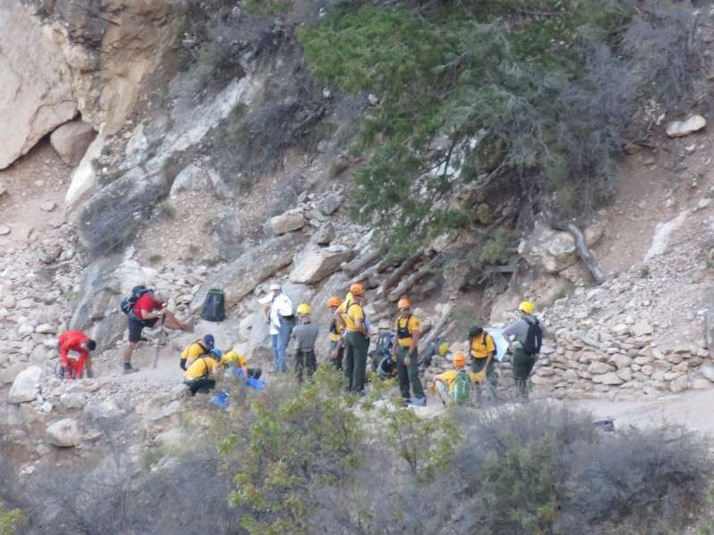
Bright Angel Trail, despite being maybe the easiest trail into the canyon, still sees plenty of injuries, since its easiness is deceptive.
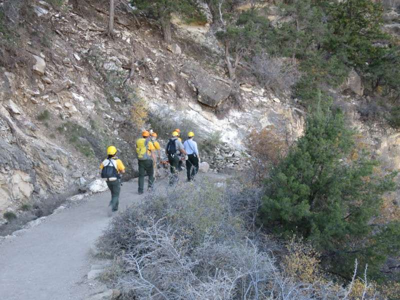
Rescue crews have to descend into the canyon on foot to tend to hikers and tourists who fall into trouble.
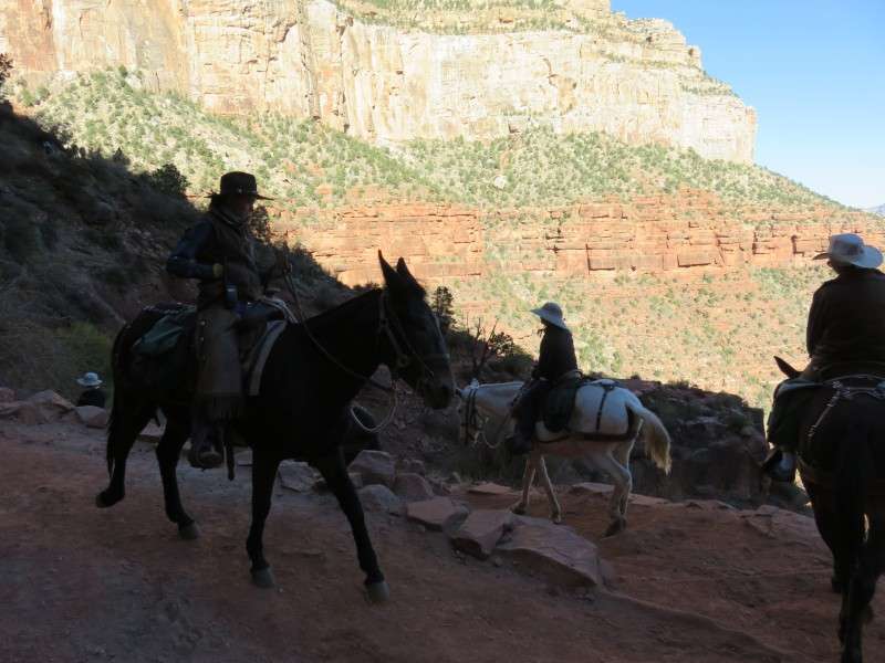
Mules are still the primary method of transporting goods through the canyon. These mules are taking the Bright Angel Trail to Phantom Ranch, located on the north shore of the Colorado River. Phantom Ranch is one of the most isolated census-designated places in the continental United States, and is one of two post offices in the United States where mail is transported by mule.
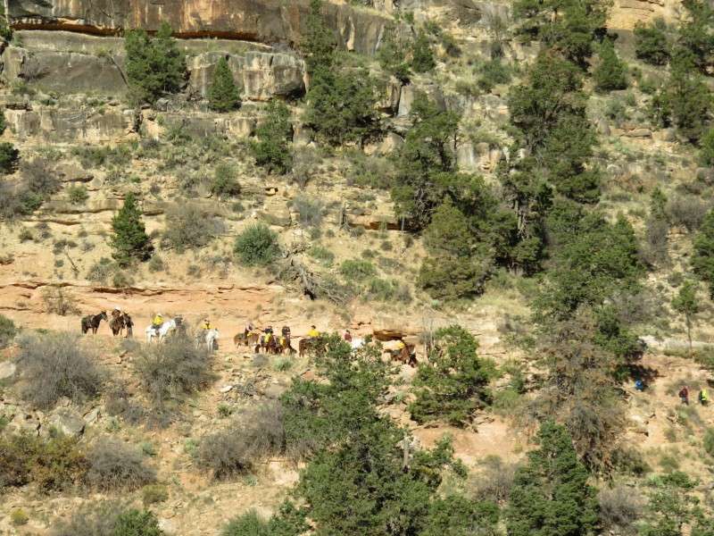
Mules are also used for guided tours through the canyon.
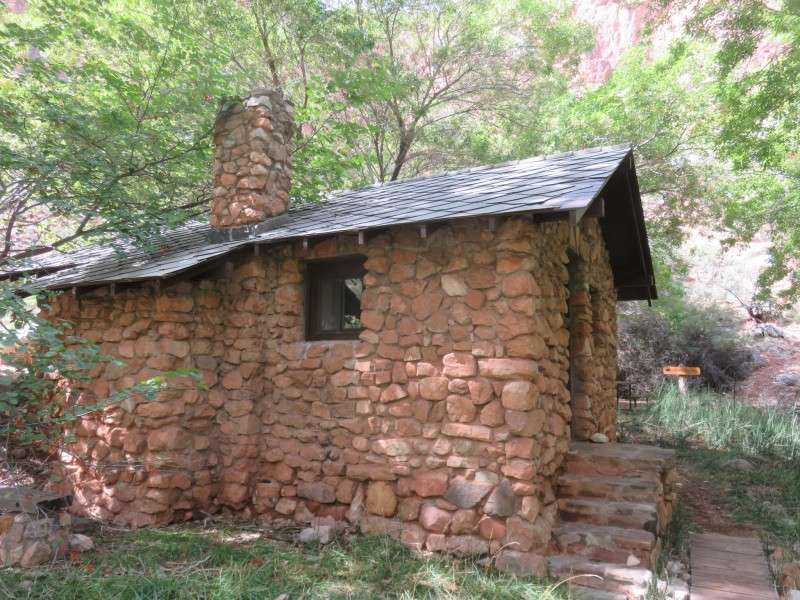
Mile-and-a-Half Resthouse, located 1.5 miles down the Bright Angel Trail from the South Rim. The resthouse was built in 1936.
The resthouse is about 1,000 feet below the head of Bright Angel Trail at the south rim of the canyon.
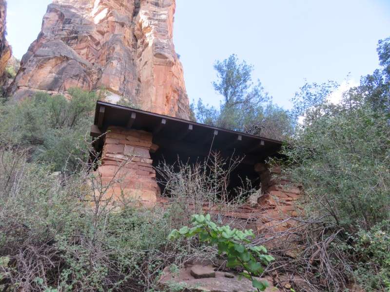
The resthouse provides a view out into the canyon.
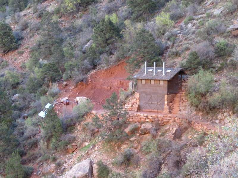
Just down the trail from the One-And-A-Half Mile Rest House are "modern" restrooms. The toilets are seats that lead to holes that go 20 feet into the ground.
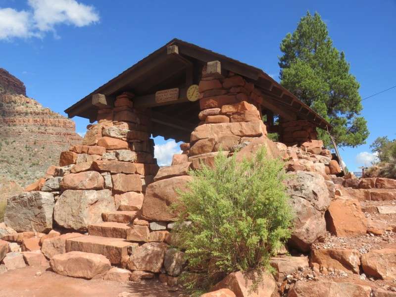
Three Mile Resthouse, located 3 miles down the Bright Angel Trail from the South Rim. The resthouse was built in 1935.
Jacob's Ladder is a series of tight switchbacks just beyond Three Mile Resthouse.
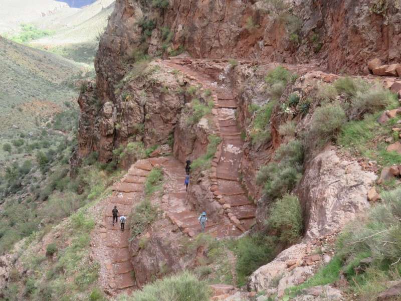
The switchbacks, one of four major sections on the Bright Angel Trail, were cut out of solid rock.
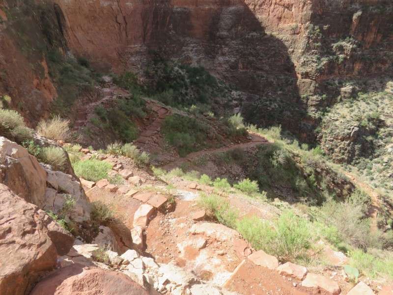
After going through Jacob's Ladder and descending the Redwall onto the Tonto Plateau, the Trans Canyon Telephone Line can be seen going across the desert landscape. The line was installed through this area in 1935, with Civilian Conservation Corps personnel starting on each side of the canyon and working towards each other near the river.
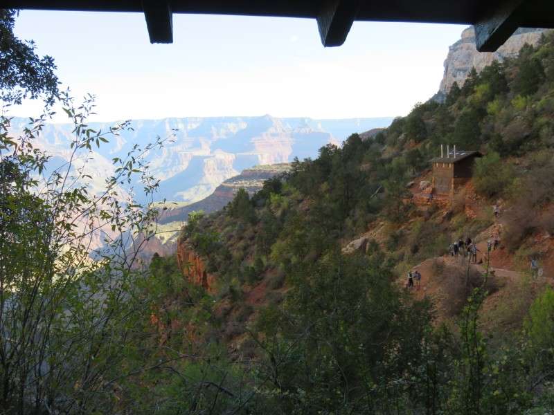
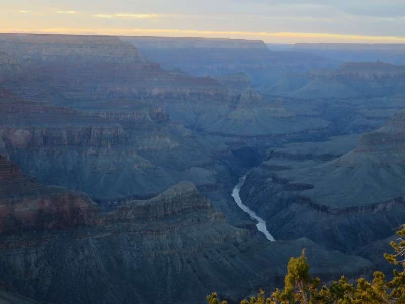
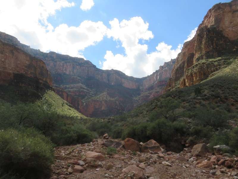
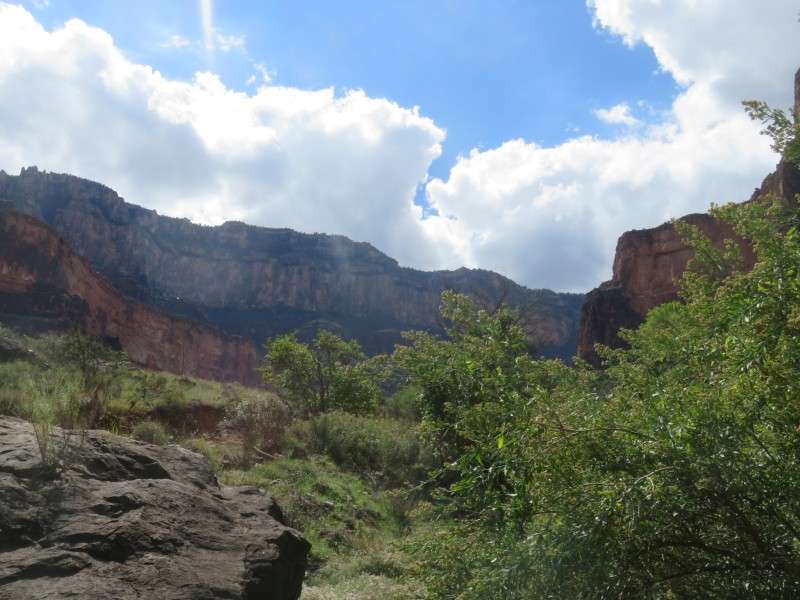
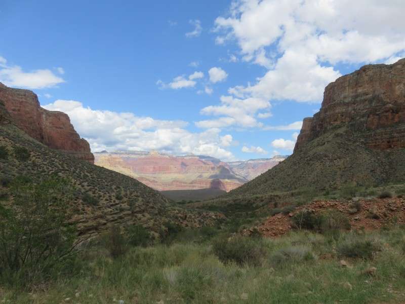
About halfway between the canyon rim and the Colorado River, along Garden Creek, is Indian Garden. Indian Garden is about 4.5 miles from the head of Bright Angel Trail. The oasis was first permanently inhabited by the Havasupai, who used the springs on site for a water source to grow crops. Indian Garden is visible from many places along the South Rim, and is also visible from most of the Bright Angel Trail.
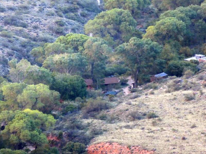
Buildings at the south end of Indian Garden. On the upper elevation is the Pump Caretaker's Residence. Below that in the foreground is the First Aid Building. Both were built in 1988.
The Ranger's Residence, on the south end of Indian Garden. The house was built in 1988.
The old Trail Caretaker's Residence, west of the Bright Angel Trail in Indian Garden. The house was built in 1932, and now houses the Visitor Information Center.
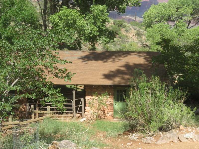
The old Pump Caretaker's Residence, west of the Bright Angel Trail in Indian Garden. The house was built in 1943.
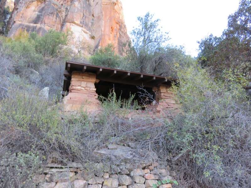
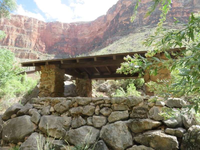
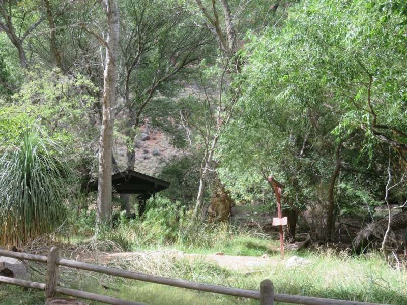
The Indian Garden Trail Shelter, along the Bright Angel Trail in the middle of Indian Garden. The resthouse was built in 1937.
The Indian Garden Mule Barn, along the Bright Angel Trail in the middle of Indian Garden. The barn was built in 1988.
A campground is located in Indian Garden, and is popular with hikers who want to spend a night in the canyon, but do not want to go as far as Phantom Ranch. The campgrounds in their current form were laid out in 1989.
Colter Hall, off of Village Loop Drive. The lodge was built in 1937. The lodge was the last building at the Grand Canyon designed by Mary Jane Colter, and was originally a female employee dormitories.
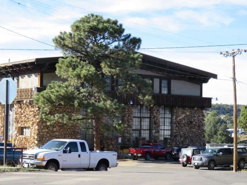
Thunderbird Lodge, off of Village Loop Drive. The lodge was built in 1968.
The old post office, along Village Loop Drive. The structure was built in 1935 to replace the Red Horse Saloon as the village post office. It now functions as a magistrate court.
The Grand Canyon Power House, on Mule Road.
The power station was built in 1926 by the Atchison, Topeka & Santa Fe Railway to supply electricity to the El Tovar Hotel, Bright Angel Lodge, and train station, and to provide steam heat to rail cars.
The El Tovar Horse Stable, on Village Loop Drive at Mule Road. The horse stable was built in 1904 to house horses used in transportation around the park at that time.
The El Tovar Mule Stable, on Village Loop Drive at Mule Road.
The mule stable was also built in 1904, when the horse stable was built. The mule stable is still used to house mules, which transport people and goods to Phantom Ranch, down near the end of Bright Angel Trail, on the north shore of the Colorado River.
Victor Hall, on Victor Street. The hall was built in 1936 for use as male employee dormitories, and was designed by Mary Jane Colter.
The Community Building, on Victor Street. The structure was built in 1935.
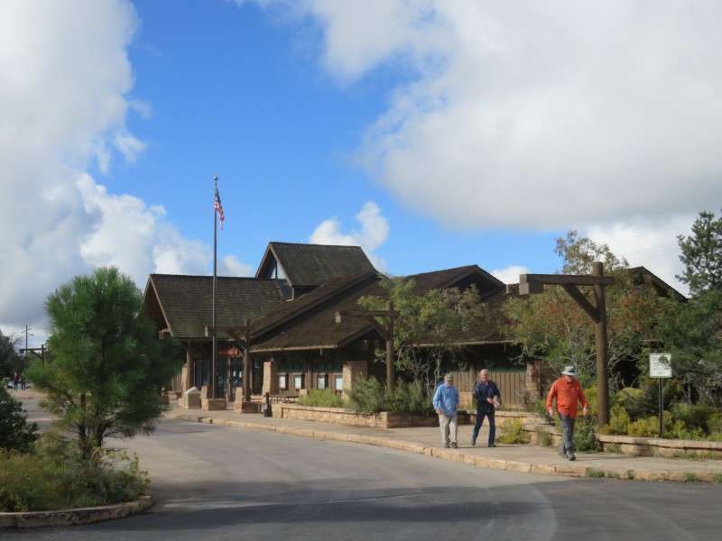
A park office building on Village Loop Drive at Entrance Road.
The Backcountry Information Center, off of Backcountry Road.
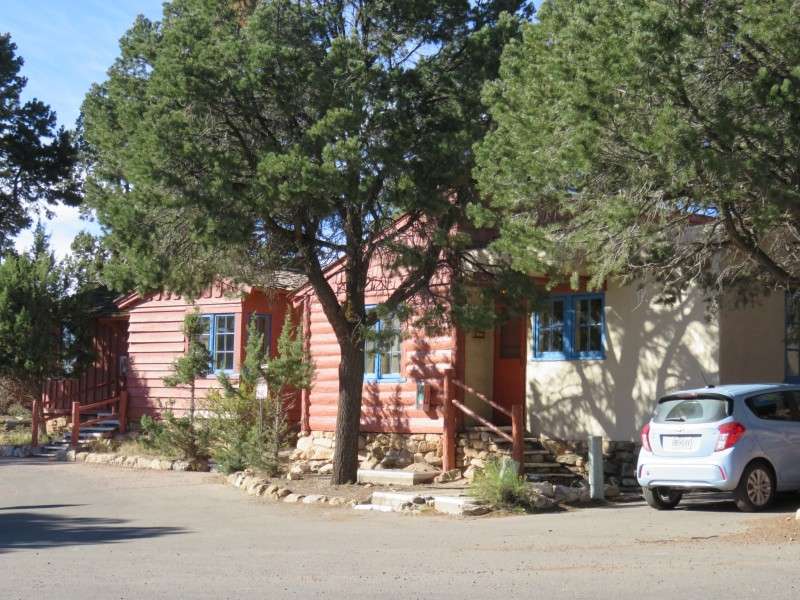
Cabins on Bourbon Street, facing Village Loop Drive.
Cabins on Bourbon Street.
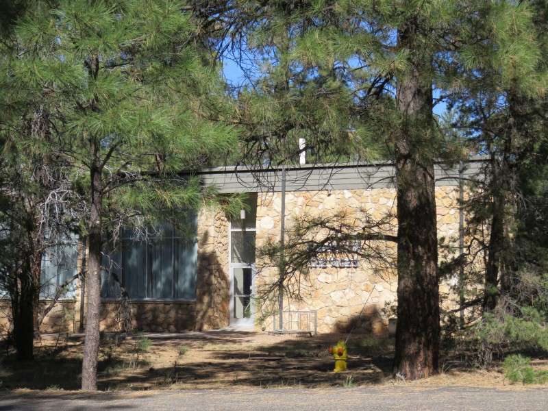
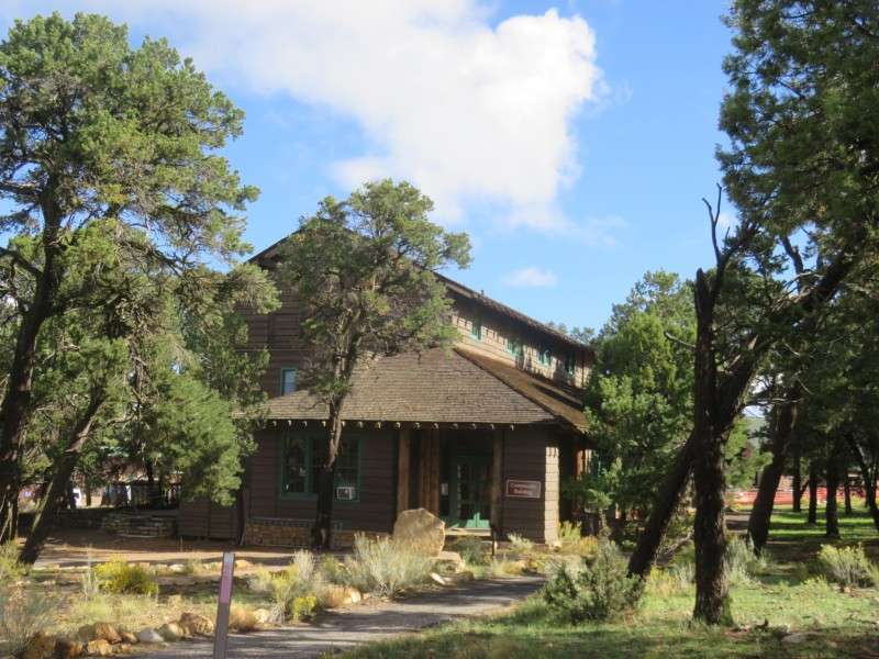
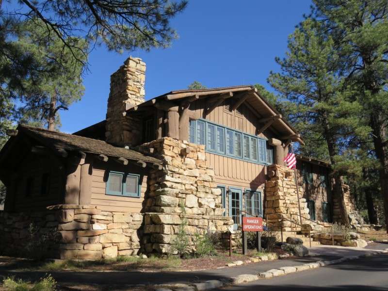
The Grand Canyon Park Ranger Operations Building, on Center Road. The structure was built in 1929 as the park headquarters, and utilizes rubble Kaibab limestone.
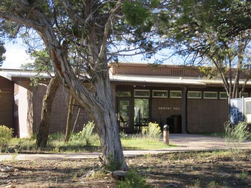
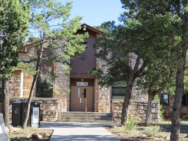
Kowski Hall, the meeting space for the Horace Albright Training Center, on Albright Avenue. The training center is used to train park rangers around the country, and was built in 1963, when it was moved from Yosemite National Park.
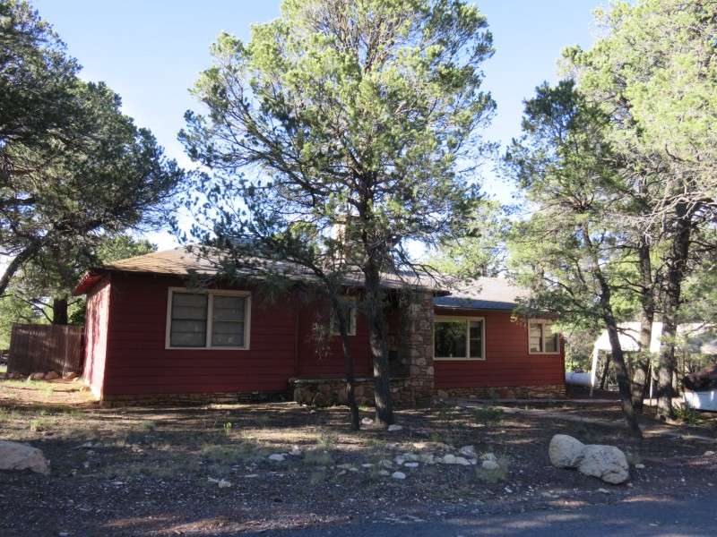
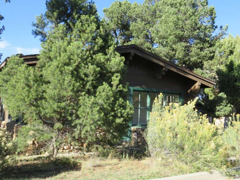
Houses on Boulder Street.
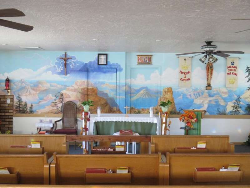
El Cristo Rey Catholic Church, on Albright Avenue.
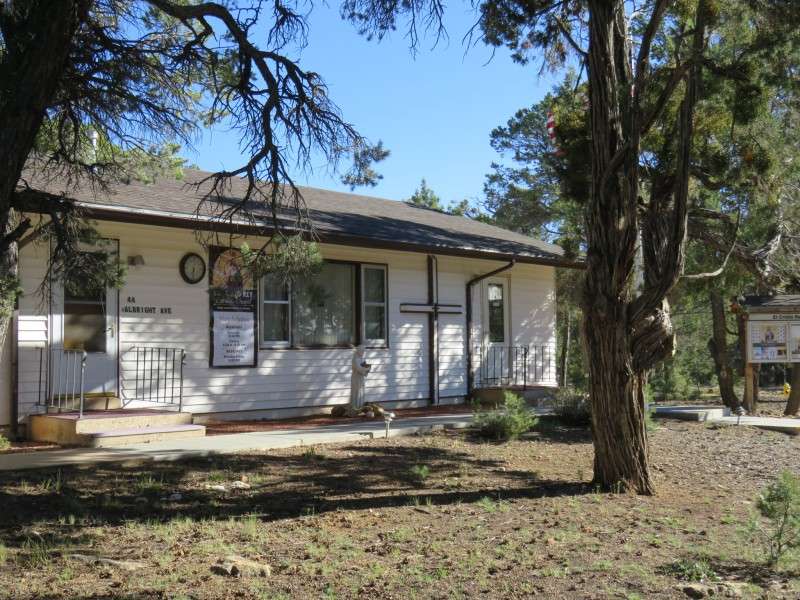
The chapel is just a small room inside a manufactured home, but serves Catholics living at the Grand Canyon.
A house on Boulder Street.
Grand Canyon High School, on Boulder Street.
A house on Boulder Street.
A house on Apache Street. The houses on Apache Street were built by the Atchison, Topeka & Santa Fe Railway for consessioner employees. These houses were built around 1929.
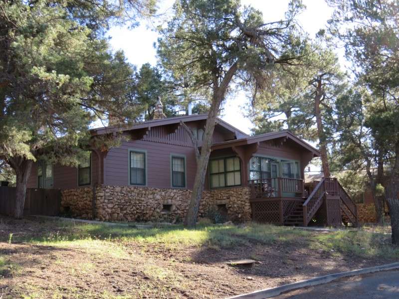
A house on Apache Street, originally for Atchison, Topeka & Santa Fe Railway employees. These houses follow the Garden City plan, with access for cars in the rear.
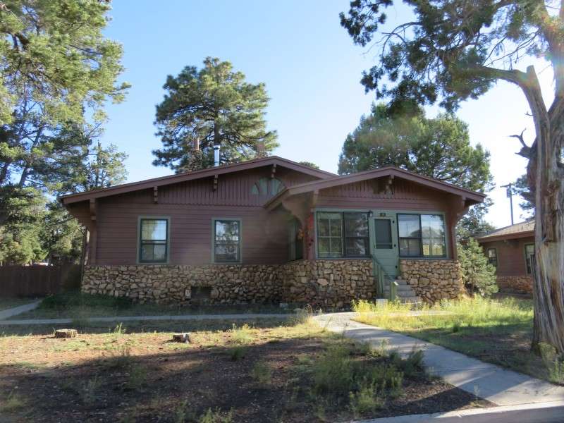
Another house on Apache Street, originally for Atchison, Topeka & Santa Fe Railway employees.


 Linear Mode
