 New Addition to Directory:
Just had some tea, and an idea clicked. I think it would be a good idea to add a GIS (Geographical Information System) to the first post to cover sections of the state or cities.
Things that include parcel data, taxes, crime, road networks, schools, and so on. Usually what you would find on a GIS system database. The types that are available to use on a browser. Some of the links or sources also have actual .MDX files, but they are all available online through the browser without using ArcGIS. Although the program is good, and if you don't want to buy it, well, there are ways. Ultimately up to you how you obtain it.

Found at the bottom, right below "project sets" which are links to posts that have lots of info such as how many projects are u/c or proposed and so on along with the accompany user credit. In red, because for their work, they need recognition.
Remember to bookmark this link:
http://skyscraperpage.com/forum/show...81&postcount=1
For easy access to all your Texas related prooject threads.
On the GIS section, just an example:
I added a number because there are possibly much better resources as I discover them or if any are brought to the forums attention.
This is already added on the directory or 1st post, and if you guys know any more GIS references or databases, feel free to share. I will look for some more and update it, because along with project info and a compilation, I also want the scope, like any other directory and compilation, to include useful map info.

I'll also add a credit section because I am very appreciative of all the support from various contributors here. Even if its just one project, thats good for me and its the effort that counts. Thanks once again to everyone!

- Chris E


 Prev
Prev


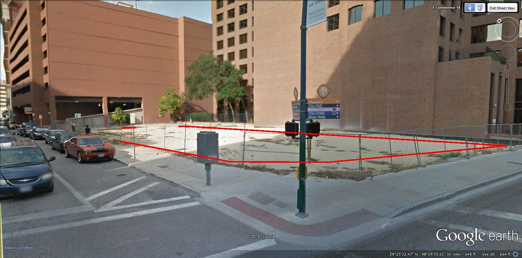


 Chart:


 Linear Mode
