HomeDiagramsDatabaseMapsForum About
     

Go Back   SkyscraperPage Forum > Regional Sections > Canada > Alberta & British Columbia > Calgary > Transportation & Infrastructure


Reply

 
Thread Tools Display Modes
     
     
  #7181  
Old Posted Apr 26, 2018, 9:59 PM
OzzyCalgary OzzyCalgary is offline
Registered User
 
Join Date: Apr 2016
Location: Calgary
Posts: 55
Quote:
Originally Posted by 5seconds View Post
They have done a lot in that area. Work on that road started 6+ months ago. This is the google map of the area: https://www.google.ca/maps/place/50%...4d-114.1460578
Yeah, so they are working on the area between what shows up on google maps, and Oakfield drive now.
Reply With Quote
     
     
  #7182  
Old Posted May 29, 2018, 12:25 AM
Corndogger Corndogger is offline
Registered User
 
Join Date: Sep 2007
Location: Calgary
Posts: 7,727
SWRR Update from Alberta Transportation

Video Link


Drivers face major detour at Glenmore and Sarcee as work continues on ring road interchange

The Alberta government is warning of potential traffic delays as new detours are put in place for construction of the southwest ring road, but it’s hoping for minimal impact on motorists.

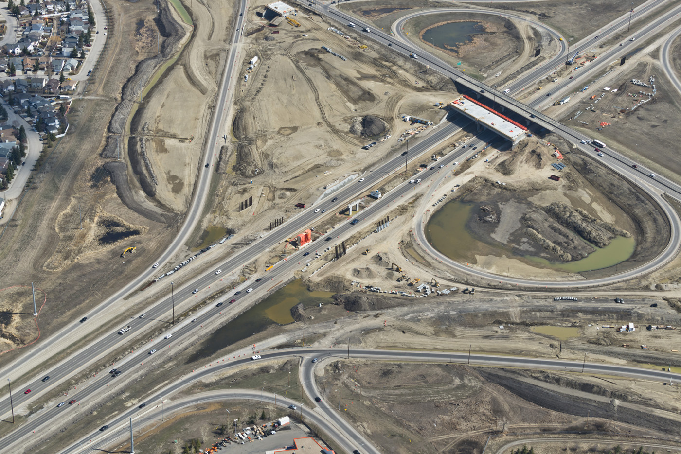
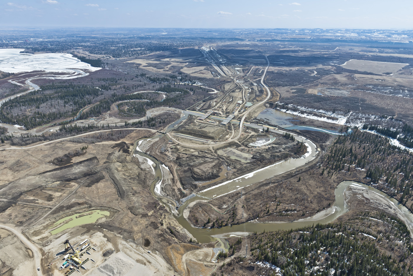
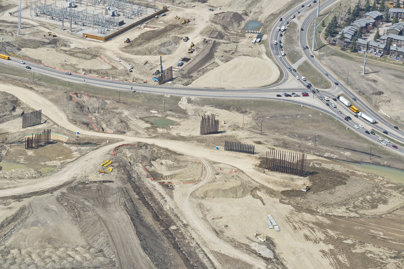
The biggest impact is expected to be felt from the June closure of the section of Highway 8 that connects with Glenmore Trail to allow for the building of a massive new interchange.

East-west traffic will be diverted on to Sarcee Trail, where new u-turn lanes will be installed to handle the flow of vehicles between the thoroughfares until the fall of 2020.

“We’ve done everything we can to ensure the level of service stays as high as possible, keeping the same number of lanes moving in each direction,” Alberta Transportation spokesman Adam Johnson told reporters touring construction on Monday.

“(But) some planning should be put in place. As much as we are aiming for the original level of service, especially in the early days of this detour … there are going to be some delays.”

Work on the Highway 8/Glenmore Trail corridor will also see the temporary closure of 101st Street between June 2 and 10, with Lower Springbank Road serving as the detour. Lower Springbank Road will itself be closed permanently in July.

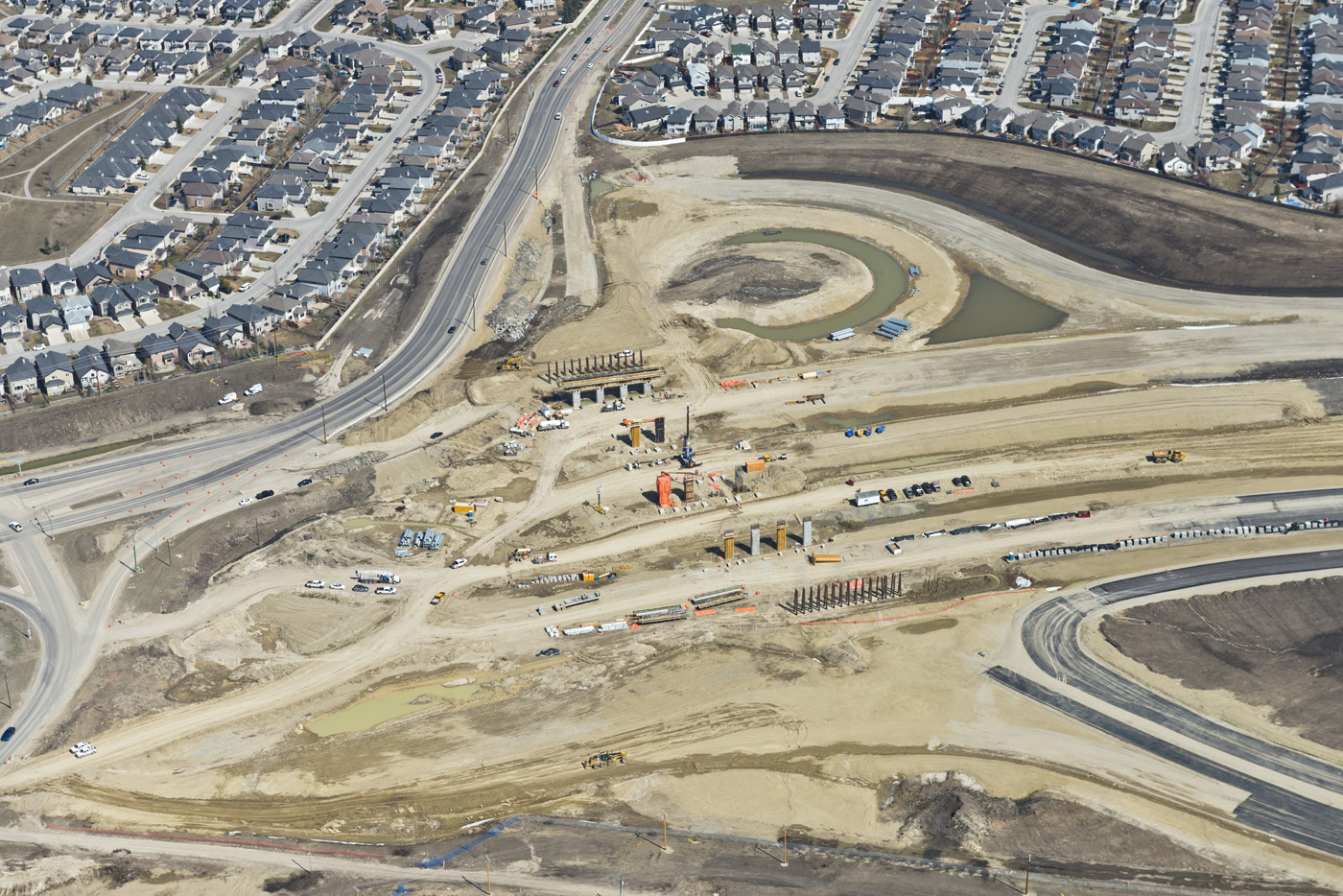
Residents of Lakeview will also be affected as access to the neighbourhood from Glenmore Trail will be shifted along the new Grey Eagle Boulevard in June. North access from 37th Street will be closed.

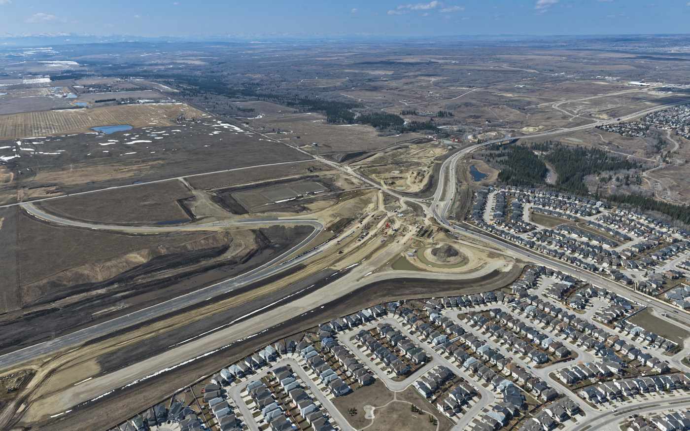
A number of changes are also being made along the Highway 22X corridor between now and the fall, including a realignment at Macleod Trail this spring, but Alberta Transportation’s project manager, Rizwan Hussain, said traffic should not be affected.

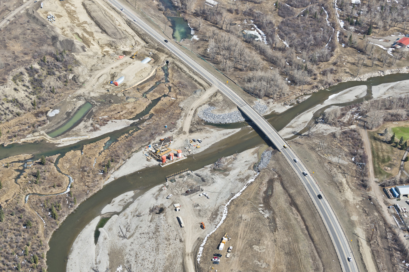
The province showed off on Monday the realigned Elbow River running under the three new bridges that go through the Weaselhead.

The government says it successfully created new channels for sections of the Elbow River and Fish Creek between April 15 and 30 to allow for construction, relocating 13,000 fish in the process.

The diversion required the approval of the federal Department of Fisheries and Oceans, as well as the provincial government.

The $1.4-billion southwest ring road has been under discussion for decades but only was able to move forward once a land deal with the Tsuut’ina Nation was reached by the government in 2013.

The scope of the ring road project has attracted criticism, with the NDP government acknowledging it is being “overbuilt” but saying it cannot significantly alter the plans because of the timelines it is operating under.

Under the agreement with the Tsuut’ina signed by the former Progressive Conservative government, the province faces a May 2022 deadline for completion of the roadway, running from Highway 22X to Glenmore Trail, or else the land reverts to the First Nation.

In January, Environment Minister Shannon Phillips ordered the protection of four wetlands in or near the Elbow River valley close to ring road construction, which had been the subject of a hearing by the province’s Environment Appeals Board.

Hussain said the only change required to adhere to the order is the addition of a retaining wall to the Beaver Pond wetland.

Source: http://calgaryherald.com/news/politi...ad-interchange
Reply With Quote
     
     
  #7183  
Old Posted May 29, 2018, 1:38 PM
Wentworth Wentworth is offline
Registered User
 
Join Date: Apr 2009
Location: Wentworth
Posts: 430
Is there a diagram somewhere of the u-turn route?
Reply With Quote
     
     
  #7184  
Old Posted May 29, 2018, 6:41 PM
Wyku Wyku is offline
Registered User
 
Join Date: May 2008
Location: Saskatoon, SK
Posts: 524
Looks like some solid progress on those bridges! The river channel looks awfully narrow under them, but I'm not sure how wide it would have been in its old spot? Seems like it wouldn't take much to overflow onto the adjacent roadways, but maybe I'm not seeing it right.
Reply With Quote
     
     
  #7185  
Old Posted May 29, 2018, 8:04 PM
Corndogger Corndogger is offline
Registered User
 
Join Date: Sep 2007
Location: Calgary
Posts: 7,727
The city has an interactive map of the entire 201. I doubt it's new but it's the first time I've seen it.

https://maps.calgary.ca/calgaryringroad/
Reply With Quote
     
     
  #7186  
Old Posted May 30, 2018, 4:57 AM
craner's Avatar
craner craner is offline
Go Tall or Go Home
 
Join Date: Mar 2007
Location: Calgary
Posts: 6,755
Quote:
Originally Posted by Wyku View Post
Looks like some solid progress on those bridges! The river channel looks awfully narrow under them, but I'm not sure how wide it would have been in its old spot? Seems like it wouldn't take much to overflow onto the adjacent roadways, but maybe I'm not seeing it right.
I don't believe there are plans for roadways adjacent to the river channel under those bridges so all that space to the sides could be used to accommodate an swelling river (I think).
Reply With Quote
     
     
  #7187  
Old Posted May 30, 2018, 3:54 PM
Mazrim's Avatar
Mazrim Mazrim is offline
Registered User
 
Join Date: Aug 2009
Location: Calgary, Alberta
Posts: 1,403
Quote:
Originally Posted by 5seconds View Post
http://www.swcrrproject.com/wp-conte...8x3Feb2018.pdf

It's a big file, and shows pavement but not the lanes exactly. Global had a better map, and I hope KGL releases it.
If you zoom in you can see some messy line work, but there's line work for the detour nonetheless. According to that plan, there is only 1 through lane for NB Sarcee at the detour intersection, which would assuredly be a disaster. I have to assume this is not the final version.
Reply With Quote
     
     
  #7188  
Old Posted May 30, 2018, 4:17 PM
milomilo milomilo is offline
Registered User
 
Join Date: Dec 2013
Location: Calgary
Posts: 10,499
The Herald article states that the number of lanes in all directions is staying the same, and the map in the article video (different to the ones above) confirms that, so I think it's fine.
Reply With Quote
     
     
  #7189  
Old Posted May 30, 2018, 5:47 PM
DoubleK DoubleK is offline
Near Generational
 
Join Date: Sep 2011
Location: Calgary
Posts: 1,447
I sent KGL a note to see if they had a better map/diagram.
Reply With Quote
     
     
  #7190  
Old Posted May 30, 2018, 6:34 PM
Wyku Wyku is offline
Registered User
 
Join Date: May 2008
Location: Saskatoon, SK
Posts: 524
Quote:
Originally Posted by craner View Post
I don't believe there are plans for roadways adjacent to the river channel under those bridges so all that space to the sides could be used to accommodate an swelling river (I think).
Ahh, okay that makes much more sense!
Reply With Quote
     
     
  #7191  
Old Posted May 30, 2018, 6:34 PM
Corndogger Corndogger is offline
Registered User
 
Join Date: Sep 2007
Location: Calgary
Posts: 7,727
Quote:
Originally Posted by DoubleK View Post
I sent KGL a note to see if they had a better map/diagram.
Don't expect too much action from them. I emailed them mid-May asking why the April photos are password protected and was told they were still upload the photos and captioning them. They also said they were "waylaid by other priorities." Is uploading and captioning 30 or so photos that time intensive?
Reply With Quote
     
     
  #7192  
Old Posted May 30, 2018, 7:07 PM
DoubleK DoubleK is offline
Near Generational
 
Join Date: Sep 2011
Location: Calgary
Posts: 1,447
Hmmmm... I've emailed them twice so far. They've gotten back to me in a couple days.
Reply With Quote
     
     
  #7193  
Old Posted May 30, 2018, 7:40 PM
Corndogger Corndogger is offline
Registered User
 
Join Date: Sep 2007
Location: Calgary
Posts: 7,727
Quote:
Originally Posted by DoubleK View Post
Hmmmm... I've emailed them twice so far. They've gotten back to me in a couple days.
They got back to me the next day but two weeks later there are still no April photos posted. I wouldn't expect them to post a map any faster.
Reply With Quote
     
     
  #7194  
Old Posted May 31, 2018, 4:14 AM
DoubleK DoubleK is offline
Near Generational
 
Join Date: Sep 2011
Location: Calgary
Posts: 1,447
Not sure if this is any better, but this is what they sent me.

Reply With Quote
     
     
  #7195  
Old Posted May 31, 2018, 3:49 PM
DoubleK DoubleK is offline
Near Generational
 
Join Date: Sep 2011
Location: Calgary
Posts: 1,447
Why didn't that link properly?! I'll try again tonight.

I saw it post on my computer last night.
Reply With Quote
     
     
  #7196  
Old Posted May 31, 2018, 8:25 PM
DoubleK DoubleK is offline
Near Generational
 
Join Date: Sep 2011
Location: Calgary
Posts: 1,447
Quote:
Originally Posted by Acey View Post
Inside of image syntax, you have something that is not an image.
It was embedded in an email. I copied that link and pasted it.

I was probably seeing a local copy in my cache, which is why I saw it.

I'll photobucket/flicker/whatever the cool kids use tonight.

I will say this. It does look to be free flow...
Reply With Quote
     
     
  #7197  
Old Posted May 31, 2018, 8:37 PM
Corndogger Corndogger is offline
Registered User
 
Join Date: Sep 2007
Location: Calgary
Posts: 7,727
Quote:
Originally Posted by DoubleK View Post
It was embedded in an email. I copied that link and pasted it.

I was probably seeing a local copy in my cache, which is why I saw it.

I'll photobucket/flicker/whatever the cool kids use tonight.

I will say this. It does look to be free flow...
That interchange complex when done is supposed to be free flow.
Reply With Quote
     
     
  #7198  
Old Posted May 31, 2018, 8:43 PM
DoubleK DoubleK is offline
Near Generational
 
Join Date: Sep 2011
Location: Calgary
Posts: 1,447
The temporary one looks free flow too.

Well parts of it will be.
Reply With Quote
     
     
  #7199  
Old Posted May 31, 2018, 8:58 PM
Corndogger Corndogger is offline
Registered User
 
Join Date: Sep 2007
Location: Calgary
Posts: 7,727
Quote:
Originally Posted by DoubleK View Post
The temporary one looks free flow too.

Well parts of it will be.
I believe that's what they said/implied in the video.
Reply With Quote
     
     
  #7200  
Old Posted May 31, 2018, 10:18 PM
Corndogger Corndogger is offline
Registered User
 
Join Date: Sep 2007
Location: Calgary
Posts: 7,727
We have new photos of the SWCRR! Not exactly new as they were taken on 4/25.

Macleod Trail/22X looking S.E.


146 Avenue/37 Street/Fish Creek Blvd. looking N.W.


Westbound lanes of Highway 8 looking east


Fish Creek Blvd. bridge connecting to 37 St looking east


Elbow River area


Driven piles for the directional ramps of the Hwy 8/Sarcee Trail/Glenmore Trail interchange


There's a lot more at http://www.swcrrproject.com/media-centre/photo-gallery/

Last edited by Corndogger; May 31, 2018 at 10:32 PM.
Reply With Quote
     
     
This discussion thread continues

Use the page links to the lower-right to go to the next page for additional posts
 
 
Reply

Go Back   SkyscraperPage Forum > Regional Sections > Canada > Alberta & British Columbia > Calgary > Transportation & Infrastructure
Forum Jump


Forum Jump


All times are GMT. The time now is 6:41 AM.

     
SkyscraperPage.com - Archive - Privacy Statement - Top

Powered by vBulletin® Version 3.8.7
Copyright ©2000 - 2024, vBulletin Solutions, Inc.