Quote:
Originally Posted by Drofmab

You mean they might need Yield signs, right? Ring Road southbound exiting onto Arcola has no Yield/Stop - it's a merge lane. Same story with Ring Road Northbound onto Victoria - no Yield/Stop... it's a merge. Winnipeg and McDonald at RR are Yield in all right-hand cases.
There isn't enough detail on the Bypass site for me to determine if there will be merge lanes. Do you have a better schematic/drawing?
(remember - the Stop signs on the south side of Arcola at Ring Road wouldn't be necessary if not for the Bike lane. Granted, given the lack of a merge lane going east on Arcola, there'd definitely be a Yield)
|
Those other locations at least have a little bit of a merging lane. The bypass on Arcola has nothing at all and is virtually a 90° turn. Also you're talking about coming off 110 KPH Freeway on to what is basically a highway not a city street.
The render below shows a merging lane which was never built. The green areas are newly constructed embankments. There is no new embankment and there is no room to construct one. I have driven this several times and have noted that there are brand-new light standards and signs that would preclude putting in a merging lane.
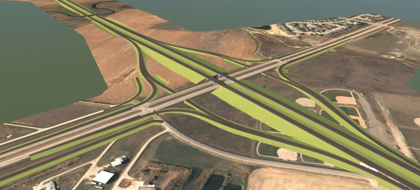
You can just barely see the as-built intersection at about 5:52 of this drone video. As you can see it looks nothing like the render.
https://youtu.be/4OJ3c-9W2dY


 Prev
Prev


 Linear Mode
