Quote:
Originally Posted by cybele

Well, here's what I have got so far and everybody will probably say it's no good, but it's just a work in progress:
|
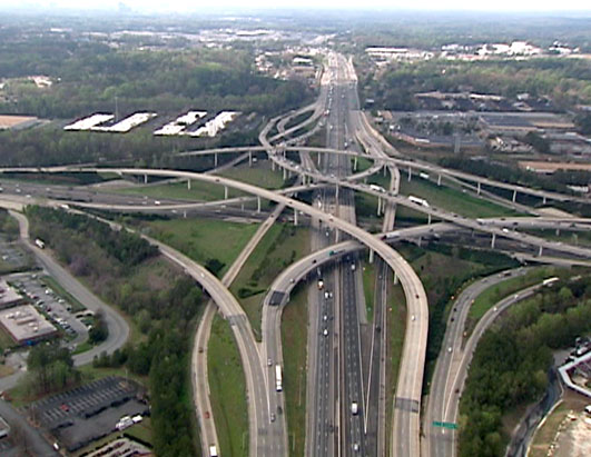
Interesting project. Looking at this map makes me think of the way that broad changes in employment and residential densities can develop over only a few years (as has happened often in Metro Atlanta) while changes in the transportation infrastructure that effectively serves those densities are much slower and require high expenditures of tax money.
This lag time between changes produces high traffic and long commutes that affect everyone in the metro directly or indirectly, resulting in lost money due to lessened productivity.
It isn't possible to make transportation routes as malleable as they need to be in order to quickly keep up with population changes when the built environment covers the land so completely. Unfortunately, underground transportation routes that would pass beneath existing developments are incredibly expensive (and unpopular). It would help if residential and commercial developments were more compact in land size so that there could be wide margins of undeveloped land to accommodate changes in density.
Public transportation routes would also be easier to build in ways that effectively serve the population if commercial and residential centers were more compact and not so spread out. For maximum use of land space, in fact, you could make residential and commercial structures especially compact by building them vertical rather than horizontal. These vertical structures could extend high in the air -- so high that they appear to 'scrape' the sky.
Holy crap! Quick, Ma -- wake up the kids! Someone's talking about skyscrapers and urbanism on the Skyscraper Forum!
Just kidding. Seriously, it's an interesting map. And I like dante's suggestion about mapping volume threshold. I lived for several years in that Cobb Galleria area where all the pink arrows are pointing and the traffic was soooo awful. They could use some relief.


 Prev
Prev


 a work in progress?
 Linear Mode
