HomeDiagramsDatabaseMapsForum About
     

Go Back   SkyscraperPage Forum > Photography Forums > Found City Photos

Reply

 
Thread Tools Display Modes
     
     
  #13641  
Old Posted Mar 31, 2013, 2:33 PM
belmont bob belmont bob is offline
Registered User
 
Join Date: Dec 2012
Location: Los Angeles area
Posts: 177
Quote:
Originally Posted by LA Jeff View Post
A few more shots of Edward Doheny’s Greystone Mansion, which has been featured in many movies and TV shows.


At 46,000 sq. ft., Greystone was the largest LA area home for 60 years until Aaron Spelling built his 56,000 sq. ft. McMansion in Holmby Hills after buying and tearing down a home where Bing Crosby once lived. Ironically Crosby’s home was designed by the same architect who was commissioned for Greystone – Gordon Kaufmann, whose other projects included Hoover Dam).
I am sure the Spelling’s home is grand and architecturally well done, but 56,000 sf….??? most cities aren’t that big…!!!
Reply With Quote
     
     
  #13642  
Old Posted Mar 31, 2013, 3:30 PM
westcork westcork is offline
Registered User
 
Join Date: Jan 2011
Posts: 189
2nd and Beaudry

Intersection of 2nd and Beaudry Streets looking northeast across Harbor Freeway construction and Bunker Hill. Gas station at left, center; houses in foreground; City Hall in distance


CA State Library
Reply With Quote
     
     
  #13643  
Old Posted Mar 31, 2013, 4:32 PM
Chuckaluck Chuckaluck is offline
Registered User
 
Join Date: Apr 2012
Posts: 649
An odd sojourn through Broadway (mostly by date rather than geography)

- Wonderful site.>>> http://www.csulb.edu/~odinthor/socal7.html


Circa 1910 - Broadway /Mercantile Place

http://catalog.library.ca.gov/exlibr...BE2RYG5846.jpg


Circa 1915 - Broadway and Sixth Street
http://catalog.library.ca.gov/exlibr...Q8BHG2QH9T.jpg


Circa 1918 -

http://catalog.library.ca.gov/exlibr...H6XDHR9RHC.jpg


Circa 1918 - Broadway and Seventh Street

http://catalog.library.ca.gov/exlibr...RSS8QGYV5N.jpg


Circa 1926 - Third and Broadway

http://catalog.library.ca.gov/exlibr...7B5SHLB8IY.jpg
Reply With Quote
     
     
  #13644  
Old Posted Mar 31, 2013, 4:32 PM
MichaelRyerson's Avatar
MichaelRyerson MichaelRyerson is offline
Registered User
 
Join Date: Feb 2011
Location: Houston, Texas
Posts: 1,155
Happy Easter


Easter prize award at Hattem's Market, South Vermont Avenue and West 81st Street, Los Angeles, CA, 1930

Just remember, Easters come and Easters go but a hard boiled egg lasts a long, long time. Bon Appetit.

USC digital archive/Dick Whittington Photography Collection, 1924-1987
Reply With Quote
     
     
  #13645  
Old Posted Mar 31, 2013, 6:10 PM
MichaelRyerson's Avatar
MichaelRyerson MichaelRyerson is offline
Registered User
 
Join Date: Feb 2011
Location: Houston, Texas
Posts: 1,155

Intersection West Temple Street and North Broadway, Los Angeles, CA, 1932

Interesting series by Dick Whittington concentrating on just the one intersection, here looking east on Temple Street with the Hall of Justice on the left and the County Courthouse on the right just beyond the Owl Drug store. The Acme semaphore sitting over here on the right curb is interesting in it's placement well short of the intersection allowing for the turning radius of the streetcar tracks. The fact that the Acme is showing neither the 'stop' or the 'go' arm means either Whittington hit the shutter at exactly the moment they were both folded into the light body or the exposure was taken early enough in the morning (probably by 7 am) before the semaphores were again operating for the day, being turned off around 9 pm when the 'red' and 'green' lights would suffice until being turned off themselves around midnight (or 1 am) when the little light seen at the base of the light body would then be turned on as a flasher. The Bank of Italy stands out down the street with the squat old post office just to its left.

USC digital archive/Dick Whittington Photography Collection, 1924-1987


Intersection West Temple Street and North Broadway, Los Angeles, CA, 1932 (2)

Second image in the series here standing with our backs to the WCTU building looking southeast across the intersection at the County Courthouse (here with it's truncated tower) and the Hall of Records, with the new City Hall just peeking through the haze. A beautiful, busy image of a favorite intersection.

USC digital archive/Dick Whittington Photography Collection, 1924-1987


Intersection West Temple Street and North Broadway, Los Angeles, CA, 1932 (3)

And number three looking southwest directly at the Owl Drug Co. with our backs now against the Hall of Justice with the County Courthouse just out of frame on the left and the WCTU out of frame on the right. Nice shot of the Broadway Rose.

USC digital archive/Dick Whittington Photography Collection, 1924-1987


Intersection West Temple Street and North Broadway, Los Angeles, CA, 1932 (4)

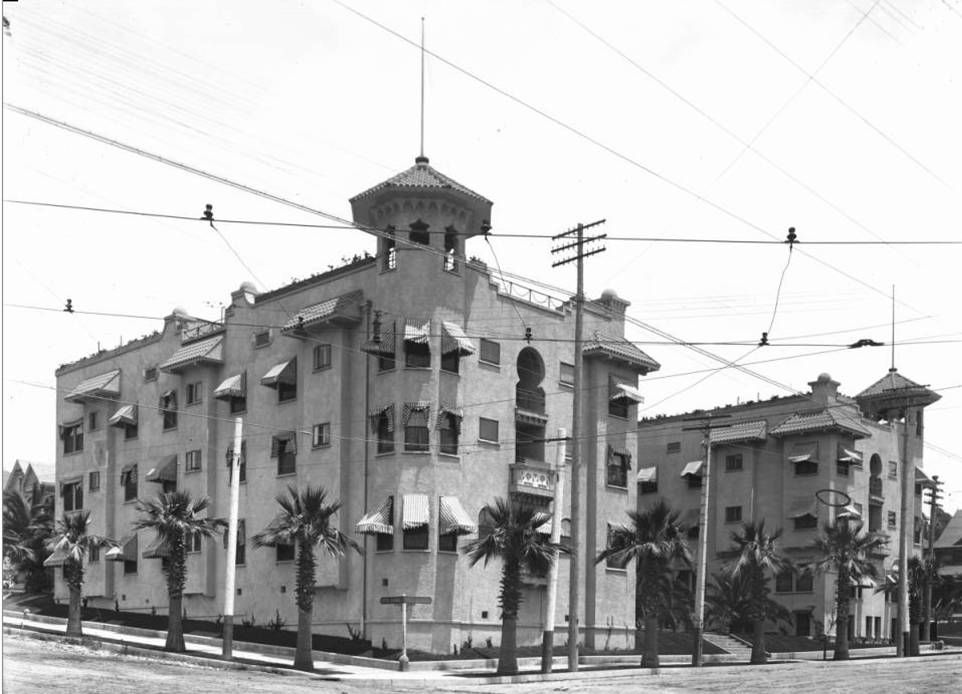
Looking north on Broadway in number four, Broadway tunnel showing just over the hump in front of the Alhambra Hotel/Apartments (the Alhambra Annex is seen on the left). The Hall of Justice on the right and the WCTU building on the left before the haircut. Here again (see number one) the Acme on the corner is showing neither the 'stop' nor the 'go' semaphore arm indicating the shot may have been taken in the early morning (perhaps before 7 am) before the semaphores were turned back on for the day. While I wish for clear skies when I look at these images, I try to remind myself even the haze is part of the truth being captured.

USC digital archive/Dick Whittington Photography Collection, 1924-1987


Intersection West Temple Street and North Broadway, Los Angeles, CA, 1932 (5)

Number five finds us looking west on Temple which is suddenly bathed in sunshine with the WCTU building on the right and farther down the block at Hill Street is the two story, light colored, Temp-Hill Hotel.

USC digital archive/Dick Whittington Photography Collection, 1924-1987


Intersection West Temple Street and North Broadway, Los Angeles, CA, 1932 (6)

And finally number six looking south across Temple Street right down the east side sidewalk of Broadway at the Hall of Records with the County Courthouse on the left. Beautiful shot.

USC digital archive/Dick Whittington Photography Collection, 1924-1987

Last edited by MichaelRyerson; Apr 1, 2013 at 3:48 PM. Reason: additional info
Reply With Quote
     
     
  #13646  
Old Posted Mar 31, 2013, 7:07 PM
BifRayRock BifRayRock is offline
Registered User
 
Join Date: Apr 2012
Posts: 1,366


Kenny's, 3314 N San Fernando Blvd. - Lockheed-close, If you are going to be modern, "Cook with Electricity!"[/I] (Kenny's private entrance ) To the best I can tell, Kenny's is no more. No answer at Thornwall 2-1731. He promised a good trade in on my Frigidaire!

http://farm9.staticflickr.com/8424/7...dd0c1922_b.jpg


Wing Co, 1941 East Colorado Street, Pasadena
(Wonder if they have a new set of rabbit ears. We're all out of foil and I never miss Korla Pandit on KTLA!)
http://farm9.staticflickr.com/8010/7...83e54262_b.jpg

Last edited by BifRayRock; Mar 31, 2013 at 7:22 PM.
Reply With Quote
     
     
  #13647  
Old Posted Mar 31, 2013, 7:09 PM
tovangar2 tovangar2 is offline
Registered User
 
Join Date: Nov 2012
Location: West Los Angeles
Posts: 2,625


Thx for all the reminders of Greystone. We went to some great parties there back when it was the American Film Institute HQ, whatever decade that was.
Reply With Quote
     
     
  #13648  
Old Posted Mar 31, 2013, 7:33 PM
BifRayRock BifRayRock is offline
Registered User
 
Join Date: Apr 2012
Posts: 1,366


Maybe not the finest, Gwinn's was one of Pasadena's finer restaurants. Bennie's was always further west!


2915 E. Colorado Blvd. (Food and car service?)
http://farm8.staticflickr.com/7249/7...51969f67_b.jpg


Bennie's 3875 E. Colorado Blvd
http://farm9.staticflickr.com/8024/7...4deaa7b4_b.jpg


Reply With Quote
     
     
  #13649  
Old Posted Mar 31, 2013, 7:55 PM
belmont bob belmont bob is offline
Registered User
 
Join Date: Dec 2012
Location: Los Angeles area
Posts: 177
Quote:
Originally Posted by westcork View Post
Intersection of 2nd and Beaudry Streets looking northeast across Harbor Freeway construction and Bunker Hill. Gas station at left, center; houses in foreground; City Hall in distance


CA State Library
Sometimes I forget just how much of Bunker Hill survived the freeways, and what would have remained if normal attrition of the neighborhoods had been allowed to take place instead of the wholesale obliteration
Reply With Quote
     
     
  #13650  
Old Posted Mar 31, 2013, 9:18 PM
Godzilla Godzilla is offline
Registered User
 
Join Date: Sep 2012
Posts: 725
Quote:
Originally Posted by belmont bob View Post
Sometimes I forget just how much of Bunker Hill survived the freeways, and what would have remained if normal attrition of the neighborhoods had been allowed to take place instead of the wholesale obliteration
"Much" is a relative term and it is not clear how much of BH would have been chewed up by the Freeways. FWIW, I believe the photo upon which you were commenting was dated '52. Well before then, short-sighted developers chipped away at Bunker Hill and its special ethos. The more they chipped, the more the area became a self-fulfilling eyesore that needed more chipping. Imagine if the property had been made a park, a la Griffith or if some of the freeways had been placed underground.

H
istorians may quibble over the exact date for Bunker's legitimized wholesale destruction. One source has it as late as '59! See: http://losangelesrevisited.blogspot....c-wall-of.html and http://www.kcet.org/socal/departures...ictorians.html http://www.kcet.org/updaily/socal_fo...nker-hill.html Of course, there were hold outs though the '60s (visualize "the Castle" house being readied for removal - and its ultimate carbonizing). Some of us, including this non-native, never fully experienced the "eminences" called Bunker Hill, except in its final gasps and/or through the modern magic realized by William Henry Fox Talbot. Those that did visit may not have appreciated things until they were long gone. One long-gone resident, then in his late '80s, told me he hated the place because it was so tough on his knees and hard to park on an incline. Yet he loved the views, sights and sounds, and said he had the same feelings toward the City by the Bay. Fortunately, SF still has a few of its hills and remaining.


I do not recall this thread addressing the history of the Bunker Hill name. Suffice it to say, Brent Dickerson seems to have put this to rest by noting the Bunker Hill moniker appears on the 1849 Ord Map/Plan of LA. http://www.csulb.edu/~odinthor/socal8.html see also http://losangelesrevisited.blogspot....c-wall-of.html


Please excuse the repetition:


1950
http://catalog.library.ca.gov/exlibr...GNDQ38D8MJ.jpg


1952 - J and B Wilson Block. Unrelated to Bunker Hill, but significant regarding freeway-related changes. From Hylen's photo essay entitled "Los Angeles before the Freeways."
http://catalog.library.ca.gov/exlibr...YHI2K9CPYA.jpg


1953
http://catalog.library.ca.gov/exlibr...CREXXXL2HI.jpg


1955 - First and Olive Streets (Were there Olive trees there? Who planted them and when?)
http://catalog.library.ca.gov/exlibr...CEUUH9TMKI.jpg


1955 - First and Hill
http://catalog.library.ca.gov/exlibr...KHXK2LJY9Q.jpg


1958 - The Dome
http://catalog.library.ca.gov/exlibr...IBPA2P4APX.jpg


1965
http://catalog.library.ca.gov/exlibr...732KJ3HVDQ.jpg


1965
http://catalog.library.ca.gov/exlibr...36BI97F5CY.jpg


1965 - Fifth and Flower (LA Dodgers were only 3 YO)
http://catalog.library.ca.gov/exlibr...8SMKEP64EU.jpg


The Castle - 1965
http://catalog.library.ca.gov/exlibr...UJQUAQ1923.jpg


1967
http://catalog.library.ca.gov/exlibr...CSYGTXHGKJ.jpg


1967


1968 - The Castle

http://catalog.library.ca.gov/exlibr...36A8FSVJGY.jpg


1973
http://catalog.library.ca.gov/exlibr...PXH8TKJ3E7.jpg

Last edited by Godzilla; Apr 1, 2013 at 3:48 PM.
Reply With Quote
     
     
  #13651  
Old Posted Mar 31, 2013, 9:41 PM
tovangar2 tovangar2 is offline
Registered User
 
Join Date: Nov 2012
Location: West Los Angeles
Posts: 2,625
Mt Zion


http://la.curbed.com/archives/2013/0...h_cemetery.php

Another cemetery gone to blazes.

Story here: http://www.latimes.com/news/columnon...5412.htmlstory

I'm glad my family gets cremated and scattered. When we go, we're dead and gone.
Reply With Quote
     
     
  #13652  
Old Posted Mar 31, 2013, 10:41 PM
tovangar2 tovangar2 is offline
Registered User
 
Join Date: Nov 2012
Location: West Los Angeles
Posts: 2,625
Quote:
Originally Posted by Godzilla View Post
Thank you Godzilla for the link. I did not realize that that bit of wall was once part of the old Fremont:


http://losangelesrevisited.blogspot....c-wall-of.html (both above)


Quote:
Originally Posted by ethereal_reality View Post
Fremont Hotel at 4th & Olive.


usc digital archive

http://losangelesrevisited.blogspot....c-wall-of.html
Reply With Quote
     
     
  #13653  
Old Posted Apr 1, 2013, 1:51 AM
Flyingwedge's Avatar
Flyingwedge Flyingwedge is offline
Registered User
 
Join Date: Jun 2012
Location: Los Angeles
Posts: 1,126
Hotel Alvarado

This John C. Austin-designed hotel was on the NE corner of 6th and Alvarado. I'm not sure when it was built, but it's on the 1906 Sanborn Map. It looks like it had a large roof garden:


USC Digital - http://digitallibrary.usc.edu/cdm/si...id/14257/rec/1


LAPL - http://jpg1.lapl.org/spnb01/00007191.jpg


LAPL - http://jpg1.lapl.org/spnb01/00007192.jpg

1970s, looking west on 6th at Alvarado. The stripped-down Hotel Alvarado, with commercial storefronts added along the sidewalk, is at right:

LAPL - http://jpg3.lapl.org/pics35/00067412.jpg

Apparently the Hotel Alvarado was closed after a bad fire in the early 1980s:
http://urbandiachrony.wordpress.com/...s-c-1910-2010/

This is what's on the NE corner of 6th and Alvarado today:

GSV 2011
Reply With Quote
     
     
  #13654  
Old Posted Apr 1, 2013, 2:56 AM
tovangar2 tovangar2 is offline
Registered User
 
Join Date: Nov 2012
Location: West Los Angeles
Posts: 2,625
Quote:
Originally Posted by kznyc2k View Post
That's a most interesting idea, and so easy to implement that I wish someone would just do it and see what happens. Hell, there's virtually nothing to be lost by doing so.
Re sending current tenants "before" pix of their buildings, I emailed that gorgeous photo of the interior of Schaber's Cafeteria to Figaro Bistro that e_r posted here. They loved it as they'd only ever seen the B&W version. When they asked for more, I sent them the old photo of the original exterior and the links about Einar Petersen. They were thrilled and are having them printed up for customers. Now they're asking for more. I think I've created a monster.
Reply With Quote
     
     
  #13655  
Old Posted Apr 1, 2013, 5:28 AM
Godzilla Godzilla is offline
Registered User
 
Join Date: Sep 2012
Posts: 725
Bunker Hill follow-up. ^^^^^

Sadly, some of the charm of these buildings is best appreciated from afar.


a few amazing noir images, some of which I can't recall seeing on this thread. vvvvv

1947 - Second Street and Hill
http://catalog.library.ca.gov/exlibr...1831NIGALT.jpg


1947 - Buildings on Fremont Ave
http://catalog.library.ca.gov/exlibr...1FTN3X6F4K.jpg


1948 - Buildings on San Pedro St.
http://catalog.library.ca.gov/exlibr...ERTARQI4Y9.jpg


1948 - (Soon to be former) Hotel Natick (http://forum.skyscraperpage.com/show...postcount=3963 )

http://catalog.library.ca.gov/exlibr...CC71294VYX.jpg

http://catalog.library.ca.gov/exlibr...9LJEUIENRQ.jpg


1948 - Old Courthouse Steps
http://catalog.library.ca.gov/exlibr...IS8JCP1H6L.jpg


1948 - Ord Street
http://catalog.library.ca.gov/exlibr...UEKES2FT6B.jpg


1950 - Sepulveda Block
http://catalog.library.ca.gov/exlibr...FGCP61HF4X.jpg


1950 - Bunker Hill, Hylen Collectiom
http://catalog.library.ca.gov/exlibr...6651146BRM.jpg


1950 - The Holly Hotel
http://catalog.library.ca.gov/exlibr...7IAT1LJB5X.jpg


1950 - Hylen Collection - Commercial Street (?)
http://catalog.library.ca.gov/exlibr...PY4INA2JSY.jpg

Commercial St
http://catalog.library.ca.gov/exlibr...343B4M4YR8.jpg
1950 - Broadway between Second and Third.
http://catalog.library.ca.gov/exlibr...83B8V6A8JT.jpg


1950 - Demolition of Natick Hotel
http://catalog.library.ca.gov/exlibr...1S9KJU3LYT.jpg


1951 - Temple Street buildings
http://catalog.library.ca.gov/exlibr...6UBDLTIX9E.jpg

1952 - Broadway near Second Street
http://catalog.library.ca.gov/exlibr...KKJCICRQBT.jpg


1952 - Broadway near First Street
http://catalog.library.ca.gov/exlibr...MVHUBSHAL6.jpg

1950 - Richfield from Figueroa. Tsk Tsk. Tall building with antenna. What an eyesore!
http://catalog.library.ca.gov/exlibr...VR8A6X77CU.jpg


1960 Hall of Records
http://catalog.library.ca.gov/exlibr...RRIMHC64J7.jpg
Reply With Quote
     
     
  #13656  
Old Posted Apr 1, 2013, 5:59 AM
Flyingwedge's Avatar
Flyingwedge Flyingwedge is offline
Registered User
 
Join Date: Jun 2012
Location: Los Angeles
Posts: 1,126
Corner of W. 11th and S. Lake Streets

The southeast and southwest corners, to be exact. We're about four blocks south of MacArthur (née Westlake) Park:

GSV May 2011

On the southeast corner at 2120 W. 11th is this apartment building erected in 1912:

GSV
I don't see a name on it now, but the 1915 LA City Directory calls it the Marwick:
http://rescarta.lapl.org/ResCarta-We...oc=2120+W+11th


GSV

And on the southwest corner at 1109 S. Lake we have the Royal Lake Apartments, built in 1925:

2012 photo by Downtowngal @ Wikimedia Commons - http://commons.wikimedia.org/wiki/Fi...Apartments.jpg


GSV

The small sign above and to the right of the front door says, "This Property Closed to the Public - No Entry Without Permission"

GSV

A closer look at the rooftop sign:

Downtowngal photo

At Yelp.com (http://www.yelp.com/biz/royal-lake-a...ts-los-angeles) there's a really bad July 2011 review of the Royal Lake, with a March 2013 rebuttal. There's also this:

"Under New Management and Ownership. The Royal Lake Apartments was purchased in late 2012 by a small private real estate investment company specializing in early 1900's buildings.
The building is in the process of undergoing major upgrades and beautification. The lobby, front door and entry system were recently renovated in the original style of the building as to maintain the building's charm.
The unit interiors have also been renovated to expose the original brick walls and wood floors. The units have large windows, wood blinds, ceiling fans, granite countertops, stainless steel refrigerator and stove, and more..."

11th and Lake ain't my usual neck of the woods, but if I get over that way I'll be sure to check for any progress on the external beautification.
Reply With Quote
     
     
  #13657  
Old Posted Apr 1, 2013, 6:38 AM
alanlutz alanlutz is offline
Registered User
 
Join Date: Feb 2012
Location: Orange, CA
Posts: 108
OK, I don't know if it was Godzilla or belmont bob, but the one photo of the 101 freeway construction photo along side the Hall Of Justice labeled 1967 seem wrong to me. Wasn't that much earlier, during the late 40s or 50s?
Reply With Quote
     
     
  #13658  
Old Posted Apr 1, 2013, 12:00 PM
MichaelRyerson's Avatar
MichaelRyerson MichaelRyerson is offline
Registered User
 
Join Date: Feb 2011
Location: Houston, Texas
Posts: 1,155
Quote:
Originally Posted by alanlutz View Post
OK, I don't know if it was Godzilla or belmont bob, but the one photo of the 101 freeway construction photo along side the Hall Of Justice labeled 1967 seem wrong to me. Wasn't that much earlier, during the late 40s or 50s?
Yes, the first pic in his post labeled 1967 was actually about '51 or '52.
Reply With Quote
     
     
  #13659  
Old Posted Apr 1, 2013, 3:51 PM
Godzilla Godzilla is offline
Registered User
 
Join Date: Sep 2012
Posts: 725
Quote:
Originally Posted by MichaelRyerson View Post
Yes, the first pic in his post labeled 1967 was actually about '51 or '52.
My mistake. Source states "1953" as date for photo. Earlier post has been corrected.

Chalk it up to the date? (Could have sworn I heard "Last Train To Clarkesville" in background while viewing image.)

http://catalog.library.ca.gov/exlibr...CREXXXL2HI.jpg
Reply With Quote
     
     
  #13660  
Old Posted Apr 1, 2013, 3:57 PM
MichaelRyerson's Avatar
MichaelRyerson MichaelRyerson is offline
Registered User
 
Join Date: Feb 2011
Location: Houston, Texas
Posts: 1,155
Quote:
Originally Posted by Godzilla View Post
My mistake. Source states "1953" as date for photo.

http://catalog.library.ca.gov/exlibr...CREXXXL2HI.jpg
Not to worry, we all make 'em but I still feel as though the source may be wrong. see below...


Freeway Link Open to Civic Center, 1951

20 December 1951. Cutting ribbon opening most important link in freeway system are, l to r: Robert Mitchell, president, Los Angeles Metropolitan Traffic Assn.; Edward R. Valentine, Prexy, Downtown Business Men's Assn.; Mayor Fletcher Bowron; Harrison R. Baker, of Calif. Highway commission; and Raymond V. Darby, county supervisor.

USC digital archive/Los Angeles Examiner Collection, 1920-1961


Freeway Link Open to Civic Center, 1951 (3)

20 December 1951. View showing first cars approaching the Civic Center on new half-mile link.

USC digital archive/Los Angeles Examiner Collection, 1920-1961
Reply With Quote
     
     
This discussion thread continues

Use the page links to the lower-right to go to the next page for additional posts

Reply

Go Back   SkyscraperPage Forum > Photography Forums > Found City Photos
Forum Jump


Thread Tools
Display Modes

Forum Jump


All times are GMT. The time now is 7:45 AM.

     
SkyscraperPage.com - Archive - Privacy Statement - Top

Powered by vBulletin® Version 3.8.7
Copyright ©2000 - 2024, vBulletin Solutions, Inc.