Quote:
Originally Posted by Chadillaccc

|
This is further down from the American Falls. Built along the side of the gorge with aqueducts and canals built to power industry.
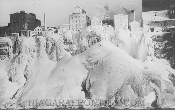
The American Falls have only been stopped one time.
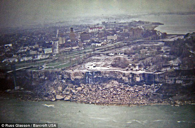
“In June 1969, U.S. engineers diverted the flow of the Niagara River away from the American side of the falls for several months.
“Their plan was to remove the large amount of loose rock from the base of the waterfall, an idea which they eventually abandoned due to expense in November of that year.
[. . .]
To achieve this the army had to build a 600ft dam across the Niagara River, which meant that 60,000 gallons of water that flowed ever second was diverted over the larger Horseshoe Falls which flow entirely on the Canadian side of the border.
“The dam itself consisted of 27,800 tons of rock, and on June 12, 1969, after flowing continuously for over 12,000 years, the American Falls stopped. Over the course of the next six months thousands of visitors flocked to the falls to witness the historic occasion.
I remember seeing this, although as I was nine at the time, I can’t say with certainty that it was in person . . . I might be mistakenly remembering seeing it on TV, although my family visited Niagara Falls frequently during the late 1960s and early 1970s.
http://quotulatiousness.ca/blog/2010...falls-ran-dry/


 Prev
Prev


 And wasn't Rob Ford trying to deminish the amount of space allocated toward park land, in favour of additional development?
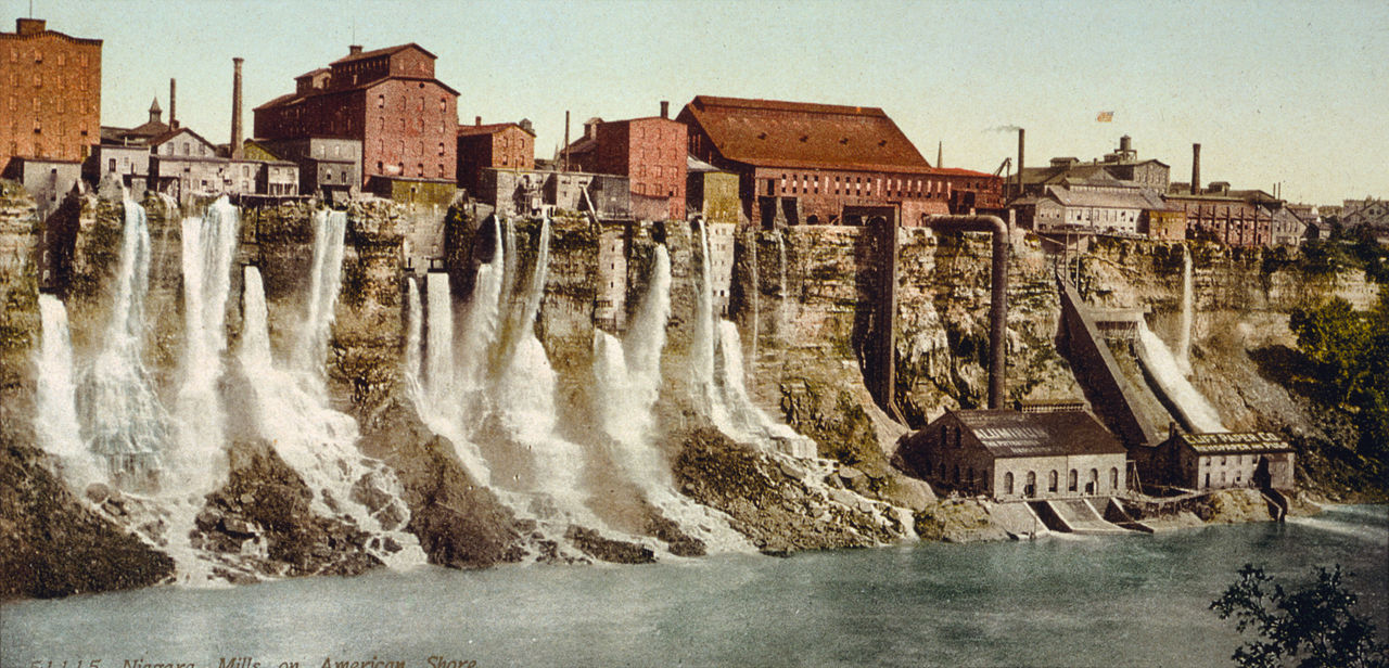


 Linear Mode
